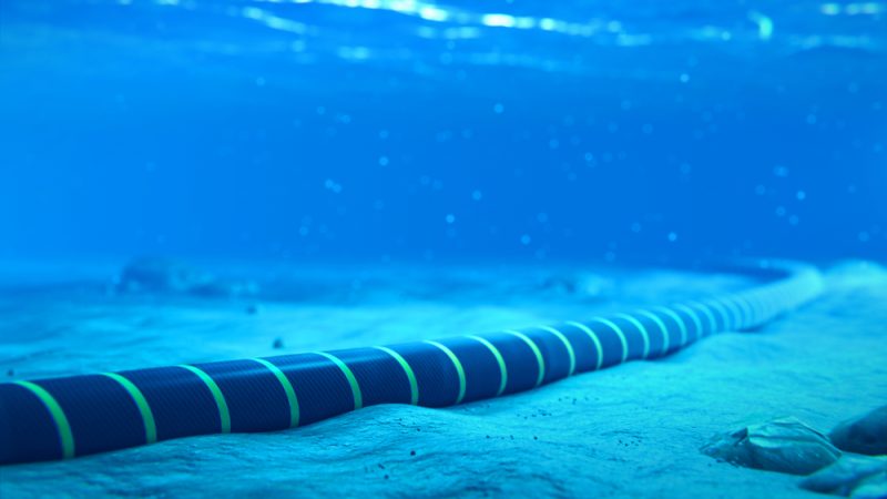
EXA Infrastructure Begium has submitted an application for the authorization for the laying and an environmental permit for the exploitation of a telecommunication cable between Broadstairs – Joss Bay in the south east of England and Ostend. This application is subject to an environmental impact assessment procedure.
The application, the environmental impact statement and its annexes (concept of the appropriate assessment, non-technical summary and the report describing the effects on fisheries) can be consulted from 22 July to 28 August 2024 at the offices of MUMM at Brussels (Vautierstraat 29, 1000 Brussels; bmm@naturalsciences.be; tel 02/627 43 52) or at Ostend (3de en 23ste Linieregimentsplein, 8400 Ostend; bmm@naturalsciences.be; tel. 059/24 20 55), by appointment only and during office hours between 9:00 am and 5:00 pm. The application can also be consulted at every coastal community, during office hours.
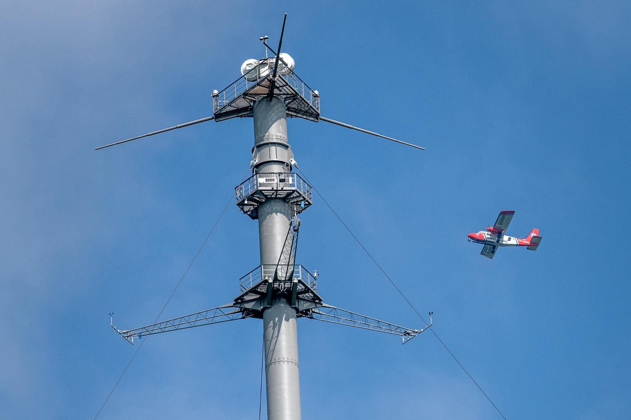
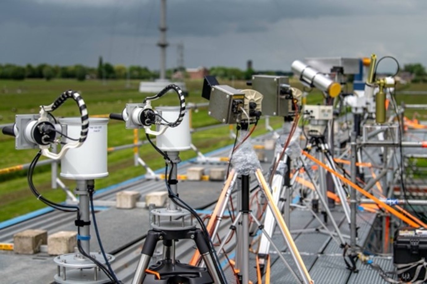
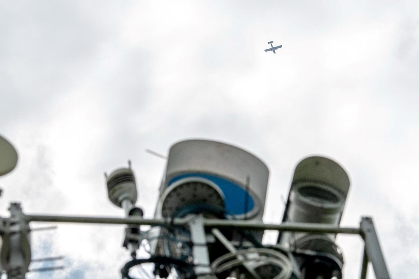
The Institute of Natural Sciences and the Royal Belgian Institute for Space Aeronomy (BIRA-IASB) recently participated in the third “Cabauw Intercomparison of UV-Vis DOAS Instruments” (CINDI-3). This campaign took place in May-June 2024 and was organized by the Royal Netherlands Meteorological Institute (KNMI) at the Cabauw observatory, located between Rotterdam and Utrecht. More than 100 persons from 16 countries, with 44 instruments, were involved in the international measurement campaign, the largest of its kind in the world.
The main purpose of CINDI-3 is to test and compare different MAX-DOAS (Multi-Axis Differential Optical Absorption Spectroscopy) instruments that measure air pollutants such as nitrogen dioxide (NO2) and ozone (O3). These instruments use a technique that analyses the spectrum of scattered sunlight to determine the presence and concentration of various gases in the atmosphere.
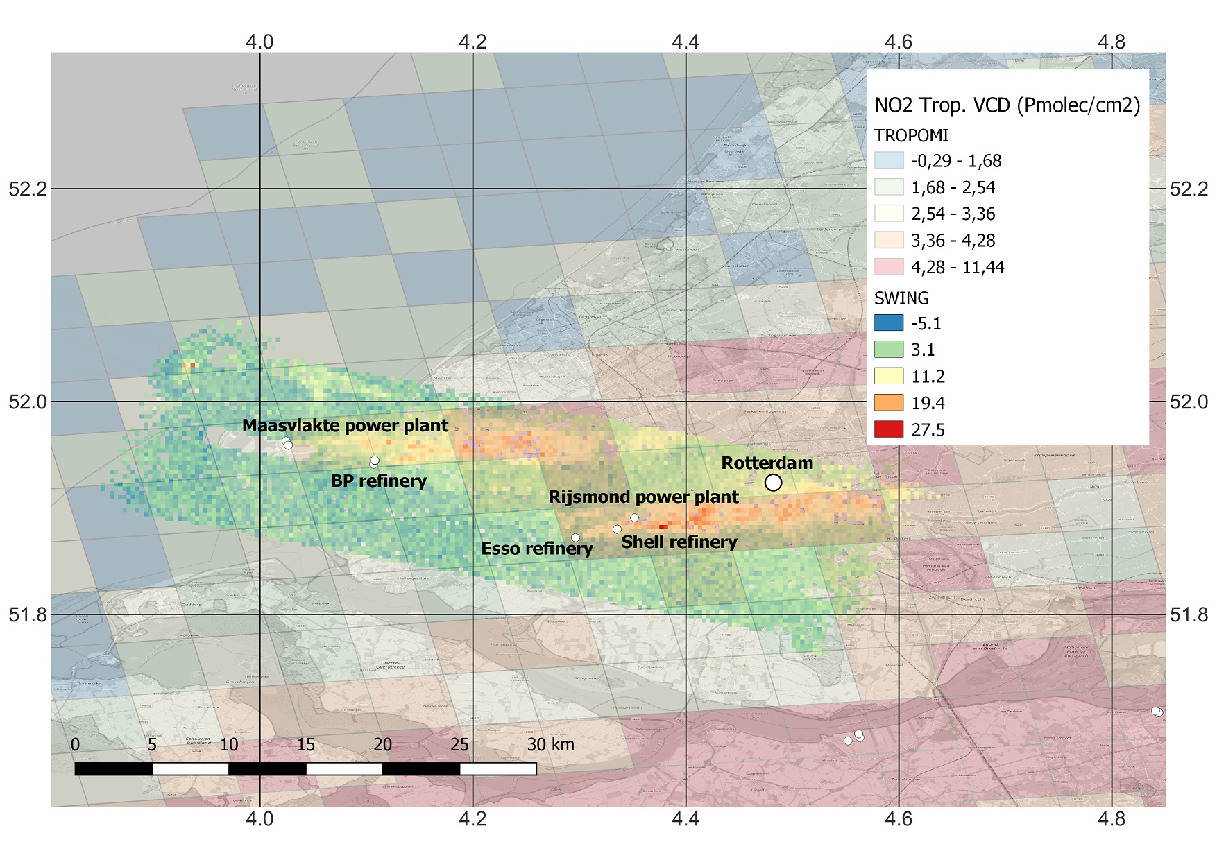
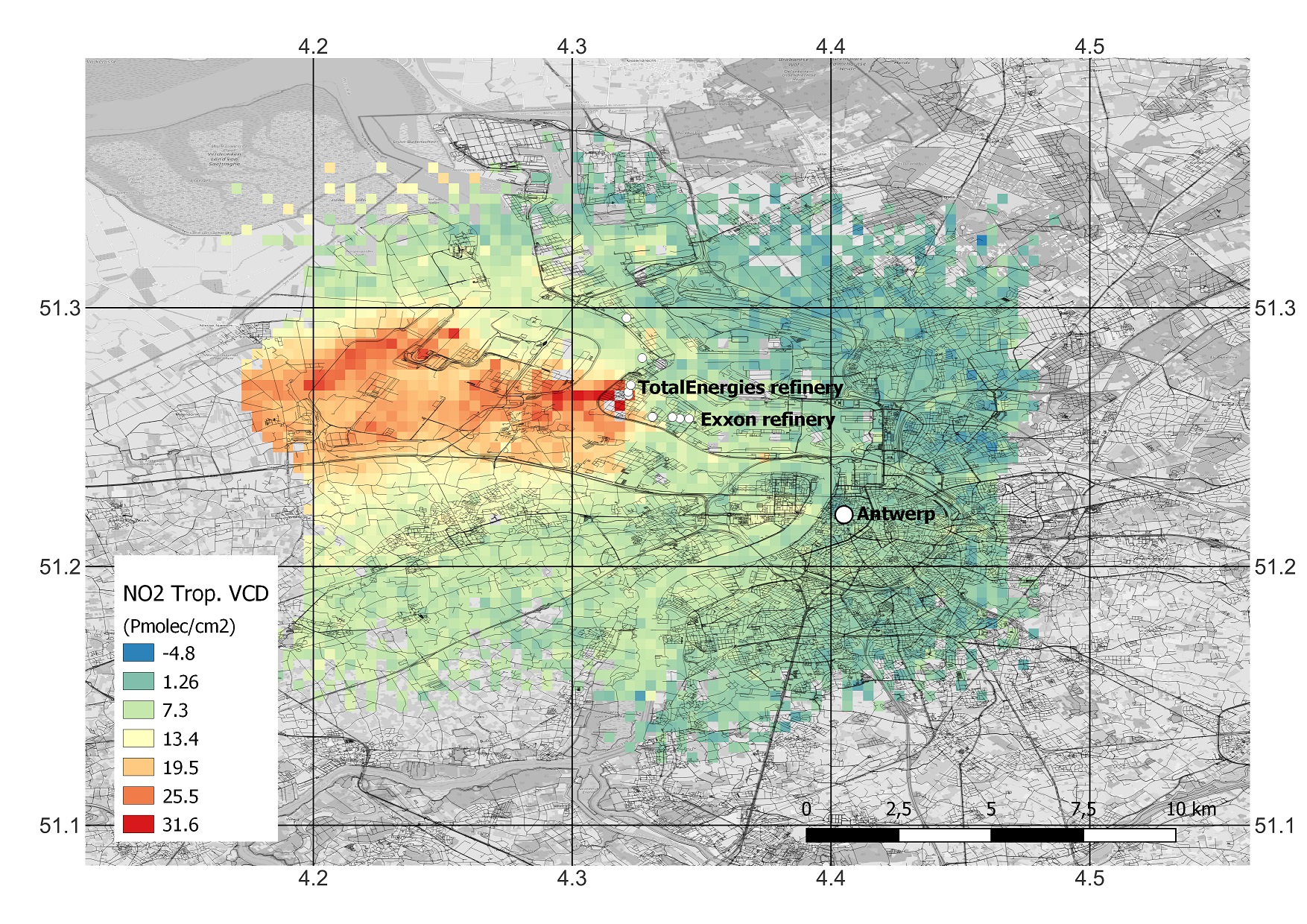
As part of the Belgian contribution, the aerial surveillance aircraft of the Institute of Natural Sciences was equipped with various measuring instruments in the weeks before the exercise (including the BIRA SWING imaging DOAS system), while BIRA also supplied NO2 and O3 in-situ measuring equipment. Together with other measuring devices near the KNMI measuring mast in Cabauw, and operated on cars and bicycles, a complete picture of the distribution of pollutants in the industrial and urban areas around Rotterdam could be compiled. The NO2 distribution over Antwerp was also mapped from the aircraft as part of the same campaign.
All flights were carried out in synchronisation with the Copernicus Sentinel-5 Precursor satellite that carries the ESA TROPOMI instrument (Tropospheric Monitoring Instrument). This instrument maps various air quality and climate parameters. Thanks to the successful comparison of the observations of the measuring instruments on board the aircraft and on the ground, they can serve as a reliable reference for validating satellite instruments that measure air pollution from space.
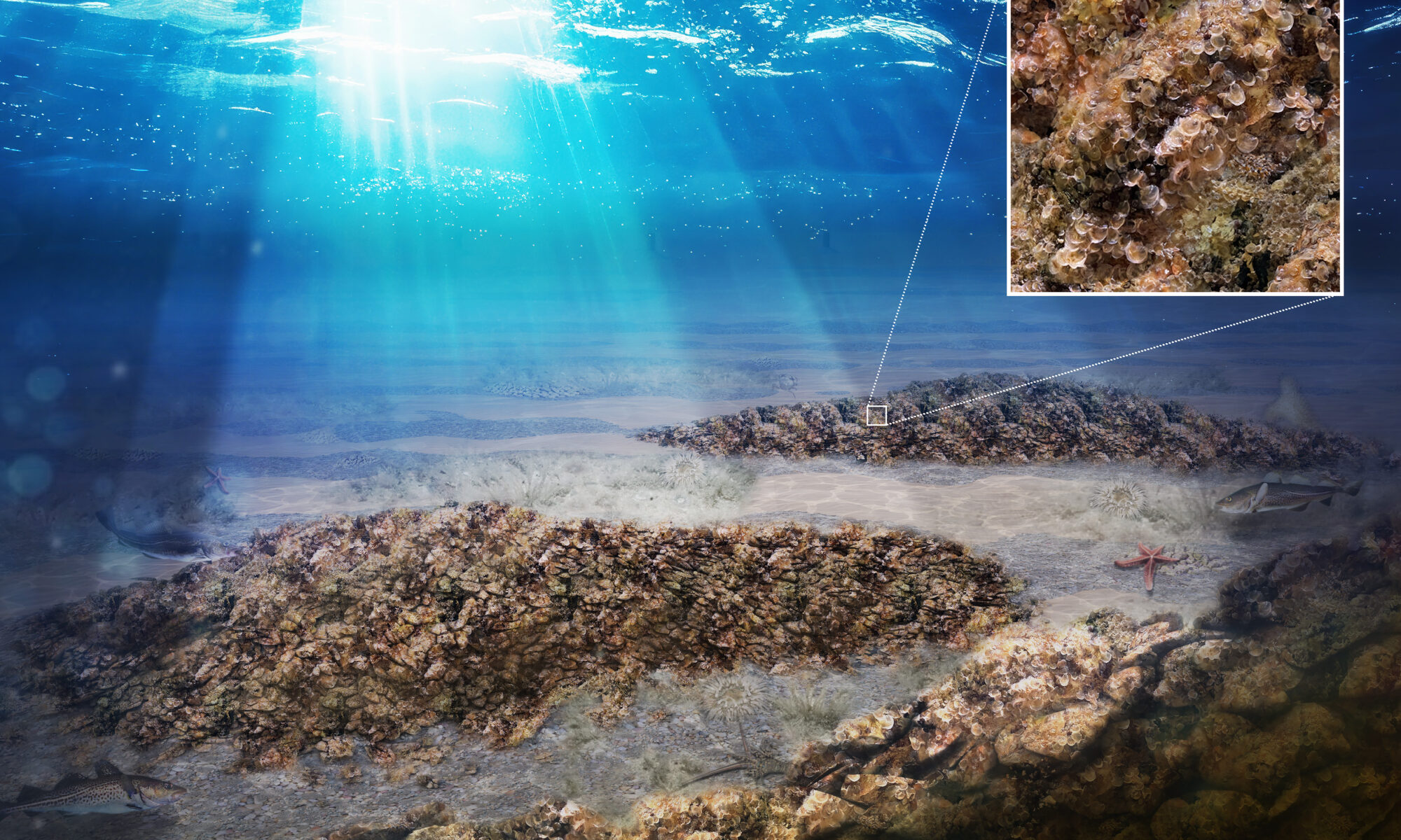
Before 1850, flat oyster reefs were a dominant structural and ecological component of the North Sea ecosystem. Due to human influences and a persistent oyster parasite, they have all but disappeared today. Nevertheless, oyster reefs are important ecosystems. They are often called “ecosystem engineers” because they create habitats that support entire ecosystems. On behalf of the Belgian FPS Public Health, Food Chain Safety and Environment, partners from science and industry are now building the BELREEFS project: the first offshore pilot project for large-scale oyster reef restoration in the Belgian North Sea.
BELREEFS is a collaboration between Jan De Nul Group, the Belgian Institute of Natural Sciences, Shells & Valves and Mantis Consulting, acting in accordance with the recommendations of the Native Oyster Restoration Alliance (NORA). Industry and science join forces to tackle the challenges of restoring oyster reefs, a complex operation that requires innovation and creative solutions. The complexity of the logistical support, and the sensitivity of oysters to disturbance (during seeding, transport and installation at sea), requires in-depth knowledge covering different fields of expertise.
Vicky Stratigaki, engineer and project coordinator for BELREEFS at Jan De Nul Group: “We want to create an oyster reef that is self-sustaining. Our ambition is to create long-term nature restoration, without further human intervention. One of the choices we are making to achieve this, is to install the oyster reefs where they historically occurred: at the so-called gravel beds.”
BELREEFS consists of three phases (see images below): from the current gravel bed to the deployment of oyster reef substrate seeded with oyster spat within the BELREEFS project, and towards the third phase where biodiversity increases. This biodiversity is characterized by various marine fauna and flora species attracted to a self-sustaining oyster reef.
Determining the precise location of oyster reefs is one of the Institute of Natural Sciences’ core missions.
Vera Van Lancker and Steven Degraer, Institute of Natural Sciences: “To maximize the survival and reproduction of oyster reefs, we identify locations with the most suitable seabed and environmental conditions. Additionally, natural protection from damage and optimal placement conditions are crucial. Therefore, we will conduct a detailed mapping of the seabed.“
Furthermore, the project builds on some key innovations. For example, BELREEFS will use ‘remote setting’, a technique in which they allow oyster larvae to settle directly on a suitable substrate in the lab, to release them into the sea afterwards. Once installed, the oysters will be followed for several years through an intensive monitoring programme.
Senne Aertbeliën, FPS Public Health, Marine Environment Department: “The European oyster has always been an important core species in our North Sea, but it has since almost completely disappeared. The active recovery of these populations is therefore a priority for us. The fact that we can cooperate on this scale with scientists and companies to this end is unique“.
The monitoring programme of the Institute of Natural Sciences for emissions of sulphur oxides (SOx) and nitrogen oxides (NOx) of ships at sea was awarded the ‘Special Commendation for Sustainable Impact’ in the context of the Greening Award Initiative of the European Maritime Safety Agency. A well-deserved recognition for the impact and sustainability of our efforts to combat air pollution from ships at sea.
Jean-Baptiste Merveille (Institute of Natural Sciences) receives the honours from Maja Markovcic, Executive Director of EMSA, at the Greening Awards ceremony. Tenerife, June 27, 2024
In May 2024, the monitoring programme of the Institute of Natural Sciences for SOx and NOx emissions of ships at sea, part of the aerial surveillance of the North Sea, was nominated as a finalist for the Greening Award Initiative of the European Maritime Safety Agency (EMSA), in the ‘Greening Operations’ category.
The Greening Award Initiative is jointly organised with Frontex (the European Border and Coast Guard Agency) and the European Fisheries Control Agency (EFCA) and celebrates the sustainability actions of authorities performing coast guard functions in the EU.
The presentation of the awards took place on 27 June 2024 at the 7th Annual European Coast Guard Event, hosted by EFCA in Tenerife, Spain, and had good news in store for the operators and pilots of the Belgian aerial surveillance programme. Although the award went to the Maltese Grand Harbour Clean Air Project, the Belgian programme ‘Remote Measurements for SOx and NOx monitoring’ was awarded the ‘Special Commendation for Sustainable Impact’.
A pioneer programme
Since 2015, the Institute of Natural Sciences, using funding from the Connecting Europe Facility programme, has equipped the Belgian coastguard aircraft with a sniffer sensor to measure ship emissions of ocean-going vessels at sea. This application made it a truly pioneering project, and the program is still a source of inspiration for many other countries.
This monitoring programme is successful thanks to good cooperation with the Secretary of State for Science Policy and the Minister of Defence, who support the maintenance, the operation and the renewal of the Belgian Coast Guard aircraft and examine how a successor can be purchased, with the Minister of the North Sea who, among other things, provided the NOx sensor, and with the Directorate General Shipping, which organizes the follow-up of suspicious SOx and NOx values on land.
The aircraft now monitors for CO2, SO2, NOx, and black carbon, and the reports from its sniffer operations mean that port state control inspection efficiency has improved by over 50%.
Well-deserved recognition
The ‘Greening Operations’ category encompasses operational actions and projects that have led to an improved environmental footprint of ships crossing the North Sea. Important attention is paid to actions or projects which empower a green transition, contribute to a more sustainable future, and which directly or indirectly support the goals of the European Green Deal.
By innovatively applying sensors in the sniffer sensor setup of the Belgian Coast Guard aircraft, continuously monitoring emissions from ships at sea and reporting the results to the competent authorities, and publishing the findings in international professional literature, the Belgian programme does not only contribute to the technical development of equipment to measure air pollution from ships at sea, but also to the development of knowledge about the effect on compliance and to the further development of national and international legislative frameworks.
It is therefore no coincidence that the special commendation that highlights both the impact and the sustainability of that impact was awarded to the Belgian aerial monitoring of SOx and NOx emissions from ships at sea.
Minister of North Sea Paul Van Tigchelt: “Establishing low-emission zones in the North Sea and embracing international regulations like MARPOL Annex VI to curb maritime emissions are only effective with strong enforcement mechanisms in place. Belgium has pioneered this effort with the NOx and SOx sensors on the sniffer aircraft. We’re paving the way for cleaner air and a healthier environment. This award is a recognition for the excellent work of everyone involved in the sniffer aircraft project.”
Other categories and commendations
More info on the Greening Award Initiative (including the other categories ‘Outreach and awareness raising’ and ‘Greening At Work’) and the nominees in all categories van be consulted here.
The ‘Greening at Work’ award went to the Flemish Agency for Maritime and Coastal Services (MDK), that is implementing an ambitious set of sustainability projects across the entire range of its actions and activities under the common denominator ‘Working Together Towards a Greener Europe Project‘.
NV DEME Building Materials has applied on April 5th, 2024 for a concession for sand extraction in the Belgian part of the North Sea for an exceptional project for the extraction of sand in control zone 3. This application is subject to an environmental impact assessment procedure. The application, the environmental impact assessment report and an addition to the environmental impact assessment report can be downloaded below (in Dutch).
The public consultation runs from June 22th, 2024 until August 22th, 2024.
Any interested party can submit its views, comments and objections by letter (MUMM, Vautierstraat 29, 1000 Brussel) or email (bmm@naturalsciences.be until September 6th, 2024.
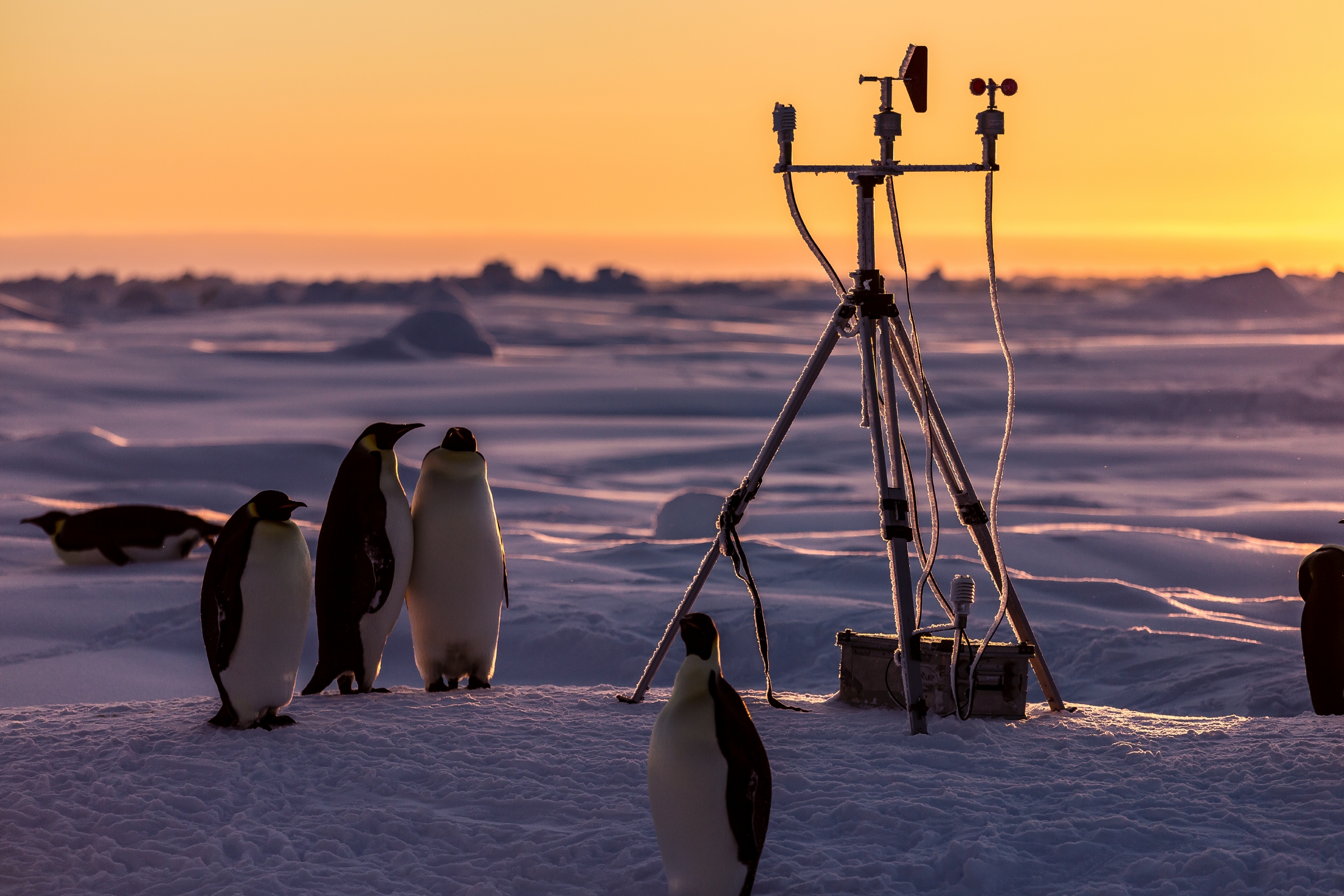
The Weddell Sea is a hotspot of Antarctic life but the impact of climate change and melting of sea ice on the biodiversity and functioning of the ecosystem is poorly known. The new project ‘Weddell Sea Observatory of Biodiversity and Ecosystem Change’ will assess the biodiversity and develop a strategy for monitoring changes in a proposed Marine Protected Area.
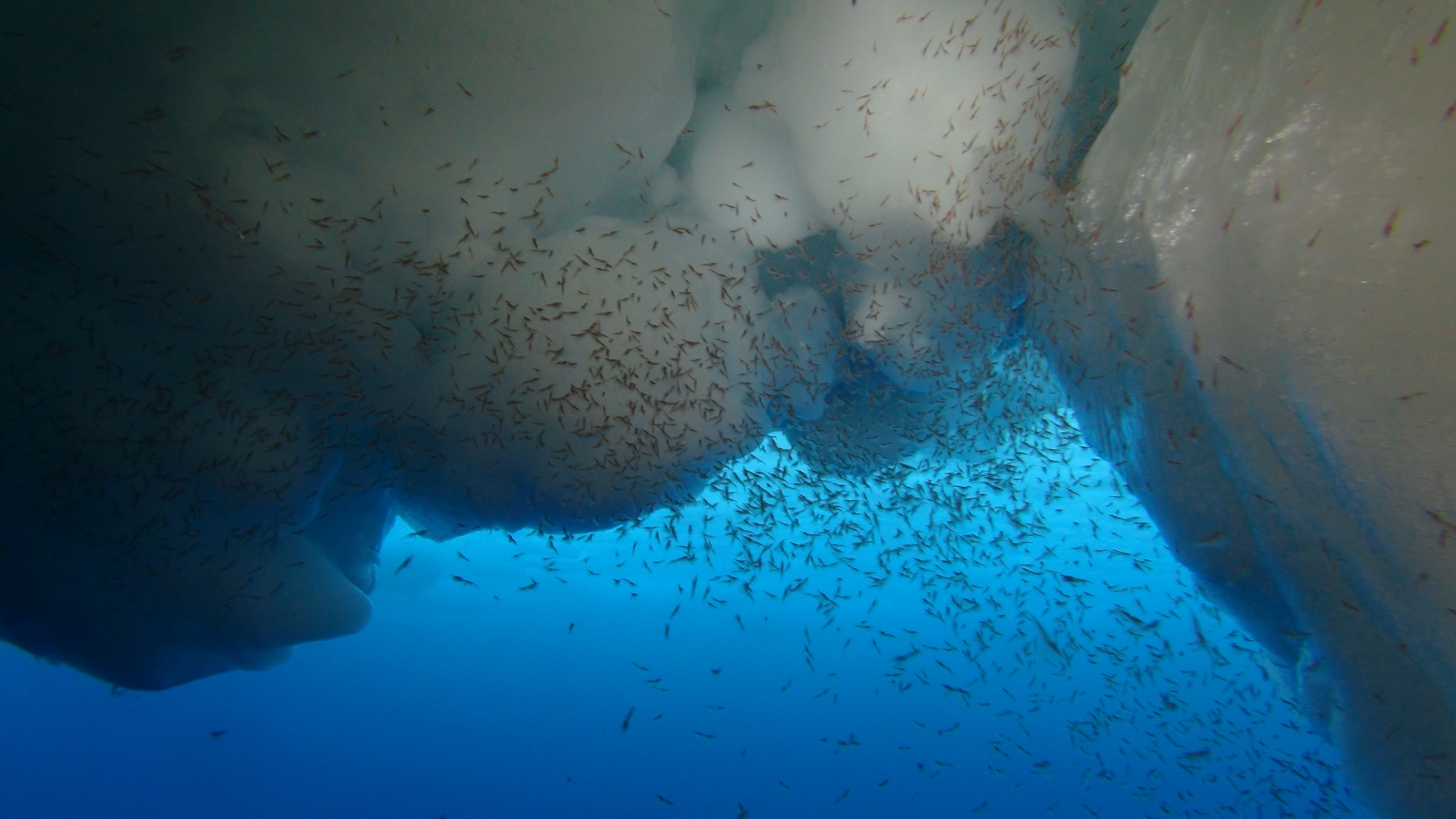
The Weddell Sea is the largest marginal sea in the Southern Ocean and a veritable hotspot of life. Here, seals and emperor penguins have their young. The swarms of krill, which graze on microalgae under ice floes, attract fish, whales and seabirds. On the seafloor, millions of icefish spawn, while underwater gardens full of glass sponges, sea anemones and sea squirts thrive, some reaching a level of biodiversity comparable to that of tropical reefs.
“The Weddell Sea constitutes a largely untouched, and therefore extremely valuable, habitat. Not only does it have a high aesthetic value, it is also characterised by unique biodiversity. This biological diversity is also the source of important ecosystem services, like the storage of carbon in the deep sea through ice algae and the remains of plankton sinking to the bottom,” explains Dr Hauke Flores, a marine biologist at the Alfred Wegener Institute (Germany) and coordinator of the Weddell Sea Observatory of Biodiversity and Ecosystem Change (WOBEC) project .
However, climate change has long-since spread to the southern polar region. Hauke Flores adds: “In the past few years, we’ve witnessed an unexpectedly rapid decline in sea ice. We don’t know how, or if, the region’s organisms can adapt to the changed environmental conditions. In order to assess this aspect, we need to first gain a better grasp of the ecosystem’s status quo and urgently need to begin systematic data collection.”
The project’s focus is on observing potential long-term changes in biodiversity in the eastern Weddell Sea. Although countries like Germany, Norway and South Africa have been conducting research in the region for decades, systematic studies on its massive ecosystem are lacking. For large parts of the Weddell Sea, long-term observations of the marine biodiversity are even completely non-existent.
To collect valuable new data, an expedition with the German icebreaker Polarstern is planned in the Weddell Sea in 2026, coordinated by the University of Rostock. In addition, the project partners will dig through their archives and make previously unreleased and hard-to-find results available in publicly accessible databases.
Dr Anton Van de Putte of the Institute of Natural Sciences and the Université Libre de Bruxelles is responsible for WOBEC’s data management. He will also be part of the 2026 expedition and will contribute to the processing and interpretation of the data. “On the basis of historical and current data alike, our goal is to create a strategy for long-term environmental monitoring in the Weddell Sea with the aid of autonomous observatories, satellite-based remote sensing, and ship-based sampling,” Anton explains.
Stakeholders from the political, business and nature conservation communities will be involved in the process, which will also take place in close collaboration with the Commission for the Conservation of Antarctic Marine Living Resources (CCAMLR). For many years now, the EU and other CCAMLR members have advocated the protection of large areas of the Weddell Sea. Unfortunately, a previously submitted proposal for a new Marine Protected Area in the Weddell Sea has failed to pass because the vote has to be unanimous and the current geopolitical situation makes CCAMLR negotiations tough.
However, the ratification of the Agreement under the United Nations Convention on the Law of the Sea on the Conservation and Sustainable Use of Marine Biological Diversity of Areas beyond National Jurisdiction (BBNJ Treaty) in 2023 is a promising development. It is hoped that this positive signal will stimulate the process of declaring a Marine Protected Area in the Weddell Sea under CCAMLR. WOBEC will provide the opportunity to create a science-based strategy for assessing biodiversity within the Marine Protected Area and its future changes.
Eleven institutes from eight countries (Europe and US) have joined forces in the Weddell Sea Observatory of Biodiversity and Ecosystem Change (WOBEC). The project is led by the Alfred Wegener Institute, Helmholtz Center for Polar and Marine Research (AWI). Over the next three years, participating researchers will determine the current state of the biotic community in the Weddell Sea, as a reference for a long-term monitoring of the ecosystem in the transforming Southern Ocean.
WOBEC is one of 33 projects in the European Union’s flagship programme BiodivMon, under the aegis of Biodiversa+, the European Biodiversity Partnership. The Kick-off Meeting for WOBEC takes place in Bremerhaven, Germany, from 11 to 14 June 2024. National partners have allocated WOBEC 1.9 million euros in financial backing.
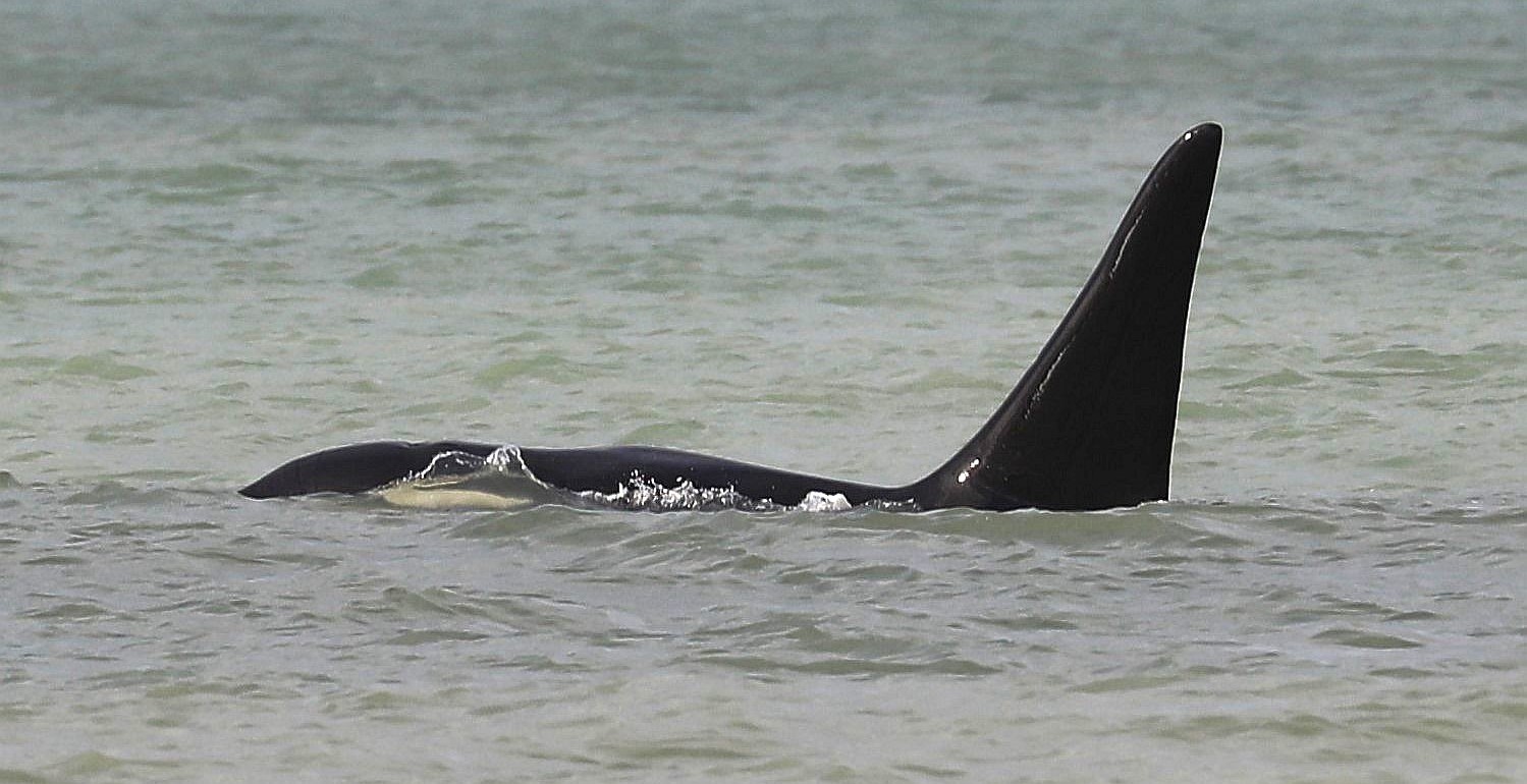
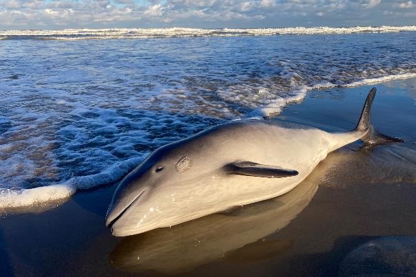
The new report ‘Marine mammals and sea turtles in Belgium in 2023’ summarizes the results of the monitoring and research on these animals in Belgium in 2023. Porpoises washed ashore less than in the past 20 years, but high numbers were still counted at sea. Seals continue to increase. The most remarkable marine mammal of 2023 was an Orca, and the stranding of a live Loggerhead Turtle was a Belgian first.
In 2023, 26 Harbour porpoises washed ashore in Belgium. Most of these animals were in an advanced state of decomposition. This was the lowest number of dead porpoises in the past 20 years, continuing the previously documented declining trend. The highest numbers date from a decade ago, when more than 100 porpoises washed ashore in some years (with a maximum of almost 150 in 2013). The reason for the declining number remains subject to speculation.
Aerial surveys of marine mammals in Belgian waters were carried out in April, June and September 2023. The observations allowed to calculate that there were 14,700, 1,400 and 2,500 porpoises present in the research area at these times, respectively. The number in April was one of the highest ever recorded. An extensive analysis of the data collected during aerial surveys in the period 2009-2022 showed that porpoises indeed occur in high densities in the Belgian part of the North Sea, especially in spring. They prefer the northernmost and westernmost parts of our waters, and appear to avoid shipping lanes.
48 dead seals washed ashore in 2023. Further investigation provided information about the cause of death for 14 of these seals. Ten of these probably died in fishing nets. The total number of dead seals washed ashore is comparable to the five previous years (with the exception of a peak in 2021). In the longer term, there is an increasing trend. Sealife cared for seven Grey and 17 Harbour seals in 2023. Almost half of the animals did not make it.
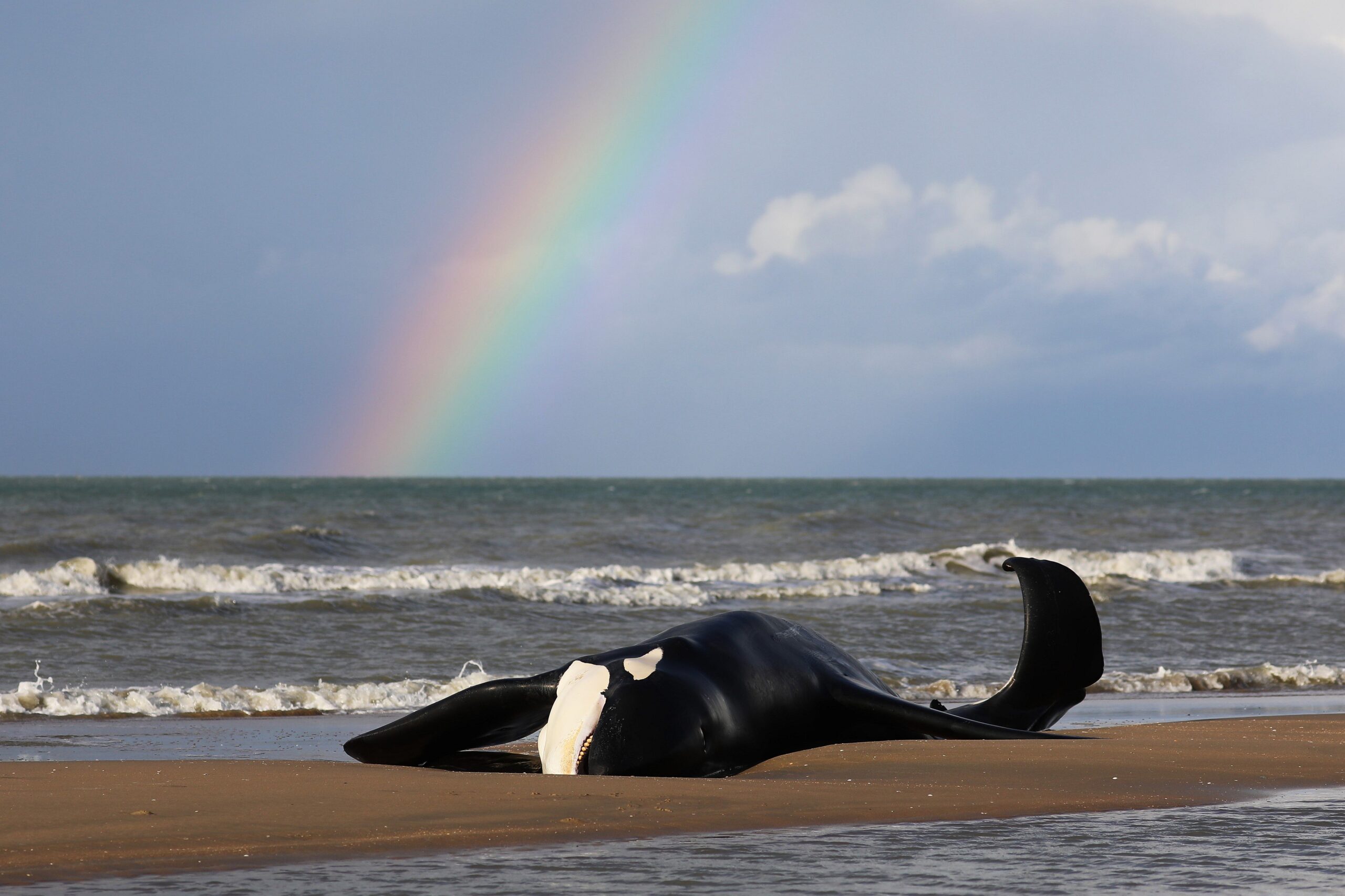
The most striking cetacean of 2023 was undoubtedly the male Orca, which first moved slowly along the coast of Koksijde on October 29, eventually ending up stranded in De Panne. The animal was very thin and weakened, and died almost immediately after stranding. For the time being it could not be determined from which population he came.
It has been since the mid-19th century that strandings of Orcas were recorded in our country. We have tried to unravel the information about those long-ago strandings. We also pay tribute to Louis François Paret, the man to whom we owe the fact that we can still admire the remains of these animals, now more than 175 years old.
A dead Fin whale was brought in on the bow of a ship in the port of Antwerp on August 29, 2023. The autopsy showed that the animal had died as a result of the collision.
Some dolphins, rare for our country, washed ashore in 2023: a Common dolphin on December 22, and two very decomposed Common or Striped dolphins on July 21 and October 8.
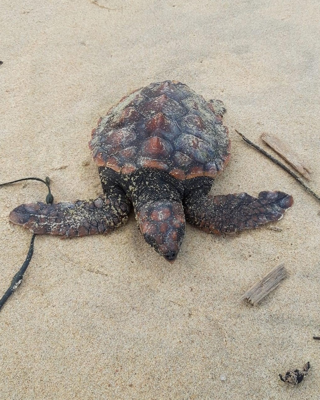
Some sea turtles also washed ashore in 2023. A dead Leatherback turtle on October 7 died from traumatic causes. A live beached Loggerhead turtle on November 25 was the first confirmed stranding of this species in Belgium.
The monitoring programme of the Institute of Natural Sciences for SOx and NOx emissions of ships at sea, part of the aerial surveillance, is a finalist for the Greening Award Initiative of the European Maritime Safety Agency.
The Greening Award Initiative is jointly organised with Frontex (the European Border and Coast Guard Agency) and the European Fisheries Control Agency (EFCA) and celebrates the sustainability actions of authorities performing coast guard functions in the EU.
Since 2015, the Institute of Natural Sciences, using funding from the Connecting Europe Facility programme, has equipped the Belgian coastguard aircraft with a sniffer sensor to measure ship emissions of ocean-going vessels at sea.
This monitoring programme is successful thanks to good cooperation with the Minister of the North Sea who, among other things, provided the NOx sensor, and with the Directorate General Shipping, which organizes the follow-up of suspicious SOx and NOx values on land.
The aircraft now monitors for CO2, SO2, NOx, and black carbon, and the reports from its sniffer operations mean that port state control inspection efficiency has improved by over 50%.
In 2023, the Institute of Natural Sciences documented 17 cases of operational discharges from ships using the Coast Guard aircraft. Suspicious sulphur and nitrogen values were measured in the smoke plumes of 24 and 42 ships. Other activities included surveillance of oil and gas installations, marine mammal counts, and broader maritime surveillance for the Coast Guard.
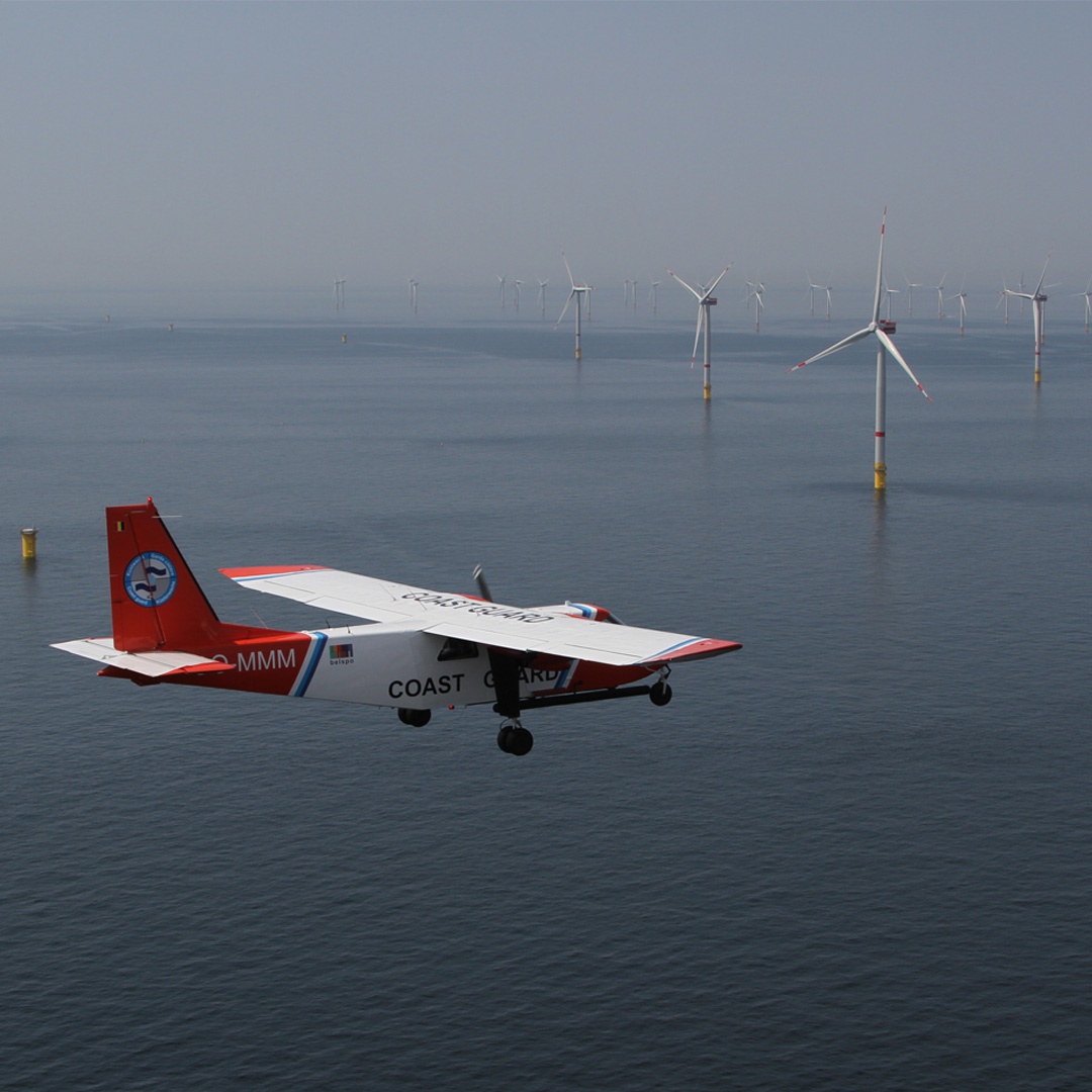
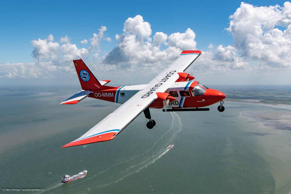
A total of 244 flight hours were performed over the North Sea in 2023 as part of the national aerial surveillance programme. This programme is organised by the Scientific Service MUMM (Management Unit of the Mathematical Model of the North Sea) of the Institute of Natural Sciences, in collaboration with the Ministry of Defence.
Most of the flight hours were for national flights (221 hours):
208 hours in the context of the Belgian Coast Guard:
164 hours for pollution control, divided equally between the detection of discharges of oil, other harmful substances and garbage (MARPOL Annex I, II and V respectively) and the monitoring of sulfur and nitrogen emissions from ships (enforcement of MARPOL Annex VI);
39 hours for fishery control, on behalf of and in cooperation with the Flemish Fishery Inspection Services;
3 hours ‘on call’, during which flights were activated in response to specific alerts, namely for the verification of pollution near the windmill parcs and after the collision of two vessels;
2 hours in the framework of a pollution combating exercise.
13 hours for marine mammal monitoring.
In addition, 23 hours were dedicated to international flights in the framework of the Bonn Agreement, namely for a ‘Tour d’Horizon’ mission to monitor drilling platforms in the North Sea.
Discharges at sea
There were no accidental spills from ships in 2023. On the 10th of October, the Coast Guard Aircraft was requested to verify any pollution after the collision of two vessels in the Westhinder Anchorage. Only material damage was observed on scene.
On the other side, 4 operational oil spills were observed last year. Although this is the largest number in the past 5 years, the downward trend of the past 30 years remains standing (see graph).
The first oil pollution was observed in the wake of a fishing vessel, over a distance of one and a half kilometre. An official report was drawn up by the MUMM officers. The slick was not treatable.
A second, small-scale oil pollution was observed at the entrance of the Western Scheldt in Dutch waters. The oil slick could not be linked to a polluter and was already heavily weathered.
The third oil slick was located near the North Hinder shipping route and was larger in size. The spill of approximately 16 km2 covered French, English and Belgian waters and was already heavily weathered by the natural action of the waves and the large number of ships passing by. A possible polluter could not be identified.
The observation of the fourth oil slick happened after notification by the Norther windfarm. It concerned a small and already weathered oil slick near the wind farms. Here too, no polluter could be identified.
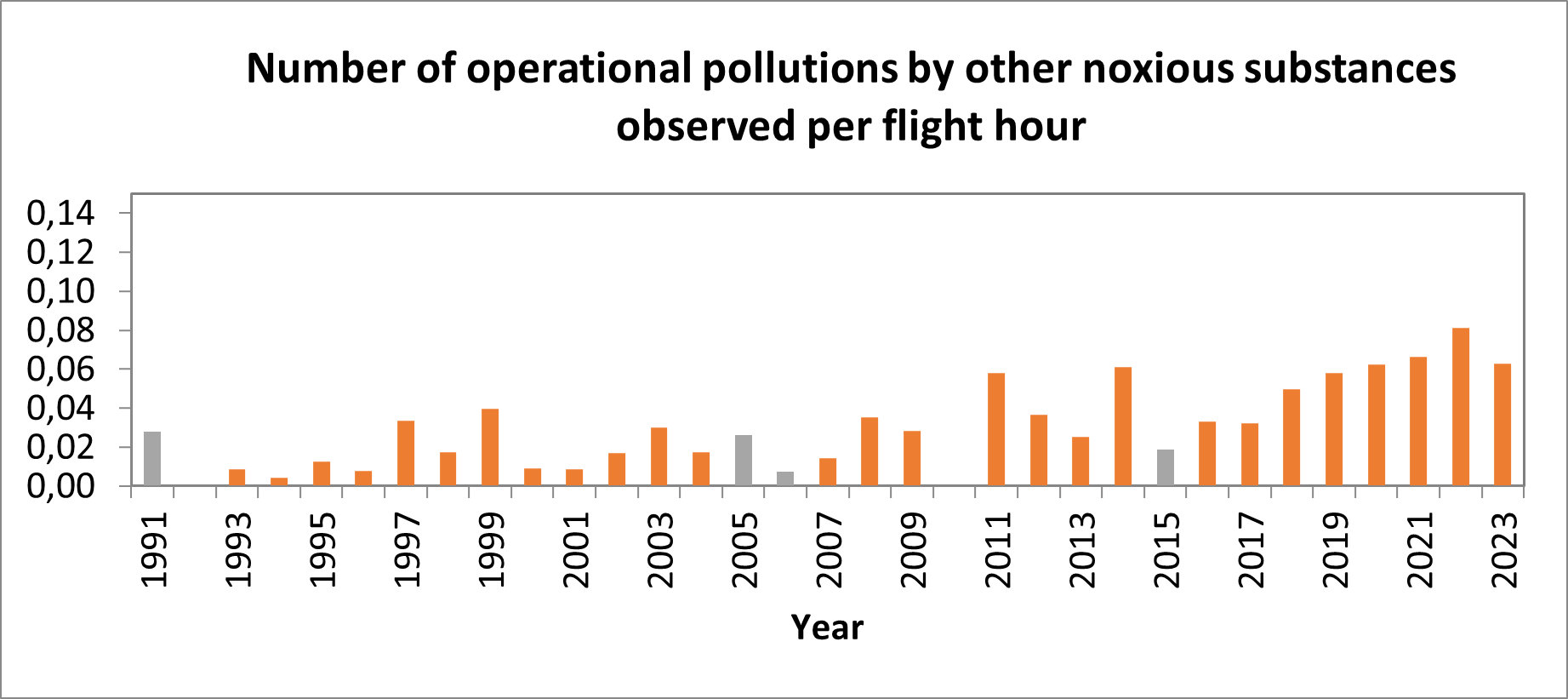
In 2023, no violations against Annex V of the MARPOL Convention concerning the discharge of solid waste from ships, including rubbish, fishing nets and solid cargo residues, were observed. However, no less than 13 cases of operational pollutions with noxious liquid substances other than oil (MARPOL Annex II) were observed. Of these 13 observations, 6 could be linked to a ship.
In 3 cases the discharged substance was FAME (fatty acid methyl ester), in the other cases the discharged substance consisted of aniline, sunflower oil and palm oil derivates. In one case, an official report was issued by the MUMM officers on board the aircraft, as one of the discharge rules for MARPOL Annex II was not met, which stipulates that such discharges must occur where the water is deeper than 25 meters. In the remaining cases, the competent port state control authorities were informed for further follow-up and investigation.
The discharge of harmful liquid substances other than oil is still a common problem, which, as reported in previous years, even appears to be on the rise (see graph below). Not only Belgium, but also other North Sea countries are noticing this increasing trend. However, the fact that these discharges often have a legal character does not alter the fact that they, to varying degrees of severity, can have a negative impact on the marine environment. It is important that coastal states continue to monitor these discharges, as this can identify problems at sea and provide an incentive to adapt, when necessary, current legislation.
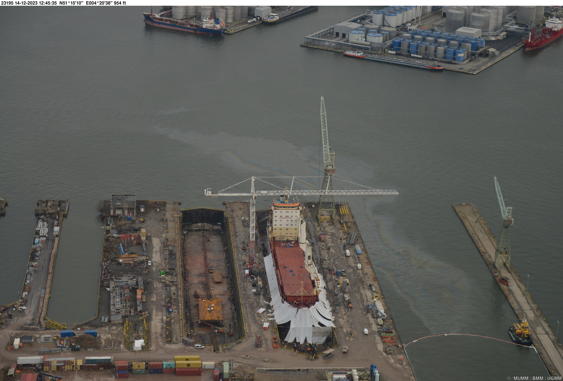
Oil pollution in ports
On the 14th of December, an oil spill was observed in the port of Antwerp. This involved a historical pollution of oil released from the subsoil. This can occur for example during excavation or dredging works. At the moment of observation, an anti-pollution vessel was already trying to recover the oil.
By using a sniffer sensor, the Coast Guard aircraft can measure pollutants in ship emissions at sea, and our country is known as a pioneer in the international fight against air pollution from ships.
The measurement of sulphur emissions has already been part of the programme since 2016. In order to monitor the strict sulphur limits that apply to ship fuel in the North Sea Emission Control Area, 59 sniffer flights (for a total of 79,7 hours) were carried out by the aircraft in 2023 over the Belgian monitoring area. Of the 902 ships whose emissions were measured, 24 had a suspiciously high sulphur content. These ships were duly reported to the relevant maritime inspection services and were subsequently inspected on shore.
Thanks to the successful integration of a NOx sensor in 2020, the aircraft can also measure the concentration of nitrogen compounds (NOx) in the exhaust plumes of ships in order to monitor and enforce the stricter limits that apply from 1 January 2021 in the North Sea Emission Control Area. Belgium has thus become the first country ready to monitor these stricter restrictions. Of the 902 ships for which nitrogen emissions were monitored in 2023, 42 suspicious values were reported.
Since 2021, a new sensor has been added to the sniffer set-up, namely the black carbon sensor. This sensor measures the amount of black carbon in the exhaust plumes of ships, which is a measure for the soot concentration. The soot concentration of 377 ships was measured in 2023. When exceptionally high soot concentrations are measured, the competent maritime port authorities are asked to take a sample of the fuel used. In 2024, these fuel samples will be analysed by the Institute of Natural Sciences.
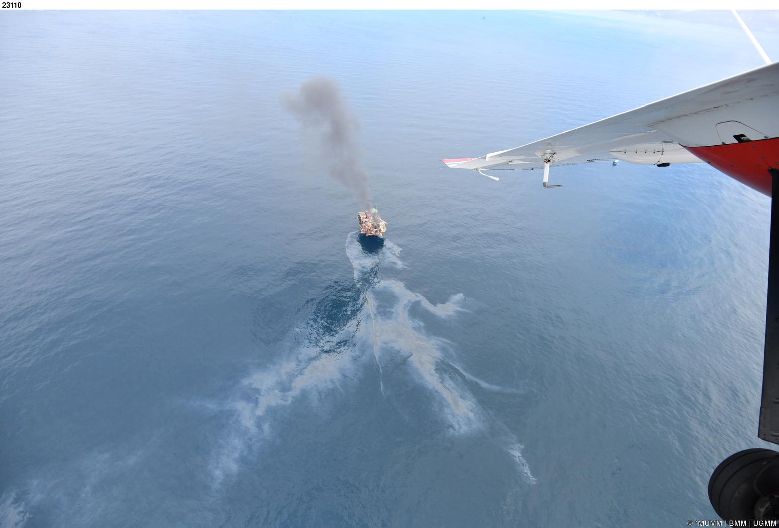
In July 2023, the surveillance aircraft carried out the annual international TdH mission under the Bonn Agreement. During this mission marine pollution from oil rigs and gas installations are reported in the central part of the North Sea (in Dutch, Danish, British and Norwegian offshore waters).
A total of 30 oil spills were detected, the second highest number since the start of the Belgian participation to the yearly mission in 1991. 28 of these could be linked to oil rigs. All these observations were systematically reported to the competent coastal State for further follow-up, in accordance with international procedures.
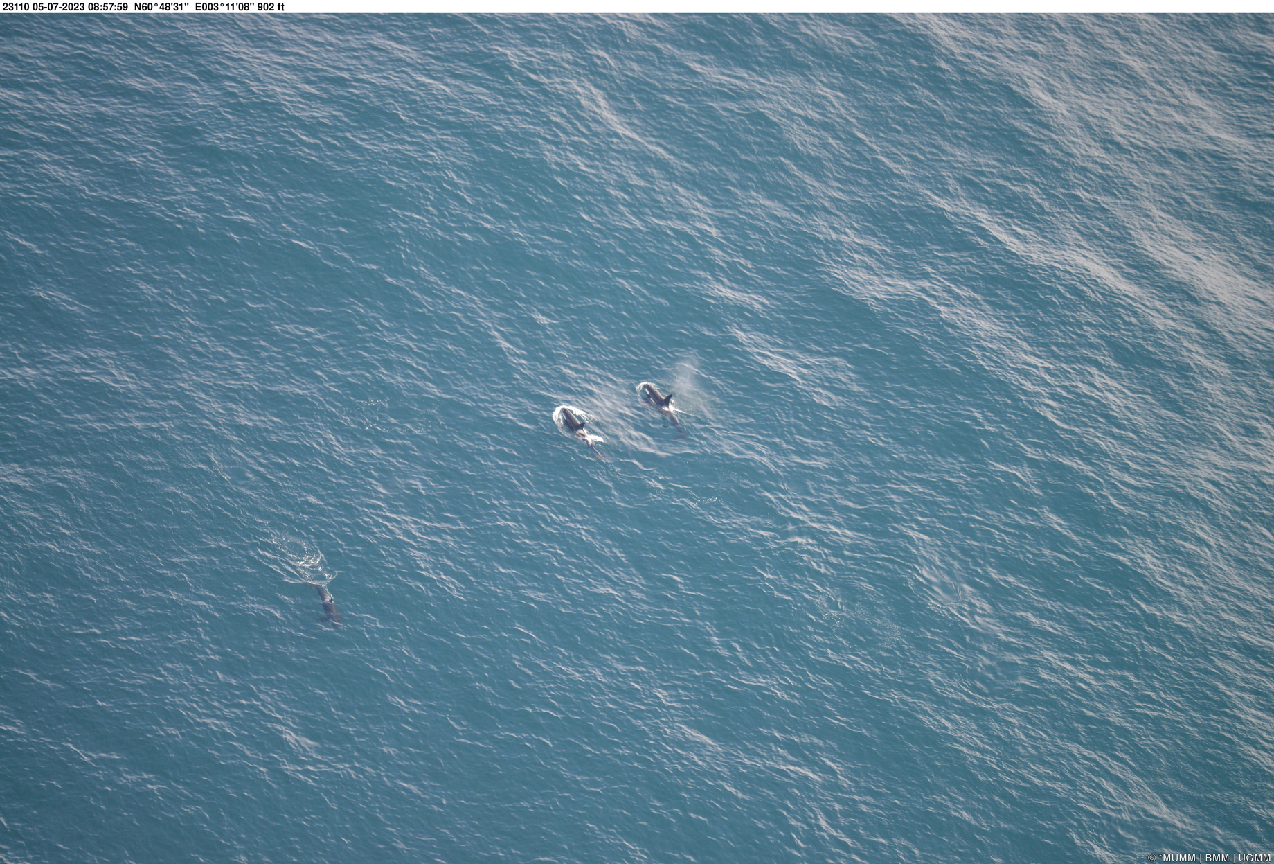
In 2023, the Institute of Natural Sciences conducted aerial marine mammals surveys in April, June and September. Respectively, 282, 32 and 55 harbour porpoises were observed along the flown transects. That are a lot of harbour porpoises for the Belgian waters: over 14.700 in April, 1.400 in June and over 2.500 in September. To a lower extent – but still quite frequently – also seals were observed, respectively 2, 10 and 30.
Extended maritime surveillance
Within the framework of the Belgian Coast Guard, the surveillance aircraft also contributed to broader missions of enforcement of maritime regulations and safety at sea.
As such, 15 ships were observed without AIS in 2023, an automatic identification system that, among other things, helps to avoid collisions. The majority (93%) were fishing vessels. The figures of 2023 confirm the increasing trend observed in the recent years, from the moment fishing vessels have been obliged to sail with AIS (in 2020).
In addition, 53 navigational violations were observed in the traffic separation scheme (“TSS”) in and nearby the Belgian waters. This is also a significant increase and mainly concerns vessels sailing in the opposite direction (“ghost sailing”) or dropping anchor in one of the shipping lanes. These observations were systematically reported to the Directorate-General for Shipping (FPS Mobility and Transport) for follow-up. In view of the increasing number of violations and the consequent increased risk of collisions, the Directorate-General for Shipping has been carrying out the necessary legal follow-up on this subject since January 2023.
Finally, 3 offenders who entered prohibited areas were also reported to the competent authorities. This is significantly less than the figures of previous years. A possible explanation is that the introduction of closed areas for shipping, such as the aquaculture farm (sea farm) off the coast of Nieuwpoort and the calibration area for scientific instruments (near Ostend) have already been established in the seagoing fleet.