Air pollution by Russian shadow fleet in the North Sea

More than four years after the Russian invasion of Ukraine began, new research by the Institute of Natural Sciences identifies a significant increase in non-compliance with international ship emission regulations among shadow fleet vessels operating in the North Sea region. More specifically, the study indicates that shadow fleet vessels increasingly use non-compliant fuels, leading to elevated emissions of sulfur dioxide (SO2).

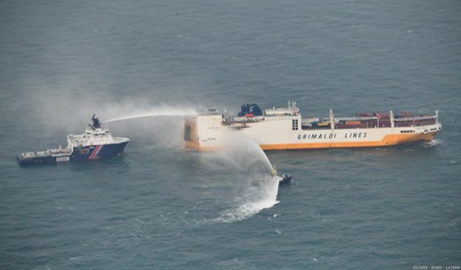
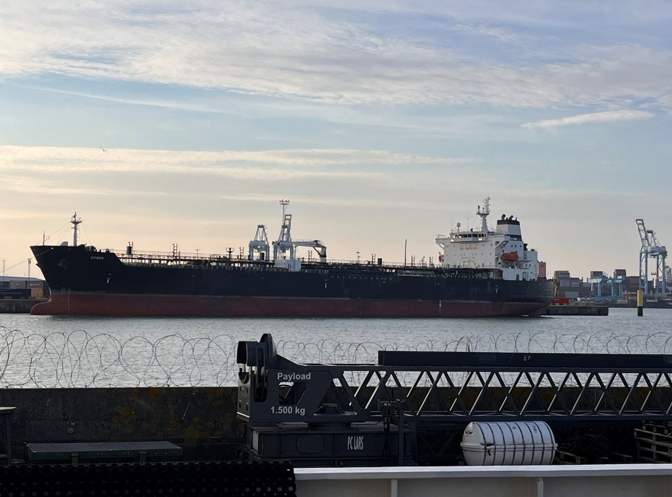
MS Ethera in the port of Zeebrugge (© Institute of Natural Sciences)
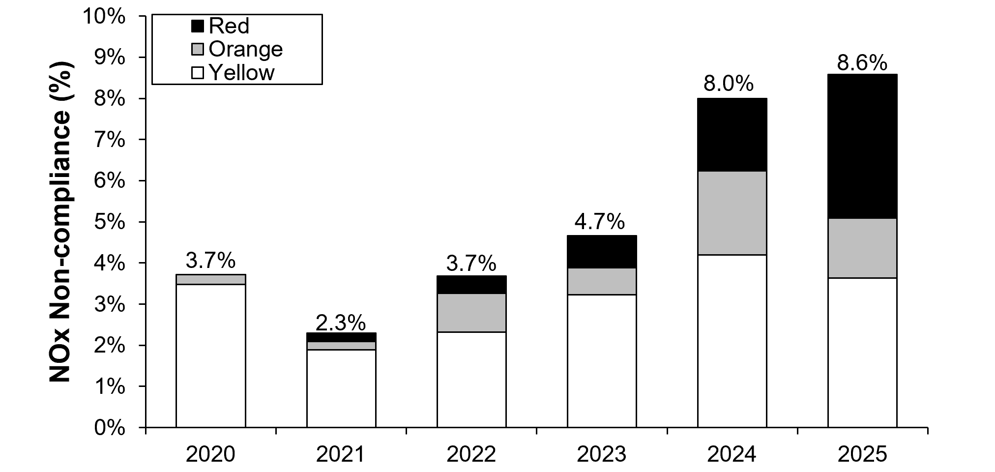
The North Sea is designated as an Emission Control Area (ECA) under regulations established by the International Maritime Organization (IMO). Within this maritime zone, stringent limits are imposed on sulfur and nitrogen oxide emissions from ships to improve air quality and safeguard marine ecosystems.

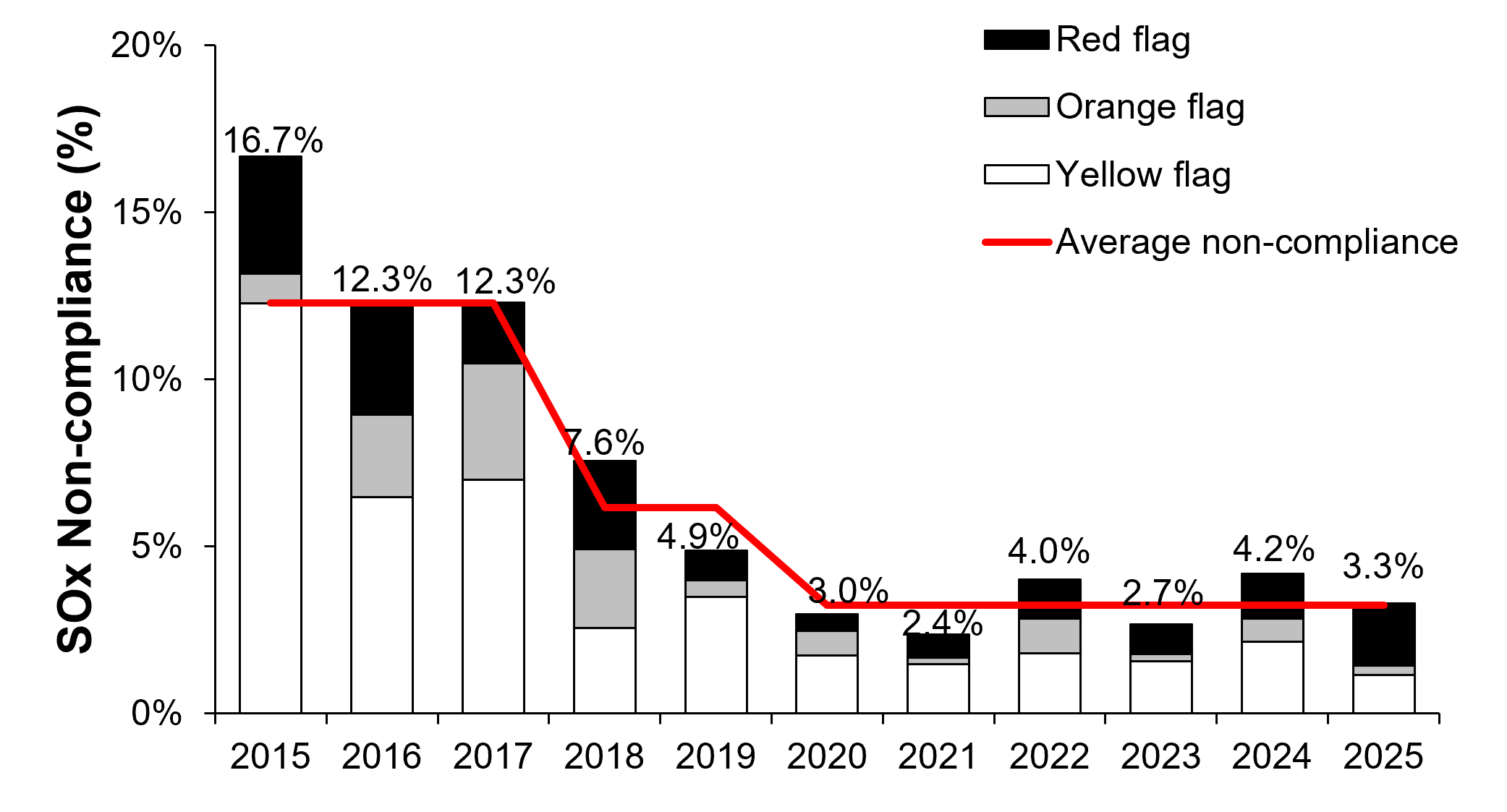
Compliance can be achieved by using fuel with a ‘fuel sulfur content’ not exceeding the prescribed limit of 0.1%. Non-compliance can be remotely determined using airborne monitoring measurements of ship exhausts.

Elevated non-compliance

The new study combines ten years (2015–2025) of airborne ship emission measurements collected by the Belgian coastguard aircraft with vessel tracking data from Automatic Identification System (AIS) and international sanctions databases. As the term “shadow fleet” is not uniformly defined, this study considers two categories of Russian-linked vessels: (1) formally sanctioned vessels and (2) vessels not subject to sanctions but trading with Russian ports or sailing under the Russian flag.

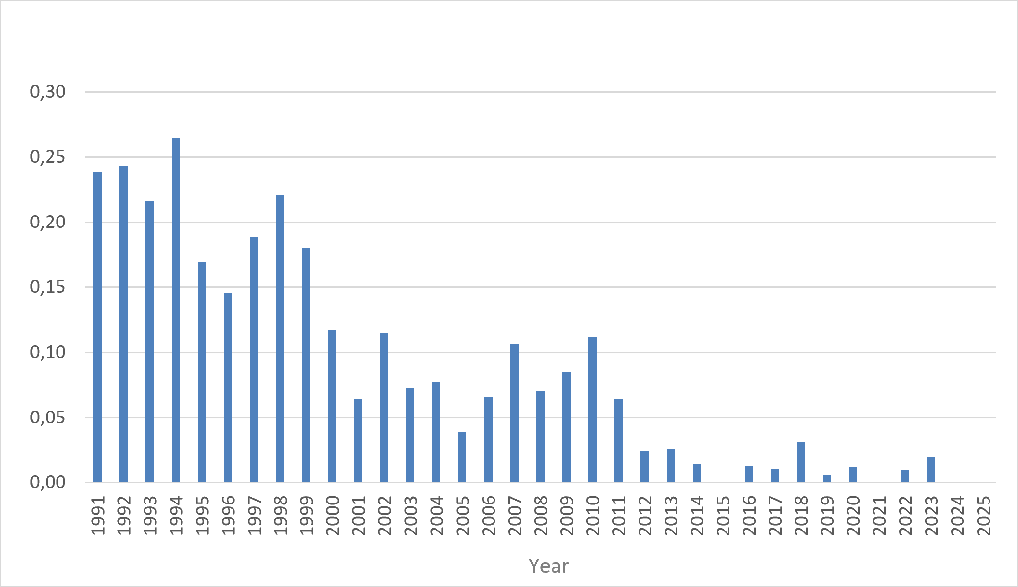
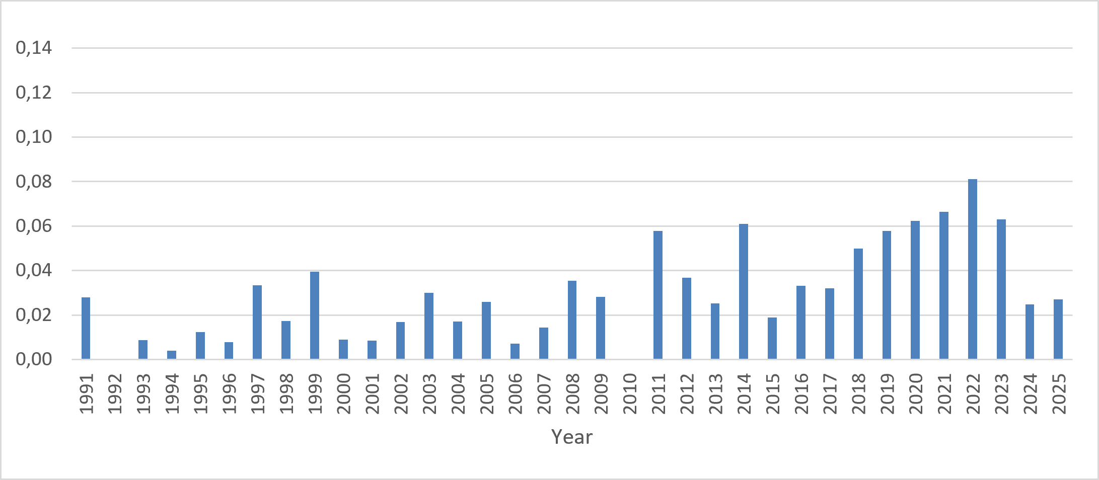
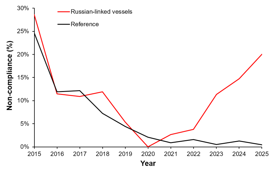
The results reveal a remarkable increase in non-compliance among Russian-linked vessels following the outbreak of the war in Ukraine in 2022. Prior to 2022, Russian-linked vessels exhibited compliance behaviour similar to the rest of the international merchant fleet. Following 2022, non-compliance among Russian-linked vessels increased significantly, reaching 14.8%, compared with only 0.7% for the reference fleet.

Evolution of the use of non-compliant fuel by Russian-linked vessels compared with the reference fleet (2015–2025)

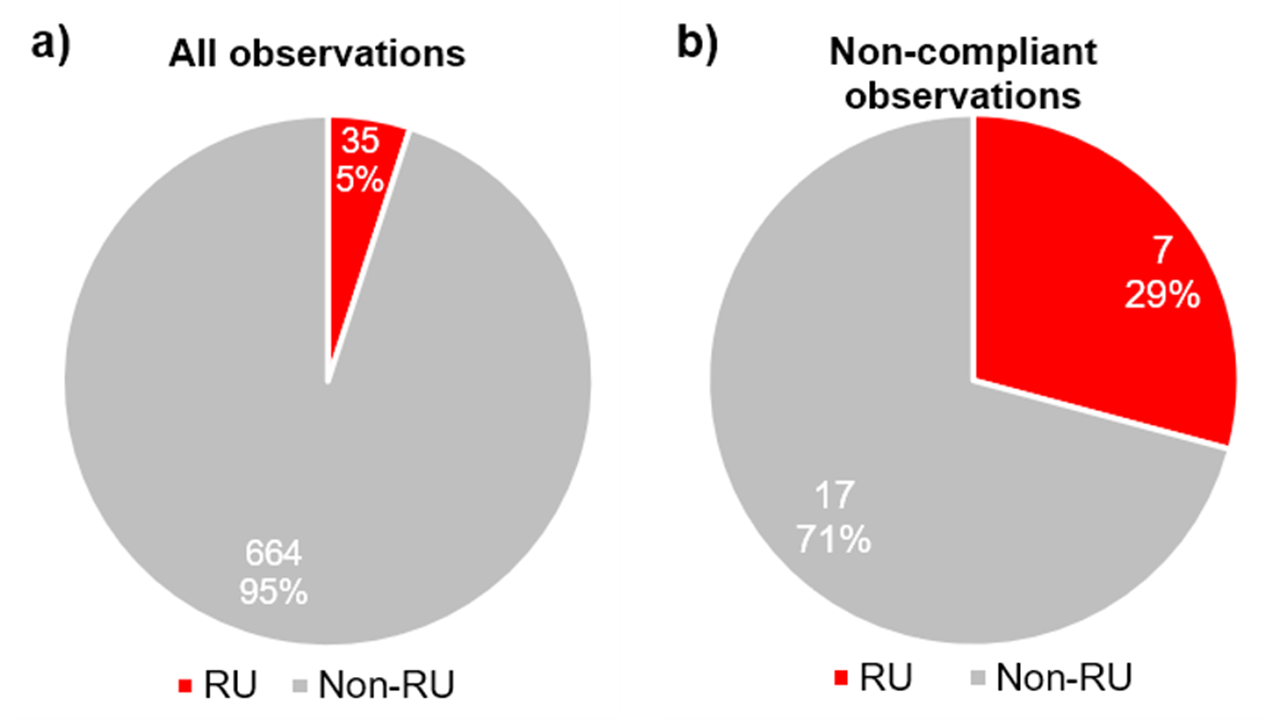
Although Russian-linked vessels represented only approximately 5% of all monitored vessels, they accounted for nearly 30% of all detected violations in 2025.

The 2025 proportion of measured (a) and non-compliant (b) Russian-linked vessels compared to all observations

Shadow fleet characterisation

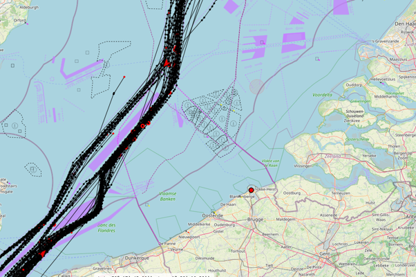
To better understand the presence of shadow fleet vessels in Belgian waters, the Institute of Natural Sciences developed an automated geofence system combining AIS vessel tracking with international sanctions databases. During the observation period, the system identified on average almost four sanctioned vessels and more than four additional Russian-trading vessels transiting Belgian waters each day.

The shadow fleet vessels observed in this study were generally old vessels, with an average age of more than 20 years. Such ageing vessels may pose a greater risk of technical failures and environmental incidents. Many of these vessels also operate without adequate insurance or even under false flag registrations, raising additional concerns about their accountability in case of incidents at sea. Their continuous presence in the Belgian part of the North Sea underlines the importance of continued monitoring and vigilance.

The higher average age of the Russian-linked vessels and their fuel use likely also explain another finding from the study: in addition to the increased non-compliance for sulfur emissions, black carbon emissions were also found to be significantly higher for Russian-linked vessels than for the reference fleet.

One month of AIS tracking information of sanctioned vessels in Belgian waters (April 2026)

Enforcement challenge

The findings of this study highlight an important enforcement challenge. Many shadow fleet vessels transit European waters without calling at European ports and therefore largely avoid conventional port State control inspections. As a result, airborne remote sensing, combined with AIS-based intelligence gathering, provides an increasingly important complementary tool for identifying high risk vessels and supporting targeted enforcement actions.

Recent actions by Belgian authorities and other European Member States, including the seizure of the MS Ethera in early 2026, illustrate the type of measures that may become increasingly important in addressing the environmental risks associated with shadow fleet activities.

The Institute of Natural Sciences remains committed to providing independent scientific expertise on maritime environmental issues. It has been pioneering airborne ship emission monitoring for more than ten years and will continue its monitoring efforts to support the protection of the marine environment in the North Sea.


Reference of the study (pre-publication, submitted for peer review):

Van Roy, Ward; Merveille, Jean Baptiste; Scheldeman, Kobe; Van Nieuwenhove, Annelore; D’hamers, Maan; Schallier, Ronny, Airborne Monitoring of Shadow Fleet Emissions in the North Sea ECA. Available at http://dx.doi.org/10.2139/ssrn.6956831

Large oil spill response exercise off the coast of Zeebrugge

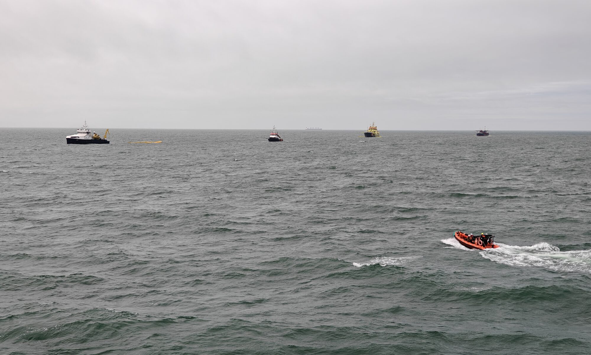
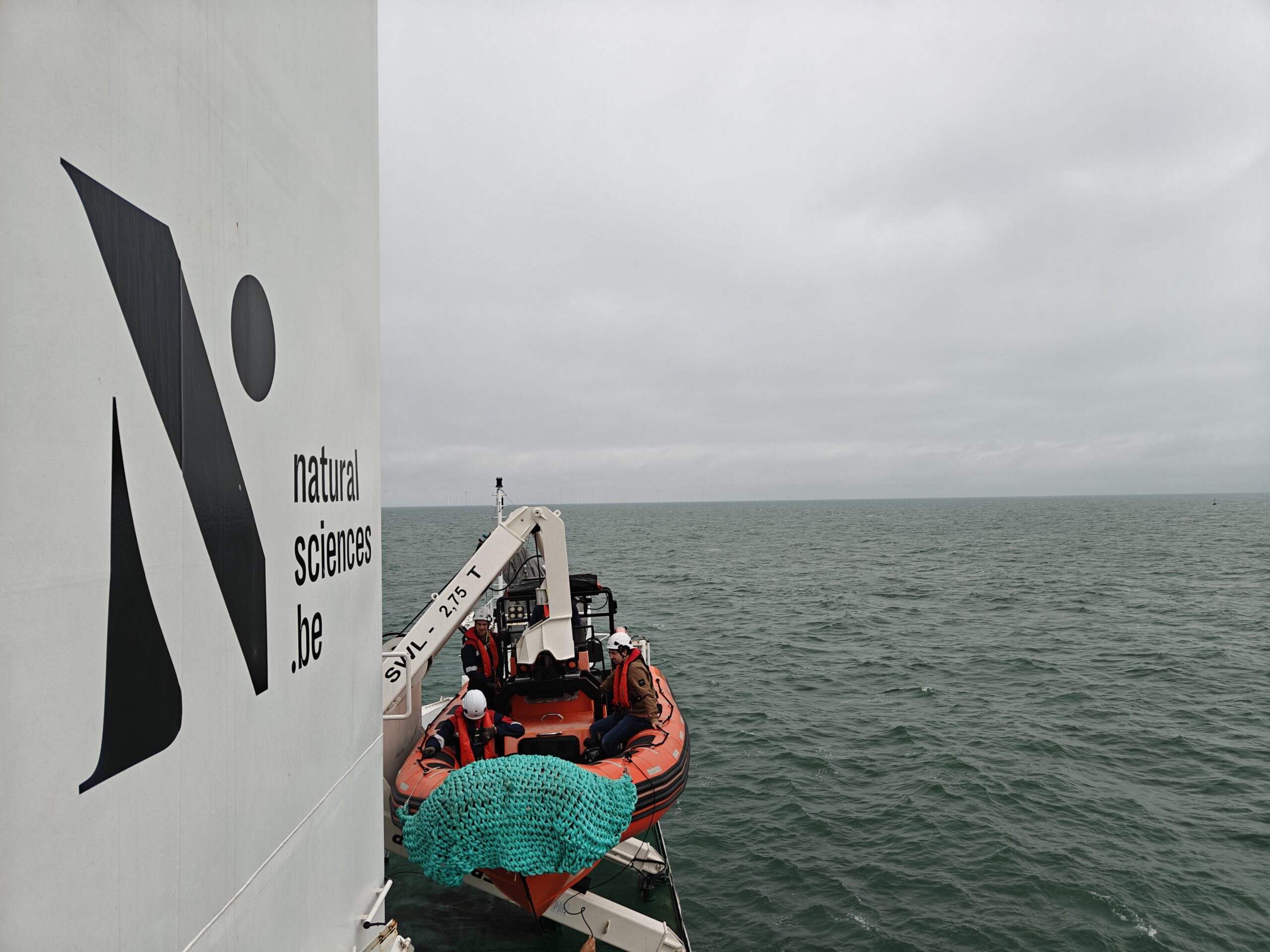
On Wednesday, June 17, a large oil spill response exercise took place off the coast of Zeebrugge, in the presence of Minister for the North Sea Annelies Verlinden. The exercise tested how Belgium and its partners respond to a serious oil spill at sea. According to the scenario, a large oil slick was discovered about 7 nautical miles (12 km) from the coast. The goal was to clean it up quickly, before it reached vulnerable nature reserves such as the Zwin and the Scheldt estuary, and to limit disruption to the ports. Instead of oil, straw was used, which behaves similarly at sea.

© FPS Public Health

Belgian and foreign vessels

A total of seven ships participated in the exercise, including both Belgian and foreign specialized vessels. For example, the Arca took part, a ship belonging to the Dutch Rijkswaterstaat equipped with sweeping arms capable of collecting the oil. Belgium deployed the Zeetijger and the Sirius. These vessels from Vloot (Fleet; Agency MDK) can be equipped to clean up oil in the event of a major disaster.

The Interballast III also participated. This vessel, actually a dredger belonging to the Group De Cloedt, is deployed by the European Maritime Safety Agency (EMSA) during major incidents in the North Sea. This ship can also be equipped with sweeping arms to clean up oil. Furthermore, the vessel’s hold is heated so that the collected oil remains liquid and can be pumped out when the ship is full.

Cooperation between coast guard partners and countries

The oil spill response exercise was coordinated by the Marine Environment service of the FPS Public Health and carried out by Belgian coast guard partners in cooperation with Dutch and European organizations.

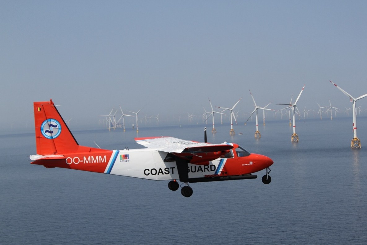
The Belgian Coast Guard is a cooperation network responsible for maritime tasks related to safety, surveillance, and assistance. 17 Flemish and federal government services and the Governor of West Flanders are part of the Coast Guard. By working together, the various services ensure that these tasks are carried out efficiently and in a well-coordinated manner in the North Sea. The Scientific Service ‘Management Unit of the Mathematical Model of the North Sea (MUMM)’ of the Institute of Natural Sciences is one of the federal partners and, in that capacity, also organizes the activities of the Belgian Coastguard aircraft.

The exercise took place within the framework of the Multipurpose Maritime Operation (MMO), an annual large-scale and multifunctional maritime operation in the North Sea, coordinated by the European Maritime Safety Agency (EMSA), the European Border Control Agency (FRONTEX), and the European Fisheries Control Agency (EFCA), with support from the European Union. Member states cooperate closely in this context on coastguard tasks such as maritime safety, environmental protection, and border surveillance.

© FPS Public Health

International attention for BBNJ candidacy

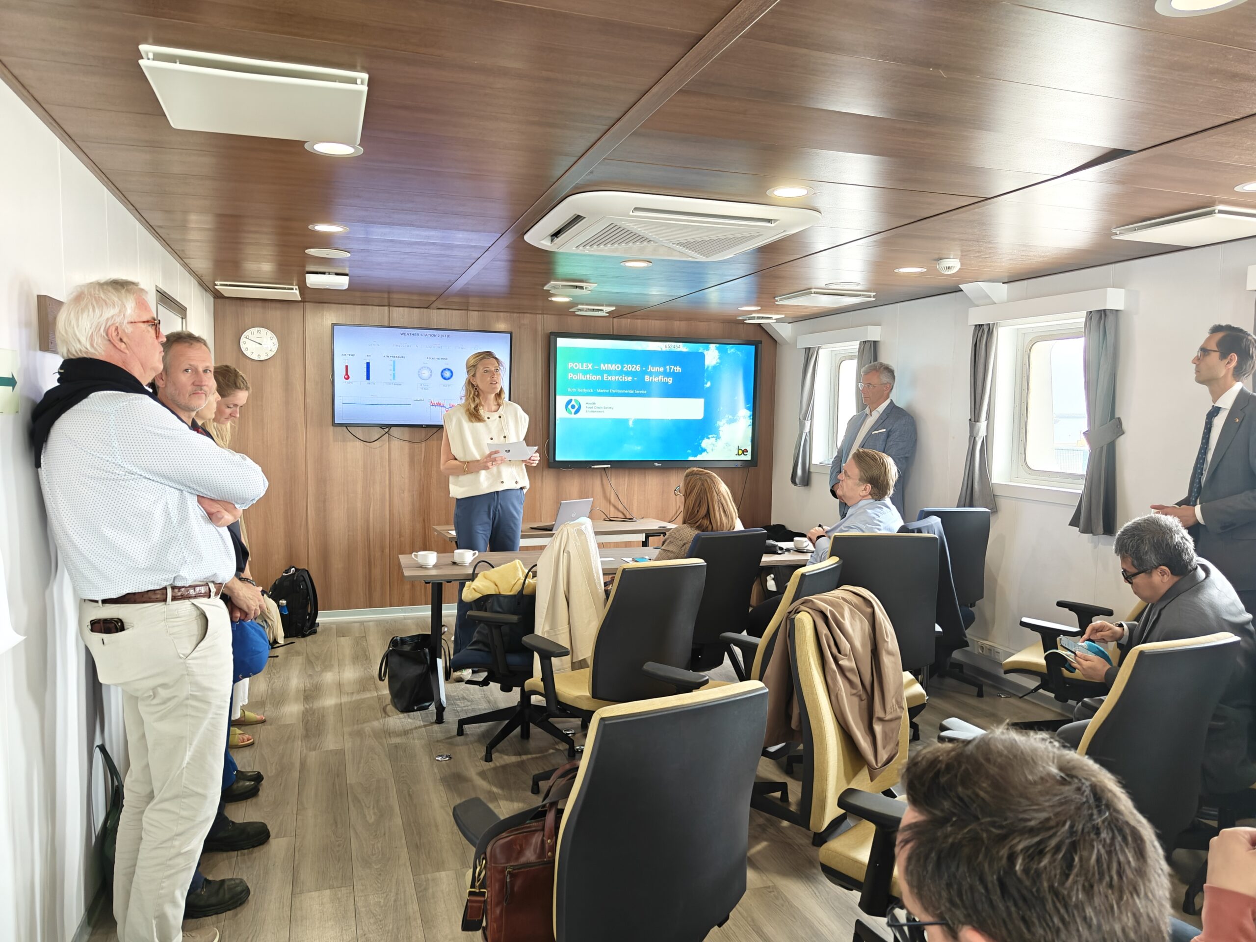
The exercise was attended by Minister of Justice and the North Sea Annelies Verlinden, together with the Chair of the FPS Public Health, Food Chain Safety and Environment Dirk Ramaekers, Director General for the Environment Pierre Kerkhofs, and the Belgian Special Envoy for the Ocean Sophie Mirgaux Dillien. For the Institute of Natural Sciences, General Director Michel Van Camp and Operational Director Steven Degraer (Operational Directorate Natural Environment), among others, attended the event.

Their presence – aboard the research vessel RV Belgica – was part of the Belgian bid to host the secretariat of the Agreement under the United Nations Convention on the Law of the Sea on the Conservation and Sustainable Use of Marine Biological Diversity of Areas beyond National Jurisdiction (BBNJ Agreement). In the same context, several foreign diplomats also followed the exercise. The BBNJ Convention aims to better protect and sustainably manage biodiversity on the high seas, including through marine protected areas, environmental impact assessments, and agreements on the use of marine genetic resources.

Annelies Verlinden, Minister of Justice and the North Sea:

“The ocean does not stop at national borders, and neither does oil pollution. This exercise demonstrates how crucial cooperation is to protect the ocean. Belgium invests in equipment, capacity, and knowledge to keep the sea safe and clean, and in national and international partnerships. With its bid for the BBNJ secretariat, Belgium wants to use its expertise and connecting role to better protect biodiversity on the high seas.”

© FPS Public Health

After the exercise: evaluation

Two weeks after the exercise, an evaluation will follow with all partners. We will then review what went well and what could be improved. The points for improvement will be integrated into the Oil Spill Response Intervention Plan.

Nature-Inclusive Design at the Princess Elisabeth Island: Discontinuation of the NID4BirdLIFE project

As part of the development of the Princess Elisabeth Island, Elia and its scientific partners explore how large-scale offshore infrastructure can contribute to biodiversity through Nature-Inclusive Design (NID). One of the NID measures proposed was the installation of a durable breeding colony of black-legged kittiwakes on the island walls. However, the ambition to establish this solution ultimately had to be abandoned due to substantial cost increases and operational safety concerns that affected the project’s viability. Despite this setback, the partners remain fully committed to implementing impactful NID measures and advancing sustainable solutions for the marine environment. Other measures of the energy island’s NID plan are progressing well.

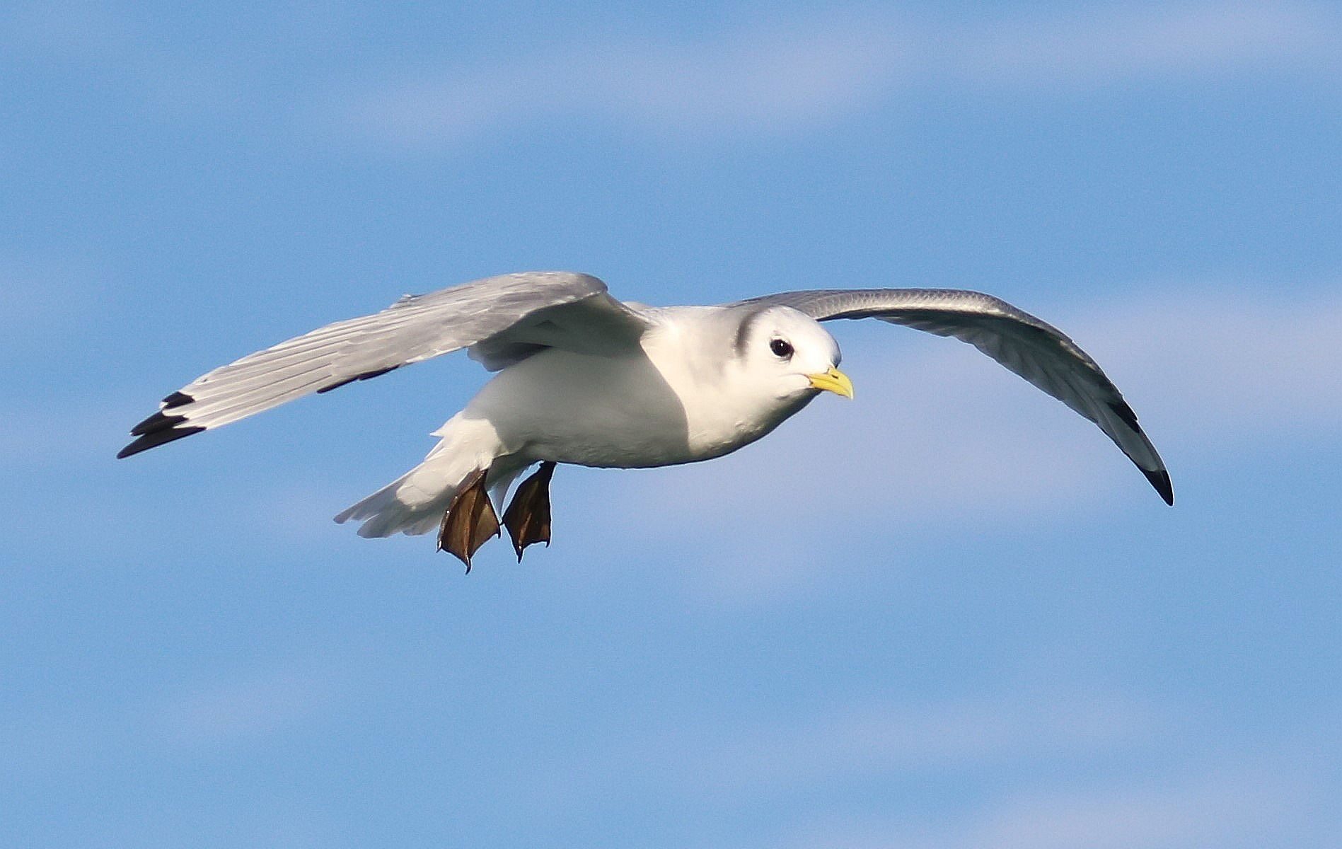
Adult Black-legged Kittiwake, 13 November 2022, Belgian part of the North Sea (© Institute of Natural Sciences/Kelle Moreau)

What is Nature-Inclusive Design in the context of the Princess Elisabeth Island?

Nature-Inclusive Design (NID) is a collaborative effort to integrate ecological expertise into the design and construction of the energy island, aiming to enhance biodiversity both above and below water. More specifically, biodiversity-enhancing elements are incorporated directly into human infrastructure. Rather than building in opposition to nature, NID fosters coexistence and creates opportunities for flora and fauna to thrive in environments shaped by human activity.

For the Princess Elisabeth Island, several NID measures were developed in collaboration with marine ecology and conservation experts:

  • Ledges for Cliff-Nesting Birds: Nesting and resting areas for the black-legged kittiwake.
  • Relief Panels in the Deep Subtidal Zone: 3D panels offering shelter and attachment surfaces for marine organisms.
  • Chaotic Scour Protection with Complex Edges: Creating diverse habitats for marine species.
  • Oyster reefs: Promoting European flat oyster restoration.
  • Strategically Placed Boulders: Increasing habitat complexity.
  • Preservation and Integration of Natural Gravel Beds: Ensuring ecological continuity with the original seabed.

These measures reflect a shared commitment to building resilient, sustainable infrastructure that respects and enhances the surrounding ecosystem.

The NID4BirdLIFE Project

Launched in 2024, the NID4BirdLIFE initiative, in which Elia teamed up with the Institute of Natural Sciences, the Research Institute for Nature and Forest (INBO) and the Renewables Grid Initiative (RGI), aimed to support the black-legged kittiwake (Rissa tridactyla) population in the North Sea. This was to be achieved through the integration of nesting ledges into the island’s wave walls to establish a durable breeding colony on the Princess Elisabeth Island.

Despite the ecological ambition and collaborative efforts invested which led to an approved technical design, two major risks emerged that significantly compromised the viability of the project:

  1. Substantial Cost Increase: Procurement and installation costs for bird ledges tripled over time, also threatening the possible budget allocation to other NID measures.
  2. Bird Strike Risk: The attraction of birds results in an unavoidable residual risk for helicopter operations, conflicting with the ALARP (As Low As Reasonably Practicable) principle required for helideck certification.

While mitigation efforts were extensively explored — including a renewed evaluation by INBO of the minimum ledge lengths which would still be expected to yield a positive outcome  — Elia could not afford the increased cost associated with a single NID measure without compromising the implementation of the other NID measures.

Faced with these constraints, the NID4BirdLIFE project had to be stopped. This decision was not taken lightly and reflects the complex reality of pioneering infrastructure projects. The support of the European Climate, Infrastructure and Environment Executive Agency (CINEA) and all stakeholders throughout the NID4BirdLIFE project has been invaluable.

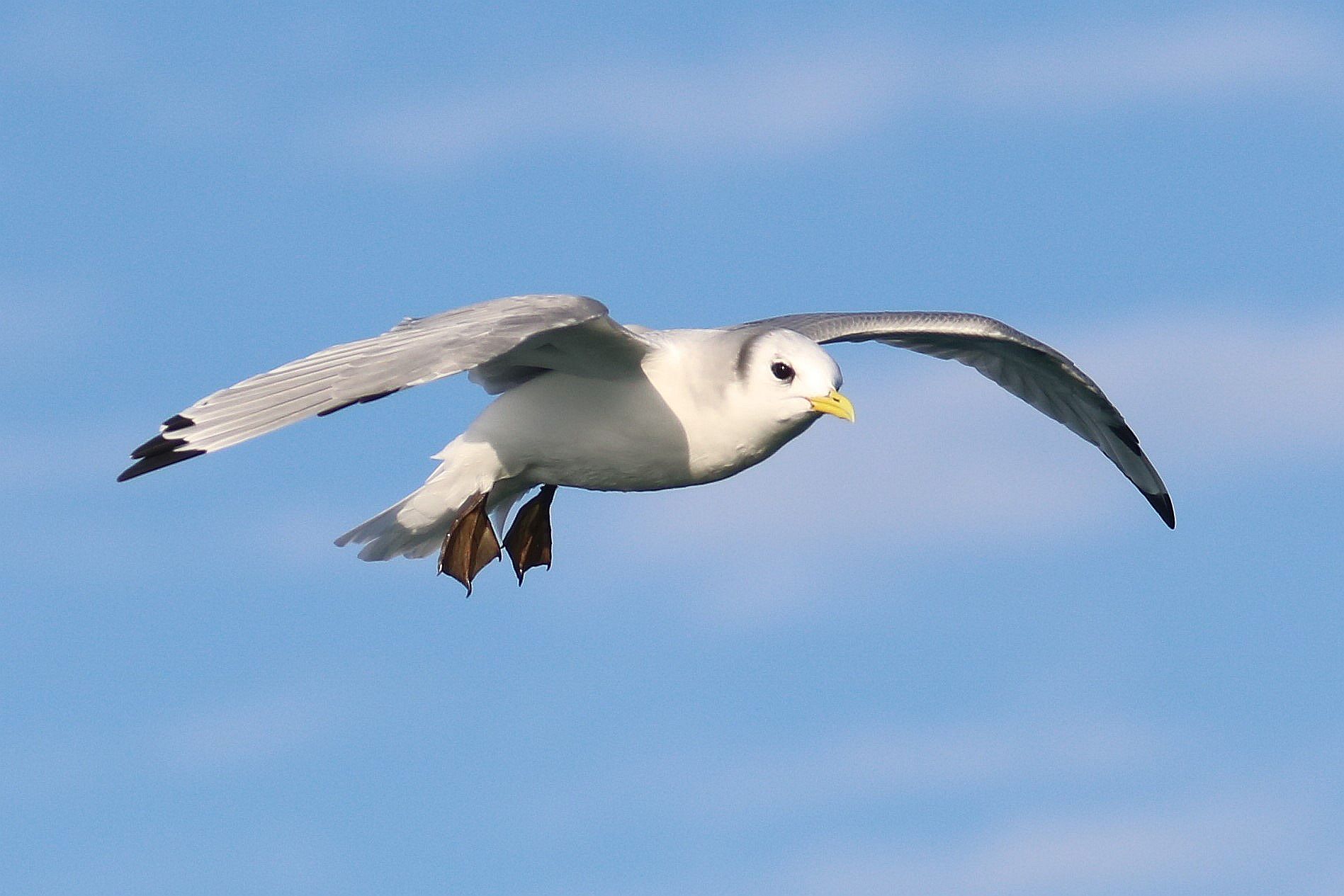
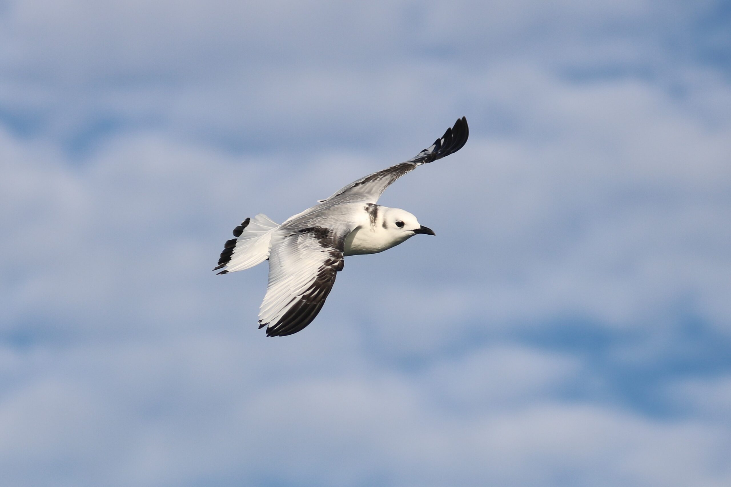
First-year Black-legged Kittiwake, 13 November 2022, Belgian part of the North Sea (© Institute of Natural Sciences/Kelle Moreau)

Looking Ahead

The consortium partners reaffirm their commitment to implementing the remaining NID measures, as agreed upon with ecological experts.

The pioneering nature of the NID strategy remains central to the consortium’s vision for the energy island. Together, they will continue to explore viable, impactful solutions that promote biodiversity and contribute to a sustainable marine environment.

Despite the early ending of the project, through the stakeholder engagement activities led by RGI, the consortium has produced a State-of-the-art report on Innovative Nature-Inclusive Design solutions for Birdlife near offshore energy infrastructure. This report summarises the main challenges and potential solutions identified by stakeholders and sets out proposed principles to support more effective implementation in future projects. The NID4BirdLIFE project helped initiating the discussions on the topic, which RGI commits to continue with key stakeholders in the future, through the Offshore Coalition for Energy and Nature (OCEaN).

Forewarned is forearmed: the Foam Alert Service of the Institute of Natural Sciences

On 10 May 2026, the Foam Alert Service that was developed by the Institute of Natural Sciences in 2020 indicated a high risk of dangerous foam formation along the Belgian and Dutch coasts. Alerts were subsequently issued to municipalities and surf clubs, and no incidents occurred.

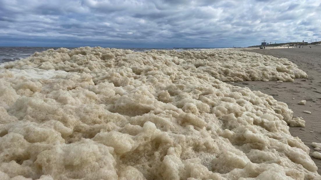
Sea foam on Dutch beach, 11 May 2026 (© Omroep West)

Most of us have seen sea foam washing up on our beaches — but few know what causes it, or the risks it can pose.

Each spring and early summer, microscopic algae such as Phaeocystis globosa can bloom explosively in the North Sea. When these algae die, proteins and gelatinous substances are released into the water. Wind and waves then whip this organic material into thick sea foam, much like beaten egg whites.

Usually, this creates the familiar foam streaks visible on the sea surface. But under certain conditions — high algal biomass, strong waves and onshore winds — the foam can accumulate massively on beaches.

This is not without danger. In spring 2020, extreme foam accumulation in Dutch coastal waters, reaching up to a metre thick in places, tragically caused the deaths of five surfers by asphyxiation.

Since then, the Belgian Coast Guard, supported by the remote sensing, marine forecasting and aerial surveillance teams of the Institute of Natural Sciences, has been actively monitoring foam risks using satellite imagery, marine forecast models and aircraft observations. A dedicated Foam Alert Service was established to issue warnings when conditions become hazardous. The Dutch coast, where foam accumulation can be even more severe, is monitored as well.

On 10 May 2026, satellite data from Aquascope (financed by Belspo), combined with wind and wave forecasts from the Marine Forecasting Centre, indicated a high risk of hazardous foam formation. In response, alerts were issued to municipalities and surf clubs along both the Belgian and Dutch coasts. Fortunately, no incidents were reported. In the following days, the situation was closely monitored by the Institute’s aerial surveillance team using Remotely Piloted Aircraft Systems (RPAS) deployed over Belgian coastal waters in the framework of the Multipurpose Maritime Operations (MMO) coordinated by the European Maritime Safety Agency (EMSA).

While sea foam is largely a natural phenomenon, human activities can intensify it. Nutrient enrichment (“eutrophication” or “over-fertilisation”) of coastal waters — often linked to agricultural fertilizer runoff entering the sea through rivers and groundwater — stimulates algal growth and can therefore increase foam formation. Research has also shown that hazardous substances such as PFAS can accumulate in sea foam at elevated concentrations. Forewarned is forearmed.

DETAIL – A sea foam alert is generated as follows:

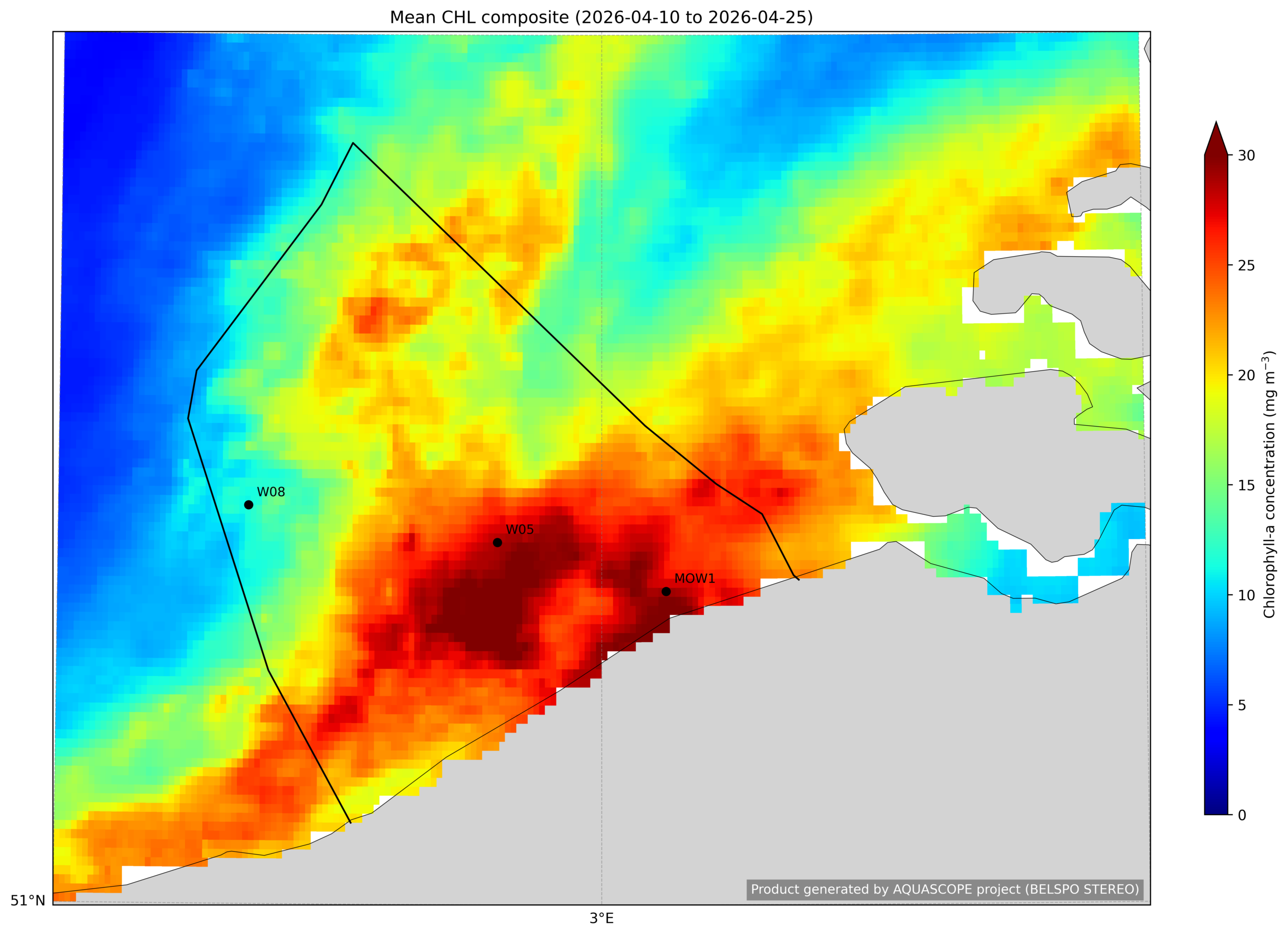
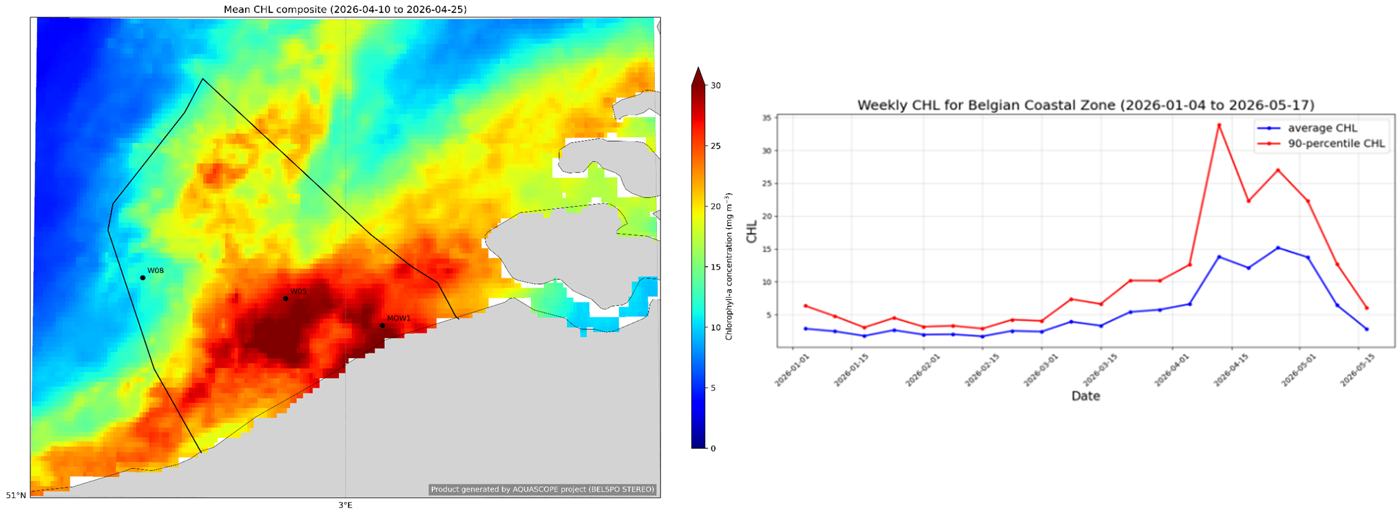
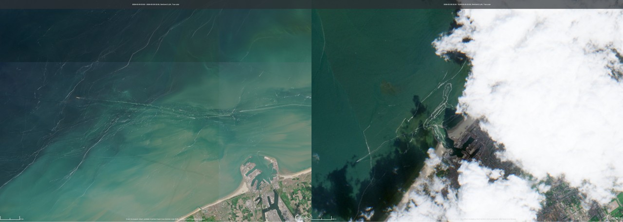
Step 1 of the foam alert warning process: Chlorophyll-a maps are generated based on the Copernicus Sentinel-3 satellite data describing the algal bloom dynamics in the Belgian Continental Zone as shown in the 2 week (10 to 25 April 2026) composite of the algal bloom and the time series. In this way, Phaeocystis blooms can be detected and it can be estimated when the algae start dying, resulting in the foam generation (approx. 2 weeks after the bloom, approx. 5th of May 2026).
Step 2 of the foam alert warning process: When chlorophyll-concentrations start decreasing, high resolution Sentinel-2 images (10m resolution) are screened for foam on the surface. A significant amount of foam was noticed on the 9th of May near Zeebrugge (left) and Scheveningen (right).
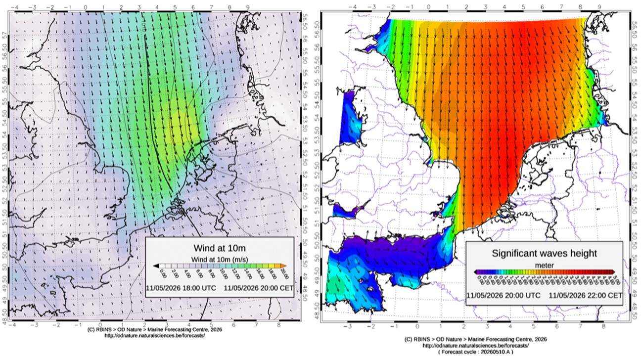
Step 3 of the foam alert warning process: Marine forecasts are screened for the presence of the two other factors that are needed to cause foam accumulation: strong waves (> 2m) and onshore winds (> 6m/s). This was the case for the 10th of May which triggered the warning.
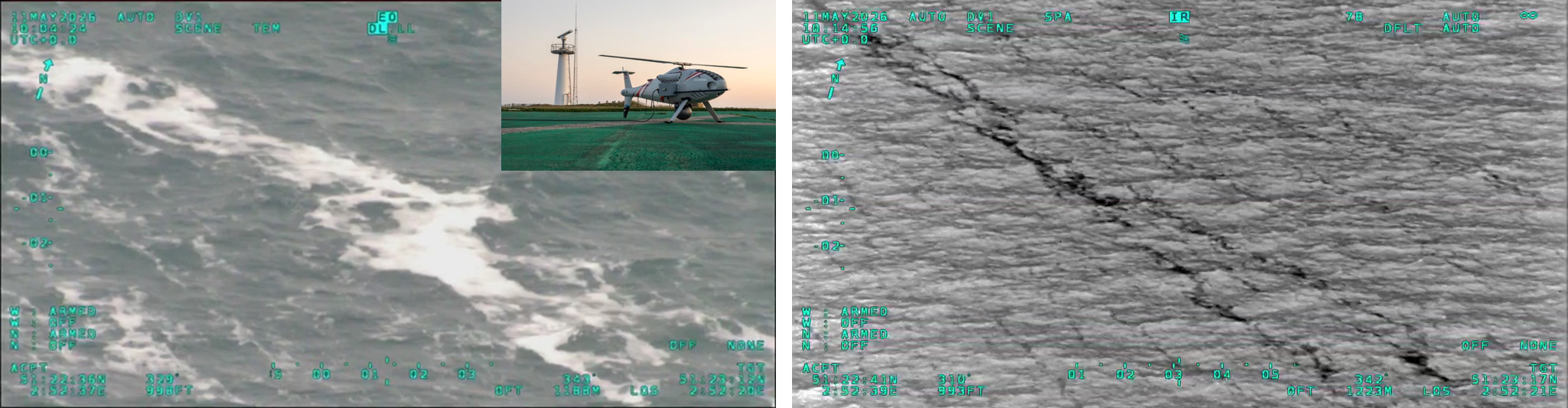
Step 4 of the foam alert warning process: verification of the presence of foam by the Institute’s aerial surveillance team using Remotely Piloted Aircraft Systems (RPAS) deployed over Belgian coastal waters providing RGB and infra-red imagery.

Smart Eye Above the North Sea: European Coast Guard Drone Deployed from Lombardsijde

For the first time, a drone carrying out surveillance operations above the North Sea is operating from Belgium. The drone is being made available to the Belgian Coast Guard for the third consecutive year in the framework of the Multipurpose Maritime Operation (MMO).

© Belgian Navy / Jorn Urbain

For the third consecutive year, the Belgian Coast Guard is taking part in the Multipurpose Maritime Operation (MMO) of the European Maritime Safety Agency (EMSA). The European Fisheries Control Agency (EFCA) and Frontex are also supporting the operation. Alongside Belgium and France, the Netherlands is joining the cooperation for the first time this year.

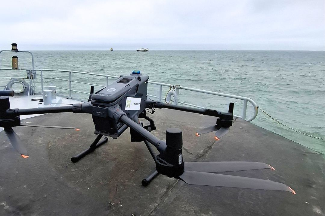
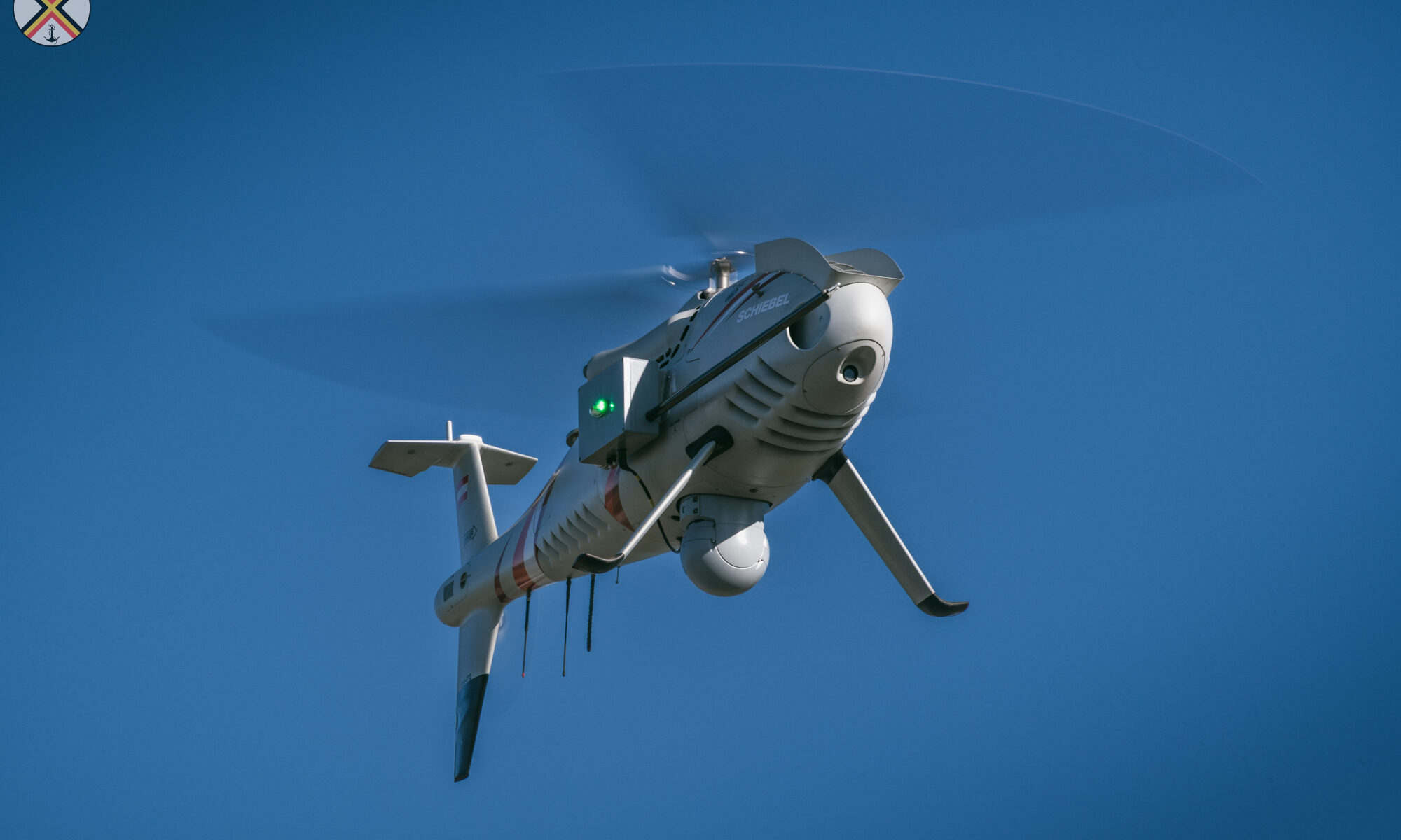
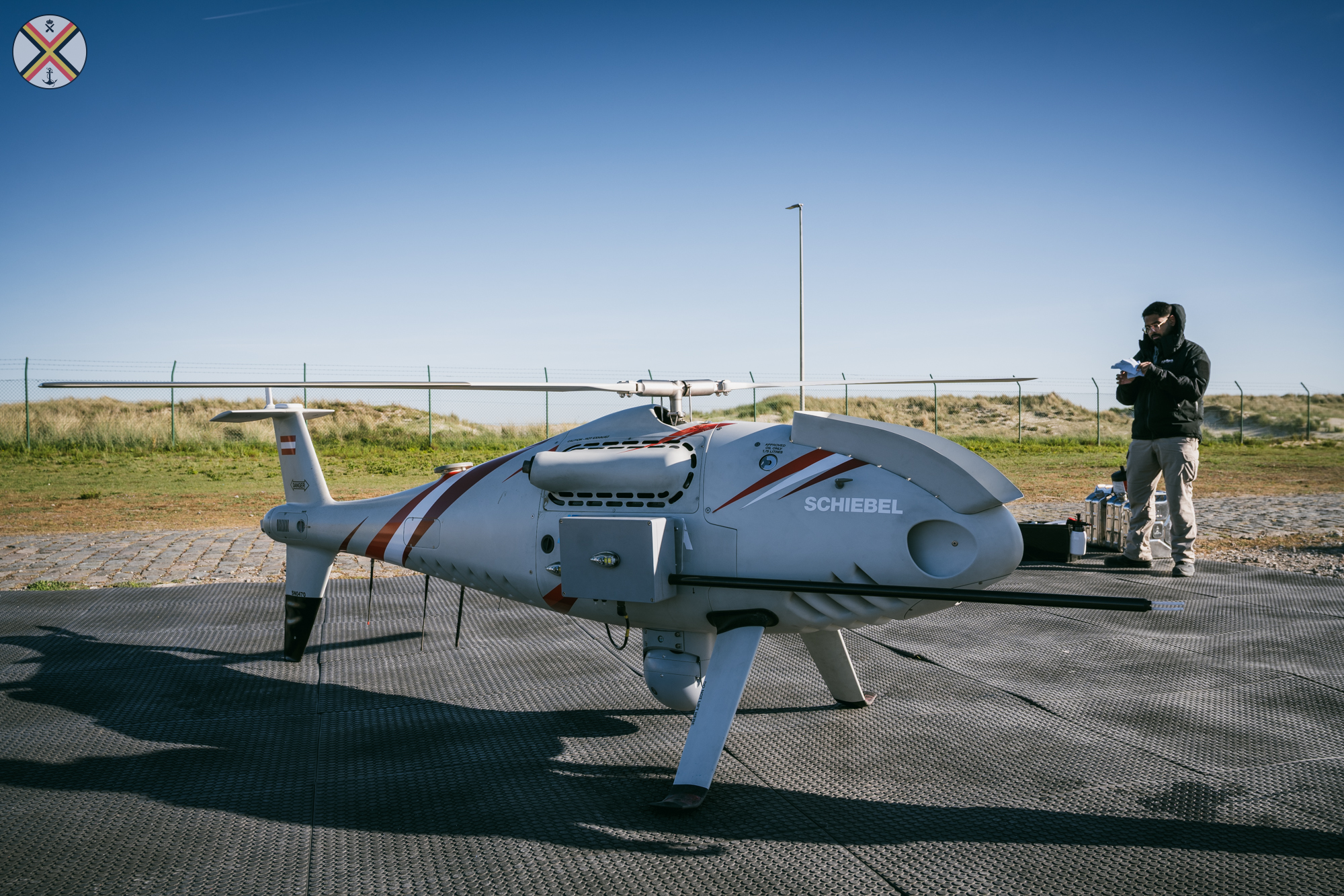
As part of this international maritime operation, EMSA is making a drone available to the participating countries. New this year is that the RPAS drone (Remotely Piloted Aircraft System) will operate from Belgium until mid-July, significantly increasing its operational deployability. The drone takes off from the military base in Lombardsijde, where a temporary operational base has been specially set up for the mission. During the previous two MMO editions, the drone operated exclusively from the French CROSS Gris-Nez centre.

“Thanks to this technology, authorities can respond more quickly and in a more targeted way in one of Europe’s busiest and most sensitive maritime areas,” says Coast Guard Chair and Administrator-General of the Agency for Maritime and Coastal Services, Nathalie Balcaen.

© Belgian Navy / Jorn Urbain

Multifunctional

Strict regulations apply in the North Sea. Ships must comply with international navigation rules that ensure safe and orderly maritime traffic. Certain zones, such as offshore wind farms, are restricted areas. The drone can efficiently detect illegal fishing, human smuggling and transmigration by sea, vessels failing to use the mandatory AIS identification system, marine pollution caused by shipping incidents, and other violations of maritime or environmental legislation, enabling more targeted enforcement. In addition, the drone can support search-and-rescue operations at sea and even scientific research.

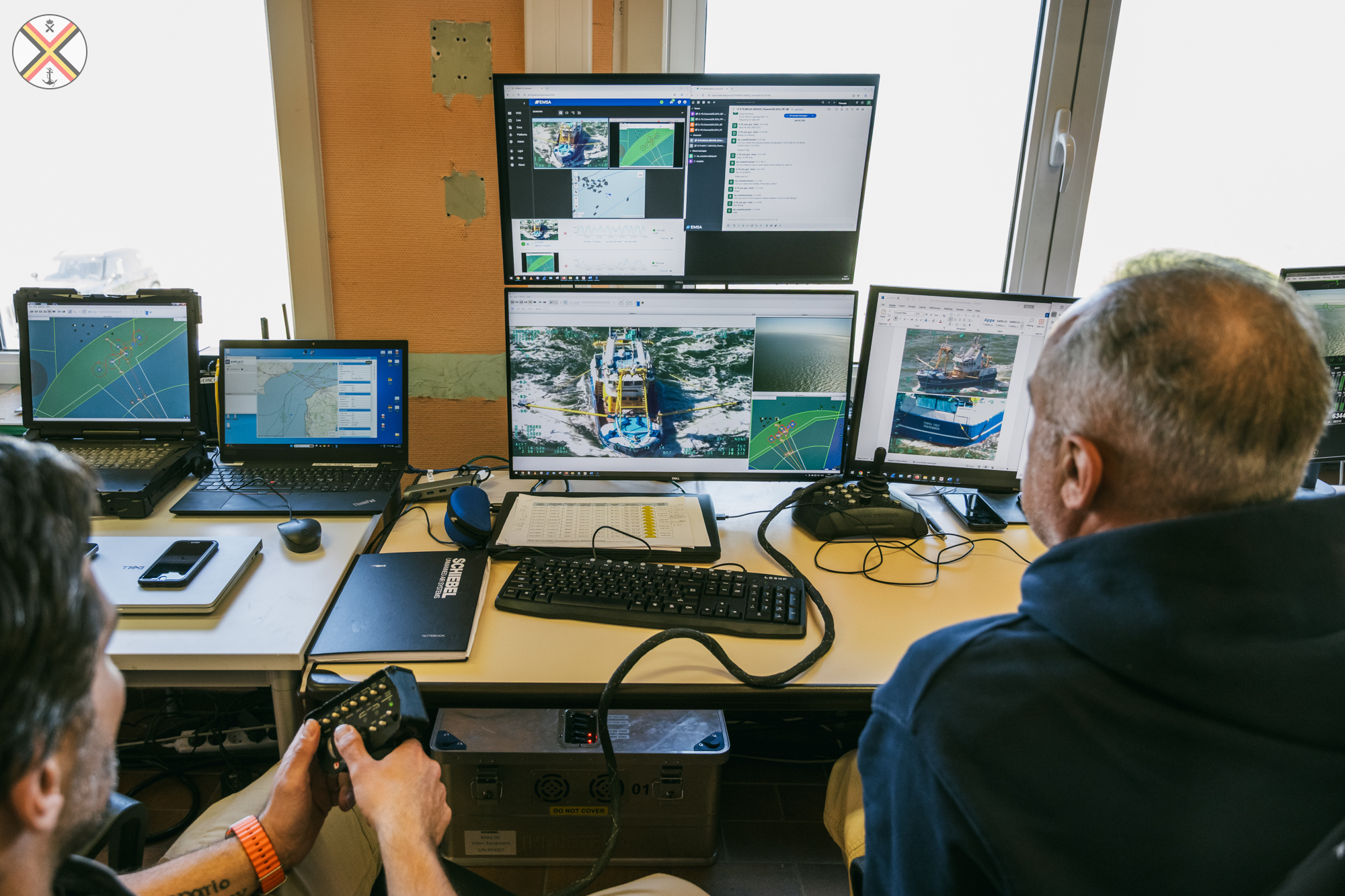
According to Admiral Tanguy Botman, commander of the Belgian Navy, the RPAS drone offers several key advantages: “The drone can be deployed rapidly, covers a much larger area than a patrol vessel, and provides extremely sharp imagery.” These images are shared in real time with the operator and coast guard centres, allowing for faster and more effective action. In the longer term, the ambition is to deploy this form of maritime surveillance permanently. (Example of footage captured by the RPAS drone in the video below.)

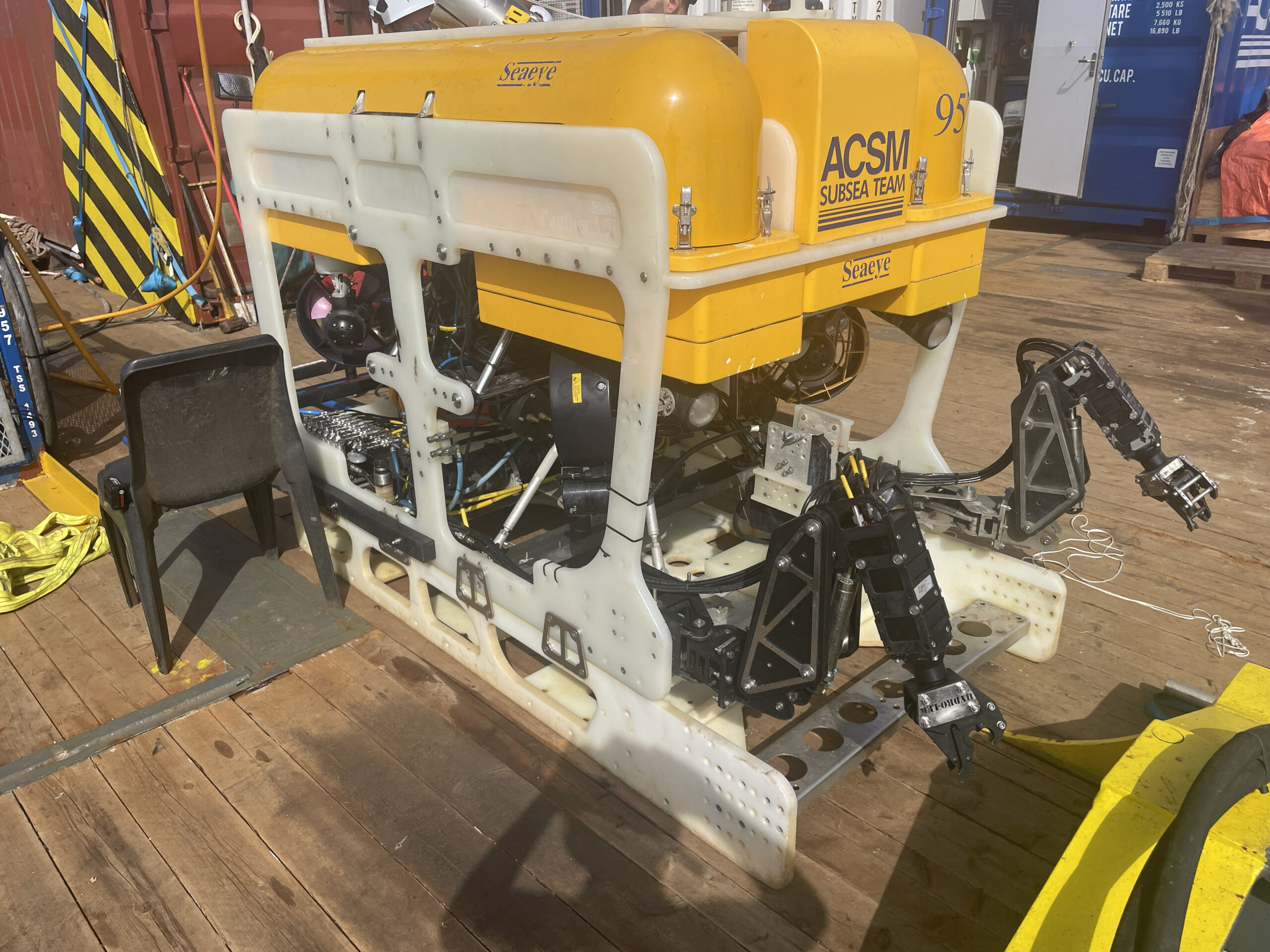
In addition to the aerial drone, the European agencies are also providing an underwater drone. This can be used, among other things, to detect unused telecommunications cables and assist in their removal. The underwater drone also enables the accurate mapping of lost anchors and wrecks.

Complementary

The aerial surveillance programme of the scientific service “Management Unit of the Mathematical Model of the North Sea” of the Institute of Natural Sciences will monitor the deployment of the RPAS as a complementary tool reinforcing the existing manned aerial surveillance over the North Sea.

The RPAS supports these operations by enabling targeted verifications, incident observations, and environmental monitoring. Using the Belgian Coast Guard aircraft, the aerial surveillance team follows up on cases involving possible marine pollution, oceanographic phenomena such as algal blooms and marine mammals, verification of CleanSeaNet satellite alerts, and pollution-related incidents.

The combination of manned and unmanned aerial assets increases the effectiveness, continuity, and future resilience of Belgian maritime surveillance.

© Belgian Navy / Jorn Urbain

The Belgian Coast Guard is a structural cooperation framework between federal and Flemish public services with responsibilities at sea, coordinated from the Coast Guard Centre. Its operations are based on two pillars: security, coordinated by the Maritime Information Crossroads (MIK), and safety and rescue services, coordinated by the Maritime Rescue and Coordination Centre (MRCC).

Public consultation on the monitoring programme for our North Sea

From 13 May to 12 July 2026, the Federal Public Service Health, Food Chain Safety and Environment is organising a public consultation on the draft monitoring programme for Belgian marine waters. During this period, stakeholders can submit comments and suggestions on the proposed programme.

In order to assess the state of nature in our North Sea and to verify whether the measures taken are actually effective, it is essential to closely monitor the state of the marine environment. The monitoring programme is part of the Belgian Marine Strategy and aims to assess the environmental status of our North Sea. It covers, among other things, biodiversity, the integrity of the seabed, non-indigenous species, eutrophication and pollution.

The Belgian Marine Strategy stems from the European Marine Strategy Framework Directive. This directive follows a six-year cycle and requires each EU Member State to develop a strategy for the protection, conservation and restoration of the marine environment. The ultimate goal is to achieve good environmental status and ensure the sustainable use of marine waters.

Why a public consultation?

The public consultation gives citizens, organisations and other stakeholders the opportunity to submit comments on the draft programme. This feedback helps make the final programme more effective and broadly supported.

Practical information

The draft monitoring programme and instructions for submitting comments can be found on the website of the FPS Health, Food Chain Safety and the Environment in Dutch, French and German.

The draft and instructions for submitting comments are available in .

The current draft of the monitoring programme for Belgian marine waters is a revision of the monitoring programmes carried out during the first two cycles of the Belgian Marine Strategy (implemented under the European Marine Strategy Framework Directive) and describes the monitoring to be carried out during the third cycle.

The monitoring programme is issued by the Scientific Service “Management Unit of the Mathematical Model of the North Sea (MUMM)” of the Institute of Natural Sciences and is a collaboration between various Belgian (federal and Flemish) public services and research institutions.

The results of the initial assessment (2012) and the subsequent assessments (2018 and 2024) of Belgian marine waters, as well as the description of environmental targets (past and current), previous monitoring programmes and measures, can be consulted at https://odnature.naturalsciences.be/msfd/.

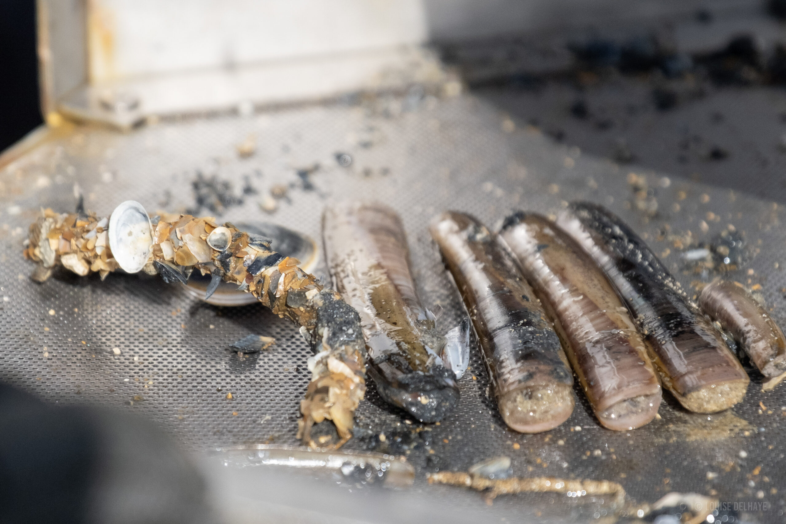
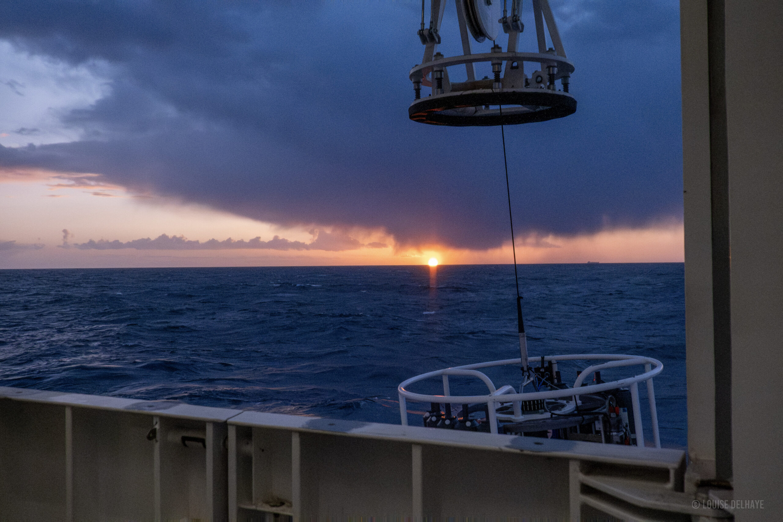
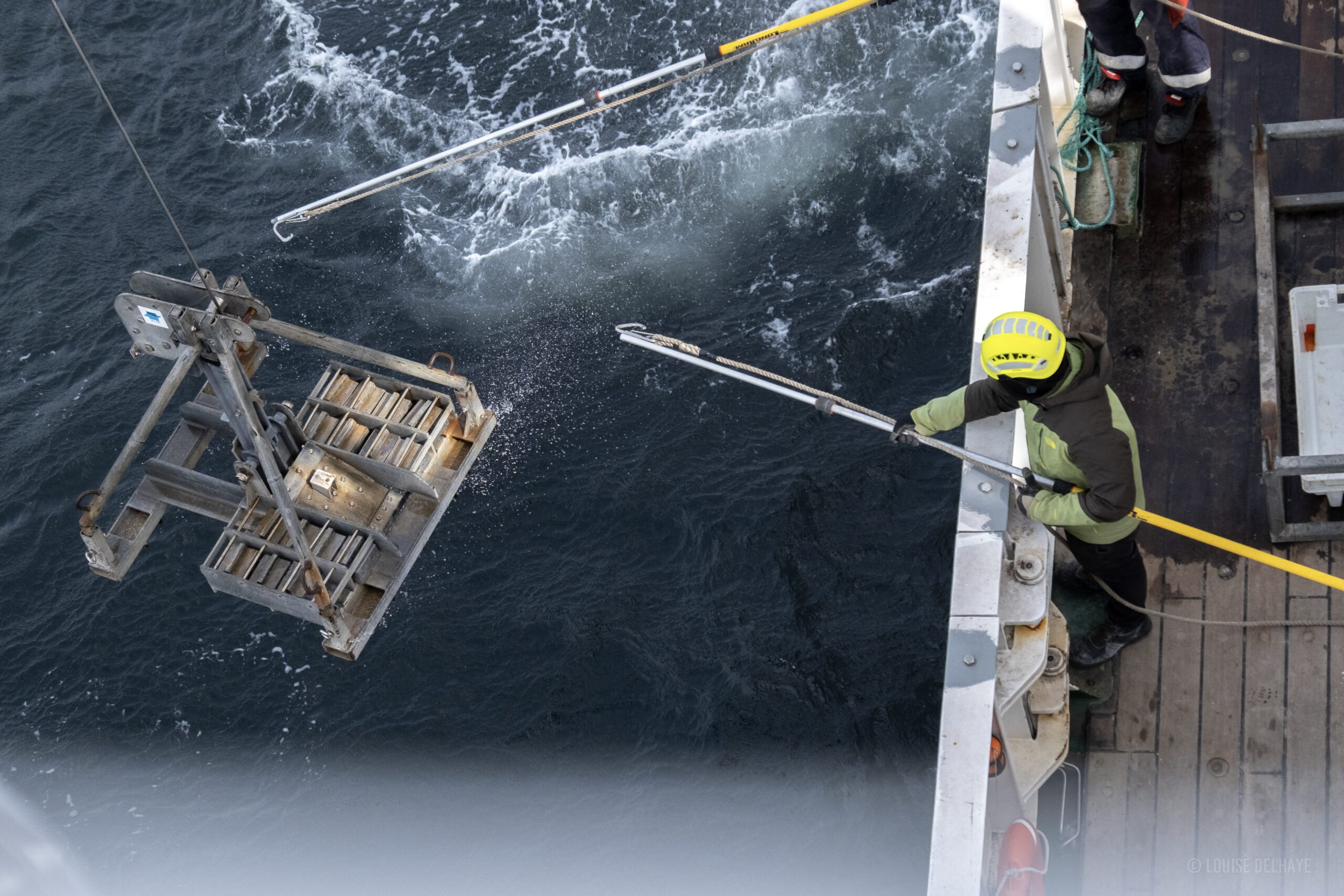
Photos: Louise Delhaye, Institute of Natural Sciences

Understanding ocean-lagoon connectivity for sustainable shrimp management in Benin

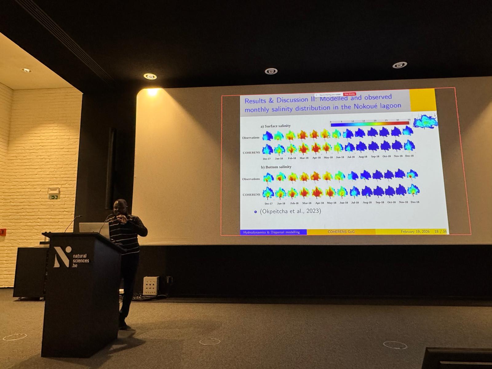
On February 19, 2026, Sylvain Gozingan brilliantly defended his doctoral thesis entitled “Developing a multi-scale modelling framework for coastal hydrodynamics and larval connectivity in the Gulf of Guinea, West Africa.” His work demonstrates that connectivity between the ocean and the Nokoué lagoon in Benin is primarily controlled by well-defined hydrodynamic mechanisms, playing a crucial role in the transport and entry of shrimp larvae into the lagoon—a key finding for the sustainable management of fisheries resources in Benin.

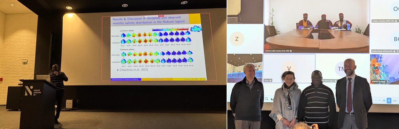
Sylvain Gozingan of the University of Abomey-Calavi in ​​Benin publicly defended his doctoral thesis in physical oceanography and numerical modeling, entitled: “Developing a multi-scale modelling framework for coastal hydrodynamics and larval connectivity in the Gulf of Guinea, West Africa”. Following the defense, which took place on February 19, 2026, at the Institute of Natural Sciences, in the presence of all members of the jury, Sylvain was awarded the highest distinction for his doctoral thesis.

Sylvain Gozingan during the public defense of his doctoral thesis, with the members of the jury. (© Institute of Natural Sciences/Olivier Gourgue & Tania D’Haijère)

Research towards sustainable management

Sylvain Gozingan explains: “The research carried out as part of my doctoral thesis focuses on the development and application of coupled three-dimensional models, combining hydrodynamics and particle tracking, to study marine circulation and larval connectivity in the Gulf of Guinea, with a particular focus on the Nokoué ocean-channel-lagoon system in Benin. This has made it possible to identify the hydrodynamic mechanisms controlling connectivity between the ocean and the Nokoué lagoon for commercially important shrimp larvae.”

First, the results show that the entry of larvae into the lagoon is not random but depends on well-defined physical conditions. It is mainly favoured by specific tidal conditions, the existence of tidal windows and hydrodynamic windows of opportunity, with a particularly favourable period during the dry season (January-June).

Secondly, the study demonstrates that larval transport can be largely explained by passive drift mechanisms. This transport is dominated by the combined action of tidal currents, residual circulation, and wind-induced currents, without the need to invoke complex active larval behaviour at the scale studied.

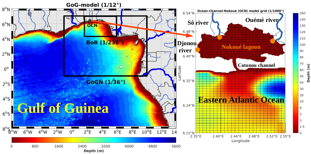
Study area in the Gulf of Guinea (southern Benin) showing the three nested domains (left) and the bathymetry of the smallest domain of the COHERENS ocean-channel-Nokoué model. The orange dots represent the locations where the rivers flow into the lagoon. (© Institute of Natural Sciences/ECOMOD-Sylvain Gozingan)

Finally, the analysis of particle trajectories reveals that the larvae that actually reach the lagoon come mainly from the shallow coastal zone, in particular from regions where the depth is less than or equal to 15 m.

“Overall, these results strengthen the understanding of connectivity in the Nokoué ocean-lagoon system and provide valuable scientific information for predicting larval dispersal, a crucial element for the sustainable management of fisheries resources,” concludes Sylvain.

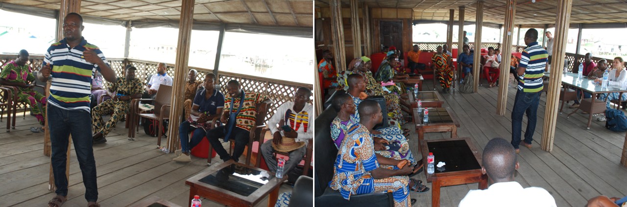
The results of the thesis were presented to local communities during a feedback workshops organized in Benin in 2024.

Presentation of the results to local communities during the feedback workshop held in the lakeside village of Ganvié in Benin. (© Institut de Recherches Halieutiques et Océanologiques du Bénin (IRHOB))

Interdisciplinary collaboration with Belgian and Beninese support

Sylvain already held a master’s degree in physical oceanography and applications, obtained in 2018 from the University of Abomey-Calavi. His thesis focused on applying an automatic algorithm for identifying and tracking vortices to a series of numerical potential vorticity fields, considered as a dynamic Lagrangian tracer. Since then, he has developed a passion for studying particles in marine ecosystems, using data analysis and numerical modeling.

Since February 2020, Sylvain has collaborated with the Institut de Recherches Halieutiques et Océanologiques du Bénin (IRHOB) and the ECOMOD team at the Institute of Natural Sciences. This collaboration took place within the framework of the Shrimp-I project (Application of the COHERENS model to improve shrimp stock management in Benin) and the Shrimp-II project (Application of the COHERENS model to the life cycle analysis of shrimp and oysters to better manage their stocks in Beninese waters). These projects were funded by the Directorate General for Development Cooperation and Humanitarian Aid (DGD) under the CEBioS programme (Capacities for Biodiversity and Sustainable Development).

From geopolitical challenges to building capacity for coast guard operations

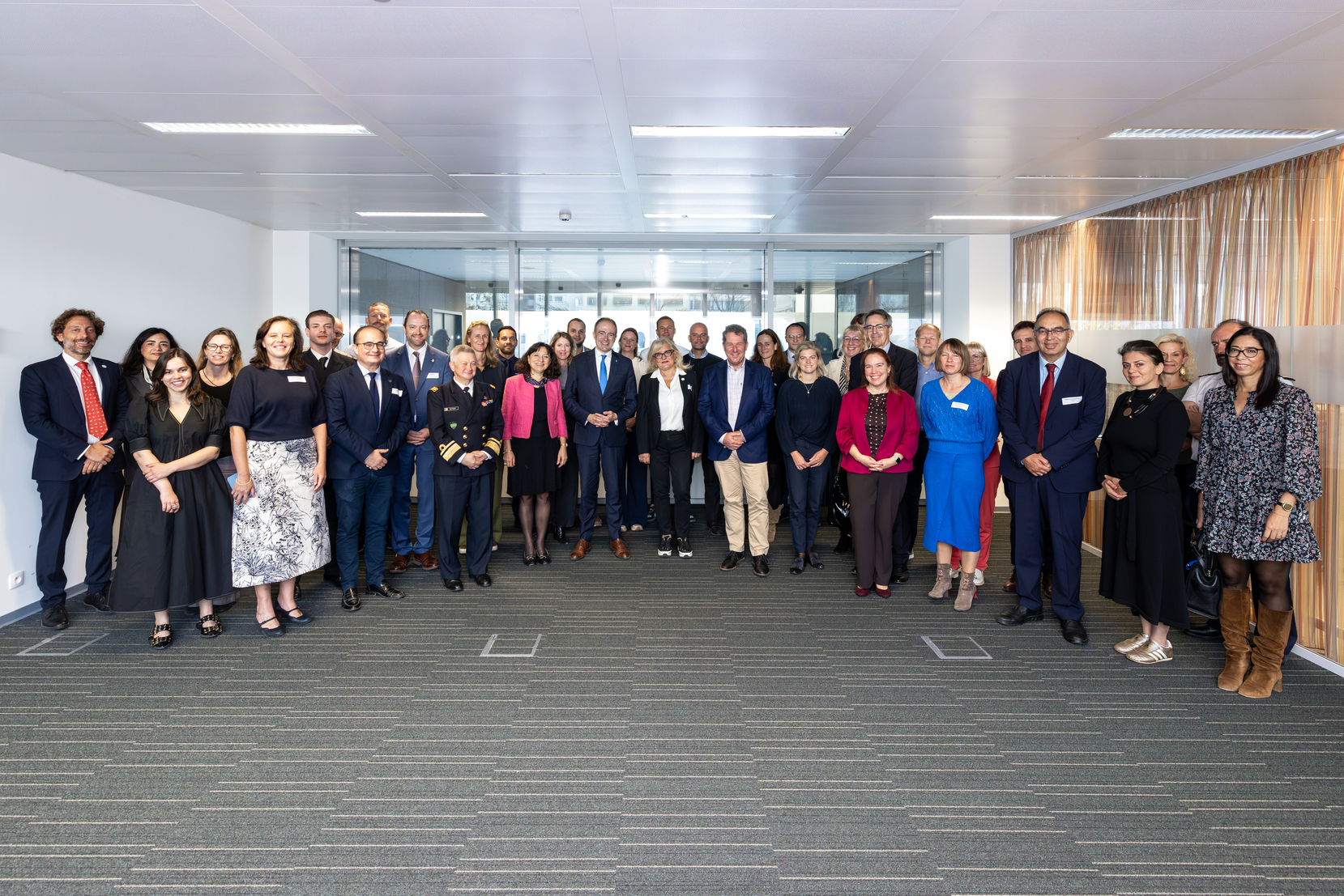
On 11-12 February 2026, the European Maritime Safety Agency (EMSA) hosted the first thematic workshop of the European Coast Guard Functions Forum (ECGFF) programme for 2026 at its premises in Lisbon. Belgium took part with representatives from DG Shipping (Stefanie Monsaert), agency for Maritime and Coastal services (Yves Maekelberg), the Coast Guard (Eefje Deweer) and the Scientific Service ‘Management Unit of the Mathematical Model of the North Sea’ of the Institute of Natural Sciences (Kobe Scheldeman).

Multifunctional and Complementary Surveillance

Modern and effective coast guard surveillance requires a multifunctional approach in which various assets — such as satellites, drones (both underwater and aerial), aircraft, vessels and ground systems — are deployed in a complementary manner. No single tool is sufficient on its own to address today’s complex maritime challenges.

Through cooperation between agencies and Member States, and by combining technologies, a robust, real-time maritime situational picture can be achieved. This enables the efficient coordination of safety, environmental protection, fisheries control and law enforcement tasks.

Geopolitical Developments and Operational Impact

Participants reflected on the rapidly evolving geopolitical context and its implications for daily maritime operations. A notable trend is the recent increase in falsely flagged vessels and the activities of the so-called shadow fleet: older, poorly maintained ships whose flag authenticity and insurance documentation are difficult to verify, posing an increased risk of incidents.

By pooling expertise, sharing operational information among Member States, and enriching it with additional data sources, steps are being taken to better identify and monitor these vessels. Many of them never enter ports and continue operating at sea through ship-to-ship transfers, with all associated risks. While the principle of freedom of navigation remains fundamental, it also complicates enforcement efforts.

EU Agencies Strengthen Their Support

EMSA provided an update on its services, with particular attention to the further development of its Remotely Operated Vehicle (ROV) capacity. These systems can operate at depths of up to 3,000 metres and are deployed for investigations and operations such as mapping cables, anchors and wrecks. Belgium has already made use of these services over the past two years.

The European Fisheries Control Agency (EFCA) presented a timeline for new regulations and technological tools, including hydrophones (to detect illegal fishing through sound monitoring), DNA kits (for fish species identification), satellite imagery, Remote Electronic Monitoring (REM), drones (UAVs) and artificial intelligence. Although these technologies were not originally developed specifically for fisheries control, the necessary adaptations are now being implemented to optimise their use in this field.

Frontex outlined the possibilities of deploying its aircraft for various coast guard functions. These aircraft provide maritime situational awareness, can zoom in on suspicious vessels and transmit imagery to onshore operation centres in near real time. In the event of incidents, flight plans can be rapidly adjusted.

The Need for a New Belgian Coast Guard Aircraft

The findings of the workshop highlight a clear reality: maritime surveillance is becoming more technologically complex, geopolitically sensitive and operationally demanding. In this context, air capability is not a luxury but an essential component of the integrated European surveillance system in which EMSA and Frontex operate.

After more than 30 years of successful aerial surveillance, it must be acknowledged that the Belgian coast guard aircraft is an ageing platform that will turn 50 this year. While the aircraft has long been a reliable asset in environmental protection, safety and maritime law enforcement, it is no longer sufficient to carry out the increasingly delicate and technologically intensive operations expected from a coastal state today.

The rise of shadow fleets, GPS spoofing, complex energy transport operations and stricter European obligations require modern sensors, real-time data processing and interoperability with European partners. Replacing the current aircraft is therefore essential to guarantee the continuity of these missions.

Without a new coast guard aircraft, Belgium risks no longer having an adequate aerial surveillance platform at its disposal. This would seriously undermine our ability to meet national and international obligations in the fields of environmental protection, crisis response, safety and security in the North Sea.

Within the Coast Guard, under the coordination of Defence and the Institute of Natural Sciences, intensive work is therefore underway with all relevant partners to prepare and implement the replacement of the aircraft, ensuring that Belgium will continue to possess a modern, high-performance and interoperable aerial surveillance capability in the future.

© Ben Ullings

EVENT : Celebrating 25 Years of Scientific Diving

We are pleased to announce a one-day symposium on Thursday, 19 March at the Grand Auditorium of the Institute of Natural Sciences, celebrating 25 years of in-house scientific diving.

Over the past quarter century, our scientific diving team has supported and advanced marine and environmental research in remarkable ways. This symposium will showcase the breadth and impact of that work.

The programme will include:

  • An opening introduction
  • Eight scientific presentations highlighting key research achievements
  • A dedicated session on the training programme we organise for the Belgian occupational scientific diving sector
  • Presentations on the Belgian and international professional frameworks supporting scientific diving
  • An inspiring example of citizen science diving and collaborative initiatives

The impact of this work is reflected in:

  • ~10 completed PhDs (with 2 ongoing)
  • 36 A1 peer-reviewed publications
  • Numerous technical and policy-supporting reports
  • More than 800 scientific diving missions, good for more than 4500 man dives

All participants will receive a printed book of abstracts on 19 March 2026.

Register by 10 March to secure your spot: https://docs.google.com/forms/d/e/1FAIpQLScoLj6Dlohw8nyZZ3xu1vVLQaSRu37xESXuHKMRR9doZPeeWA/viewform

We look forward to welcoming colleagues, partners, and collaborators to celebrate 25 years of scientific diving and to discuss the future of this unique research field.

Coördination: Alain Norro, MARECO – Marine Ecology and Management, Institute of Natural Sciences

Video : 2025 Multipurpose Maritime Operation

From the end of May to October 2025, the Belgian and French Coast Guards cooperated in a Multipurpose Maritime Operation (MMO) in the southern North Sea. The MMO is a large-scale maritime operation coordinated by the European Maritime Safety Agency (EMSA) and the European Fisheries Control Agency (EFCA), with the support of the EU, organized in support of European Member States.

In the MMO 2025 operation, various Belgian (Flemish and federal) and French Coast Guard authorities joined forces, performing various missions for the purpose of maritime safety, pollution control, environmental protection, fishery control, or border control.

A video about the successful MMO 2025 is now available :

As Belgian Coast Guard partner, the Scientific Service ‘Management Unit of the Mathematical Model of the North Sea (MUMM)’ of the Institute of Natural Sciences took part in the operation. This involved close cooperation with various partners, with the Belgian Navy, the Directorate-General Shipping, the Directorate-General Environment, the Flemish Maritime and Coastal Services, the French authorities and EMSA being of particular interest.

Given the many challenges facing the Coast Guard in the southern North Sea, and the importance of sub-regional cooperation in this regard, preparations are currently underway for a new and even more comprehensive MMO in 2026. Further communication on the MMO 2026 will follow later this year.