Climate change and environmental pressures pose growing risks to the Belgian North Sea and various sectors

In a newly published report, the Institute of Natural Sciences and the Climate Risk Assessment Center (CERAC) warn about the significant impacts of climate change on the Belgian part of the North Sea. Combined with the many human activities taking place in our sea, climate change is exerting a strong influence on marine habitats, species, and the services they provide to society. The researchers identify seven major climate-related risks.
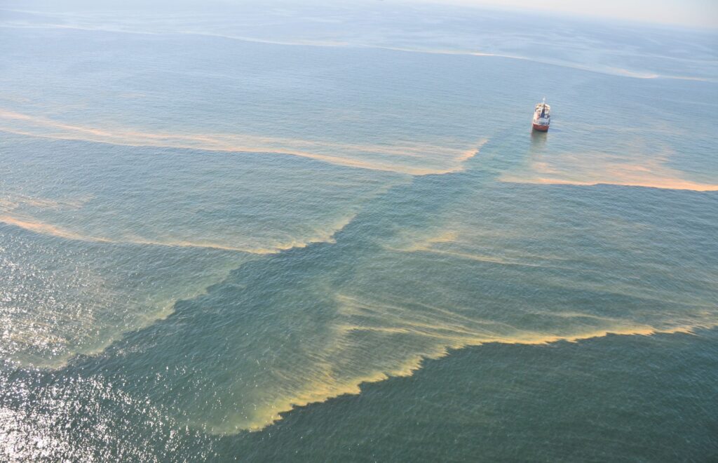
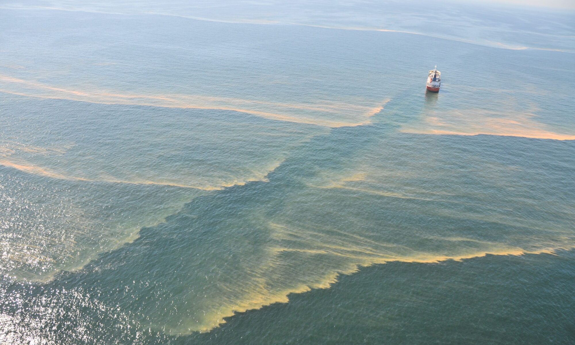
The surface waters of the North Sea are warming rapidly. Combined with eutrophication (nutrient enrichment), this may lead to a significant increase in harmful algal blooms (orange streaks visible at the surface). (Photo: Institute of Natural Sciences)

The Belgian part of the North Sea accounts for 11% of Belgium’s territory. Many important activities are concentrated in this area, including shipping, fisheries, offshore wind farms, sand extraction, military exercises, and tourism. All of these activities compete for space and place considerable pressure on marine ecosystems. Furthermore, pollution and seabed disturbance make life in the North Sea vulnerable.

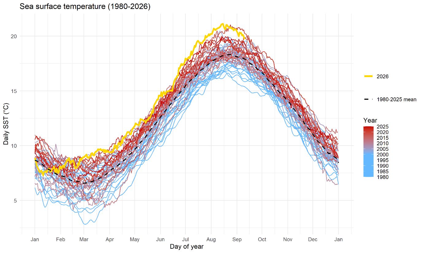
Climate change adds an additional layer of pressure and its impacts are already clearly visible today. Sea level in Ostend rose by nearly 24 centimetres between 1951 and 2024. Sea surface temperatures have also increased markedly in recent decades, with last summer bringing the longest marine heatwave ever recorded, lasting no fewer than 87 days.
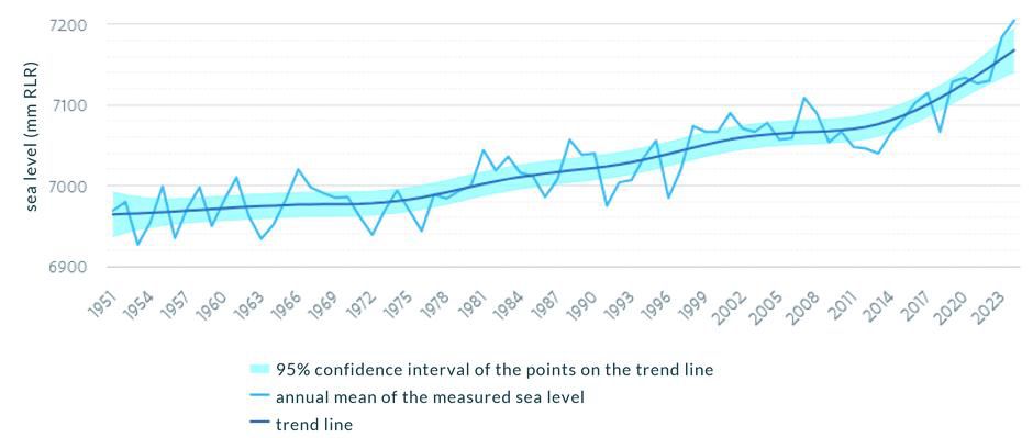
Annual mean sea level at Ostend. An increase of nearly 24 cm over seventy years. (Graph: VMM)


Sea surface temperature at the Akkaert monitoring station (located in the centre of the Belgian part of the North Sea), 1980-2026. Last summer, a marine heatwave lasted 87 days, a record. Such events can affect the entire marine food web. (Source: Institute of Natural Sciences)

Two Critical Risks at +2°C, Seven at +4°C

In this first exploratory report, the researchers identified seven major climate-related risks. With a temperature increase of 4°C above pre-industrial levels, all seven risks become critical. Four of them are already critical at +3°C, while two become critical at +2°C.

  1. Species migration: The continued warming of seawater is expected to reduce stocks of commercially important species such as cod, herring and plaice, while driving them northward and into deeper waters. Species from warmer or more southern waters, including invasive species, will become more prominent. However, they are unlikely to fully compensate for the loss of existing fish stocks.
  2. Damage to coastal infrastructure: The combination of sea-level rise and more frequent, intense storms increases the risk of damage to vital structures such as coastal defence systems, ports and offshore wind farms.

At +3°C, harmful algal blooms also become a critical risk. Warmer seawater enriched with nutrients carried by rivers (mainly nitrogen and phosphorus compounds) can induce harmful algal blooms. Some species produce toxins that accumulate in shellfish and may lead to food safety concerns. Microscopic algae can also cause the formation of sea foam on beaches. When these algae die, they release proteins and gelatinous substances that are whipped into thick foam by waves and wind. In 2020, five surfers drowned in the Netherlands after becoming trapped in exceptionally dense sea foam.
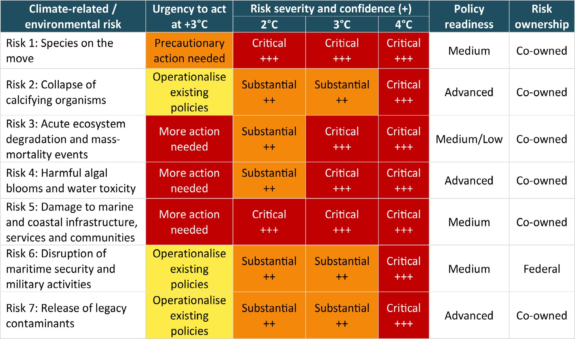
The seven main climate-related risks for our North Sea region under different climate warming scenarios.

Climate risks amplify the impacts of human activities
“The main finding is that climate risks rarely occur in isolation,” says Ward Van Roy, marine researcher at the Institute of Natural Sciences. “Sea-level rise, ocean warming and ocean acidification all drive multiple risks simultaneously. They are superimposed on the already considerable pressures caused by the many human activities in our North Sea area. As a result, impacts can accumulate. Imagine a marine heatwave occurring together with an extreme algal bloom and a less well-mixed water column. This can cause severe oxygen depletion in the sea, triggering a domino effect that may result in mass mortality of marine life.”

Our economic activities depend heavily on the ecosystems of the North Sea and on coastal infrastructure. Consequently, the impacts of climate change may cascade into other sectors, including shipping, logistics and the wider Belgian economy. A healthy and safe North Sea is the foundation of our blue economy. Protecting the sea also means protecting our economy.
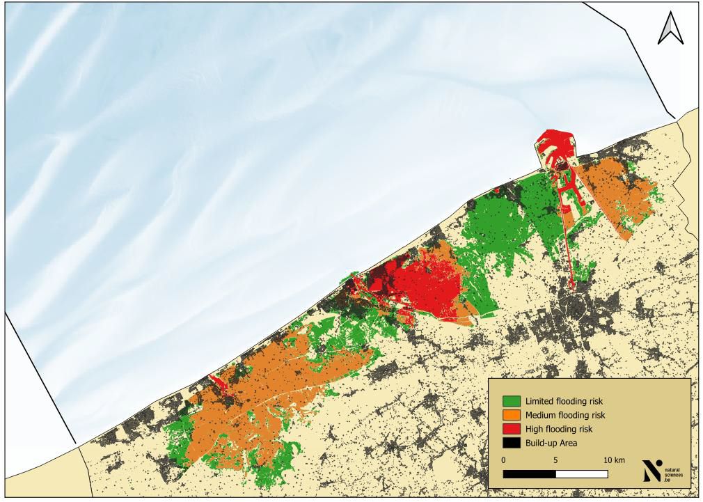
Flooding risk for coastal communities due to climate change. (Geopunt, 2026)


Recommendations
“The challenge was to establish priorities and bring together the consequences of these risks for a wide range of stakeholders and sectors within Belgian society into a single analysis,” says Luc Bas, Director of CERAC. “This cross-sectoral approach helps identify where action and anticipation are needed in public decision-making. Further work is required, but this already represents an important first step.”

Belgium already has a wide range of instruments for monitoring, planning and managing the marine environment. The report recommends integrating the potential impacts of climate change into existing policy frameworks and ensuring sufficient resources for their implementation. It also calls for reducing existing human pressures, such as eutrophication (causing harmful algal blooms), pollution and seabed disturbance, and for developing specific action plans for acute events.

Finally, the report recommends clarifying responsibilities, building on existing coordination mechanisms, such as the Belgian Coast Guard, and adapting measures as new knowledge becomes available.

“Our North Sea is changing, and policymakers must take this into account,” the researchers conclude.
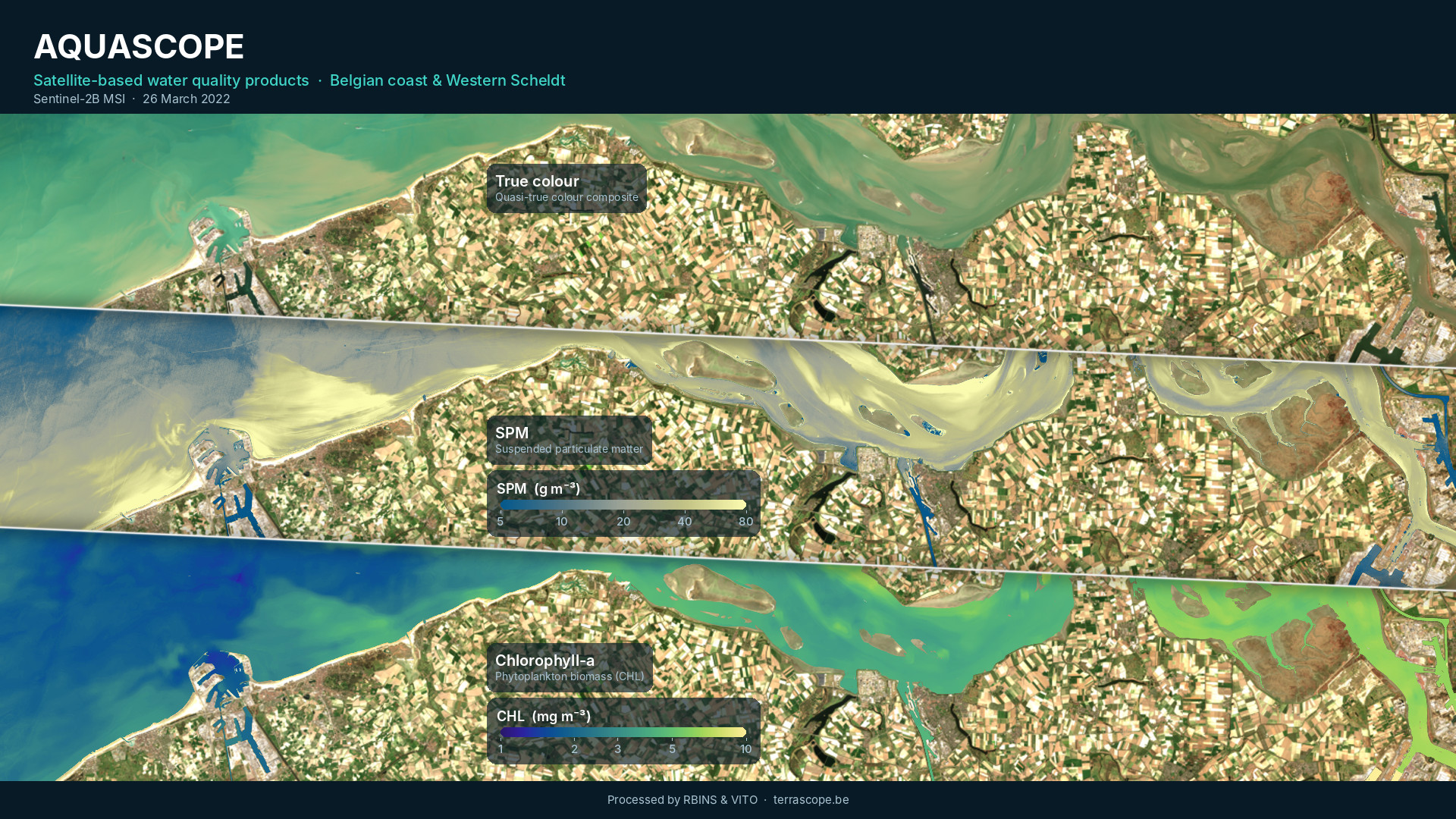
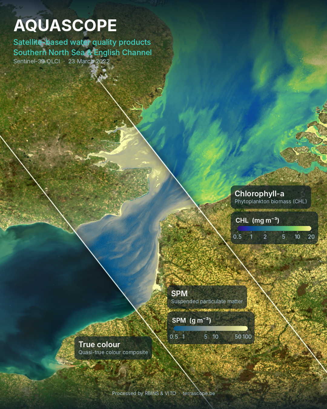
 

New satellite-based water quality data available

New satellite-based water quality products for the Belgian part of the North Sea are now publicly available. For this purpose, the Institute of Natural Sciences, in collaboration with VITO, expanded the existing Terrascope portfolio from land and atmosphere to the sea, covering offshore waters, coastal zones and the ports of Zeebrugge, Ostend and Nieuwpoort.

Terrascope is the Belgian Earth Observation platform providing easy access to satellite data, products and services. Traditionally focused on land and the atmosphere, Terrascope is now expanding its portfolio to the marine environment with new Aquascope water-quality data products for the Belgian North Sea.

Through Terrascope, users can explore and access these new aquatic products alongside other Earth observation data. In addition to viewing satellite data, Terrascope provides services to find and download data, analyse time series and process data to gain further insights into environmental changes and dynamics.

Explore the Belgian North Sea with Aquascope data products

Using data from a range of satellites (Sentinel-2, Sentinel-3 and Landsat 8 and 9), Aquascope provides data from 2015 to near real time, with recent observations processed within 24 hours. The available products cover a range of marine and coastal parameters, providing valuable information for monitoring environmental conditions and assessing the impacts of human activities at sea.

Quasi-true-colour (RGB) imagery and remote sensing reflectance (Rrs) allow users to visualise the sea surface as observed by satellites and explore its optical properties, helping to characterise coastal and marine environments.

Suspended particulate matter (SPM) and turbidity (TUR) products provide insights into sediment concentrations and water clarity. They can be used to track sediment transport, monitor dredging activities and coastal protection works, and assess the potential impacts of offshore infrastructure on the marine environment.

Chlorophyll-a (CHL) products provide information on phytoplankton biomass, supporting the assessment of water quality, the monitoring of phytoplankton dynamics and the study of eutrophication in coastal and marine waters.

Sea surface temperature (SST) products provide access to high-resolution temperature maps that combine thermal observations from Landsat and Sentinel-3. These data help users investigate the spatial and temporal variability of sea surface temperatures and monitor changes in the marine environment.

With spatial resolutions ranging from 10 metres for Sentinel-2 to 500 metres for Sentinel-3, the Aquascope products support both large-scale analysis and detailed investigation of coastal features such as sediment plumes. The processing algorithms are tailored to the turbid and nutrient-rich conditions of Belgian waters and validated using WATERHYPERNET radiometers, in-situ sampling stations and buoys in the Belgian North Sea.

More aquatic products coming soon

Over the coming months, Aquascope will expand its range of products to support coastal monitoring and early warning, providing users with improved tools to observe and assess changes in the marine environment.

Gap-filled, multi-resolution products for chlorophyll-a, suspended particulate matter and turbidity  will combine data from Sentinel-2 and Sentinel-3 to generate daily, cloud-free maps.

Algal bloom detection and eutrophication assessment will help users identify and monitor algal blooms and assess the environmental conditions associated with eutrophication. These products will support marine environmental assessments and reporting obligations under the EU Marine Strategy Framework Directive (MSFD) and the OSPAR Convention.

Floating object detection will enable the identification of certain features at the sea surface, including foam lines that can form following Phaeocystis algal blooms and subsequently wash ashore. Monitoring these features can help improve our understanding of their occurrence and distribution along the coast.

Marine heatwave monitoring will focus on identifying periods of unusually warm seawater, which are becoming more frequent and intense as a result of climate change. By tracking these events and their evolution, Aquascope will help users better understand changes in sea surface temperatures and assess potential impacts on marine ecosystems.

Access the data

Aquascope data can be accessed through a range of Terrascope services, allowing users to explore, process, download and integrate the available products into their own workflows and applications.

Users can explore the products directly in the Terrascope viewer, which provides a convenient way to visualise satellite imagery and environmental data. For more advanced analyses, the Terrascope cloud services offer tools and computing resources to process the data online, without requiring users to download and manage large datasets locally.

Those who wish to access the underlying datasets can use the Terrascope STAC browser to discover and download products. Finally, the Web Map Tile Service (WMTS) allows users to integrate the data into GIS software and web applications, facilitating the visualisation and use of satellite-derived information alongside other geospatial datasets.

Together, these services make Aquascope data accessible to a broad range of users, from those who simply want to visualise coastal and marine conditions to researchers and professionals conducting more advanced analyses.


Aquascope is funded by the Belgian Science Policy Office (BELSPO) under the Terrascope II programme.

Turning good intentions into measurable impact – reviewing the application of Nature-Inclusive Design in marine infrastructure

This spring, the ICES Journal of Marine Science published a review, headed by Steven Degraer of the Institute of Natural Sciences, regarding the use of nature-inclusive design to enhance the ecological value of infrastructure at sea. Although such innovative solutions are generally viewed positively, the paper highlights the need for more concrete goals and monitoring targets for projects to deliver on their promises.

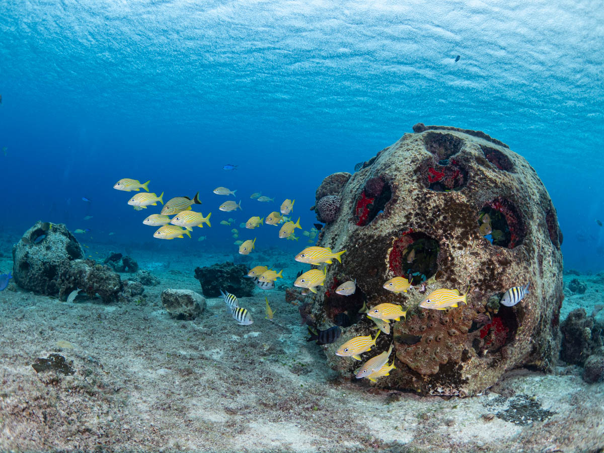
©Sand Dollar Sports (CC 4.0)

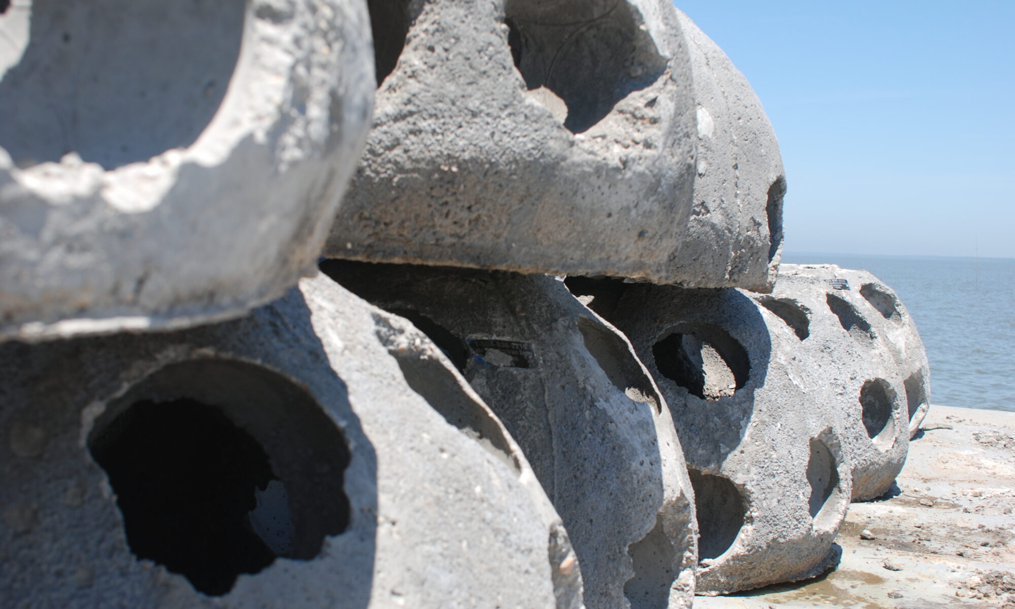
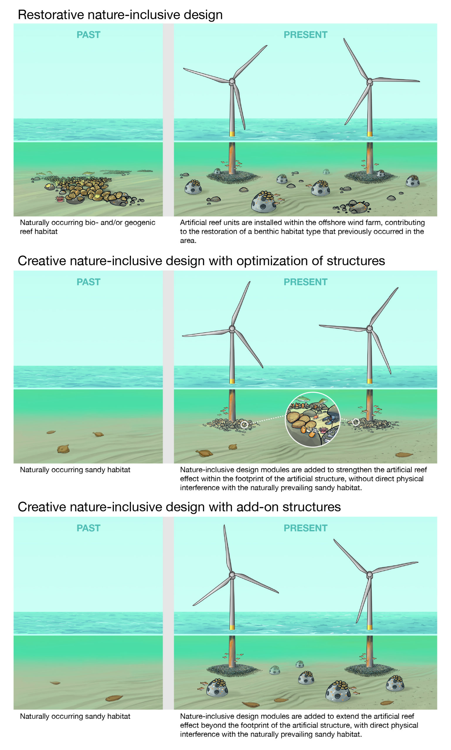
Nature-inclusive design (NID) generally refers to the incorporation of ecological features or the creation of additional habitat around marine infrastructure. In the review “Rethinking the responsible application of nature-inclusive design in marine infrastructure to restore ecosystems and enhance biodiversity”, the authors highlight that the term is currently unspecific, encompassing a wide range of strategies and approaches. They propose a framework that divides the umbrella term of “nature-inclusive design” into three categories: restorative NID, creative NID through optimized infrastructure, and creative NID through add-on structures.

“We propose to make a distinction between NID that will contribute to restoring lost ecological values (i.e. restorative NID) and NID that will promote or boost ecological values beyond what the local environment may naturally offer (i.e. creative NID),” said Steven Degraer of the Institute of Natural Sciences.

One of the central concerns raised in the paper is that creative NID walks a tentative line between optimization and replacement. While NID through optimized infrastructure remains centered within the footprint of the site (for example, the foundation pile of a wind turbine), NID through add-on structures goes beyond – creating additional habitat spaces in the vicinity of the structure. A cited example in the paper is the creation of artificial reefs between turbines in a Dutch wind farm. Adding the artificial habitat in this case was not emulating the conditions that predated the wind farm but instead replaced the naturally occurring habitat with one that would boost species richness.

Illustration by Hendrik Gheerardyn in Degraer et al., 2026

The review warns that increasing the number of species present does not necessarily add ecological value to a site nor does it indicate overall site health. Therefore, the priority should be shifted away from structural indicators of biodiversity (like species richness, density, or biomass) toward encouraging ecological function, such as shelter, nursery or spawning habitat, or nutrient cycling. They caution that these endeavours require clearly defined goals and continual evaluation, ideally following SMART (specific, measurable, achievable, relevant and time-bound) principles. Without clear objectives and evidence of ecological benefits, NID can fail to deliver the desired positive outcome.

“By deepening our understanding of marine ecosystems and applying this knowledge to infrastructure design, NID can help us live more harmoniously with nature, benefiting both biodiversity and human needs,” Steven adds.

Overall, the review regards NID as a promising approach but emphasises the need for caution. The use of NID presents an opportunity to restore lost ecological values as well as to offset the potential for negative impacts in marine infrastructure. However, with this potential there is a need to ensure its ecological benefits are substantial, well-evidenced, and lasting.


Header image: ©Louisiana Sea Grant College Program, Louisiana State University (CC 2.0).