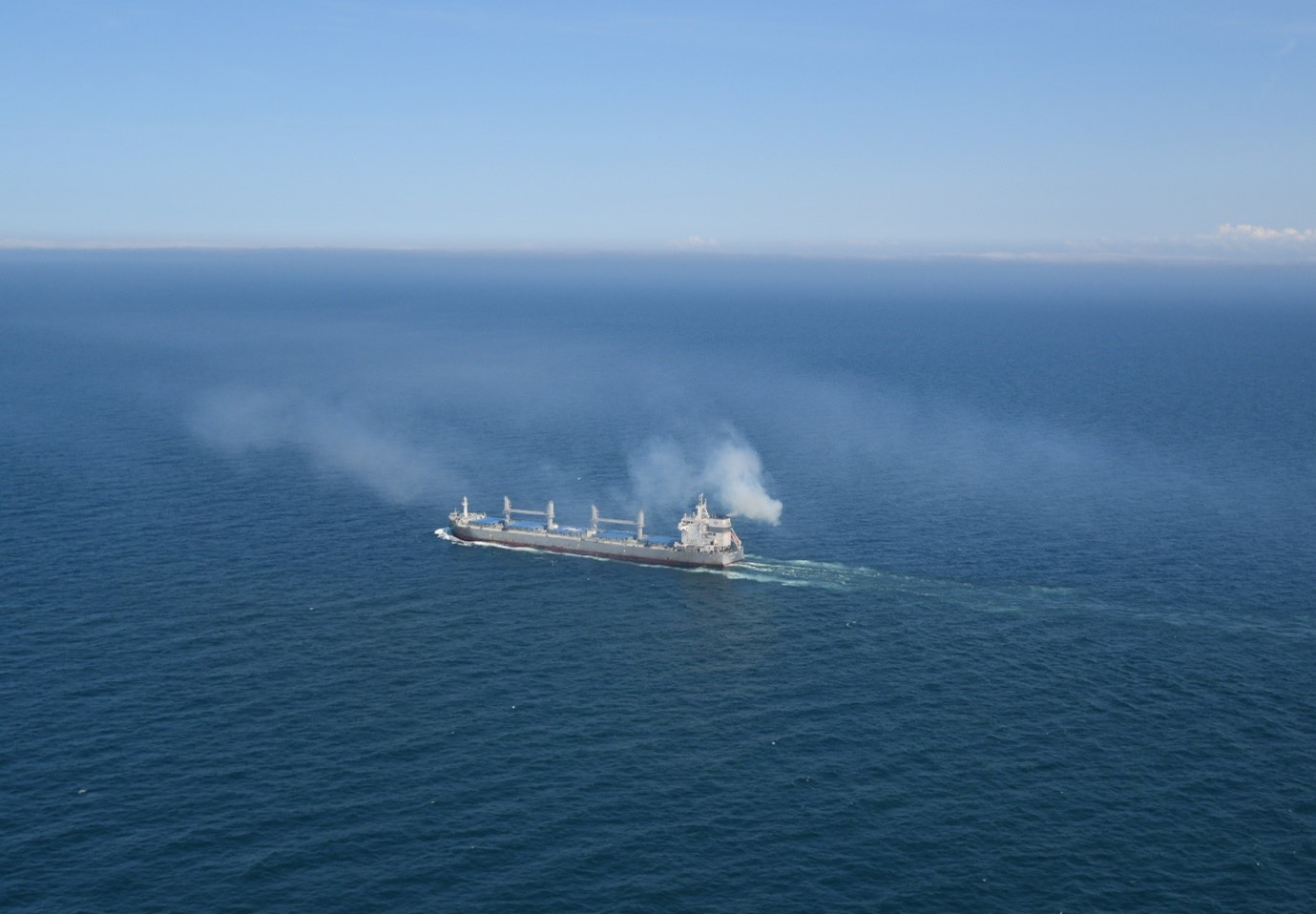
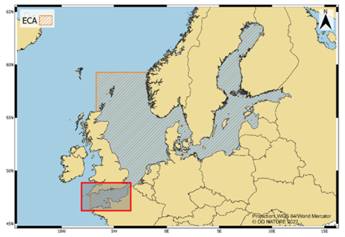
Collaborating with researchers from Germany, the Netherlands, Sweden, and Denmark, researchers from the Institute of Natural Sciences (Ward Van Roy and colleagues) assessed the effectiveness of ship emission regulations that have been in place in the North and Baltic Seas for more than 15 years. The findings of this study were published today, October 26th, 2023, in the leading scientific journal Nature Communications Earth and Environment. The study was based on more than 110,000 remote ship plume measurements and on-board inspections. Remote measurements were conducted using various fixed monitoring stations and aerial measurements using drones, helicopters, and fixed-wing aircraft.
The data revealed a substantial improvement in compliance rates for sulfur emission limits since the initiation of these measurements. This positive trend was observed across the Baltic Sea and the North Sea. Nevertheless, it was observed that the introduction of the global cap limit of 0.5% FSC (fuel sulfur content) led to a slight increase in SO2 emissions in the SECA (Sulfur Emission Control Area) from 2020 onward, possibly due to the increased use of scrubbers and the fuel price inflations.
In contrast to the successful reduction of SO2 emissions from ships, the international ship emission regulations appeared to have no impact on the nitrogen oxide (NOx) emissions from ships. In fact, there was even an increase observed of ships’ NOx emissions. This outcome can be attributed to various regulatory gaps in the NOx regulations, an issue on which the Institute of Natural Sciences and other researchers have published before.
These research findings are of particular importance to policymakers and other stakeholders responsible for environmental regulation and enforcement, as they offer valuable insights for developing more effective regulations and strategies for the implementation of emission regulations and their enforcement at sea and in ports.
The full study can be consulted here, with a ‘Behind the paper’ blog post being accessible here.
From 16 to 20 October 2023, the UNESCO world heritage city of Bruges was the scene of the 34th annual meeting of the International Research Ship Operators. The meeting was organised by the Institute of Natural Sciences and the Flanders Marine Institute. 129 participants attended the meeting to share information and solve problems of common interest. Improving support for the marine scientific community’s research efforts at sea is always a key focus.
The International Research Ship Operators (IRSO) forum brings together research ship operators representing 49 organisations from 30 countries. Together, they operate more than 100 of the world’s leading marine science research vessels. Membership of IRSO is open to all organisations operating research ships and national research programmes that collect data from ships at sea and follow established protocols for the open publication of their results.
IRSO was founded in 1986 and since then has had annual meetings organised by and in participating countries. In 2023, the Institute of Natural Sciences, operator of the RV Belgica, and the Flanders Marine Institute, operator of the RV Simon Stevin, took care of the organisation. Together, they also guarantee the Belgian representation in IRSO. 129 participants travelled to Bruges for this 34th IRSO meeting. Besides plenary sessions and some specific workshops, which took place at the Bruges Grand Hotel Casselbergh, the programme also included some social activities. A visit to the research vessels RV Belgica and RV Simon Stevin was, of course, a must. For this occasion, both ships were docked at the Zeebrugge Naval Base on Friday 20 October.
Objectives of the annual meeting
Sharing successful experiences (best practices) in the design and operation of research vessels and scientific equipment are among the main objectives of the annual IRSO meeting.
“These meetings allow efficient sharing of information and resolution of problems of common interest. This allows the marine scientific community’s research efforts at sea to be ever better supported” clarifies Greg Foothead, chairman of IRSO and General Director of New Zealand’s NIWA Vessel Management Ltd.
Giuseppe Magnifico, IRSO vice-president and Deputy Director of the Italian Consiglio Nazionale delle Ricerche (CNR) completes, “IRSO also acts as a voice to promote the research ship community and provides expert advice to other bodies as required.”
Additional benefits
However, IRSO also goes a step further than keeping each other informed about experiences and developments in national research fleets. “Being active within IRSO sometimes also results in actual collaborations and in the exchange of ship time and equipment between institutes and countries,” says André Cattrijsse, Head of Research Infrastructure at the Flanders Marine Institute.
“Moreover, this strategic exchange of knowledge and experience is crucial in an era of declining budgets, while the need for knowledge of coastal seas and the ocean and their relationship with humans is rapidly increasing.” stresses Lieven Naudts, coordinator of the RV Belgica and head of the Ostend Measurement Service at the Institute of Natural Sciences.
IRSO also initiates projects of common interest to its members. For example, a code of conduct for marine research vessels was developed and IRSO contributed to the creation of the OCEANIC database for research vessels at the University of Delaware. IRSO also sponsors workshops and working groups, such as the biennial International Marine Technician’s Workshop (INMARTECH).
More than 200 scientists from 19 countries have released the first comprehensive assessment of trends in Southern Ocean ecosystems, in a report written specifically for policy makers. The Marine Ecosystem Assessment for the Southern Ocean (MEASO) stresses that climate change is the most significant driver of species and ecosystem change in the Southern Ocean and coastal Antarctica.
The Southern Ocean around Antarctica is home to unique wildlife and therefore of fundamental importance to biodiversity. It is also crucial to human welfare by providing us with food and helping to control our climate. However, as the Southern Ocean is absorbing most of the global temperature rise, the wildlife is feeling the heat. Together with additional pressures from fisheries, tourism and pollution, this environment and its residents now face an uncertain future.
“Long-term maintenance of Southern Ocean ecosystems, particularly polar-adapted Antarctic species and coastal systems, can only be achieved by urgent global action to curb climate change and ocean acidification,” says Dr. Anton Van de Putte (Institute of Natural Sciences and Université libre de Bruxelles, Belgium), who was a member of the steering committee that supervised the Marine Ecosystem Assessment of the Southern Ocean (MEASO).
The five-year MEASO process was modelled on a working group of the Intergovernmental Panel on Climate Change (IPCC). Dr. Van de Putte, who also actively contributed to a Summary for Policymakers adds: “The MEASO report can be considered like an IPCC report for the Southern Ocean, and in a similar way, the science was distilled into an easy-to-read and concise summary to inform politicians and policy makers around the world.”
The authors of the report also stress that the MEASO process should continue in this critical decade for climate action. Future assessments will be strongly facilitated by archiving, curating and openly sharing data and algorithms. “The SCAR Antarctic Biodiversity Portal (www.biodiversity.aq), hosted by the Institute of Natural Sciences will provide important contributions to this. Such open data systems will allow bringing the best-available science together in a timely fashion and to harmonise the information for policy makers,” Dr Van de Putte said.
Key Findings
The Summary for Policymakers sets out 40 key findings, including:
Managing for change: Long-term maintenance of Southern Ocean ecosystems, particularly polar-adapted Antarctic species and coastal systems, can only be achieved by urgent global action to curb climate change and ocean acidification.
Measuring change: There is a need for investment in sustained and ocean-wide scientific assessment and monitoring of the health of the ocean by the international community.
Projecting change: Models are needed to understand what future habitat changes and human impacts will mean to different ecosystems, communities and species.
Value and importance of Southern Ocean ecosystems: The Southern Ocean is globally connected and important to climate and oceanography and provides food and breeding grounds to many migratory species. However, the movement and activities of humans, including the introduction of non-native species, diseases, and pollution, threatens this unique ecosystem.
Changing habitats in the Southern Ocean: Southern Ocean habitats, from the ice at the surface to the bottom of the deep sea, are changing. The warming of the ocean, decline in sea ice, melting of glaciers, collapse of ice shelves, changes in acidity, and direct human impacts such as fishing, are all impacting different parts of the ocean and their inhabitants.
Biological changes and vulnerabilities: The organisms that live in the Southern Ocean, from microscopic plants to whales, are facing a changing environment. How most species will react is uncertain, but important foundation species such as Antarctic krill are likely to decline and impact the whole ecosystem.
About MEASO
The Marine Ecosystem Assessment for the Southern Ocean (MEASO) is the first circumpolar interdisciplinary assessment of status and trends in Southern Ocean ecosystems and drivers of change, for use by policymakers, scientists and the wider public. The report was launched on Wednesday 18 October 2023 in Hobart, Tasmania, during the annual meeting of the Commission for the Conservation of Antarctic Marine Living Resources (CCAMLR), the international body under the Antarctic Treaty System responsible for the conservation of marine ecosystems in the Southern Ocean, with membership of 26 nations, including Belgium, and the European Union.
Beginning in 2018, MEASO is an open and participatory process involving 203 scientists from across the Antarctic and Southern Ocean scientific community (19 countries), contributing to 24 research articles published in a special research topic in Frontiers journals.
MEASO is a core activity of Integrating Climate and Ecosystem Dynamics in the Southern Ocean (ICED), which is a regional program of Integrated Marine Biosphere Research (IMBeR, which in turn is a joint program of the Scientific Committee on Oceanic Research [SCOR] and Future Earth). MEASO is co-sponsored by the Scientific Committee on Antarctic Research (SCAR) and is also supported by the Southern Ocean Observing System (SOOS), a joint program of SCAR and SCOR.
The MEASO Summary for Policymakers is available to download here.
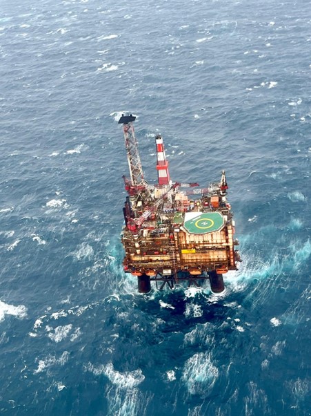
In early July 2023, the Coast Guard aircraft of the Royal Belgian Institute of Natural Sciences (RBINS) carried out its annual Tour d’Horizon (TdH) mission. This involves checking for oil slicks coming from offshore oil and gas platforms in the Northern North Sea (i.e. outside Belgian waters). The mission yielded detections of no fewer than 30 oil slicks, the highest number ever found by a TdH partner in a single mission.
The TdH mission is carried out every year under the Bonn Agreement and aims to control marine pollution from drilling rigs in the central and northern parts of the North Sea. The focus is on Dutch, Danish, British and Norwegian offshore waters, and Belgium also commits to this operation. The activities of surveillance aircraft from the various North Sea countries are coordinated internationally to ensure optimal surveillance coverage of offshore oil and gas infrastructure.
Highest Number of Oil Spills Ever Detected
During this TdH mission, the Belgian Coast Guard aircraft detected no less than 30 oil slicks. This is the highest number of oil slicks detected by a single aircraft in a single mission since the start of the programme in 1991. Of these detections, six involved large oil spills with a minimum estimated quantity of more than 1 m³. The largest was estimated to be at least 16.9 m³. All but two detections were oil slicks linked to a drilling rig. 17 oil slicks were detected in UK waters, 12 in Norwegian waters and one in Dutch waters.
All detections were reported to the competent national authorities in accordance with the procedures established within the Bonn Agreement.
It was notable that the satellite surveillance programme (CleanSeaNet) of the European Maritime Safety Agency (EMSA) reported no detections for their satellite passages in the same zone and time period. This shows the primary importance of traditional aerial surveillance with satellite surveillance in support.
Observations of Marine Mammals
Besides oil slicks, the Belgian Coast Guard aircraft was also able to observe orcas and other marine mammals during the 2023 TdH mission. For the first time during a TdH mission, the team was able to photograph two groups of orcas between Norway and Scotland. It is likely that the two groups were part of one single pod of about 10 individuals.
Thanks to the long-standing experience of the crew, functionality and deployability of RBINS’s Coast Guard aircraft, Belgium continues to honour its commitments under the Bonn Agreement. As a result, the RBINS continues to prove its commitment to better protection of the North Sea. However, the aircraft dates from 1976 and is starting to show more technical defects. The replacement of the aircraft is therefore a top priority so that aerial surveillance can continue in the future.
Until a dead Leatherback Turtle was found on the beach in Knokke on 7 October 2023, we knew of only three strandings of this species in our country. The autopsy, which took place on 9 October, shows that the unfortunate animal was in healthy condition when an acute but unknown trauma caused a sudden death.
On Saturday morning 7 October 2023, walkers found nothing less than a washed-up dead Leatherback Turtle (Dermochelys coriacea) on the beach in front of the Zwin Nature Park in Knokke, near the Dutch border. An exclusively marine species that only comes ashore to lay eggs, the Leatherback Turtle is also the largest turtle species in the world (with a maximum length of 2.5 m). The unfortunate animal from Knokke measured as much as 1.73 m and was already in a state of decomposition. Death may have occurred a few days before it was washed ashore.
The Royal Belgian Institute of Natural Sciences (RBINS), which is responsible for organising the research on protected marine species, collected the animal from the Knokke fire brigade after it was removed from the beach in collaboration with the municipality’s technical service.
In the North Sea?
The Leatherback Turtle is a so-called cosmopolitan, meaning the species is found worldwide. It is best known as a species of warm seas, but it is only for egg-laying that beaches along tropical and subtropical seas are important. Outside the laying season, Leatherback Turtles are also found much further north (as far north as Alaska and Norway) and south (as far south as South Africa and New Zealand). In the shallow North Sea, they are very sporadic, but they can feed there during periods with very abundant jellyfish.
Jellyfish are therefore a possible explanation for the appearance of this Leatherback Turtle in the southern North Sea. In the past few weeks, Barrell Jellyfish (Rhizostoma pulmo) in particular have been abundant in our waters, a jellyfish species that is on the menu of the Leatherback Turtle and which peaks in our waters from August to October. It is not inconceivable that the Leatherback Turtle of Knokke followed this food source into the North Sea.
Four strandings in Belgium
In our regions, the Leatherback Turtle is a great rarity. Jan Haelters (RBINS), coordinator of the stranding network and marine mammal expert, gives an overview: “Only three previous strandings of the Leatherback Turtle are known in Belgium. Earlier strandings date from 1988, 1998 and 2000. Furthermore, only a few sightings of live Leatherback Turtles in Belgian waters are known: one in 2018, two in 2019 and one in 2020. The latter was found between Ostend and Middelkerke in the nets of shrimp fishermen, and was able to be returned to the sea alive.”
It seems that the number of cases in our waters is increasing, but with such a small number, it is dangerous to draw such a conclusion. After all, the number of potential observers and the flow of data have also greatly increased thanks to the high digital connectivity in our current world. Nor can a link to global warming be made with such a low number of observations.
Autopsy
The autopsy of the Leatherback Turtle took place on Monday morning 9 October at the Faculty of Veterinary Medicine of Ghent University, in a collaboration between the universities of Ghent and Liège. This revealed that it was a 247 kg female. The remains of Barrell Jellyfish in the oesophagus showed that the animal was eating when it died. A small piece of plastic was found in the gut, but the amount was too small to cause problems. It is well known that animals that eat jellyfish sometimes mistake plastic floating in the water for jellyfish.
Everything seems to indicate that the Leatherback Turtle was healthy when she died suddenly. Although the animal showed no external signs of acute trauma, internally numerous hemorrhages were observed. This indicates a sudden death due to a traumatic event, but it remains unclear what the exact cause of this trauma was.
Within the framework of the EU project EuroSea, 53 partners from 14 European countries as well as Brazil and Canada worked together to improve the European system for ocean observing and forecasting in a global context. In doing so, they provided an important basis for meeting the growing demand for information supporting social and political processes and decisions. About 200 stakeholders met in Paris for the plenary meeting (19-20 Sep ’23) and the final symposium (21 Sep ’23). GEOMAR Helmholtz Centre for Ocean Research Kiel led the project, which is funded by the European Union with 12.6 million euros from 2019 to 2023.
The ocean forms the basis of all life on our planet. It regulates the climate and provides food and oxygen. However, human-induced changes such as pollution, overfishing, warming and other factors are upsetting marine ecosystems. Understanding ocean and coastal processes is essential to maintaining ocean health and sustainable ocean management.
The EuroSea project, funded by the European Union with 12.6 million euros, has filled important knowledge gaps in these areas over the past four years and paved the way for an interdisciplinary and sustainable ocean observation and forecasting system. To this end, the most important European players in ocean observation and forecasting worked together with the users of oceanographic products and services. At the end of September ‘23, the stakeholders met for the General Assembly and a subsequent symposium at the headquarters of the Intergovernmental Oceanographic Commission (IOC) of the United Nations Educational, Scientific and Cultural Organization (UNESCO) in Paris.
Under the leadership of Dr Toste Tanhua, chemical oceanographer at GEOMAR Helmholtz Centre for Ocean Research Kiel and coordinator of EuroSea, the project brought together 53 partners from 14 European countries as well as Brazil and Canada. Participants included scientific institutions as well as private sector partners and international organisations and networks such as IOC-UNESCO, the European Marine Board and the European part of the Global Ocean Observing System (EuroGOOS).
The project partners have set the course for connecting existing ocean observation systems of individual European actors and making ocean data more accurate and accessible to all. For instance, actors of the Blue Economy – an environmentally sound economy based on the use of the oceans, including fisheries, ports, tourism and offshore energy production – and policy makers should be able to make better informed decisions based on the data. At the EuroSea General Assembly, the working groups of the ten individual, interlinked work packages shared their results.
The project has produced numerous innovations that improve ocean observing and forecasting at the European level, in a global context. Among other things, the partners developed a tool to be used by cities and their ports based on data from three test sites in Spain, Italy and Colombia, which provides real-time information and forecasts on waves, sea level, sea surface temperature, thus increasing safety in maritime operations. A system for aquaculture monitoring that uses sensors, unique buoys and advanced modelling capabilities to measure parameters such as oxygen, temperature and pH has also been created within the EuroSea project. It enables targeted predictions of extreme marine events such as marine heat waves and provides aquaculture operators with an early warning mechanism.
At the subsequent final symposium, national and international stakeholders from politics, science and industry were able to inform themselves about the current state of innovations in the field of European ocean observation and forecasting. In addition to addressing upcoming challenges, the discussion focused on recommendations for an effective, sustainable and interdisciplinary system.
In his closing statement, Dr Toste Tanhua highlighted the pioneering nature of the project and advocated for a continuation of the joint efforts at European level: “EuroSea has paved the way towards an interdisciplinary, sustainable ocean observing and forecasting system. We, the ocean experts and stakeholders, are committed to a concerted action to sustainably strengthen the European Ocean Observing and Forecasting System to meet the growing needs of European society and policy and to support the European Green Deal and the Ocean and Waters mission.”
The stakeholders want to build on the collaborations and relationships that have been established through the project. Parallel workshops of the Global Ocean Observing System (GOOS) and a meeting of the European national focal points for GOOS also took place in Paris. There, possibilities for follow-up projects were discussed and experiences exchanged. “We were able to pass on the knowledge we gained directly at the global level”, said Dr Toste Tanhua, who is also co-chair of GOOS.
Project funding:
The EuroSea project is a European Union innovation action funded with €12.6 million from 2019 to 2023 by the European Commission’s Horizon 2020 research and innovation funding programme as part of a call to support the G7 Future of Seas and Oceans initiative.
Pollutant emissions from ships to air are subject to strict standards worldwide. Ward Van Roy analysed the potential and added value of aerial surveillance for monitoring harmful ship emissions in a doctoral study. To this end, he used data collected with the Belgian aerial surveillance aircraft1. His findings underline the operational benefits of aerial monitoring and provide valuable insights into the effectiveness of international regulations in improving air quality over the North Sea. Moreover, the study revealed regulatory gaps and provides recommendations to resolve them. Ward Van Roy is attached to the Royal Belgian Institute of Natural Sciences (RBINS) and, on 28 September 2023, became the very first doctor of maritime sciences to obtain this degree from the Faculty of Law and Criminology at Ghent University. An extra reason for Ward, Ghent University and RBINS to be proud.
Shipping plays a crucial role in connecting economies and cultures around the world but is also one of the biggest sources of air pollution. Indeed, burning traditional marine fuels creates sulphur compounds, nitrogen compounds and ‘black carbon’, with adverse effects on human health and the environment.
To address this, international efforts have been made to draft regulations2 aimed at reducing ship-to-air emissions. However, without effective enforcement, regulations risk remaining dead letter. This moved Ward Van Roy3 to describe in a PhD the extent to which aerial monitoring can contribute to the development of a strategy for monitoring and enforcing emissions rules for shipping.
The first part of the doctoral thesis presents the science-based method for airborne monitoring of ship emissions. The so-called ‘sniffer sensor’ integrated into the Belgian aerial surveillance aircraft plays a central role in this. Thanks to the implementation of several innovations, Ward was also able to significantly improve the method for monitoring sulphur oxides (SOx) in ship emissions. A comprehensive manual, also part of the thesis, ensures the uniformity and quality of measurements and can serve as a guide for setting up corresponding programmes in other countries.
Analysis of the obtained data then shows not only that the international regulations on sulphur dioxide (SO2) and nitrogen oxides (NOx) emissions can be effectively monitored from the air, but also that SO2 emissions regulations are relatively well complied with, both in Belgium and in the larger emission control area encompassing the entire North Sea and Baltic Sea.
Ward Van Roy: “We can conclude that aerial monitoring has actually contributed to the significant reduction in SO2 emissions. For NOx emissions, on the other hand, it appears that the targeted reduction in emissions has not yet been achieved, neither in Belgium nor beyond”.
The analyses used data from Belgian aerial surveillance as well as data from measurement campaigns from other countries, land-based air quality monitoring stations, and satellite imagery.
Unexpected results
However, Ward’s study also uncovered some unexpected trends.
It was thus shown for the first time that ships equipped with after-treatment systems for their emissions to air, known as scrubbers, account for a significantly higher proportion of emission violations. As scrubbers are being installed to reduce emissions of harmful components to the air, this finding runs counter to expectations. Moreover, the use of scrubbers is increasing, already reaching 30 per cent of observed ships by 2022. If this development continues, combined with the current increase in shipping, SO2 emissions from shipping will increase again and the sector will become responsible for a larger share of total SO2 emissions.
Ward also made a remarkable observation with regard to NOx: “My research shows that the average NOx emissions of more recently built ships are significantly higher than those of older ships, which obviously cannot be the intention” he indicates. “Moreover, I found that the regulations, which aim to reduce NOx emissions, are only very slowly taking hold due to the way these international regulations are drafted.” If this does not change, it is expected that the shipping sector will be the largest source of NOx in Flanders by 2025, and will even account for 40 per cent of all NOx emissions by 2030.
Added value and policy recommendations
In his thesis, Ward also reflects extensively on the legal aspects of aerial surveillance and the added value for various stakeholders.
First of all, an important added value could be demonstrated for port inspection services. By identifying potential violators at sea, port inspection services can follow up the ships concerned in a more targeted way when they call at a port, which can lead to sanctioning when necessary. Air monitoring thus appears to positively influence the follow-up and sanctioning of emission violations by ships. A cost-benefit analysis shows that aerial monitoring also pays off financially as a result.
The Belgian findings also benefit international cooperation and are included in efforts to achieve effective and harmonised international monitoring.
Furthermore, based on the experience gained, it also formulates recommendations for policymakers, which can make an effective contribution to reducing air pollution from shipping. These include increasing the direct legal value of aerial measurements (which currently always have to be confirmed by port control), obtaining an internationally accepted protocol to monitor NOx violations at sea and an associated enforcement mechanism, and eliminating certain regulatory gaps. These recommendations are being discussed at the international level in the framework of the Bonn Agreement (cooperation of North Sea states in detecting, reporting and combating pollution in the North Sea) and the International Maritime Organisation (IMO), while in Belgium, solutions are being sought in cooperation with the Directorate-General Shipping (FPS Mobility and Transport), which will find their way into international regulation through federal policymakers.
Additional background
1 The Management Unit of the Mathematical Model of the North Sea (MUMM), Scientific Service of the Royal Belgian Institute of Natural Sciences (RBINS), is responsible for implementing the Belgian aerial surveillance programme over the North Sea. For this purpose, the RBINS owns a Britten Norman Islander type aircraft equipped with scientific sensors for detecting marine pollution, and cooperates with Defence, which provides the pilots. Since 1990, this programme has been producing significant results. The focus is on three groups of core tasks: 1) surveillance of illegal and accidental marine pollution, 2) monitoring of the marine environment and 3) broader maritime surveillance in the context of the Coast Guard (the aircraft therefore bears the inscription ‘Coast Guard’ and is also widely known as ‘Coast Guard aircraft’).
2 Globally applicable emission standards for sulphur and nitrogen are described in Annex VI of the international MARPOL Convention (International Convention for the Prevention of Pollution from Ships). Furthermore, the European Sulphur Directive also prescribes restrictions on sulphur emissions from ships, and sulphur and nitrogen compound emissions are even more strictly regulated in the very busy ‘North Sea and Baltic Sea Emission Control Area’ (of which Belgian waters are also an integral part) than outside it. Black carbon (a measure of airborne soot concentration) from shipping is not yet subject to international restrictions, these emissions are currently being mapped to feed the development of a restrictive framework.
3 Ward Van Roy graduated as a bioengineer from Ghent University in 2008, and later joined the RBINS aerial surveillance team (BMM) as an operator. He is also responsible for managing the scientific instruments and is considered the brain behind the integration of the so-called ‘sniffer sensor’ setup in the Belgian aerial surveillance aircraft. He is thus partly responsible for the team’s international name and fame in the field of airborne ship emission monitoring. Ward has the honour of being the very first person to obtain the title of ‘doctor of maritime sciences’ at Ghent University (Faculty of Law and Criminology).
A dead fin whale (Balaenoptera physalus) was found in the Deurganckdok in the port of Antwerp on Tuesday 29 August 2023. The carcass was lifted from the water by the crane vessel Brabo.
The autopsy on Wednesday confirmed that the animal died from a collision and was brought into the port on the bow of a ship. Bruising was found at the level of the pectoral fin, and the spine was also fractured at that location.
“It was a young male measuring 10.5m and weighing about 8-9 tonnes,” said Jan Haelters, marine mammal expert of RBINS. “The animal was not healthy, quite a few parasites were found and the blubber layer was very thin.”
The autopsy was performed by staff from the universities of Ghent, Antwerp and Liège, and civil protection provided technical support, in cooperation with the Port of Antwerp.
Due to heavy shipping traffic in the Bay of Biscay and the Mediterranean Sea, among others, collisions with large cetaceans are not uncommon. Also in 2009, a 20-metre fin whale ended up in the port of Antwerp after a collision. In 2015, the same happened in the port of Ghent, with an 11-metre fin whale.
The Belgica Documents Climate Change in an Arctic Marine Ecosystem
On the 13th of July 2023 the new Belgian oceanographic research vessel RV Belgica is leaving from Reykjavik, Iceland, for a trip of three weeks to southwest Greenland. The international research team on board will make use of the advanced facilities on board of the ship to investigate how climate change, and more specifically changes in glacial melt, will affect the carbon dynamics, biological communities and food webs in Greenlandic fjords, a typical Arctic marine ecosystem.
Fjords are systems of regional and global importance by supporting highly productive and diverse food webs. As this rich marine life stores a lot of carbon, the fjords play a far more important role as CO2 sinks than one would suspect based on their limited size relative to the vast ocean basin.
From Marine- to Land-terminating Glaciers
These days, global warming significantly impacts fjord systems through the accelerated melting of ice, with the greatest impact in polar areas such as Greenland. Here, coastal glaciers often terminate in the fjord, so called marine-terminating glaciers.
However, especially at Greenland’s marine-terminating glaciers draining 88 % of the ice sheet in the study area, discharge has recently increased sharply caused by increased melting of the ice sheet. As a consequence, many of Greenland’s marine-terminating glaciers are gradually shifting to land-terminating glaciers, a process which will likely intensify in the near future.
Impact on Ecosystem Functioning and Services
Whereas there is increasing evidence that shifts in glacier types cause major changes in the physical, biogeochemical and ecological processes in the associated fjord systems, the consequences for the marine food web and carbon burial in sediments are currently not fully understood. As a result, the impacts of further warming on ecosystem services provided by Arctic fjords (e.g. food provisioning, climate regulation) remain unknown.
This Belgica expedition aims to investigate to what extent changing glacial melts in Arctic fjords may lead to lower primary productivity and a less rich food web. The research is part of the CANOE project (Climate chANge impacts on carbon cycling and fOod wEbs in Arctic Fjords), which is funded by the Federal Science Policy Office (BELSPO).
Study Area
The study area consists of two adjacent fjords with contrasting glacier input, respectively marine- and land-terminating. In both fjords, a gradient from shelf to inner fjord will be sampled. Oceanography and pelagic (water column) biogeochemistry will be described at high resolution in each fjord (oceanographic stations), in addition to the benthic (seafloor) biogeochemistry and biodiversity (basic and medium stations), while the food web will be described and quantified at two contrasting locations in each fjord (full stations).
“With this expedition the team will contribute to major societal concerns for which research-based management strategies are crucial for the future” says Ann Vanreusel, professor at the Department of Biology of Ghent University and chief scientist of the RV Belgica Greenland expedition. “By providing insights into expected climate change effects on coastal marine food webs, important information for a future ecosystem-based management in the Arctic fjords is generated.”
The CANOE project, coordinated by prof. Ulrike Braeckman (RBINS and UGent), will also construct predictive models that will help to anticipate the ongoing and future climate-related shifts in marine ecosystems and the consequences for natural resources and other ecosystem functions such as CO2 mitigation.
The Tradition of Integrated Research
Belgium has a long tradition in marine Arctic research since Adrien de Gerlache set sail with the historical Belgica in 1907 for a scientific expedition exploring parts of the Arctic Ocean. Even at that time, this involved integrating many research disciplines into the expedition, and involving scientists of different nationalities. In the spirit of this tradition, the CANOE-scientists now also use the new RV Belgica for an integrated and international research campaign, linking physical, biogeochemical and biological aspects of the water column with seafloor processes in Greenlandic fjord ecosystems with glacier dynamics under influence of climate change. Such an interdisciplinary campaign requires optimal use of the numerous oceanographic and biological research instruments offered by the RV Belgica.
The multidisciplinary international CANOE team is led by researchers from Ghent University (UGent) (Prof. Ulrike Braeckman) and also consists of researchers from the Royal Belgian Institute of Natural sciences (RBINS), Flanders Marine Institute (VLIZ), University of Antwerp (UAntwerp), Royal Netherlands Institute for Sea Research (NIOZ), University of Southern Denmark (SDU) and University of Bonn (Germany). The research is also carried out in association with Greenland research institutes.
CANOE is funded by the Belgian Science Policy Office (BELSPO) as beneficiary of a specific call that was designed to give an impulsion to the start-up of research on the new RV Belgica and to allow researchers to get to know the ship and her potential. The project runs from 15 December 2021 to 15 March 2026. For more information of the project please visit http://canoe.marinetraining.eu/.
The CANOE expedition with RV Belgica follows the DEHEAT expedition that operated in Icelandic waters from 26 June to 11 July. Here, it investigated how the natural weathering of silicate minerals in the sea consumes the greenhouse gas carbon dioxide from the atmosphere, thereby helping to remove it from the atmosphere, and when accelerated could be an ally in the fight against global warming.
More information on RV Belgica can be consulted at the ship’s websites at RBINS (including live position information and webcam images) and BELSPO. The ship and its scientific activities can also be followed on Facebook and Twitter.
28 June 2023 – Three down, two to go! As if the Van Veen grab, the box corer and the GEMAX corer don’t provide the DEHEAT-team with enough sediment samples to learn to understand the bottom of Hvalfjördur and the biogeochemical processes taking place in it, the scientists are sending two additional types of devices to the bottom to collect even more sediments.
The first is the long gravity corer, that essentially consists of a narrow corer of 3m in which a sampling tube is fitted – or two such corers and tubes combined, totaling 6m – and a huge weight to drive the corer into the seafloor (hence ‘gravity’ corer). This way, much deeper sediment layers are cut than with the other techniques, with deeper meaning older. The long cores allow the sedimentological history of the seabed to be reconstructed and to unravel a host of secrets from the past. In the case of DEHEAT and of the biogeochemists on board, this is obviously done with attention to how silicate weathering has evolved over time here, and how historical changes can be linked to climate-relevant processes.
Christian März, Professor for General Geology at the University of Bonn, is especially interested in the deeper part of the sediments, and therefore depends on the long cores. By studying these, he can determine how the composition of the sediment changed over time and how these changes affected the cycling of essential elements like carbon, metals and nutrients in the seafloor. By studying past environments from the sedimentary records, climate change signals can also be extracted.
“It is also exciting to dive deeper into the topic of silicate weathering, a new and quite hip topic due to the need to stop and reverse global warming. Through this link, my colleague Katrin Wagner and I got offered the opportunity to join the expedition with RV Belgica in Iceland as collaboration partners of the DEHEAT project. As such, we bring in our expertise both for the benefit of our and the DEHEAT research” Christian explains.
However, deploying and retrieving the long gravity corer is anything but an easy task. And once in the water, the actual sampling of the bottom does not prove to be easy either. Indeed, the multi-purpose and interdisciplinary RV Belgica is not perfectly equipped for this particular type of sampling. It takes a lot of inventiveness and advancing insight to get the procedure right, but the highly motivated crew succeeds and regularly delivers usable ‘long cores’ to the scientists.
Christian: “The long gravity corer cannot be deployed over the sides of RV Belgica, so this has to be done from the stern. If swell causes the amplitude of the movement of the stern to be bigger than the accuracy with which the position of the corer in relation to the depth of the seabed is known, it is nearly impossible to successfully apply this method. We sometimes have to try several times but in the end manage to secure good cores thanks to the crew”. He adds laughingly: “This is why I like working in the central arctic so much. There, the ice prevents the ship from moving and allows us to work more accurately”.
Finally, there is a fifth way by which sediment is brought to the surface during the DEHEAT cruise: the benthic lander. However, it would be irreverent to wear this unit down as a simple ground grabber. After all, the lander does much more than that. It is a platform that is sent down in the deep to take measurements on the seafloor itself, and that is equipped with so-called ‘benthic flux chambers’ that measure the flow of substances between the seafloor and the water above it. It stays on the seafloor for one or several days while the DEHEAT-scientists proceed and sample at another station, and carries out the pre-programmed actions while storing the resulting data in a battery-driven data logger.
The benthic lander that is used during the DEHEAT-expedition belongs to the University of Gothenburg, Sweden, that employs a true benthic lander guru in the form of Mikhael Kononets. It is almost inconceivable that the lander would be deployed without Mikhael being present to oversee the operation, so the Royal Belgian Institute of Natural Sciences arranged a contract for him for the duration of the RV Belgica adventure in Iceland, as well as for the subsequent expedition in Greenland. He boarded in Galway, Ireland, and was continuously engaged with the lander throughout the transit to Iceland as well as during the two-day stay in Reykjavik. Mikhael and the lander seem intertwined, and he did not even set foot on Icelandic soil but kept busy with making sure that the lander is fully ready for its duties on the RV Belgica. “It’s only concrete, that’s the same everywhere, isn’t it?” he jests.
There is some work involved in deploying the lander from RV Belgica, and especially in retrieving it. Mikhael explains how this works: “Deploying the lander is not so much the problem. It can be lifted over the side, after which ballast causes it to sink to the seabed. Old pieces of railway track, which were donated to us by the Swedish company Stena Recycling, are used as ballast in this case. After the lander has done its job, we activate the decoupling mechanism with an acoustic signal via a hydrophone, whereupon the styrofoam-filled compartments cause it to rise back to the surface. The railway tracks remain behind, which is not a problem as primary production in the sea is limited by the availability of iron”.
Only then does the hardest work begin, getting the lander back on board. Mikhael: “First, the floating lander must be spotted. We usually know its position very accurately, but if we cannot see it immediately – due to wave action, for example – we can still determine in which direction to look using a simple radio signal. Once found, the lander is then carefully towed by RHIB (rigid-hulled inflatable boat) to near the stern of the RV Belgica, from where he can then be hoisted on board. The time elapsing during the calling and ascent of the lander through the water column can sometimes be nerve-wracking … after all, there are known cases of landers lost for eternity …”.
For launching this wide variety of sampling equipment, for the actual sampling of the water column and the bottom, and for retrieving the equipment again, it is obviously very important that the platform on which these operations take place is very stable and remains very accurate on site. For the first, the RV Belgica is indeed a very stable vessel but wind and wave action are also important and one also depends on the swell. For the second, the so-called Dynamic positioning system comes into play. Dynamic positioning is a computer-controlled system to automatically maintain a vessel’s position and heading by using its own propellers and thrusters. The DEHEAT-team is blessed: all sampling is proceeding as planned in Hvalfjördur thanks to favourable conditions and the RV Belgica’s Dynamic Positioning. Fingers crossed that this will continue to be the case later on the continental shelf.
Now, don’t get us wrong, the soil sampling techniques mentioned are not only used on the day they are described in this blog but are part of the routine of every day. The same goes for the CTD reviewed earlier, and for many of the operations and analyses that will follow.