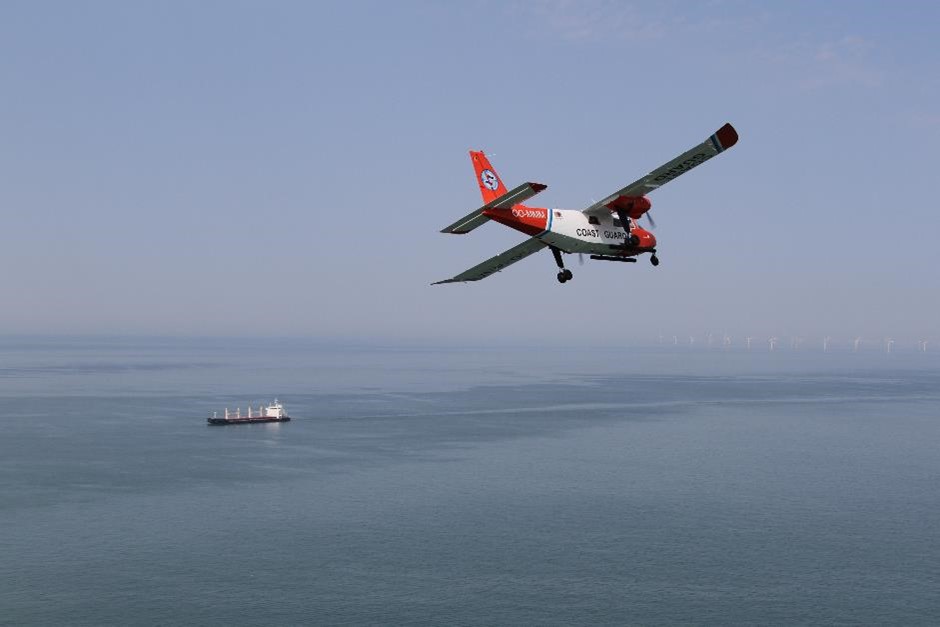
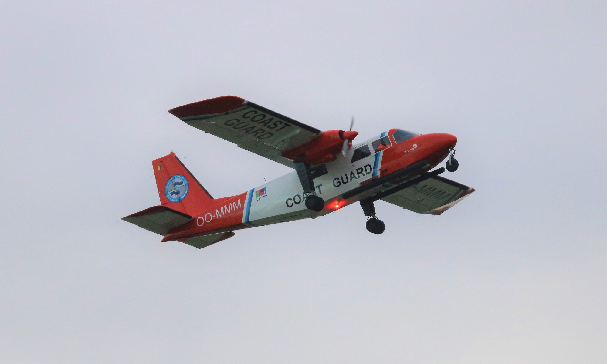
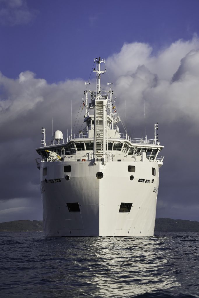
In 2020, the Royal Belgian Institute of Natural Sciences (RBINS) performed a total of 158 flight hours over the North Sea in the framework of the national programme of aerial surveys. Ten cases of operational discharges by ships have been observed, and one case of accidental pollution that resulted from a collision between two tankers. Additionally, suspicious sulphur values have been measured in the smoke plumes of 10 vessels. Since 2020, the sniffer sensor is able to measure nitrogen emissions as well. With this capacity expansion, Belgium keeps on playing an international pioneering role in the field of ship emission monitoring. Notwithstanding the COVID-19 pandemic, the aircraft also successfully participated in an internationally coordinated surveillance mission of the oil and gas installations in the central part of the North Sea. Furthermore, the annual marine mammal counts were also carried out successfully.
Overview of Surveillance Flights
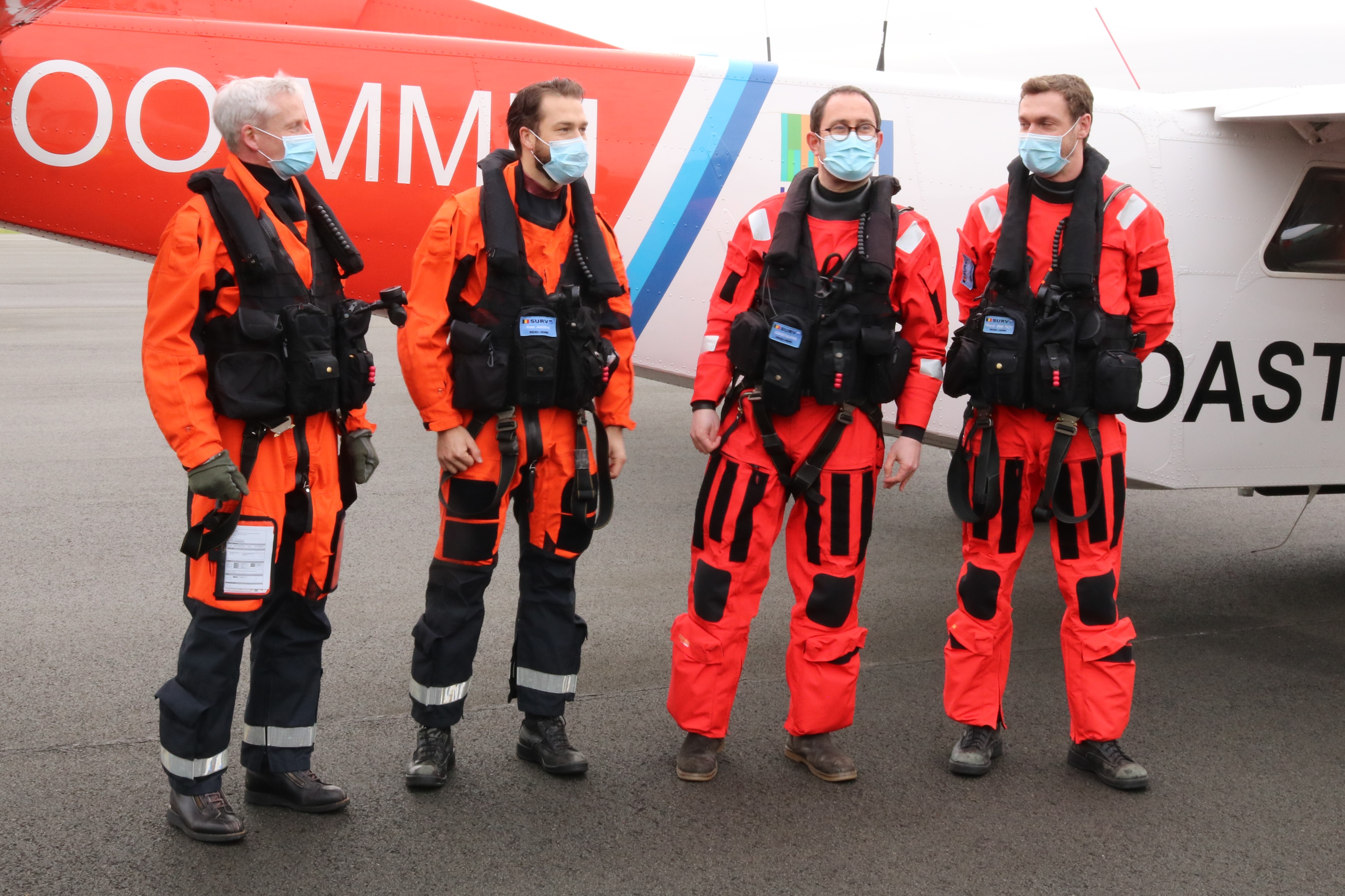
A total of 158 flight hours have been performed in the framework of the national North Sea aerial survey programme in 2020. This programme is organised by the Scientific Service MUMM (Management Unit of the Mathematical Model of the North Sea) of the Royal Belgian Institute of Natural Sciences, in collaboration with the Ministry of Defence. Due to the COVID-19 pandemic, less flight hours could be performed than initially planned. However, due to the elaboration and application of an extensive Covid-19 switching plan, a considerable part of the anticipated hours (approximately 75%) was performed despite the exceptional and difficult circumstances.
Most of the flight hours were for national flights (136 hours):
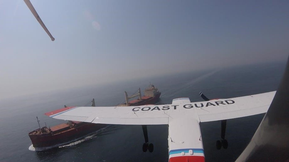
- 128 hours in the context of the Belgian Coastguard:
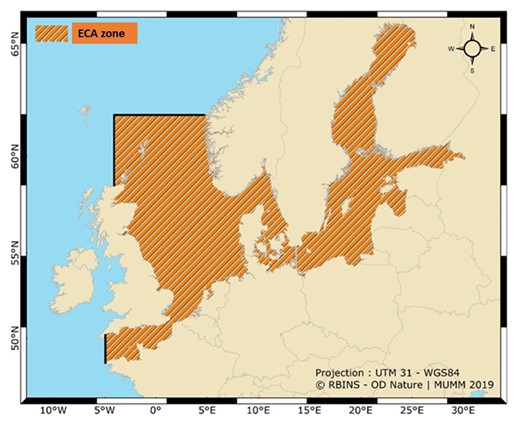
- 92 hours for pollution control: 56 hours for the detection of discharges of oil and other harmful substances (MARPOL Annex I, II and V) and 36 hours for the monitoring of sulphur emissions from ships (MARPOL Annex VI / SECA – Sulphur Emission Control Area enforcement;
- 27 hours for fishery control, on behalf of and in cooperation with the Flemish Fishery Inspection Services;
- 9 hours in response to a specific alerts: a collision with pollution, a considerable accidental oil pollution in the western Scheldt, an alert for large amounts of brown substances in the water (after verification it turned out to be algae) and a search for a whale in Belgian waters.
- 8 hours for marine mammal monitoring.
A smaller part (22 hours) has been spent on the international level: the Tour d’horizon-mission for aerial surveillance of offshore oil and gas installations in the North Sea, an international mission framed in the BONN Agreement.
Accidental Pollution
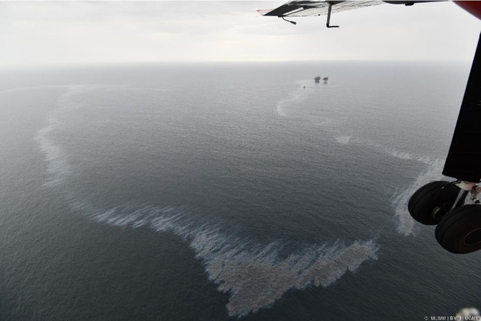
On 12 and 13 May 2020, a small accidental spill of a liquid noxious substance (LNS) other than oil was observed after a collision between the vessels ISOLDE and NAVIGATOR CERES. The pollution originated from the slightly damaged ISOLDE. The traces, which had an oily appearance, could be observed in the vicinity of ISOLDE at the sea surface for 2 days during 4 consecutive flights. The pollution was not a consequence of a loss of cargo but due to an accidental loss of Bioneptan, a bio-oil used to lubricate the screw drive. Given the nature and the limited discharged volume (<100L), this accidental pollution did not pose a major threat to the marine environment.
Operational Discharges from Ships
Besides the accidental spill, 10 cases of operational discharges from ships have been observed throughout the year:
- 2 minor oil spills (MARPOL Annex I), that could not be linked to a polluter.
- 8 spills of liquid harmful substances other than oil (MARPOL Annex II). In one of these cases a link could be made with a ship; a port state control was requested in the next port of call. This made clear that it consisted of a permitted discharge of sunflower seed-oil (MARPOL Annex II).
- In addition to aerial surveillance with the Coast Guard aircraft, MUMM also regularly receives alerts from satellite detections of possible marine pollutions. This Clean Sea Net (CSN) satellite surveillance service is provided by the European Maritime Safety Agency (EMSA). In 2020, the aircraft carried out 5 verification flights in response to a CSN satellite detection alarm of a possible contamination in the Belgian surveillance area. In one case, a contamination was effectively confirmed by the aircraft, involving a harmful liquid substance other than oil. During the other 4 verifications, no detections of pollutions could be made (anymore). Feedback was provided to EMSA for each verification.

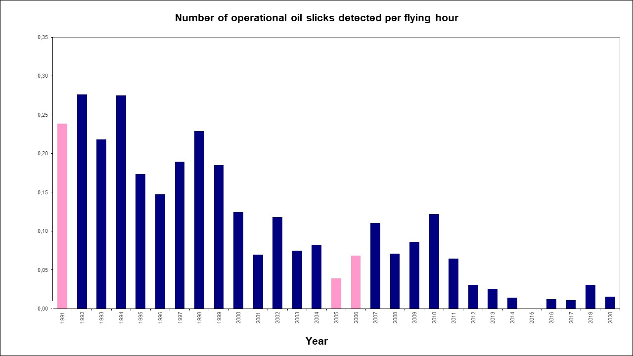
The numbers show that the number of oil spills has been greatly reduced in the last decade (graph 1), while the number of spills of other harmful substances remains a common problem, that even appears to be on the rise (graph 2). It should be noted that it often concerns discharges that comply with international discharge standards, as contained in Annex II of the MARPOL Convention. From 2021, stricter MARPOL Annex II discharge standards are in force for so-called “persistent floaters” such as paraffin-like substances. The impact of these stricter discharge standards at sea will be monitored in the coming years.
Oil Pollution in Belgian Ports and the Western Scheldt
During transit flights from the airport of Antwerp (the home-base of the Coast Guard aircraft) to the North Sea, one oil spill has been observed in the port of Antwerp and one accidental oil spill in the western Scheldt. In the latter case, sludge oil was pumped out by a vessel during debalasting operations as a result of corrosion between the ballast and sludge tanks. Both observations were immediately reported to the competent authorities to ensure follow-up.
Monitoring of Sulphur Emissions from Ships at Sea
Due to application of a ‘sniffer’-sensor in the aircraft our country is known as a pioneer in the international combat against air pollution from ships at sea. The sensor makes it possible to measure pollutants in the emissions of ships on site.
Sulphur measurements have been on the program since 2016. In order to monitor compliance with the stringent fuel sulphur content limits for ships sailing in the North Sea SECA (Sulphur Emission Control Area), 25 sniffer fights (36 hours) were conducted. Of the 394 vessels of which the sulphur exhaust was measured at sea, 10 showed a suspiciously high sulphur value. These cases were systematically reported to the competent maritime inspection services for a further follow-up in port.
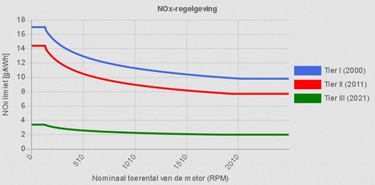
Thanks to the successful integration of a NOx sensor, the aircraft can now also measure the concentration of nitrogen compounds (NOx) in the smoke plumes of ships. This new sensor was extensively tested in 2020, where it was also possible to determine the nitrogen emissions of the 394 monitored ships. The associated monitoring and reporting procedures were also worked out, which means that Belgium is the first country ready to start monitoring and enforcing the strict restrictions that will apply in the North Sea from 1 January 2021 regarding nitrogen emissions from ships. Therefore, RBINS continues to play a key role on the international level in the field of MARPOL Annex VI. During the 2020 tests, it was found that the majority of the inspected ships already complied with the new rules, although some were documented with nitrogen concentrations in their emissions that were more than double of the 2021 limit values.
International ‘Tour d’Horizon’ Mission
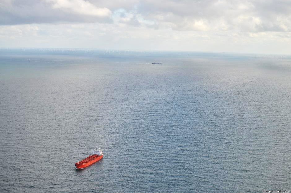
The annual TdH-mission for the surveillance of offshore platforms in the central part of the North Sea (in Dutch, German, Danish, Norwegian and British waters), performed in the framework of the Bonn Agreement, was conducted in September 2020. Due to the COVID-19 pandemic, the team was forced to change the classic flight route (with stops in several North Sea countries) and to operate exclusively from the United Kingdom. The Belgian surveillance aircraft detected 24 pollutions, of which 21 oil could be directly linked to offshore installations. The 3 remaining detections – 2 oil spills and 1 detection of another harmful substance – were made without a vessel or platform in the vicinity. All detections were systematically reported for further follow-up to the competent Coastal State, in accordance with agreed international procedures.
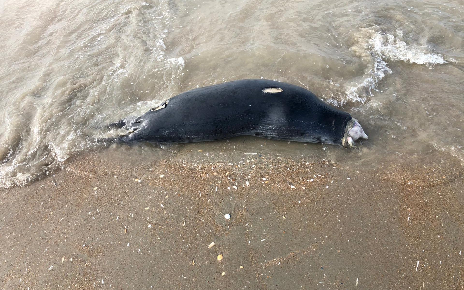
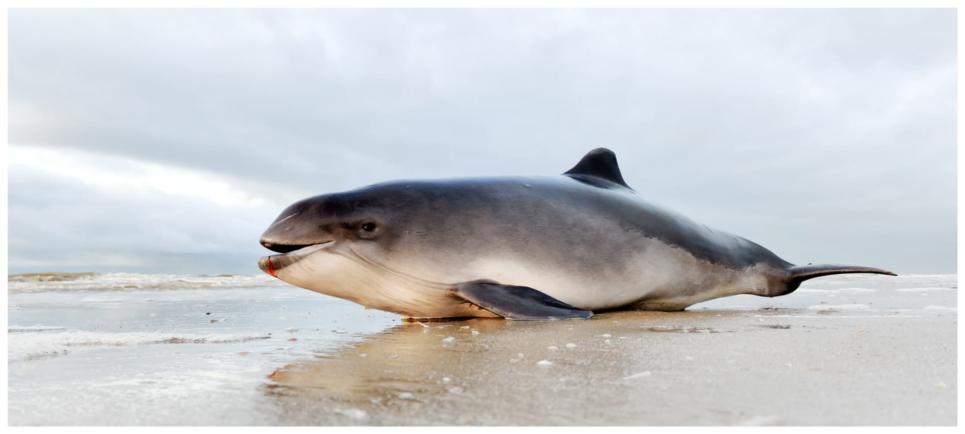
Monitoring of Marine Mammals
In 2020, RBINS conducted two surveys in Belgian waters to determine the distribution and density of harbour porpoises. Such surveys are also carried out in other North Sea countries in a standardized manner, in order to obtain long-term data that yield a bigger picture of the population dynamics for the entire southern and central North Sea. Due to COVID-19 restrictions, the seasonal surveys could only be carried out at the end of June and the beginning of September. Although these months are not the peak months for the presence of harbour porpoises in our waters, considerable numbers were still spotted during these campaigns.
During the survey in June 34 harbour porpoises were spotted, whereas in the beginning of September 37 individuals were recorded. The resulting estimates of average density in the Belgian part of the North Sea were 0,56 and 0,55 harbour porpoises per km², corresponding to about 1900 animals in Belgian waters. Besides harbour porpoises, other marine mammals were spotted too during the campaigns: in June 3 seals were recorded, in September this number was 13, the highest number recorded since the start of the surveys. Of those 13 seals, 3 were identified as adult grey seals. In September one bottlenose dolphin was spotted in the north-western part of the Belgian waters.


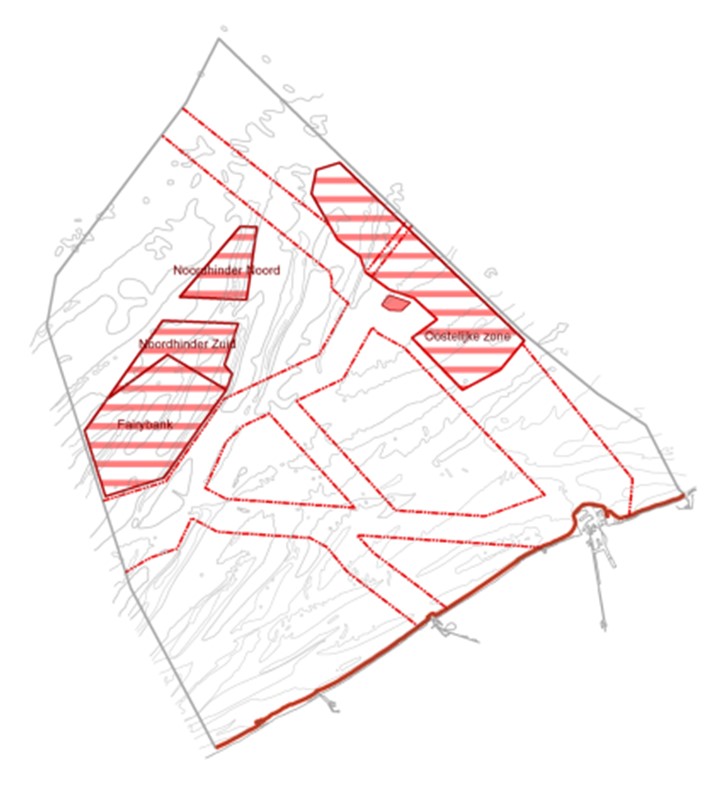
 While Belgium emerged as a world leader in the offshore wind industry, the Belgian scientists that monitor the environmental impact of offshore wind farms have also developed extensive knowledge and expertise. Shortly after the first Belgian offshore wind zone was completed (the world’s biggest to be operational), the monitoring consortium presents its latest conclusions and recommendations in a