
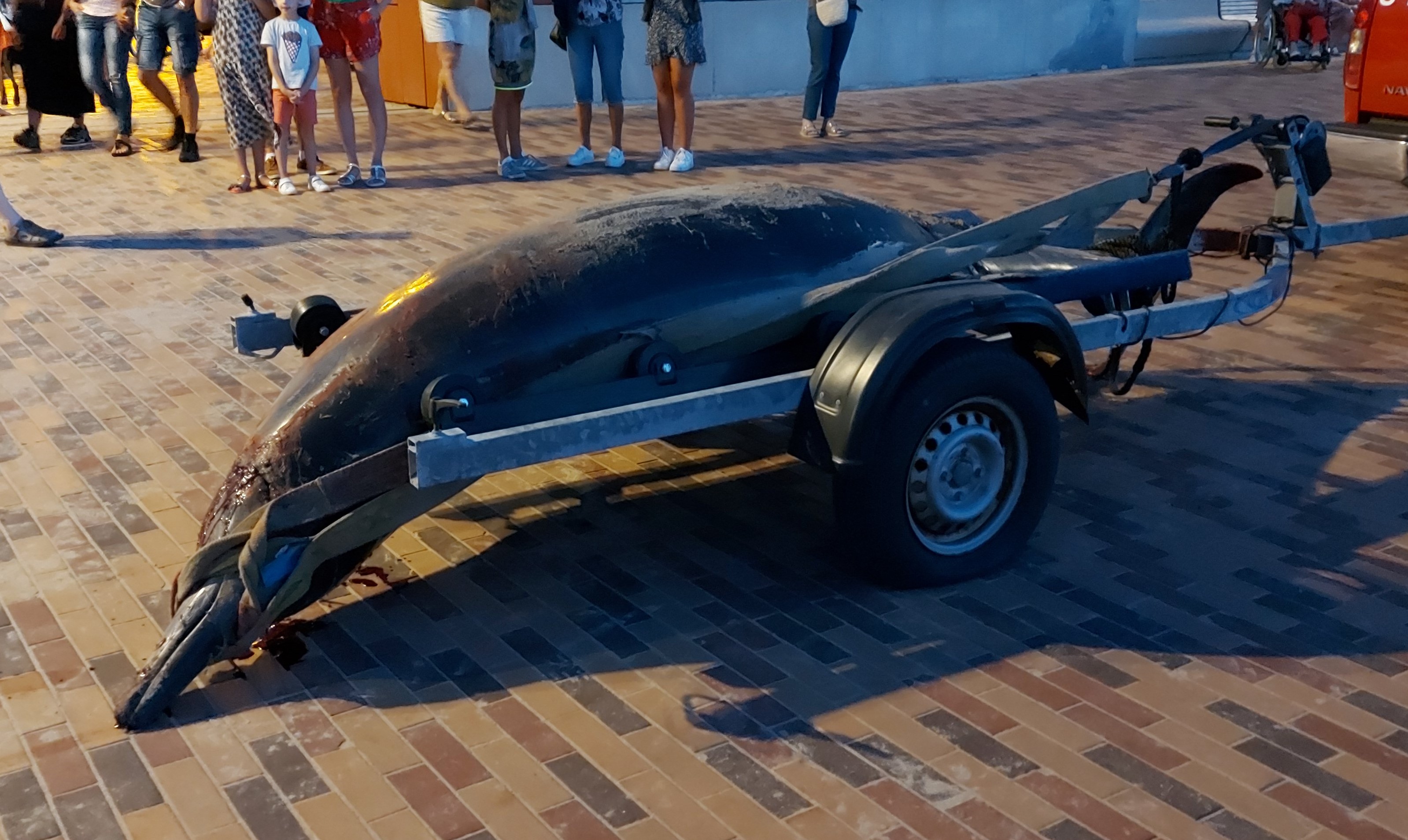
On 15 August, striking orange spots and strings were observed in the Belgian part of the North Sea near the Buitenratel sandbank, that were reported to the Coast Guard as a possible pollution. After inspection by various services, it became clear that this was an unseen bloom of the single-celled plankton species ‘Sea Sparkle’. The warm and calm weather of the past few days is probably an important explanatory factor. The rotting mass could possibly lead to oxygen deficiency and fish mortality. It is also possible that the remains will be washed ashore on Belgian beaches during the next week.
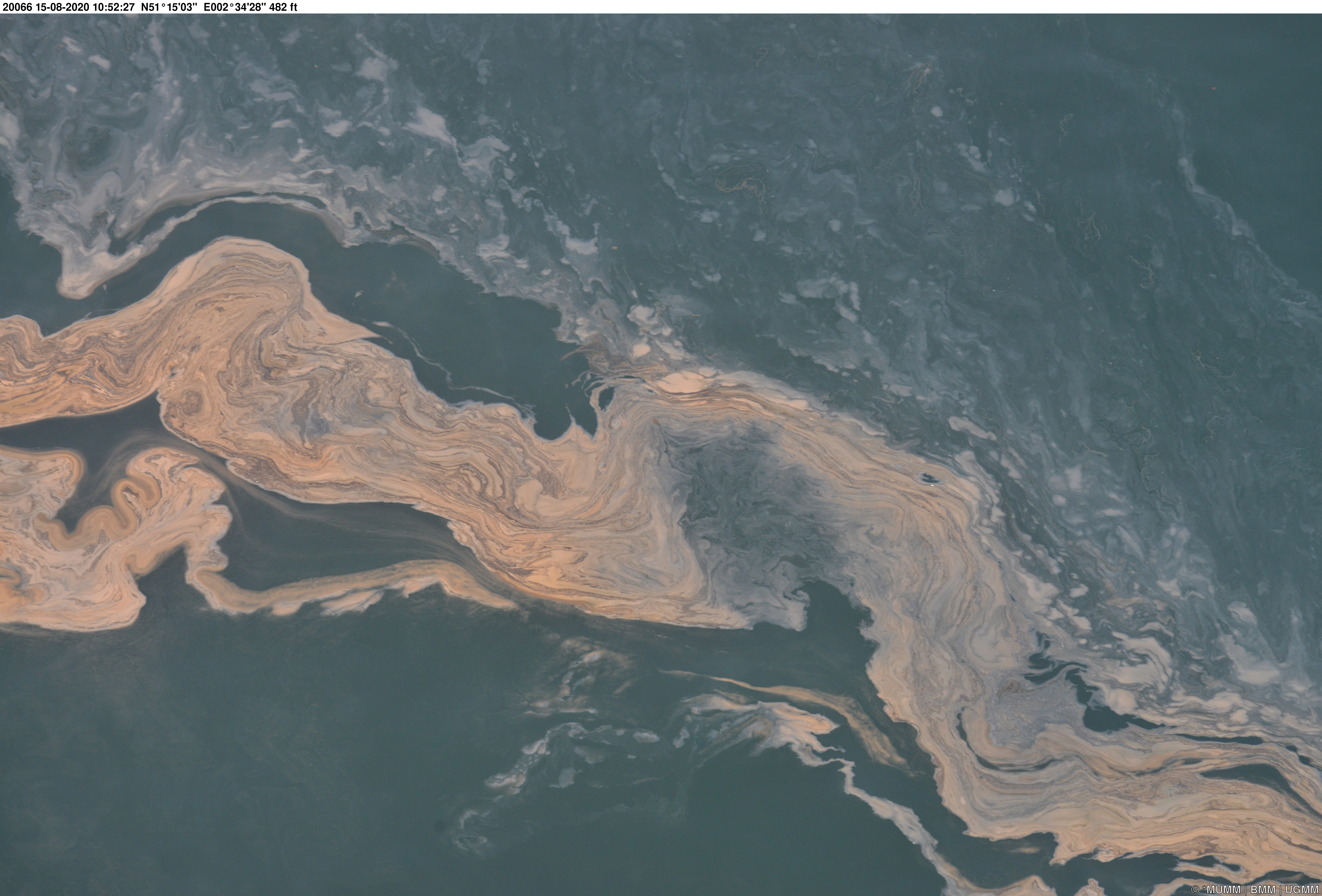
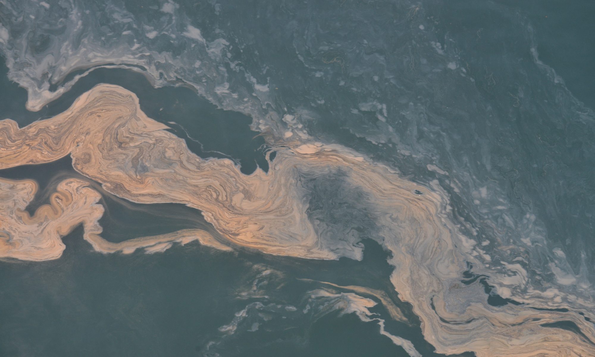
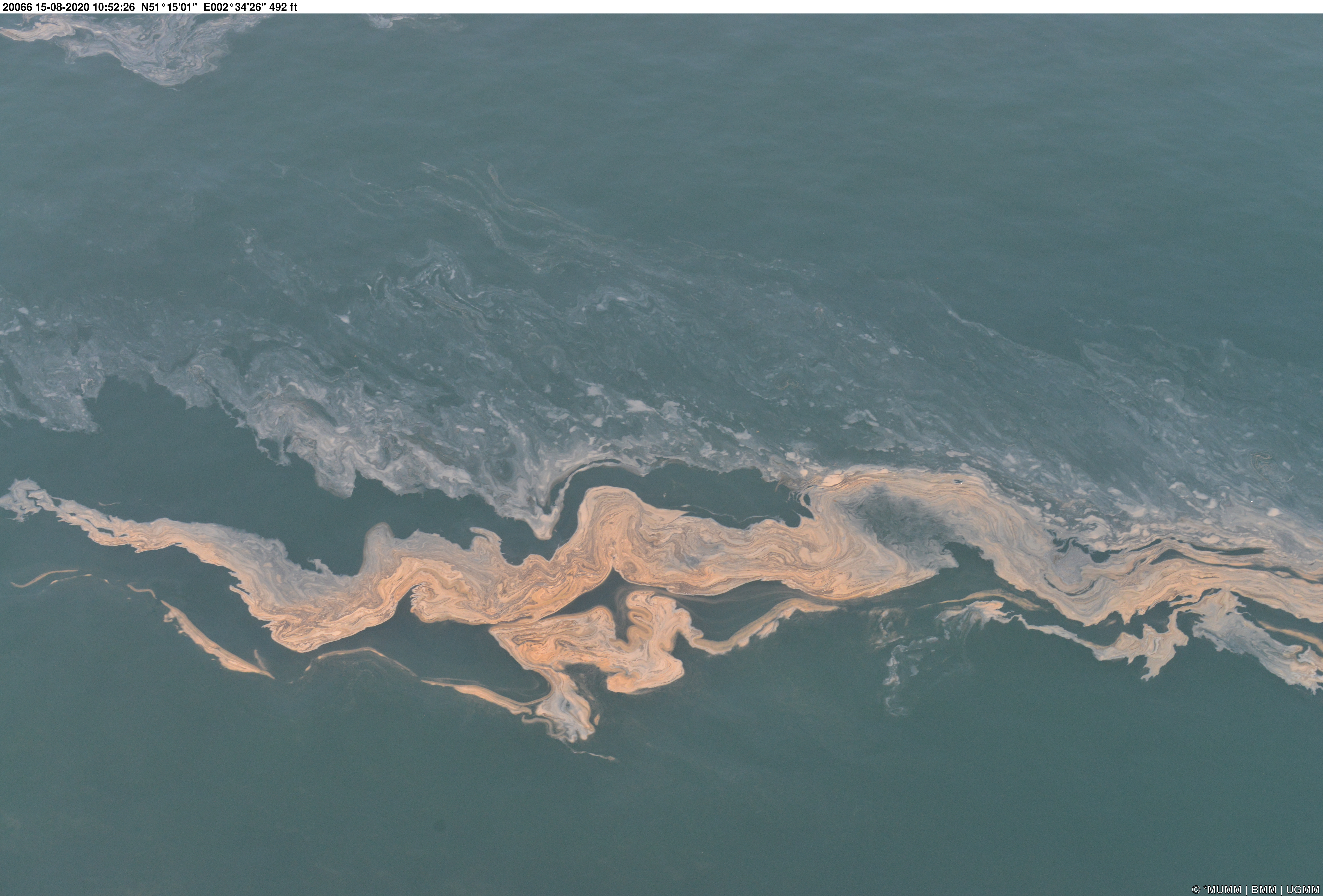
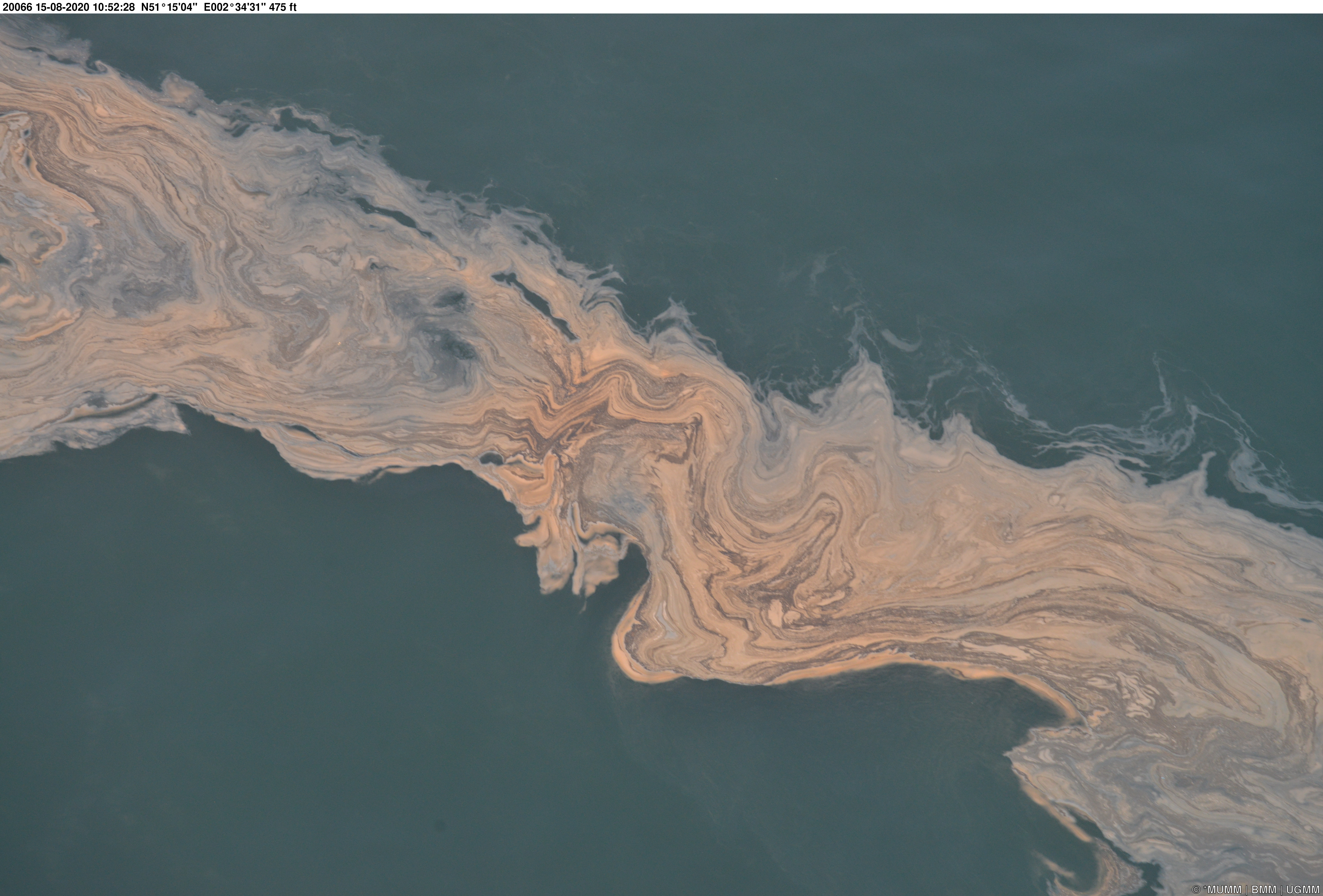
In the morning of Saturday 15 August, the Belgian Coastguard Centre (MRCC – Maritime Rescue and Coordination Centre) received a report of a striking orange patch at sea, containing some dead birds. A sailor had noticed this at the ‘Buitenratel’ sandbank, one of the sandbanks in the ‘Vlaamse Banken’ complex. This sandbank is situated about 16 to 20 km from the shore of the Belgian West Coast, near the border with the French waters. The striking report raised eyebrows at the Coast Guard, because the reported colour did not match the typical colours of mineral oil, and because the dead birds may have hinted to a chemical product. However, an extensive natural algal bloom was also a possibility.
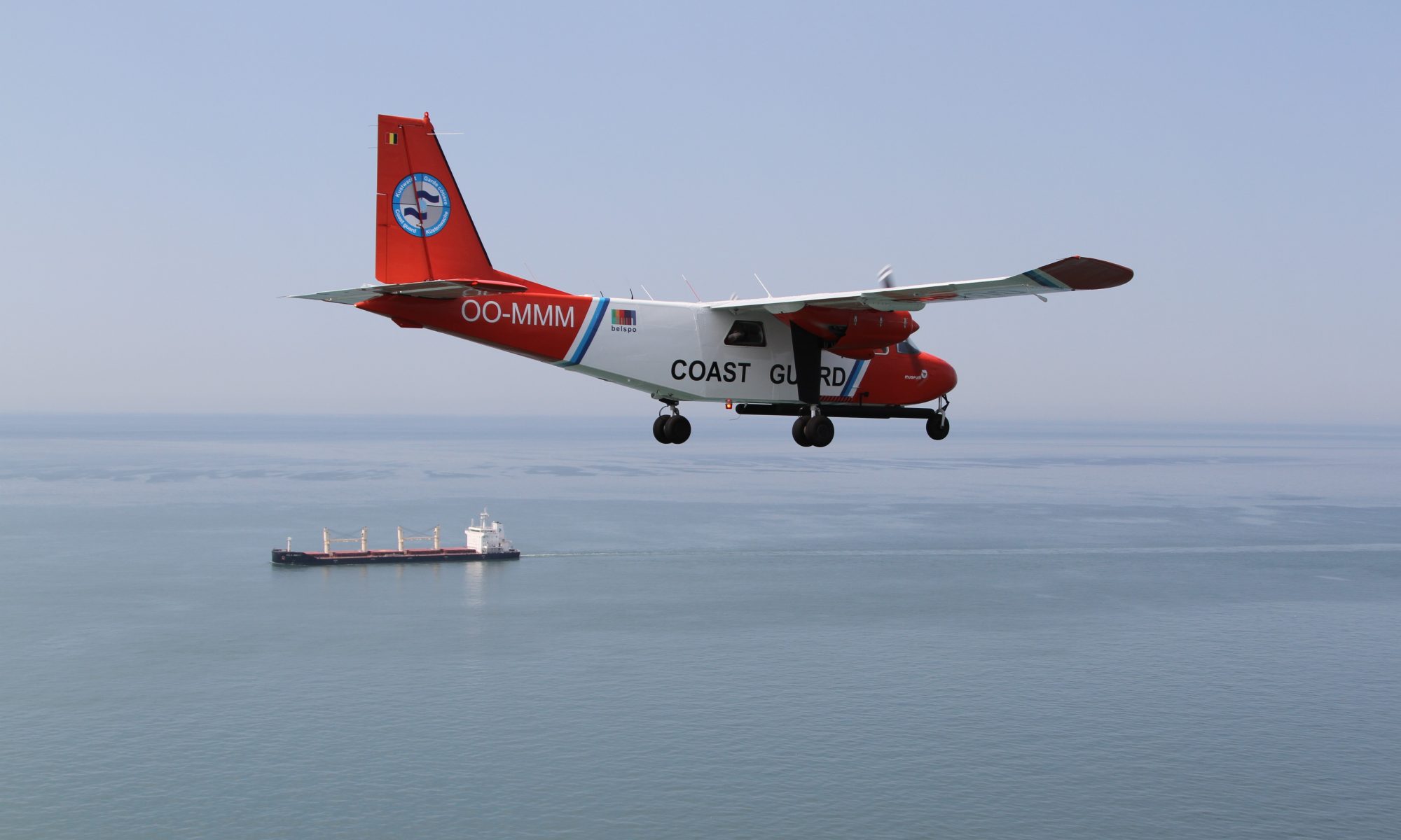
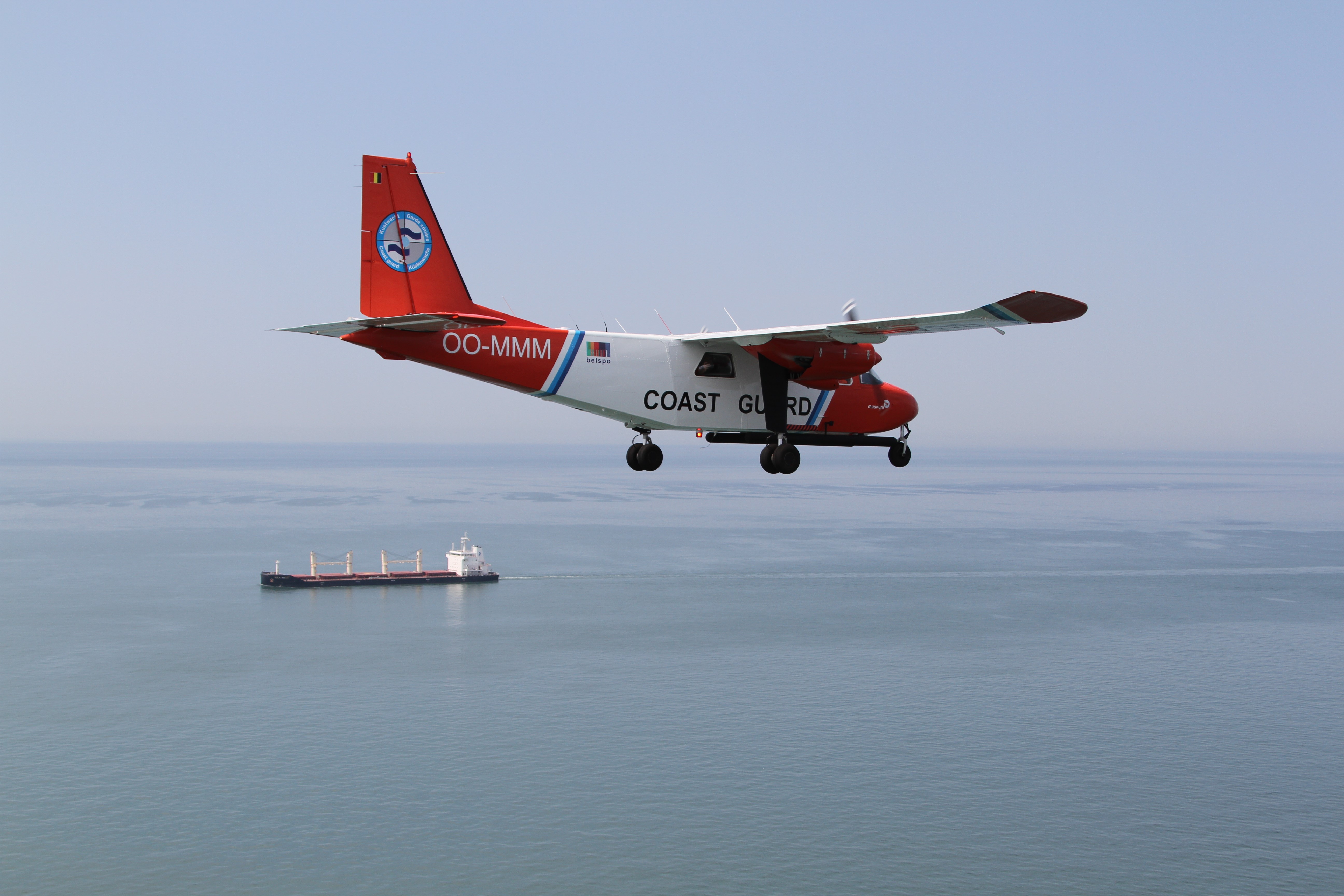
Control on Land, at Sea and in the Air
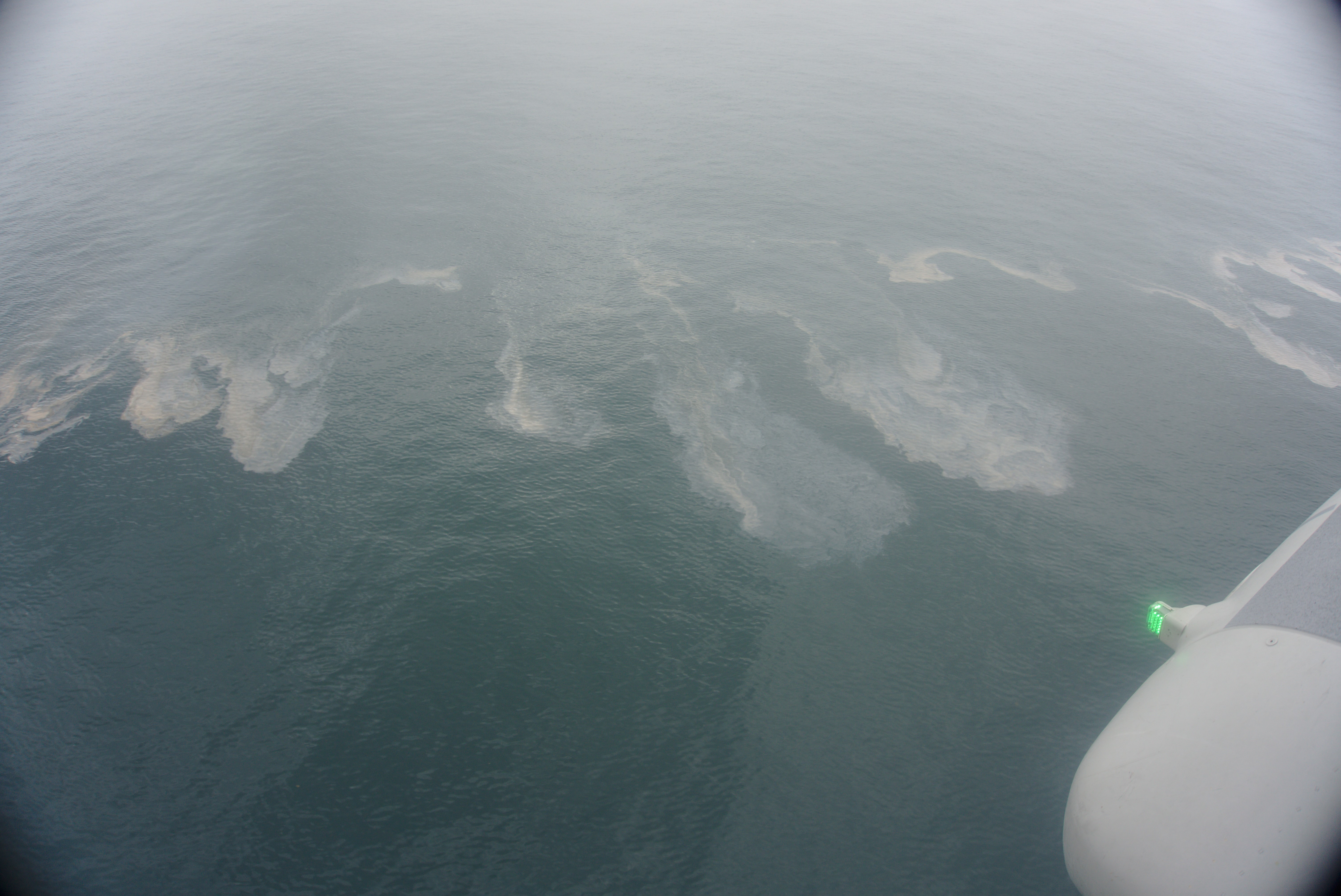
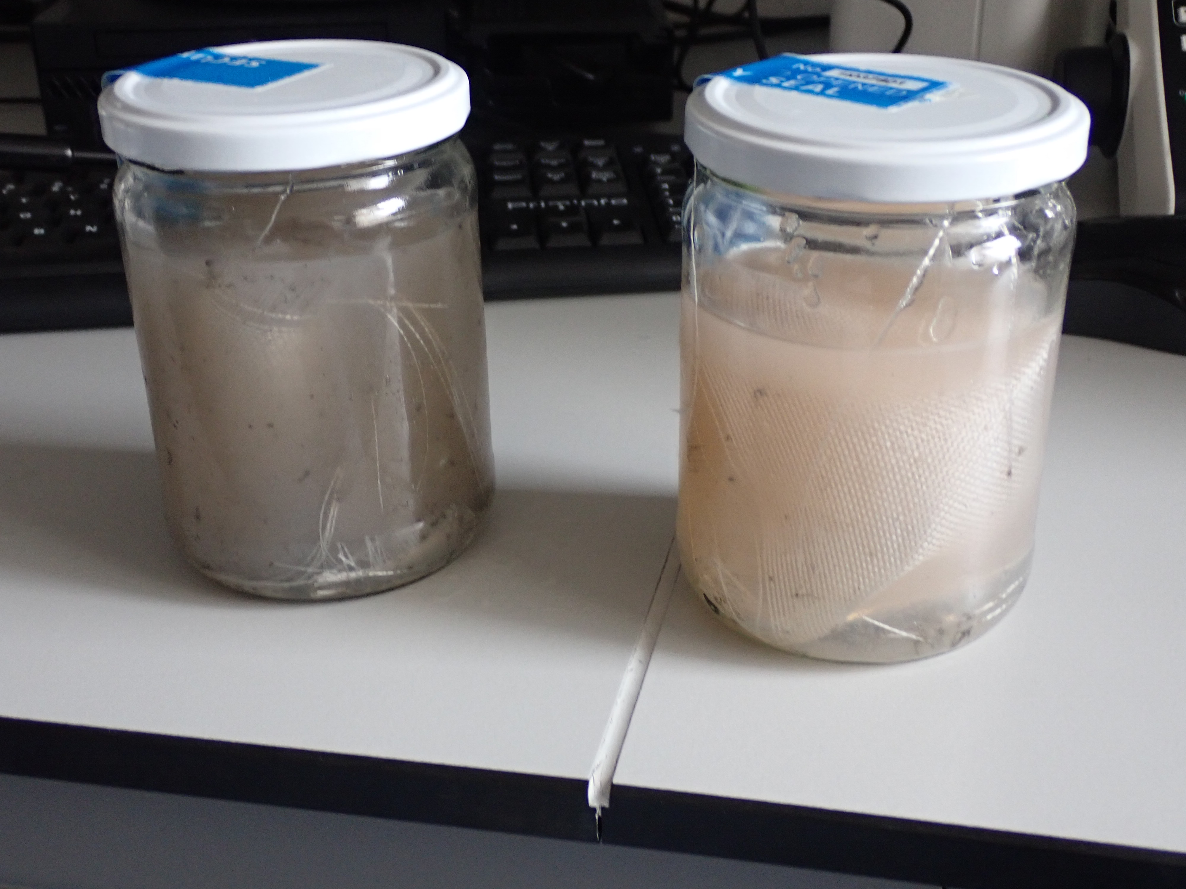
Following the report, the Shipping Police sent a patrol vessel to the Buitenratel. They found the reported patch and took some samples. Dead birds were no longer spotted. A rescue helicopter from the Coxyde air base also flew over the area, and the surveillance aircraft of the RBINS (MUMM, Royal Belgian Institute of Natural Sciences) was called upon to scan the wider sea areas off the Belgian coast for any further pollution. Both aircraft made images of the orangeish, kilometre-long patches and streaks.
All the sailing and flying units involved came to the same conclusion: the patch probably indicated a large natural bloom, albeit on a very large scale. The sample taken by the Shipping Police was taken to the RBINS biological laboratories in Ostend where it could soon be confirmed that it was indeed a Noctiluca bloom.
Video: 2020_08_15 Noctiluca Buitenratel (c) Geronimo_Rodrigo Vissers NL
Sea Sparkle
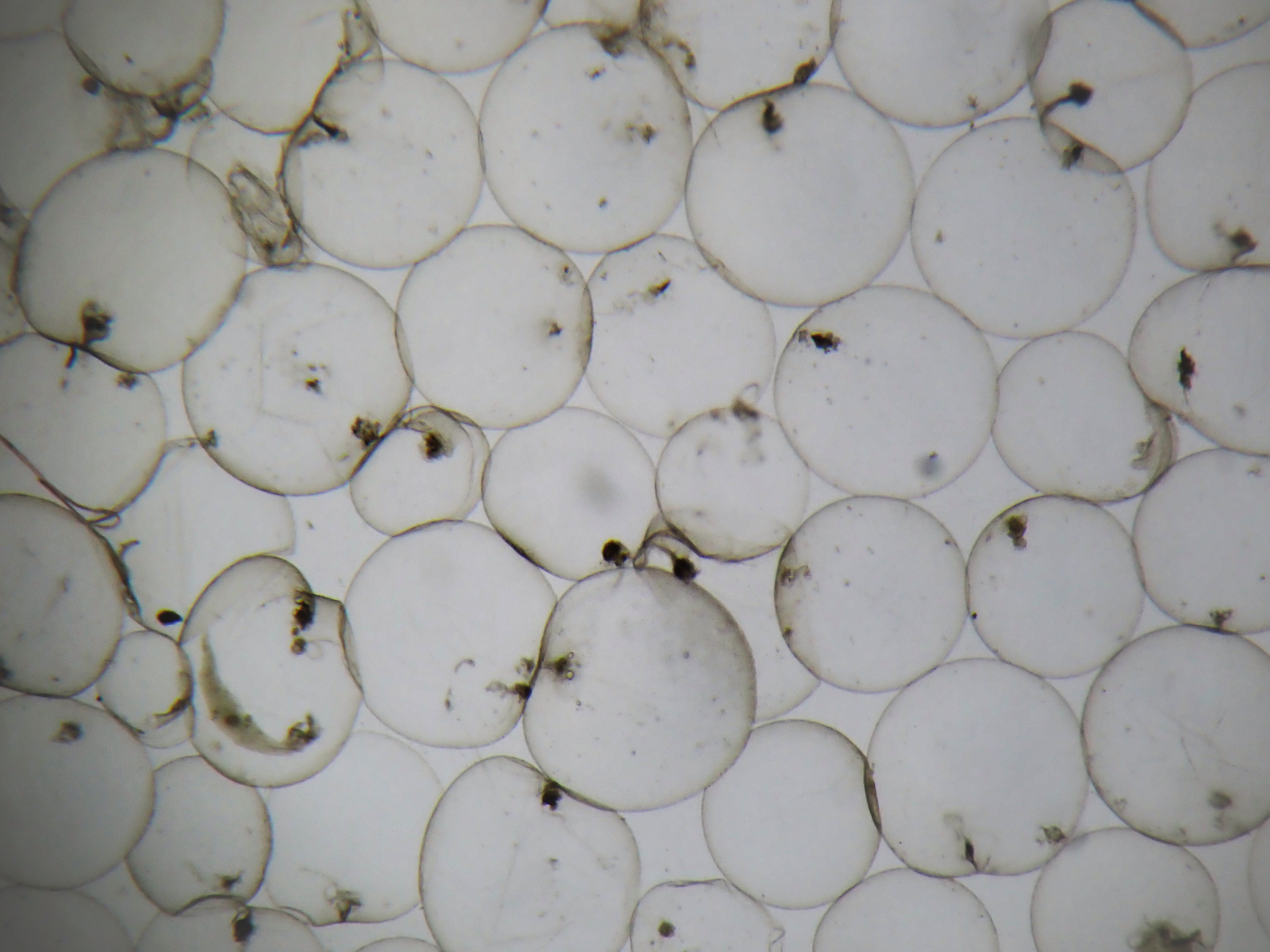
The dinoflagellate Noctiluca scintillans or Sea Sparkle is a relatively large single-celled micro-algae (0.5 – 1 mm, so visible to the naked eye) that occurs in most seas of the world and belongs to the plankton. It looks like a gelatinous pellet with a tail (flagel), which catches food. In high concentrations – called blooms – Noctiluca forms highly visible orange-red spots that can occur in spring and summer. In case of turbulence, Sea Sparkle produces a bluish light that creates fairytale effects in the dark (‘lighting up’ of the sea). This bioluminescence is caused by luciferin, a pigment, and luciferase, an enzyme, when they come into contact with oxygen.
Current Conditions
The high concentrations of Sea Sparkle that have now been observed are probably due to the very warm and calm weather of the past few days. The sampled Noctiluca was also already partly rotting, a process that consumes oxygen. Although it is essentially a harmless organism, mass extinction and rotting can locally lead to oxygen deficiency. At higher temperatures, less oxygen dissolves in water anyway, and the absence of strong winds and waves means that there was also little mixing that brought extra oxygen into the water. The resulting low oxygen tension due to the various phenomena can lead to the death of fish and other aquatic organisms, although under normal circumstances this is very unlikely in open sea conditions.
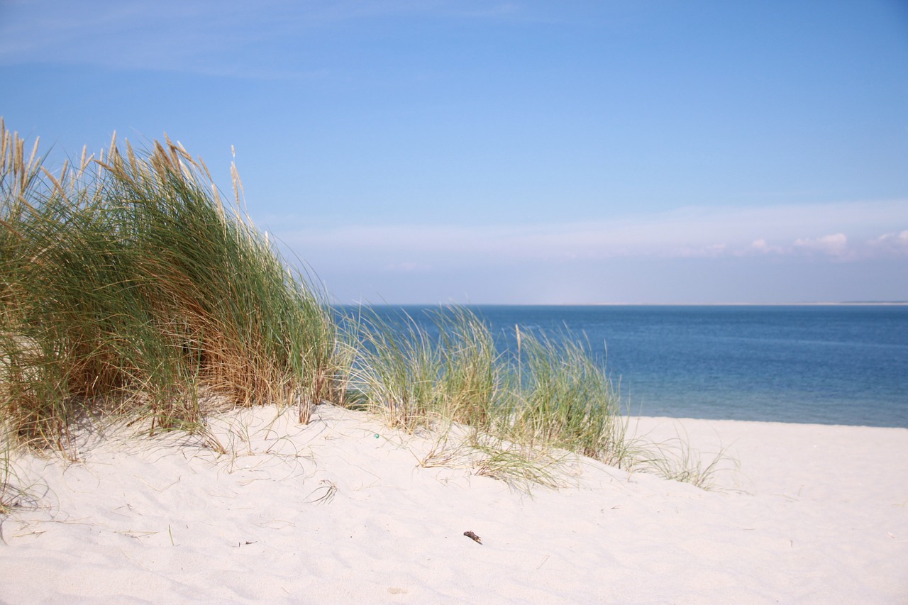
Modelling simulations by the RBINS, taking into account currents, meteorological conditions and the physical properties of the floating Noctiluca spots, illustrate that the remains of these spots could potentially wash ashore on Belgian beaches in the course of the next week.
In recent decades there has been a relative increase in the dinoflagellate community in the Belgian part of the North Sea. This increase could be related to the warming of the sea water (+ 1.6 ° C over the last thirty years). Noctiluca scintillans may also show an upward trend. In addition, blooms from other single-celled plankton organisms can also be expected, including some potentially dangerous species.

 The Policy Brief on Policy Needs for Oceans and Human Health summarizes the policy challenges when attempting to address both ocean and human health together, and the cooperation and research needed to enable those challenges to be addressed. It proposes ways in which the existing regulatory framework could be adapted to incorporate Oceans and Human Health. It also provides recommendations relating to data and indicators, monitoring, funding and training.
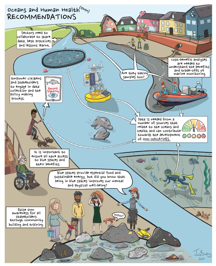

 The European Marine Board’s (EMB) 6th
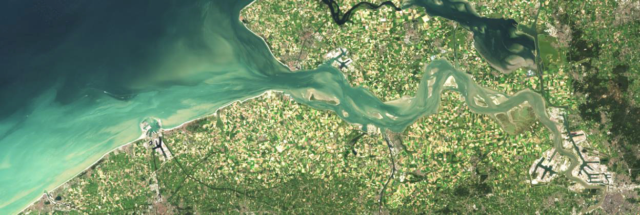
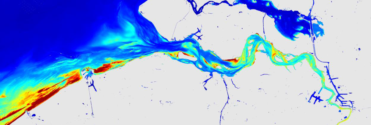
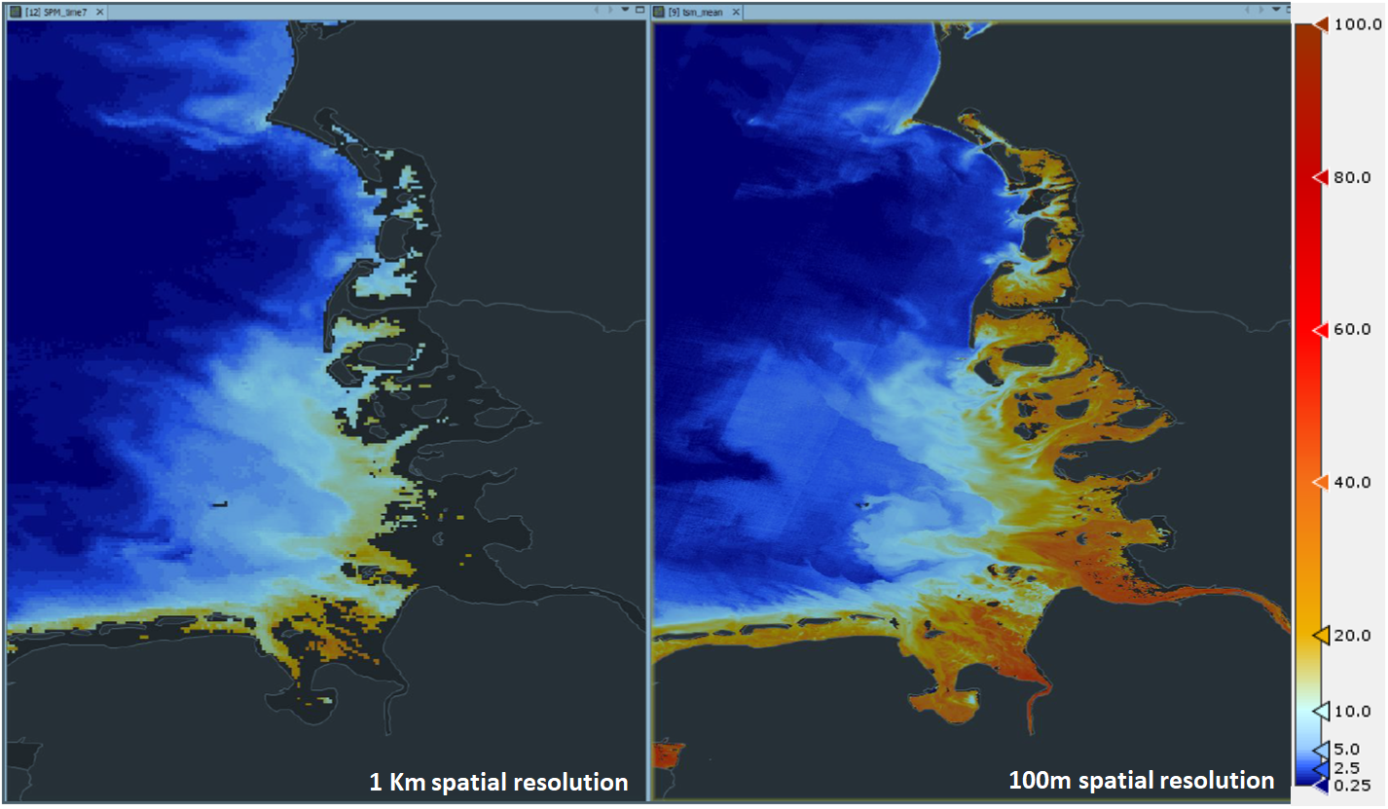
 Sentinel-2 image in true colours of the study area (10 m resolution) and Suspended Particulate Matter product (SPM)
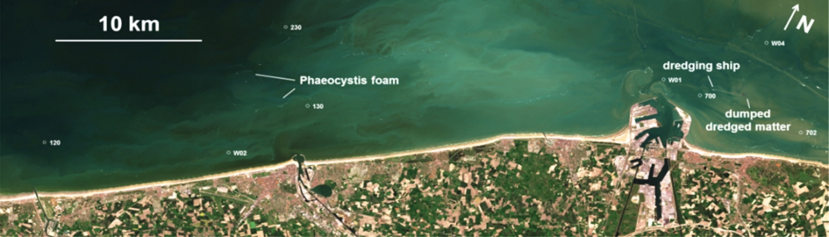
 Sentinel-2 image of May 1st, 2016 (true colour image on top, and chlorophyll-a product below) showing a near-shore algal bloom near Ostend