
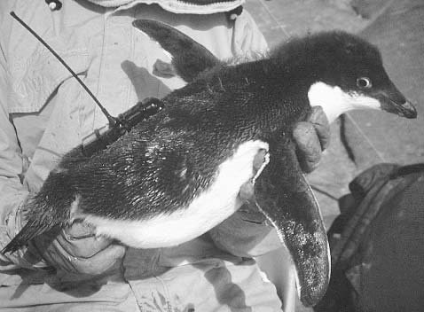
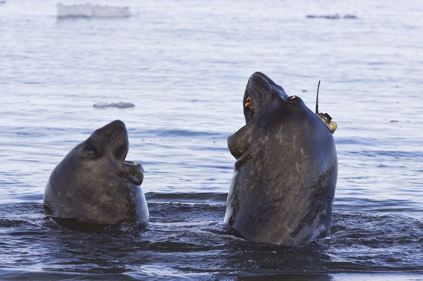
An international group of scientists has mapped the « hotspots » of biodiversity in the Southern Ocean around Antarctica. As animals go to places where they find food, the researchers managed to do this by collating electronic tracking data of more than 4,000 individuals of 17 species of predators. By regularly analysing such large datasets, we can better protect vulnerable ecosystems.
In a rapidly changing world, we need to know which areas warrant protection from existing, developing and forthcoming threats. This is hard to do objectively in the vast realm of the oceans, and particularly so in the remote Southern Ocean around Antarctica. A paper published this week in the journal Nature (together with a companion data paper in the journal Scientific Data) describes a novel solution to this problem : using electronic tracking data from birds and marine mammals. The Antarctic Biodiversity Portal managed by RBINS was closely involved in collecting, cleaning up and standardizing these data.
The solution relies on a simple principle: animals go to places where they find food. So, identifying areas of the Southern Ocean where predators most commonly go also tells us where their prey can be found. For example, humpback whales and penguins will go to places where they can feed on krill, whereas elephant seals and albatrosses go where they can find fish, squid, or other prey. If all these predators and their diverse prey are found in the same place then this area has both high diversity and abundance of species, indicating that it is of high ecological significance.
Joining Antarctic Forces
The project was conducted by the Scientific Committee for Antarctic Research (SCAR), with support from the Centre de Synthèse et d’Analyse sur la Biodiversité, France, WWF-UK and many other partners.
SCAR engaged its extensive network of Antarctic researchers to assemble existing Southern Ocean predator tracking data. The result : an enormous database containing tracking data of over 4000 predators from 17 species, collected by more than 70 scientists across 12 national Antarctic programs. « The SCAR Antarctic Biodiversity Portal, that is managed by the Royal Belgian Institute of Natural Sciences (RBINS), was closely involved in collecting, cleaning and standardizing these data. » says RBINS scientist Dr. Anton Van de Putte, who co-authored both papers. He acts as a Belgian scientific representative for both SCAR and the Commission for the Conservation for Antarctic Marine Living Resources (CCAMLR).
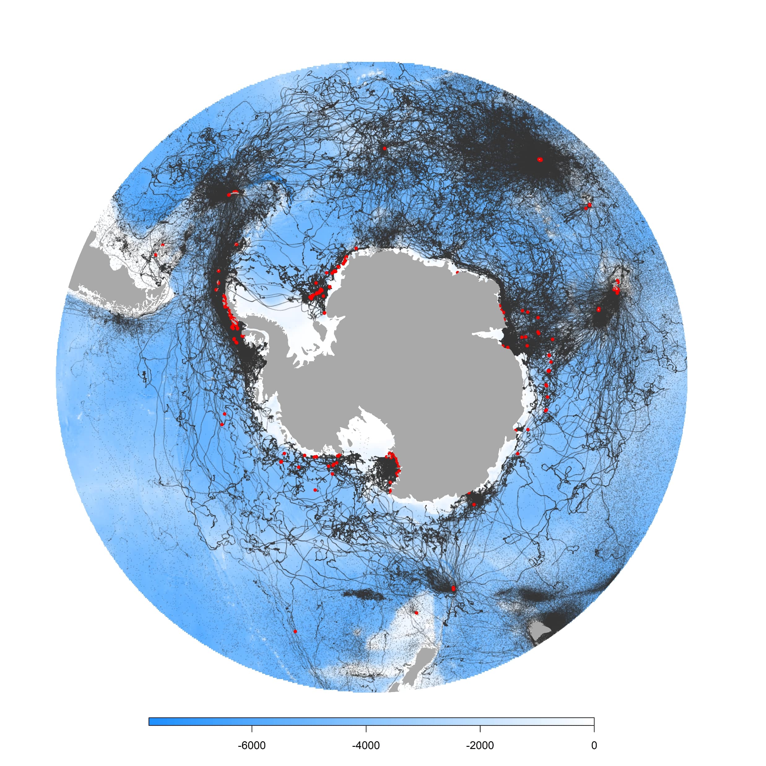
Even this impressive dataset does not directly represent all Southern Ocean predator activity, because it is impossible to track all the breeding colonies of every species. « To overcome this, sophisticated statistical models were used to predict the movements for all known colonies of each of the 17 predator species across the entire Southern Ocean. These predictions were combined to provide an integrated map of those areas used by many different predators with diverse prey requirements. » Van de Putte adds.
Current and Future Areas of Ecological Significance
The most important of these areas – areas of ecological significance – are scattered around the Antarctic continental shelf and in two wider oceanic regions, one projecting from the Antarctic Peninsula engulfing the Scotia Arc, and another surrounding the sub-Antarctic islands in the Indian sector of the Southern Ocean.
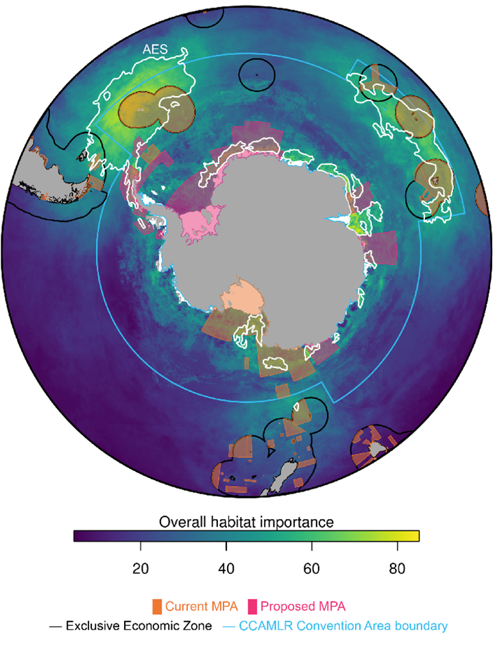
Marine Protected Areas (MPAs) are a crucial tool in the conservation management toolbox. Existing and proposed MPAs are mostly found within the areas of ecological significance, suggesting that they are currently in the right places. Yet when using climate model projections to account for how areas of important habitat may shift by 2100, the existing MPAs with their fixed boundaries may not remain aligned with future important habitats. Dynamic management of MPAs, updated over time in response to ongoing change, are therefore needed to ensure continued protection of Southern Ocean ecosystems and their resources in the face of growing resource demand by the current and future generations.
Van de Putte : « This kind of study indicates the importance of international cooperation and sharing scientific data. Only by combining the data and jointly analyze them, we can come to these results. I look forward to also sharing our future findings and thus to keep contributing to the preservation of the unique Antarctic ecosystems. »
Watch the timelapse video of the data: youtu.be/BUgYD1dQwBI