
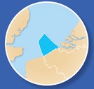
On 20 March 2020, the new Belgian marine spatial plan (2020-2026) came into force. The plan provides a spatial arrangement, integrating the various utility functions of the Belgian part of the North Sea.
Did you know that Belgium has 37% marine protected area, far above the European average of 8.9%? And that, in relation to the surface area, our country provides more offshore space for renewable energy than any other country in the world?
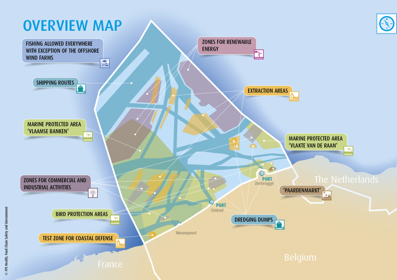
Nature conservation, green energy, shipping, fishing, sand extraction, defence and many more activities take place in our little Belgian part of the North Sea on a daily basis. To ensure that all these activities are safely combined, the federal government draws up a marine spatial plan every six years. On land this kind of spatial planning has existed for a long time, but at sea it is quite unique in the world. Many countries come to Belgium to see how we do it in order to attribute a rightful place at sea to all activities and stakeholders.
More info and the complete marine spatial plan.
What’s new in the plan?
The first plan covered the period 2014-2020. On 20 March 2020, the Marine Spatial Plan 2020-2026 came into force. This new plan 2026 foresees, among other things, these novelties:
- a second offshore energy zone, the Princess Elisabeth zone, which aims to almost double the energy capacity (from 10% of Belgium’s electricity needs at the end of this year to 20% by 2025/2026).
- an additional nature reserve on the Dutch border
- three new search zones for soil protection measures
- five specific zones within which commercial and industrial activities can be developed. Sustainable development, in particular, will be at the heart of these areas.
Philippe De Backer: “Belgium was a pioneer with a first marine spatial plan and we are now the first to revise this plan. It’s been a long but exciting journey where the balance between economy, ecology and safety was central. I would like to thank all stakeholders, citizens and organisations for their constructive contribution to this process and I am satisfied that this new marine spatial plan will allow the North Sea to develop further in terms of the blue economy, with respect for the marine environment and the protected Natura 2000 nature areas.”
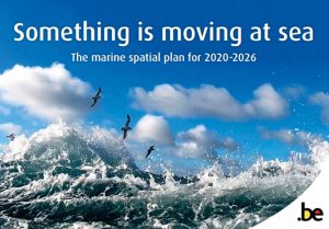
A Brand New Brochure
The brochure ‘Something’s moving at sea. The marine spatial plan 2020-2026‘ contains a lot of facts and summarises the marine spatial plan 2020-2026 in an accessible way. It gives an overview of the most important activities in our North Sea on the basis of specific maps. You can also test your knowledge with a short quiz.
Order the brochure at the FPS Public Health, Food Chain Safety and Environment.
The Marine Atlas project
In order to make the geographical information from the Marine Spatial Plan accessible to a broad community of potential users, it was made available on the marineatlas.be website. Currently, the marine atlas contains validated and fully documented geographical layers from the Belgian marine spatial plans adopted by royal decrees in 2014 and 2019. The content will be regularly expanded with data on the different themes of the European ‘INSPIRE’ Directive, such as environmental monitoring, energy sources and energy production, geology, etc. to name but a few. The Marine Atlas is a joint initiative of several Belgian federal administrations and is developed and maintained by a team of experts from the Scientific Service Management Unit of the North Sea Mathematical Model (MUMM) and the Geocell of the Royal Belgian Institute of Natural Sciences.
The marine spatial plan was drawn up by the Marine Environment Department of the FPS Public Health, Food Chain Safety and Environment on behalf of the Minister for the North Sea, Philippe De Backer. Because of its major impact, it was drawn up in close collaboration with all those involved. NGOs, companies, government bodies, interest groups and citizens passed on their proposals and comments during two consultation rounds. The sustainability aspect was also given extra attention, for example through the Strategic Environmental Impact Assessment (SEA). After the contributions had been processed, the new MSP was signed by the King on 22 May 2019.
Text: Jesse Verhalle, Mieke Van de Velde, Kelle Moreau