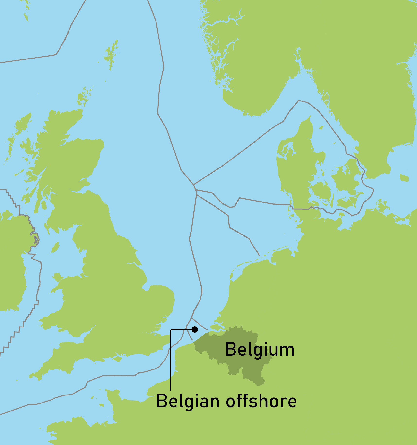
Spatial planning is a discipline mostly associated with onshore built-up areas, but if there is one region in the North Sea that requires a rigorous mapping of activities it is the Belgian offshore area. Nature conservation, shipping, fishing, sand extraction, energy production, cables and pipelines, military exercises, … are all competing for space in this little patch of sea.
The Norwegian Expronews linked the Belgian marine spatial planning nicely with some of the RBINS work in relation to the assessment of reserves of certain abiotic resources and their potential for exploitation in a summarizing article.
Special attention is attributed to
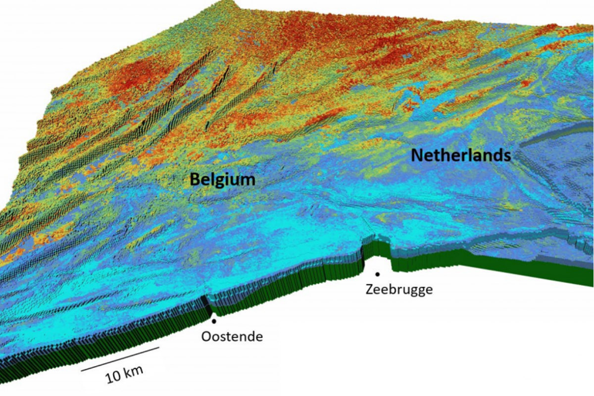
- the state-of-the-art 3D resource model that describes the distribution and availability of all non-hydrocarbon geological resources in the Belgian and adjacent Dutch marine waters, and can also serve as a resource decision support system and to underpin long-term adaptive management strategies (TILES, Van Lacker et al. 2019, Hademenos et al. 2019)
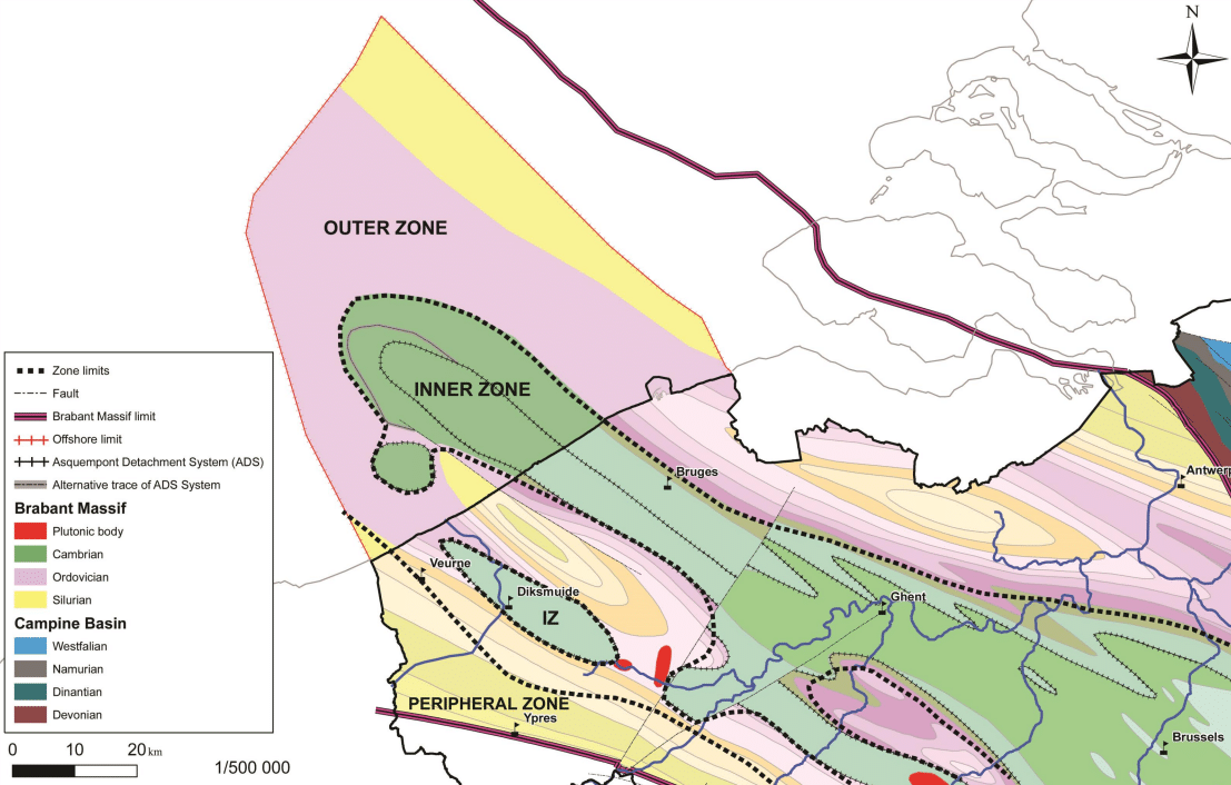
- the work of the Geological Survey of Belgium, explaining why there is no interest from the oil industry in the Belgian waters and why the Belgian offshore is highly unlikely to be a suitable area for sequestration of CO2 (dedicated article on expronews.com)