
Although the Belgian part of the North Sea only represents 0.5 % of the North Sea surface, it is situated in one of the busiest shipping lanes in the world and combines a large number of human activities on a limited space. All the more reason to keep close eye on the health of the marine environment and the compliance of the many actors with regulations, also from the air. In their just-published multiannual activity report, the aerial surveillance team of the Royal Belgian Institute of Natural Sciences describes the various missions and results, trends and developments of the Belgian program for aerial surveillance over the North Sea over a period of 30 years, from its start in 1991 up to and including 2021. The numbers are downright impressive.
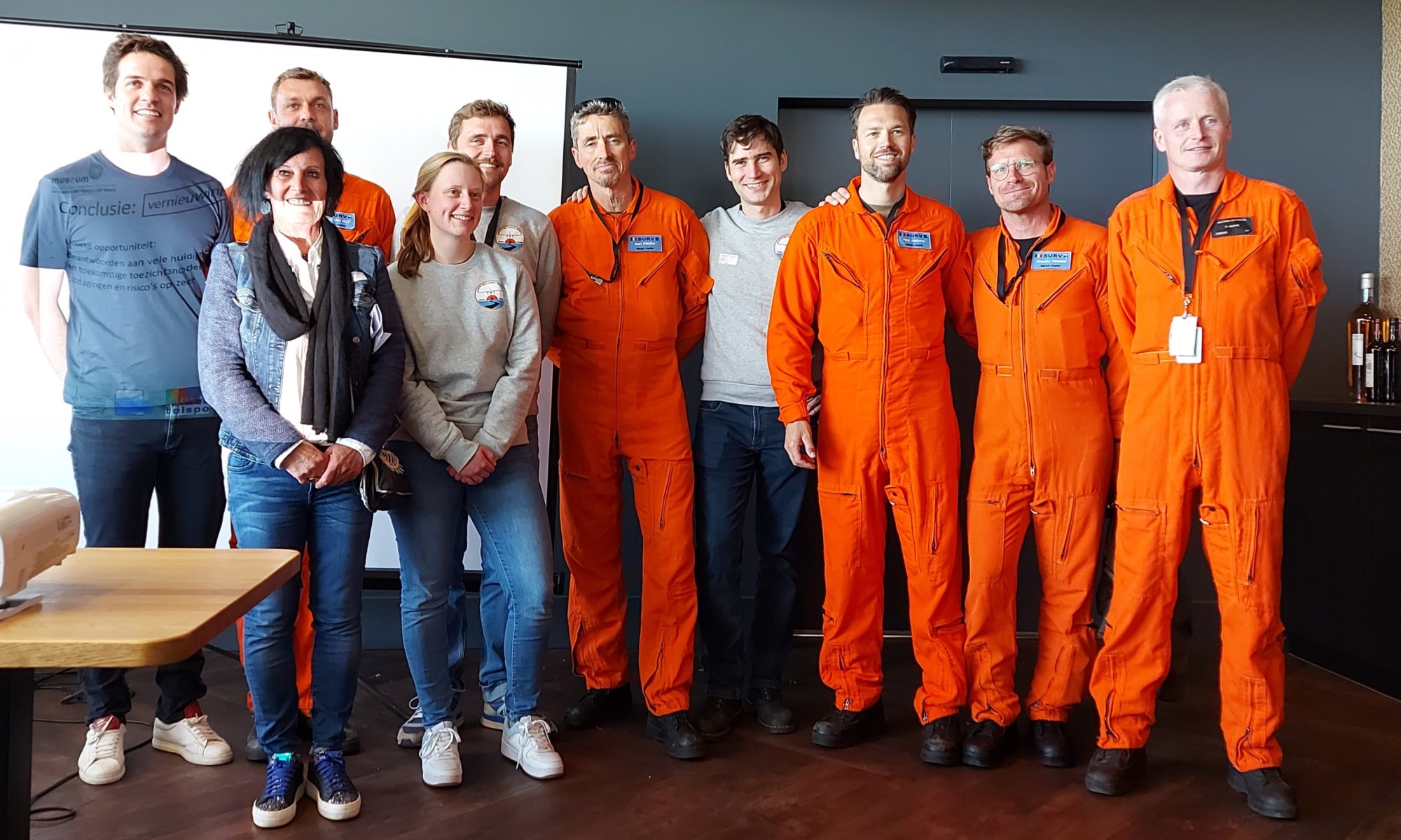
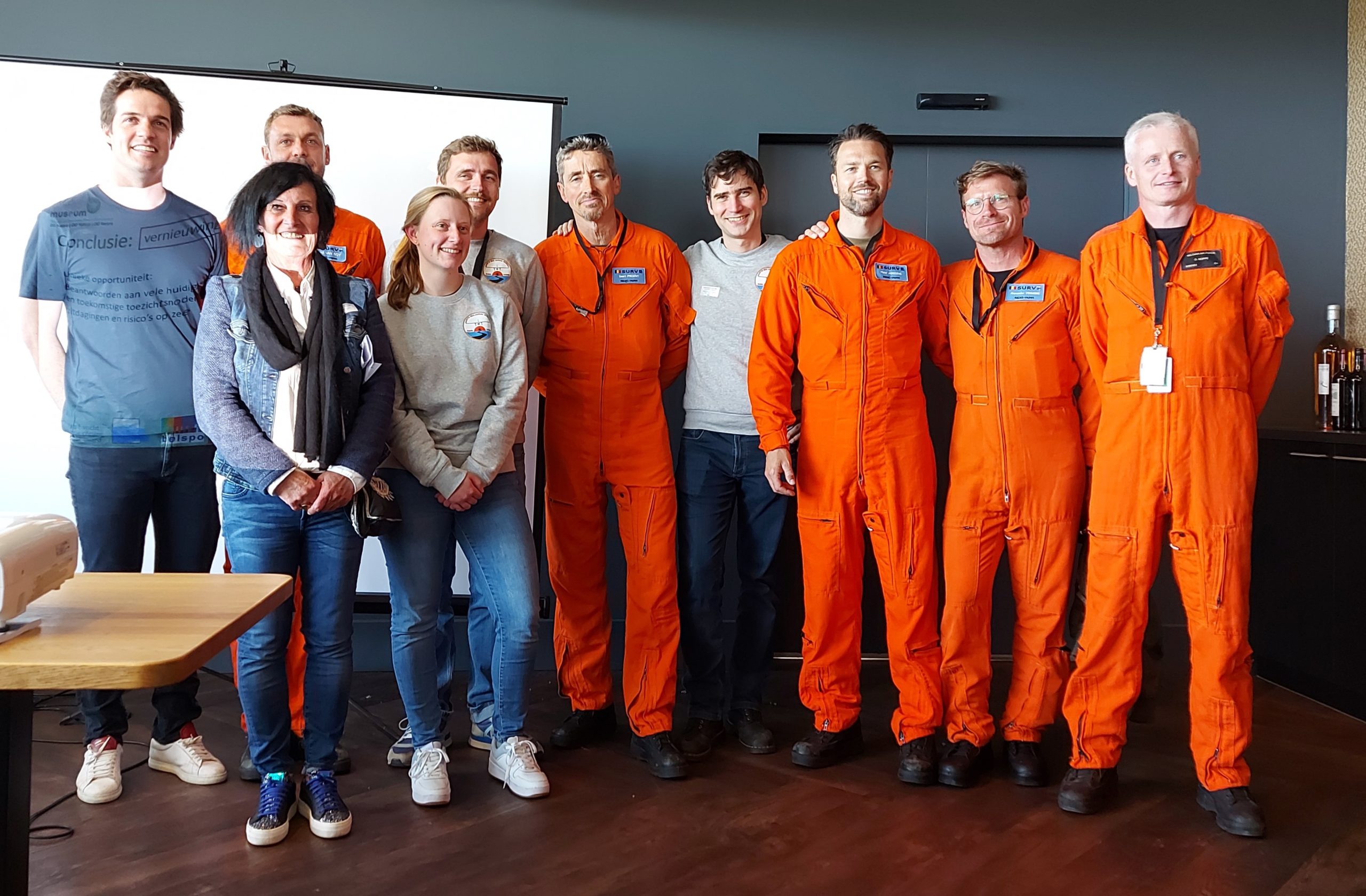
The report “30 years of Belgian North Sea aerial surveillance : evolution, trends and developments” was presented on 16 May 2023 at Restaurant Runway in Ostend, in cooperation with the federal cabinets of Mr Thomas Dermine, Secretary of State for Relance and Strategic Investments, in charge of Science Policy, and Mr Vincent Van Quickenborne, Deputy Prime Minister and Minister of Justice and North Sea, and with the support of Bruges-Ostend International Airport.
Aerial surveillance tasks
The core tasks of the Belgian aerial surveillance programme can be grouped under three themes:
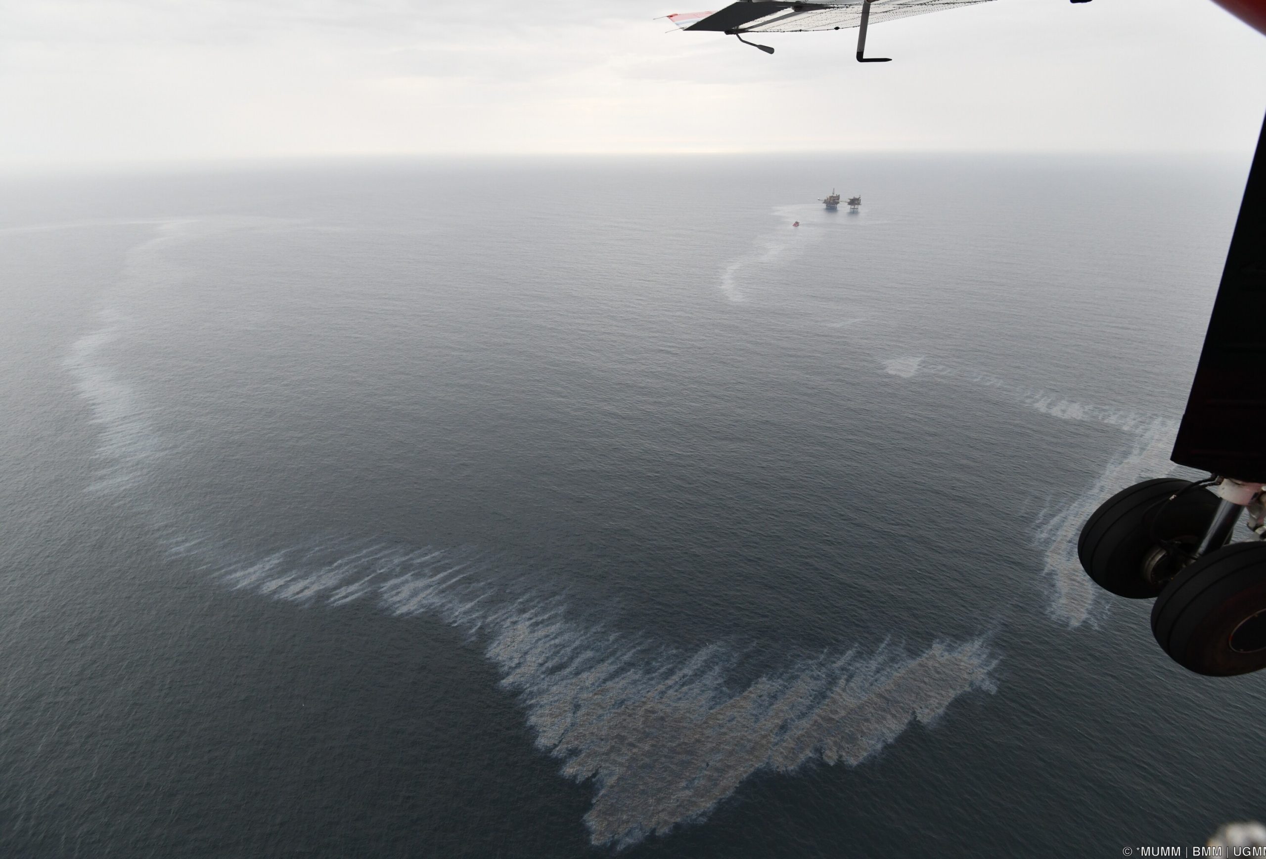
Surveillance of illegal and accidental pollution: Besides detecting water pollution originating from ships (ship discharges of oil and other harmful liquids), Belgium currently plays a leading international role in monitoring sulphur and nitrogen emissions from ships to air. The aircraft also plays a role in the internationally coordinated monitoring of oil and gas installations in the North Sea.
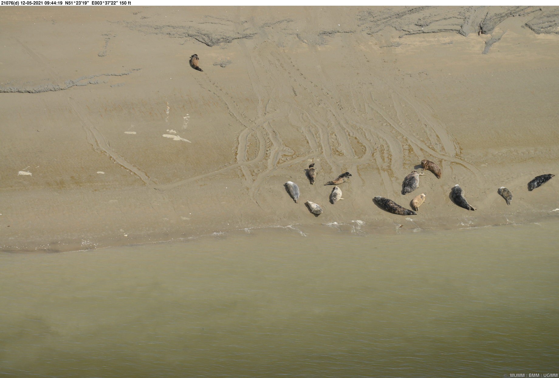
Environmental and scientific monitoring: The team performs important scientific monitoring tasks including marine mammal counts and the monitoring of various environmentally licensed human activities at sea (sand and gravel extraction, wind farm construction, compliance within marine protected areas, etc.).
Broader maritime surveillance in the remit of the Coast Guard: These tasks include the control of fishing activities, compliance with navigation rules and AIS violations by ships (not using Automatic Identification System).
By being active in these three areas, the aerial surveillance has an important contribution to the sustainable management of the Belgian North Sea.
Facts and figures
The report describes how aerial surveillance over sea evolved from the surveillance of marine pollution in the early years to a broader environmental and maritime surveillance above sea, following the extension of the Belgian jurisdiction at sea and the creation of the Belgian Coast Guard structure.
In relation to pollution, the major facts of the Belgian North Sea aerial surveillance program in the period 1991-2021 can be summarized as follows:
- 9574 flight hours were conducted, of which 7100 hours above sea (approximately 6400 flight hours in national and 700 hours in international context).
- 625 operational (deliberate) oil spills were reported in the Belgian survey area, resulting in an estimated 1013 tonnes of oil pollution. When monitoring began, oil spills were a prominent problem, now they are almost entirely a thing of the past.
- 158 operational spills of other harmful liquids (Noxious Liquid Substances, e.g. vegetable oils, biodiesels, paraffin) were observed. This type of contamination unfortunately shows a slightly increasing trend.
- 51 ships were caught red-handed while performing an illegal discharge.
- 35 serious shipping accidents have taken place in or around the Belgian marine areas, with accidental marine pollution or a high risk thereof. In 26 of these cases, the aircraft was effectively activated to monitor the emergency situation from the air and provide air support to response units.
- 24 international “Tour d’Horizon” missions were executed, during which the offshore gas installations and oil rigs in the central part of the North Sea were surveyed, resulting in 430 flight hours and a total of 296 pollution detections (272 mineral oil detections, 9 detections of a harmful substance other than oil, and 15 contaminants whose nature could not be visually verified).
- There was participation in 10 Coordinated Extended Pollution Control Operations, regional missions consisting of a series of successive pollution control flights carried out by multiple surveillance aircraft from different North Sea countries.
- The Belgian aircraft participated in a total of 33 national and international pollution response exercises and related experiments at sea.
- 353 emission monitoring flights were conducted with a sniffer sensor since 2015 and 6012 exhaust plumes were sampled. 9% of the monitored ships had a suspicious Fuel Sulfur Content. Since 2020, when the aircraft was further equipped with a NOx sensor, 3% of the monitored ships did not comply with the international NOx regulations. This form of monitoring the gaseous emissions from ships at sea is a Belgian pioneering work, and contributed greatly to the name and fame of the air monitoring team.
Notable figures regarding monitoring of the marine environment, fishing activity and navigation rules are:
- In the period 2009 to 2021, 214 flight hours were spent on marine mammal counts. A total of 3223 harbour porpoises were observed during the monitoring campaigns (3 to 404 animals per survey, on average 87 per survey). In addition, 100 seals were seen and sporadically some other species of marine mammals such as white-beaked dolphins, bottlenose dolphins, a minke whale and a humpback whale.
- From 1993 to 2021, 1239 fishery control flights were carried out, leading to a total of 1185 flying hours. This resulted in a total of 7272 monitored and identified fishing vessels.
- Between 2011 and 2021, 112 violations on the use of Automatic Identification Systems by ships were observed, together with 148 navigation violations. In recent years there has been a sharp increase in the annual number of observed navigation violations with the highest number in 2021 (36).
The future of aerial surveillance
Using and interpreting these facts and figures, the activity report also looks to the future, by explaining the programme evolution from pollution control and environmental surveillance at sea, to broader maritime surveillance in support of the overall Coast Guard framework, and by outlining that the substantive challenges of aerial surveillance above the sea are and will remain innumerable in the years to come.
Indeed, in addition to the tasks described above, some newer tasks are becoming increasingly important elements of aerial surveillance, such as the efficient enforcement of a new European external border (post-BREXIT), promoting maritime security, and offering support to search and rescue operations.
Finally, the report also explains the medium-term need for renewal of the aircraft. Only in that way can the Coast Guard renew its strategic vision and increase its cooperation on airborne surveillance, and modernise and expand its surveillance capacity with the aim to effectively deal with current and future needs at sea.
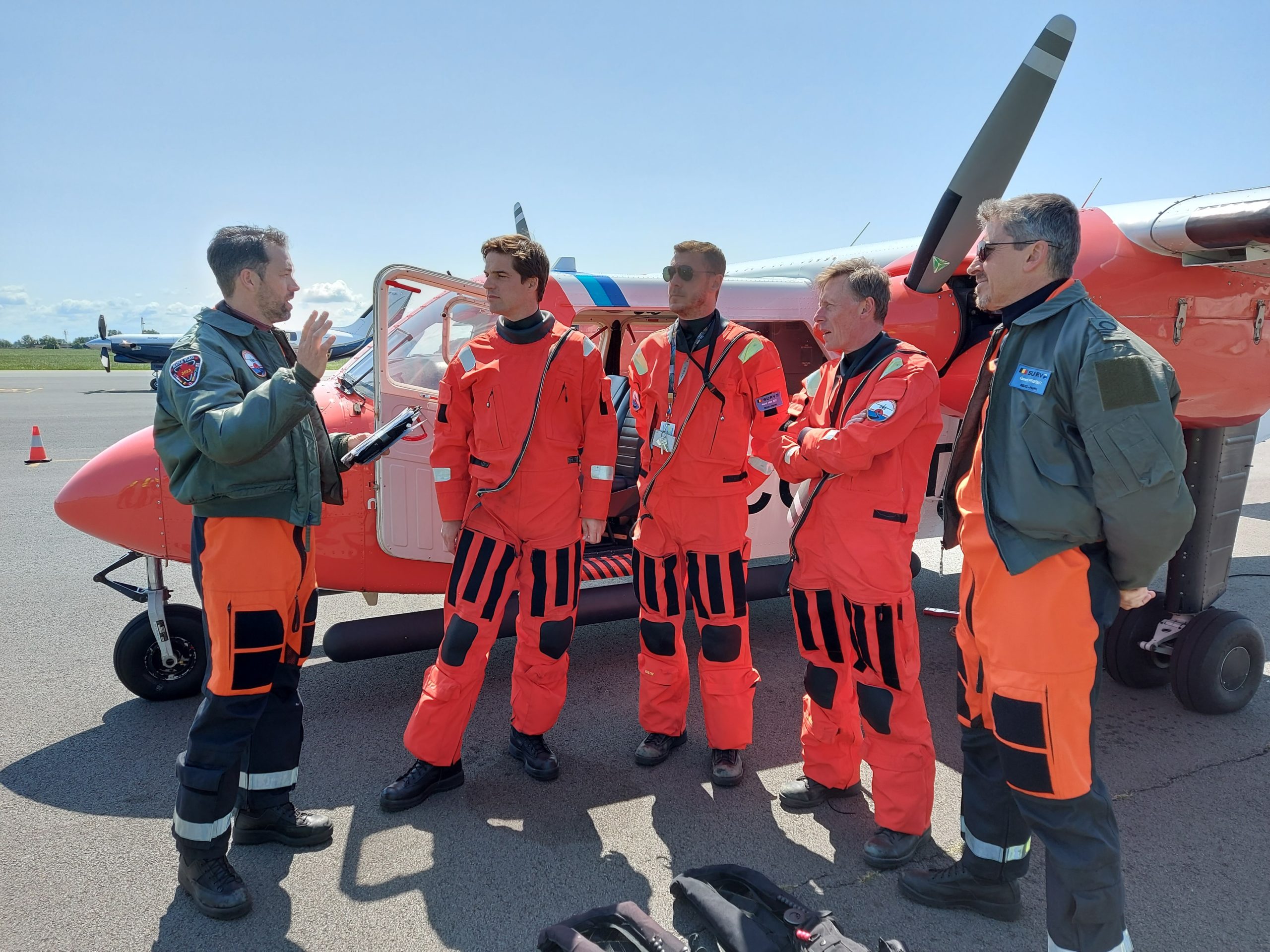
Thomas Dermine, Secretary of State for Science Policy, who also personally participated in an operational flight of the aerial surveillance aircraft before the presentation of the report on 16 May: “The North Sea is a complex ecosystem, an important fishing zone, a busy shipping area and, since the Brexit, an external border of the European Union. It is therefore essential to study our North Sea and continuously monitor what is happening there. The aerial surveillance aircraft has been doing this for 30 years, thanks to a smooth cooperation between Defence and the Royal Belgian Institute of Natural Sciences. Now that the aircraft is outdated, I will fully support the dossier for its renewal.”
Vincent Van Quickenborne, Minister for the North Sea: “Belgium was the first and only country in the world to use a sniffer plane for ship pollution controls. Some 5,500 different ships call at Belgian ports every year. So it is impossible to check them all. With the sniffer plane, work can be much more targeted because suspicious ships are already identified at sea. Thanks to aerial surveillance, our port inspection services can detect 50% more violations and save 20% per inspection. We must cherish our North Sea. It is Belgium’s largest nature reserve. The increasing number of marine mammals and the return of species such as the European flat oyster, which has reappeared in our North Sea for the first time in decades, show that progress is being made. But the plane is in need of replacement after 30 years of service as a sniffer. Together with colleague Dermine, I am putting my full weight behind this.”
The implementation of the Belgian aerial surveillance programme over the North Sea is organised by the Management Unit of the Mathematical Model of the North Sea (MUMM), scientific service of the Royal Belgian Institute of Natural Sciences (RBINS).
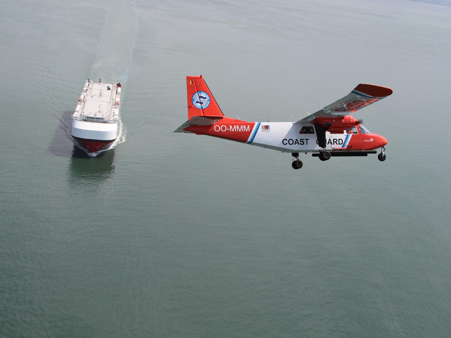
For the aerial surveillance, MUMM uses a Britten Norman Islander aircraft (immatriculation OO-MMM) equipped with scientific sensors for detecting marine pollution. The aircraft is owned by RBINS/MUMM but can only fly thanks to the support of the federal policy areas “Science Policy” and “North Sea” and good cooperation with Defence, which provides the pilots.