‘The Ocean We Need’ – Europe’s Leading Ocean Experts Launch Advice For Governments

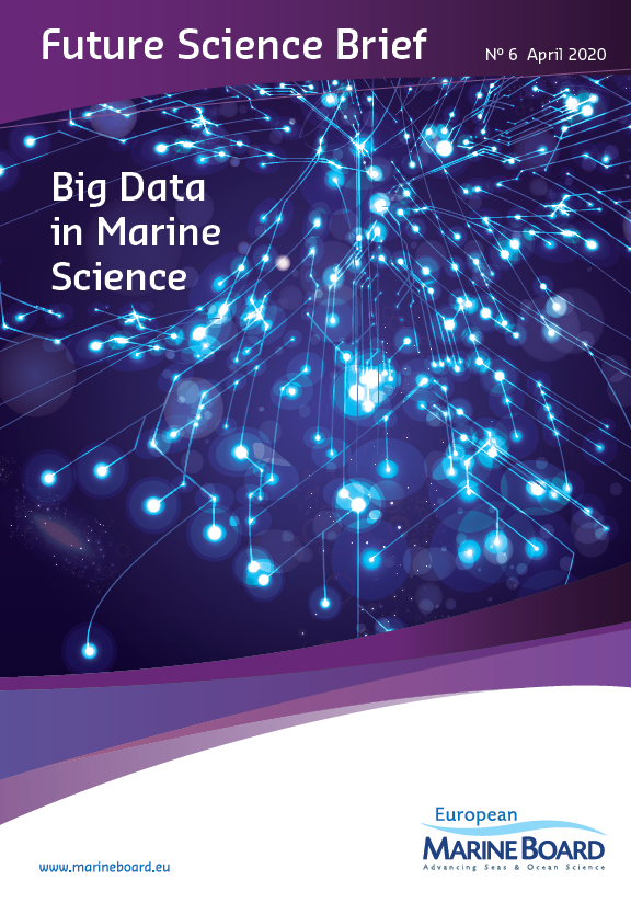
The European Marine Board has recently launched a publication, titled ‘Navigating the Future V’, which will provide European governments with robust, independent scientific advice and expert opinion on future seas and ocean research to 2030 and beyond. To achieve this, leading ocean experts have identified the key areas of marine science where there are still gaps in knowledge.


The European Marine Board (EMB) is a leading European think tank in marine science policy. It is an independent non-governmental advisory network with a membership comprising more than 10,000 marine scientists from the major national marine/oceanographic institutes, research funding agencies and national networks of universities from countries across Europe. The Board provides a platform for its member organizations to develop common priorities, to advance marine research, and to bridge the gap between science and policy to meet future marine science challenges and opportunities.

Navigating the Future V

The knowledge gaps that Navigating the Future V (NFV) advises to prioritise in the research agenda is critical in understanding the four-dimensional ocean, to predict tsunamis and the impact of multiple stressors on biogeochemistry and biology, and to understand the impact of the future blue economy on our marine ecosystems. NFV shows that we need transdisciplinary science and sustainability science to address the management of a holistic four-dimensional ocean. It also highlights the technological advances and modelling needed for a possible future virtual ocean that would enhance public engagement and understanding of the ocean.

NFV proposes the science we need for the forthcoming United Nations Decade for Ocean Science for Sustainable Development (2021-2030), the next European Framework Programme, Horizon Europe, and its Mission on Healthy Oceans, Seas, Coastal and Inland Waters. The report was officially launched on 11 June 2019 in Paris, France, at the EurOCEAN 2019 Conference (High-level science-policy conference co-organised by European Marine Board, the European Commission and the Intergovernmental Oceanographic Commission of UNESCO).

Key Messages

Specifically, the report recommends a solutions-oriented marine research agenda, co-designed with all stakeholders, and with the governance of sustainability at its core. It should address the following key knowledge gaps:

  • The four-dimensional ocean (changes in the three-dimensional ocean over space and time) and functional links between the components of the marine system, i.e. physics, chemistry, biology, ecology and humans;
  • The impact of multiple stressors (e.g. climate change, pollution, overfishing) on the functioning of marine ecosystems, their interactions, evolution and adaptation over time, and the ecosystem services they provide;
  • The characteristics, probability and impacts of climate-related extreme events and geohazards (e.g. marine heat waves, meteotsunamis and submarine earthquakes, landslides, volcanic eruptions and their associated tsunamis) and how these might change under climate change; and
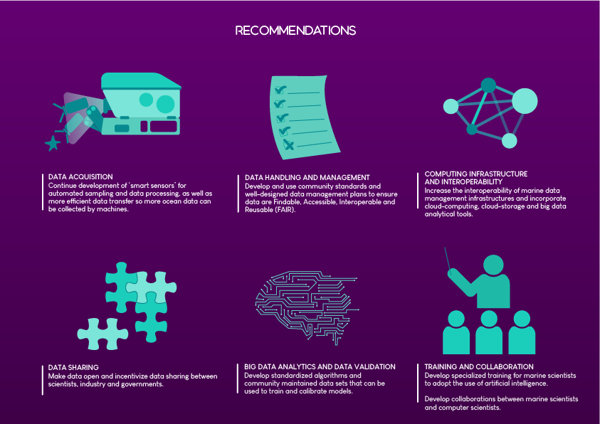
  • Ocean technologies, modelling, data and artificial intelligence needed for sustainable ocean observations to understand, predict and manage human impacts on the ocean.

Key actions include the development of a business model ensuring the long-term economic sustainability of ocean observations. We also need to develop a new generation of sustainability scientists and establish a sustainability forum within Europe bringing together all actors including industry and civil society.

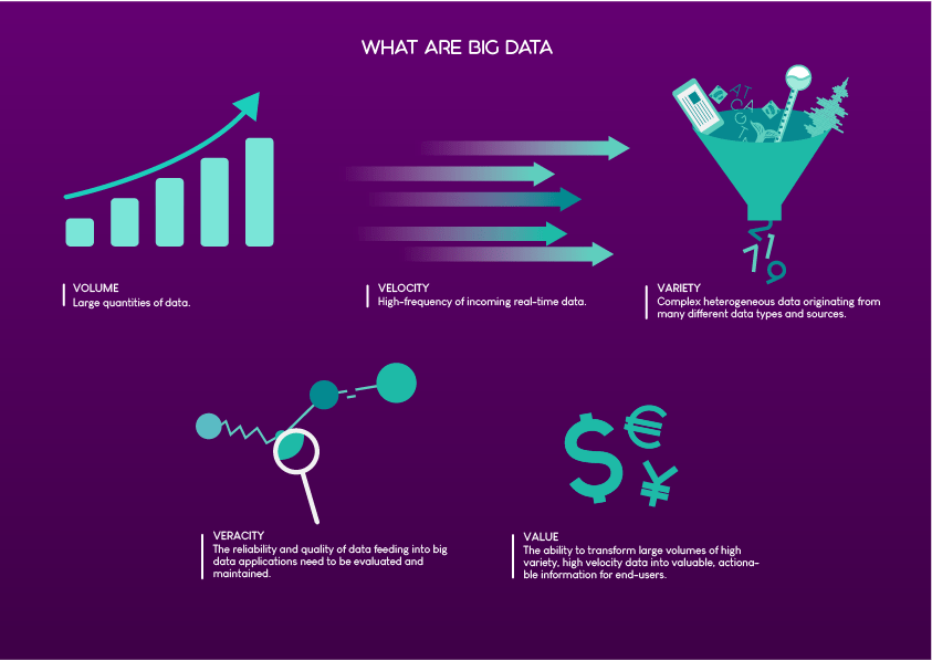
The key messages and actions are also explained in a set of infographics (see below).

The report has been a collaborative effort starting in November 2017 with a planning meeting of 19 leading European experts in the field of marine science and related disciplines to decide on the high-level content. Larger collaborative working groups with representatives from 13 European countries then worked to identify knowledge gaps and draft the recommendations of the report.

The Belgian Federal Government is represented in the European Marine Board by the Belgian Science Policy Office (BELSPO). A scientific communicator from RBINS is delegated for communication aspects and membership of the European Marine Board Communications Panel (EMBCP).

Development of a Methodology to Acquire a Spatiotemporal Series of Physicochemical Parameters of the Coastal Marine Environment of Benin

IRHOB and RBINS developed a first prototype of an arduino based temperature  sensor that is waterproof. This is done in the framework of a CEBioS/BBI project. The cost of this model was 56 euro, which is 16 euro more than initially expected, this was mainly because of the inclusion of an expensive GPS module of 18 euro. The next step is to investigate where future  budget cuts can be made. It is difficult to compare the price of our prototype with market prices as a gps and storage of data on an SD card is included in this model. The coming weeks the prototype will be improved and tested in the field, we will keep you posted.

The overall objective of this Project is to foster long-term cooperation between IRHOB, the University of Abomey-Calavi (UAC) in Benin, and the Royal Belgian Institute of Natural Sciences (RBINS) on the development of a methodology to acquire reliable scientific data for rational management and the conservation of aquatic resources in Benin, using sound scientific, technical, and socioeconomic advice. BBI funding enables cooperation in manufacturing Arduino sensors in order to measure physicochemical water quality parameters, such as temperature, salinity, acidity and dissolved oxygen, of the marine and lacustrine environment around Cotonou in Benin. This data collection will constitute the first step towards constructing habitat suitability maps.

The project is mainly sponsored by the Bio-Bridge initiative and co-sponsored by the CEBioS programme of RBINS.

The concept of the methodology is explained in this short movie:

First prototype of an arduino based temperature that is waterproof. Cost of this model is 56 euro.

Text and pictures: Katrijn Baetens, Zacharie Sohou

Transport of organisms by ballast water: are Belgian and Dutch waters part of a Same Risk Area?

WaterBallast_FinalReport_20.12.2018

Ballast water is used to improve the draught, stability and strength of seagoing vessels when these are not (fully) loaded. The water is discharged elsewhere when new cargo comes on board. In this way, approximately 10 billion tonnes of ballast water are transported all over the world every year. Unfortunately, also a lot of marine organisms get transported in this way, some of which develop into invasive alien species in the new places where they end up. This makes treatment of ballast water necessary, but perhaps this does not make sense everywhere and ‘Same Risk Areas’ can be defined in which species are transported via natural currents anyhow?

In February 2004, the International Maritime Organisation (IMO) adopted by consensus the International Convention for the Control and Management of Ships’ Ballast Water and Sediments (BWM). The BWM requires all ships to implement a ballast water management plan, keep a ballast water record book and carry out ballast water management procedures according to a given standard. Parties of the convention are given the option to take additional measures based on criteria set out in the convention and IMO guidelines. The BWM entered into force on 8 September 2017. In 2024, all ships that sail in international waters should comply with the regulations and have a ballast water management system.

Same Risk Areas

In order to anticipate on this future situation, governments around the world have started analyses to determine the viability of so‐called Same Risk Areas (SRA). SRAs are exemption areas within the ballast water management convention in which it is not necessary to treat the ballast water, that can be loaded and unloaded anywhere within the SRA. Dutch and Belgian Ministries have taken the initiative to analyse the viability of an SRA in their waters. RBINS/ODNature and GIMARIS performed the research focusing on Zeebrugge, Antwerp, Vlissingen and Rotterdam. The role of the Eastern Scheldt as a hub for connectivity in the SRA is also investigated. The inclusion of London, Hull and Amsterdam in the SRA was briefly considered. An economic study in parallel with this ecological assessment was executed as well. Economic considerations were investigated in a parallel study.

The followed approach was two‐fold: available biological data on the occurrences of alien species within the region of the SRA were collected and analysed, and the connectivity between the ports was tested by verifying that all the water bodies of the ports connected to the seaside in the SRA are connected through natural water circulation, which would allow organisms to disperse by water currents. This was done by means of numerical mathematical models.

Summary of the results per port or zone

Zeebrugge‐Vlissingen

The biological sampling showed that all recorded alien species have probably been dispersed to all the suitable habitats in this region.  This is confirmed by the modelling study and the expert panel.

Rotterdam‐Scheldt zone  (Scheldt Estuary containing the Eastern Scheldt, Vlissingen and Antwerp)

Some hydroids (medusa stages) and dinoflagellates are found in Rotterdam, but not in the Scheldt zone. Differences in species occurrences between these two areas may be due to differences in salinities (lower salinities in some parts of the port of Rotterdam), and the timing of the surveys done. The modelling study shows connectivity but only when species are able to show specific behaviour. Species are able to travel faster from the Scheldt zone to Rotterdam than the other way around.

Antwerp‐Scheldt zone

Some alien species that are recorded in Antwerp are not recorded in the Scheldt zone and vice versa. Differences in species occurrences between these two areas may be due to different environmental conditions.  The model shows a strong, but unilateral connection from Antwerp to the Scheldt zone. Here the strength of the connection also depends on the species behaviour.

Antwerp‐Rotterdam

The oceanographic results show a weak connection between the two ports. The impact of behavior and season on dispersal is very important. The river system connecting Antwerp and Rotterdam is not taken into account, in this study. The fresh and brackish water species that could be connected through this system, are not included in this study.

A case study on the variable and invasive Ruditapes philippinarum showed that the model predictions should be further interpreted by means of biological information when available. (no copyright)

In conclusion, this study shows that the Scheldt zone (without Antwerp) can be considered a Same Risk Area. Whether this SRA can be extended to Rotterdam and Antwerp is less clear. Further investigation should clarify how an SRA between Belgium and the Netherlands can be finetuned.


Baetens K., Gittenberger A., Barbut L., Lacroix G. (2018). Assessment of the ecological implications when installing an SRA between Belgium and the Netherlands. Final project report. Royal Belgian Institute of Natural Sciences. Operational Directorate Natural Environment, Ecosystem Modelling. 71 pp. WaterBallast_FinalReport_20.12.2018

This research was financed by the Dutch Ministry of Infrastructure and Water Management under the contract 31136193 and by the Belgian Federal Public Service Mobility and Transport under the contract MA20180257 (including the participation of the Flemish government). We would like to thank Steven Degraer (RBINS), Francis Kerckhof (RBINS), Flemming Hansen (DTU Aqua, DK) and Johan van der Molen (NIOZ, NL) who reviewed this work and suggested useful comments.

New method allows processing of 4 decades of satellite data

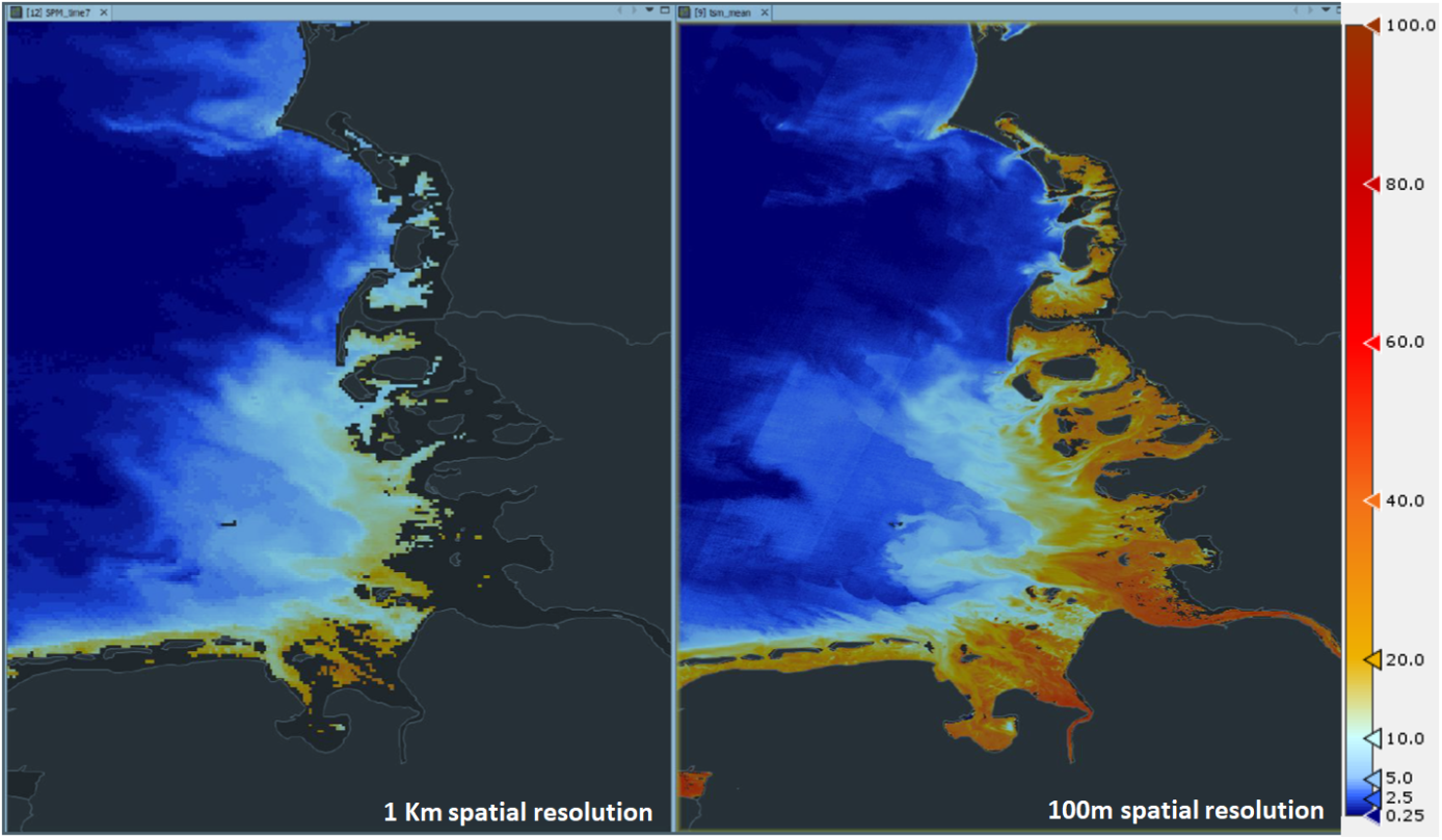
Over the past four decades, different satellites have been circling Earth whilst collecting numerous data. However, technology evolved during this time, creating the need for a unified processing method. A newly developed algorithm and software now make it possible to consistently process all these data and obtain unified image series for parameters such as water reflectance and turbidity.

Since the launch of Landsat 5 in 1984 the earth’s landmass and coastal zones have been imaged every 16 days. Landsat 5 provided regular imagery for over 25 years and was disabled fully in 2013. Its mission is being continued by Landsat 7 (launched in 1999) and Landsat 8 (2013). The Landsat missions are complemented by two Sentinel-2 missions, launched in 2015 (S2A) and 2017 (S2B) which image the earth every 5 days. The data from the Landsat missions has been open access since 2008, and those of Sentinel-2 since their launch. Combining the data streams allows the study of long time series, but due to differences in sensor design and image formats of these satellites, it was difficult to align these data over time. More precisely, an atmospheric correction algorithm and processing software for the automated and consistent processing of these images was needed.

Unified processing

In a recent publication in the journal ‘Remote Sensing of Environment’, Quinten Vanhellemont of the Remote Sensing team (REMSEM) of our institute, describes a method for unified processing of these data in order to retrieve water reflectance and derived parameters, such as water turbidity. These products have been validated with a long time series of in situ measurements from around the globe (Figure 1). This method has been the default in the ACOLITE software since April 2018 that can process imagery from Sentinel-2A/B and Landsat 5/7/8. ACOLITE was also developed by Quinten at the Royal Belgian Institute of Natural Sciences.

Figure 1: Time series of water turbidity from in situ measurements (solid line) and derived from satellite imagery for a location in the southern North Sea. A good correspondence is found through the 20 year spanning time-series.

Images of long time series

The unified processing of data collected by the different satellites provides standardized, easily interpretable (and also beautiful) data series and images series. In the Belgian coastal zone, we can for example observe the impact of the extension of the ports of Zeebrugge and Oostende on the sedimentation on both sides of the port walls. The image series in Figure 2 show an accumulation of sand on the beaches to the east and west of the extended ports. Water turbidity is also retrieved and is in the Belgian coastal zone mainly dominated by resuspension of bottom material in superimposed cycles: an annual cycle of winter-high, summer-low turbidity and cycles of ebb-flood and neap-spring tidal resuspension.

Figure 2a: Extension of the port walls and inland docks of the port of Zeebrugge, and accumulation of sand on the beaches east and west of the port walls (1980s-2010s)
Figure 2b: Port of Oostende (1980s-2010s)

Vanhellemont, Quinten. “Adaptation of the dark spectrum fitting atmospheric correction for aquatic applications of the Landsat and Sentinel-2 archives.” Remote Sensing of Environment 225 (2019): 175-192. https://doi.org/10.1016/j.rse.2019.03.010


ACOLITE processor https://odnature.naturalsciences.be/remsem/software-and-data/acolite

ACOLITE forum https://odnature.naturalsciences.be/remsem/acolite-forum/

ACOLITE source code https://github.com/acolite/acolite


EUROFLEETS+ Ship-time and marine Equipment Application (SEA-Programme) Call “OCEANS”

Eurofleets+ is an Alliance of European marine research infrastructure to meet the evolving needs of the research and industrial communities.

General information

The Eurofleets+ project facilitates open access to an integrated and advanced research vessel fleet, designed to meet the evolving and challenging needs of the user community. European and international researchers from academia and industry are able to apply for several access programmes, through a single-entry system. Eurofleets+ prioritises support for research on sustainable, clean and healthy oceans, linking with existing ocean observation infrastructures, and supports innovation through working closely with industry.

Eurofleets+ accessible Research Vessels: The project enables access to a unique fleet of 27 state-of-the-art research vessels (13 Global/Ocean and 14 Regional) from European and international partners. Through competitive calls, Eurofleets+ provides a wide geographic coverage, with access to the Mediterranean and Black Seas, the Baltic Sea and the North Sea, the North Atlantic (incl. Greenland and Norwegian seas), and the Southern Pacific Ocean and Ross Sea.

Eurofleets+ accessible embarked equipment: Researchers have access to cutting edge equipment, which includes 7 ROVs (Remotely Operated Vehicles) and 5 AUVs (Autonomous Underwater Vehicles). A unique portable telepresence system enables remote access by researchers and diverse end users including the public; a first for Europe.

Eurofleets+ programmes

Three access programmes are foreseen to be launched in Eurofleets+:

1) Ship-time and Marine Equipment Application (SEA programme) for access to the vessels and marine equipment through a full ship-time application, for which there will be a minimum of two calls, one with “ocean“ and one with “regional“ vessels. The SEA call for Ocean vessels and equipment has opened on the 26th of June and remains open until 27th of September 2019. More details on this call can be found below. The SEA call for Regional vessels will be opened in fall 2019 and will also remain open for three months. Research vessels and marine equipment not offered or requested in the first call (Oceans), or with spare capacities will be offered in the second, Regional call.

2) Co-PI programme specifically aimed at early career researchers to implement their own research together with experienced scientists in Eurofleets+ scheduled cruises. The Co-PI programme is anticipated to be open to applications from November 2019 onwards, and remain open continuously to the beginning of 2022.

3) Remote Transnational Access (RTA programme) to provide researchers with remote access to samples or data from a Eurofleets+ fleet vessel. Remote access will allow smaller projects, sample or data needs, to be addressed, when this can be accomplished with one day of ship time. RTA programme applications will be submitted in a continuous running call that is also anticipated to be open to applications from November 2019 to the beginning of 2022.

Notes: Non European applicants are also elegible for funding. Industry partners, early career researchers and female researchers are encouraged to apply.

EurofleetsPlus funds cover use of the vessels, crew, fuel and other standard operating costs, as well as travel expenses for the embarked team and transport of equipment and samples.

SEA-Programme Call “OCEANS”

The SEA Programme offers fully funded transnational access to 14 Research Vessels (some with ice class) and 9 pieces of Marine Equipment to carry out ship-based research activities within any field of marine science.

Funding conditions, application guidelines and full eligibility criteria.

This call will remain open for the submission of proposals until Friday 27th of September 2019.

Research vessels:

North Atlantic Ocean

RV Arni Freidrickson (HAFRA, Iceland)

RV Celtic Explorer (MI, Ireland)

RV DANA (DTU, Denmark)

RV Magnus Heinason (HAVST, Faroe Islands)

RV Mar Portugal (IPMA, Portugal)

Arctic Ocean

RV Sanna (GRONLANDS, Greenland)

RV G.O. SARS (HAVFO, Norway)

Mediterranean Sea, Atlantic Ocean

RV Alliance (NATO-CMRE, Italy)

RV Pelagia (NIOZ, The Netherlands)

RV Ramon Margalef (IEO, Spain)

RV Thalassa (IFREMER, France)

North-West/West Atlantic

RV Coriolis II (UQAR, Canada)

RV Atlantic Explorer (BIOS, Bermuda)

Pacific Ocean

RV Tangaroa (NIWA, New Zealand)

Marine Equipment:

AUV Hugin (UGOT, Sweden)

AUV Hugin (FFI, Norway)

ROV Ægir 6000 (UiB, Norway)

HROV Ariane (Ifremer, France)

ROV Genesis (VLIZ, Belgium)

ROV Holland1 (MI, Ireland)

ROV LUSO (IPMA, Portugal)

ROV Marum Squid (UB, Germany)

ROV Ocean Modules V8 offshore (UGOT, Sweden)

VSAT Satellite System (Telepresence Unit) (GFOE, United States of America)

Detailed descriptions of the Research Vessels and Marine Equipment offered by EUROFLEETS+.

Contact: eurofleetsplus@awi.de

RBINS and Zwin Nature Park install GPS transmitters on white storks

In the Zwin Nature Park in Knokke-Heist three young storks were provided with a transmitter at the end of June. Thanks to their transmitters, the movements of these storks can be followed at all times. With this study, the Royal Belgian Institute for Natural Sciences and the Zwin Nature Park want to document the consequences of changing conditions in the wintering areas on the migration behaviour of the storks.

Young white stork that was equipped with a transmitter at the end of June 2019 at the Zwin Nature Park. (© Zwin Natuur Park)

Since Leon Lippens started an introduction programme for white storks Ciconia ciconia in the Zwin Nature Park in 1957, about five hundred young have hatched here (the first in 1965). More than 300 of them were equipped with a scientific ring, within the framework of the long-term research tradition and cooperation with the Royal Belgian Institute of Natural Sciences. The majority were reported at least once (on average five times per reported stork), mainly along an axis towards the southwest, through the western half of France and central Spain. The furthest observation of a Zwin-ooievaar came from Algeria, at 2,164 kilometres from the Zwin. But Belgian storks have also been reported to spend the winter in West Africa, south to Senegal and Mali. The white stork is one of the species for which the Zwin has been designated as a special protection area under the EU Birds Directive.

Reports of white storks that were ringed in Belgium, 1965-2019 (© RBINS/Geoapp BeBIRDS)

This year the Zwin population counted 13 breeding pairs. In the wider area, however, 27 additional pairs were documented (region Knokke-Heist, Damme, Bruges, and across the Dutch border), so that the total regional population in 2019 was no less than 40 breeding pairs. A few years ago, the feeding of storks in the Zwin was stopped, which probably contributed to their distribution over a larger area.

Transmitters in addition to rings

In 2019, the Zwin also devoted attention to the ringing of a number of young storks: on 5 June, 13 individuals were provided with a scientific ring. The codes on these rings can be read remotely with a pair of binoculars or a telescope, but the chance that a ringed stork is observed and reported remains rather small. Although such observations teach us a lot, they are still snapshots. With a transmitter, a bird can be tracked continuously, which provides much more information about the survival, the movements and the habitat use of the transmitter-equipped birds.

The transmitters only weigh 25 grams and use solar energy (© Zwin Natuur Park)

On 26 June, for the first time, three young Zwin storks (from two nests) were equipped with a transmitter. They weigh only 25 grams, which represents less than one percent of the weight of the birds. The transmitters are very sustainable: they operate on solar energy and transmit the data that their GPS collects via the GSM network. Don’t worry if there is no reception: everything is stored in the internal memory and passed on when a signal is available. It is also possible to adjust the transmitter parameters (such as the frequency of location measurements) remotely. The accuracy is astonishing, positions are determined to within a few meters.

The spatial use of one of the young storks that carries a transmitter (period 20-28 July, the bird is hanging around the nest site) shows a very high resolution (© RBINS/Geoapp BeBIRDS)

Storks on garbage dumps

Before 1990, almost all Western European storks crossed the Strait of Gibraltar (the strait that separates Spain from Morocco) in the autumn to spend the winter in West Africa. Since then, however, much has changed. More and more storks have understood that they could drastically shorten this long and energy-consuming journey by staying in Spain, where they find all the food they need on landfills. In the winter of 2018-2019, up to 46,000 wintering storks were counted on the Iberian Peninsula. This is no less than 20% of the Western European population. These birds also have a higher chance of survival, and return more quickly to the breeding grounds in the spring, where they can occupy the best territories.

The storks experience no problems with the transmitters on their backs (© K. Moreau/RBINS)

But … clouds are rising in the Spanish stork paradise skies! The European Waste Framework Directive prohibits landfills exposed to the open air, and the European Commission took Spain to the European Court of Justice in June 2018, in response to repeated calls for this legislation to be applied in Spain. The Spanish garbage dumps that many storks have learned to use will therefore be closed shortly. This will fundamentally change the state and conditions of their wintering quarters. The RBINS and the Zwin Nature Park are therefore seeking to use the transmitters to help document the impact of this changing situation in Spain on the storks’ migratory behaviour.

Two young storks with transmitters in the ‘Kleine Vlakte’ outside the Zwin Nature Park (© K. Moreau/RBINS)

The results of the research will be available on a specific project page on the website of the Zwin Natuur Park. It is the intention that more storks will be equipped with a transmitter in the coming years.

As an international airport for birds, the Zwin Nature Park is a knowledge and expertise centre for bird migration. In addition to ringing storks and installing transmitters, the Zwin Nature Park also focuses on ringing of other bird species. From 1 August to 20 October 2019, ringing will take place almost every day, and the public will also be able to gain an insight into this activity. In Belgium, the scientific ringing of birds is coordinated by the BeBIRDS group of the Royal Belgian Institute of Natural Sciences (RBINS).

EuroGOOS, the European Global Ocean Observing System

EuroGOOS is the European component of the Global Ocean Observing System of the Intergovernmental Oceanographic Commission of UNESCO (IOC GOOS). The EuroGOOS Secretariat is located in Brussels, serving 44 members and supporting five regional systems in Europe. The Royal Belgian Institute of Natural Sciences (RBINS), and in particular its Marine Forecasting Centre, is one of these members and is involved in the North West Shelf Operational Oceanographic System (NOOS).

EuroGOOS identifies priorities, enhances cooperation and promotes the benefits of operational oceanography to ensure sustained observations are made in Europe’s seas underpinning a suite of fit-for-purpose products and services for marine and maritime end-users.

EuroGOOS working groups, networks of observing platforms (task teams), and regional systems (ROOS), provide for a for cooperation, unlock quality marine data and deliver common strategies, priorities and standards. The many EuroGOOS networks work towards integrated, sustainable and fit-for-purpose European ocean observing, underpinning the EOOS (European Ocean Observation System) framework.

EuroGOOS General Assembly – New Relevance, New Strategy

On 8 and 9 May the EuroGOOS General Assembly met in Heraklion, hosted by the Hellenic Centre for Marine Research and George Petihakis, EuroGOOS Chair. EuroGOOS strategy and integration were the main themes on the agenda. The meeting was attended by EuroGOOS members and the chairs of the EuroGOOS activities (working groups, infrastructure task teams, and the regional systems – ROOS).

The Assembly discussed the evolution of the organization and brainstormed on the next EuroGOOS strategy 2020-2030. The brainstorming was done through an interactive session in a World Café around four major areas of the strategy: high-level priorities, challenges, partnerships, and national benefits and advocacy. The results of this brainstorming will be transformed into the strategy and an accompanying roadmap, with the first draft prepared in the summer. The upcoming OceanObs’19 conference will further feed into the strategy preparation.

The Assembly also discussed ways to achieve a better integration between the variety of EuroGOOS activities. EuroGOOS task teams (networks of ocean observing technologies) and working groups (on science, technology, data integration and coastal ocean) are delivering best practices and state of play analysis, while the EuroGOOS Regional Operational Oceanographic Systems (ROOS) deliver regional coordination. At the end of 2019, EuroGOOS will host an integration workshop bringing all those activities together, to brainstorm and agree on steps to activate the new EuroGOOS strategy, and on the support needed from the EuroGOOS office.

Glenn Nolan (EuroGOOS General Secretary), George Petihakis (EuroGOOS chair) and Sebastien Legrand (Marine Forecasting Centre, Royal Belgian Institute of Natural Sciences) shake hands on the new office contract. © Dina Eparkhina/EuroGOOS

New members, new hosts

At the formal part of the meeting, the Assembly approved and warmly welcomed three new members to EuroGOOS: SHOM (France), PLOCAN (Spain) and NIVA (Norway). Representatives of these organizations showcased their activities and future contributions to EuroGOOS, spanning technological development, observing integration, ocean monitoring, and ocean literacy. The Assembly also elected a new member to the Executive Directors Board – Holger Brix of the Helmholtz-Zentrum Geesthacht in Germany. Two Executive Board members stepped down upon the completion of their full mandates – the Assembly thanked Urmas Lips (Tallinn University of Technology, Estonia) and Bernd Brugge (Federal Maritime and Hydrographic Agency, BSH, Germany)  for their contributions to the work of the Board over the past six years. At the Assembly, Chair George Petihakis also signed the EuroGOOS office hosting agreement with the Royal Belgian Institute of Natural Sciences (RBINS), represented by Patrick Roose and Sebastien Legrand. RBINS will host the EuroGOOS secretariat in its Brussels offices (also housing the Belgian Museum of Natural Sciences) from the end of 2019.

Text: Dina Eparkhina (EuroGOOS), Kelle Moreau (RBINS)

When originality makes you sail- a fourth grade class on the Belgica

The naming of Belgica II, the new Belgian research vessel that will succeed the Belgica at the end of 2020, was announced on 25 April 2019 and caused a great deal of ink to flow. However, if originality and cinematographic creativity had been the most important selection criteria, the new vessel would have been called “Gamma Ruspo”. This name was suggested by the students of class 4B of the Institut de la Providence de Champion, Namur. A reward was also announced for the most original video, so the students were expected on Monday 20 May in the military port of Zeebrugge, to sail on the Belgica for half a day. Captain Haddock’s shadow will be hanging over the North Sea…

On November 6th, 2018, the Belgian Federal Science Policy Office launched a contest in order to determine the name of the new Belgian oceanographic vessel. After a first phase in which schools could suggest names (accompanied with an explanatory video) and a second phase where everyone could choose one of the six selected names, the Minister for Science Policy announced the chosen name on 25 April 2019: “Belgica II”. The winning class, 1LA from Liège’s Athénée Maurice Destenay could enjoy a cruise on the Belgica the same day.

Nonetheless, a second laureate was chosen to reward the most convincing video, emphasising originality. For this prize, a jury determined that the class 4B of the Institut de la Providence de Champion (Namur) had realised the most original production. Their video was inspired by the comic heroes Tintin and professor Calculus, and states why they would have called the new vessel “Gamma Ruspo”. On 20 May 2019, this class also benefited from an excursion with the RV Belgica.

Scientists explain the measuring equipment on a tripod that will be placed on the seabed.

The Institut de la Providence, a green school interested in marine sciences

On the initiative of its direction, professors and students, l’Institut de la Providence is a school which has been engaging in multiple initiatives in terms of environmental protection for a long time: installing photovoltaic panels, replacement of all lighting with LEDs, managing beehives with a didactic hive in the classroom, signing of the “Green deal sustainable canteens” contract, soft mobility week from 20 to 25 May 2019, investment in recyclable cups and water fountains, environmental certification process, etc.

It is thus no surprise that the students of class 4B of the Institut de la Providence de Champion have heard of the naming contest in their French class. Before suggesting a name for the successor of the Belgica, everyone was invited to investigate and learn more about this venerable vessel. Consequently, the teenagers learned that it collects important information which contributes to thinking about sustainable fisheries, offshore wind turbines, mining activity in the deep sea, or offshore energy production and storage. The pooling of information made it possible to launch lines of thought to formulate original names for the successor of the Belgica.

It was a particularly busy day in the laboratories of the Belgica.

Gamma ruspo

After a flamboyant debate, 4B went for originality. What if we called this vessel “Gamma Ruspo?”.

Gamma rus what? The “Gammarus pulex” is a type of shrimp, “ruspo” means “I search” in latin, and there is no need to explain the link between the word “Gamma” and the world of science.

The name being chosen, it was time to go through the second part of the competition: film a one and a half minute video presenting the suggested name in an original way. A small group of students turned into a film crew and at the end of January, without anybody’s help, they shot a video in which  typically Belgian characters (Calculus and Tintin) are associated with the playful and scientific universe of “C’est pas sorcier” (French educational television programme). The result was quite successful on the internet and aroused reactions as far as Austria (the video has been translated in the three national languages).

Interpretation of Tintin – one of the protagonists of the winning film – by one of the students.

The outcome

In February 2019, the decision was made: “Gamma Ruspo” was not selected as one of the names from which the public could choose. The students were rather surprised to hear that the new Belgica was named… “Belgica 2”! They didn’t think this contest would result in this choice, although it is a strong mark that honours Belgian marine research’s history and tradition.

However, the Providence students were fair players, admitting that the name they suggested perhaps lacked readability. Although they were a little disappointed, they were still satisfied to have participated in the competition with a nice group work and a cool video.

April 2019, big surprise: a message from one of the contest organiser informed them that their video has won the award for being the most creative submission.

Dominique Rappe, the 4B’s French teacher, reacts: “It’s great that the class is rewarded, because many have gone really far in their thinking, proving their interest in biology, climate, and sciences in general. The film crew has been completely autonomous, and it is their intuitive talent that has been rewarded. Everyone is delighted that they were able to go on an excursion with the Belgica on Monday 20 May. We prepared the visit so that the youngsters could gather a maximum of information from the scientists that were carrying out research on that day. They also questioned the military staff that operates the vessel. The class even offered a little animation (song) in recognition of the adults that welcomed them in their professional environment.”

The students are amazed at how much can be told about a bottle of seawater.

Inventories of macro-and micro-plastics in the Belgian fishing areas and on the beaches

The research partners of the EMFF-FIVA-research project MarinePlastics have started a study that accurately maps how much and what types of plastic are found on the Belgian fishing grounds. It involves both larger pieces of waste (macro-plastics larger than 5 mm) and minuscule plastic particles (micro-plastics smaller than 5 mm).

Since 2012, Europe has been asking each Member State to collect figures about macro-plastics on the seabed. From this year onwards, data must also be collected on micro-plastics in the sediment and in the water. The waste on the beaches must also be monitored.

The project MarinePlastics also examines the extent to which microplastics are found in the commercial fish from our fishing areas. The researchers make the distinction between the plastic particles in the fish stomach (which people do not consume) and the fish fillet (which we do eat).

Our marine environment guarantees a rich variety of plastic and other waste (© K. Moreau/RBINS)

Macro-plastics in the Sea and on the Coast

For almost 10 years, the Research Institute for Agriculture, Fisheries and Food (ILVO) has been voluntarily collecting data on plastic, which is hoisted on board the research vessels within existing measuring campaigns aimed at the state of fish stocks and the impact of human activities at sea. The plastic contained in the fishing nets was sorted, described, measured and weighed according to the standards of OSPAR and the European Marine Strategy Framework Directive (MSFD). It is those data that are now undergoing a statistical depth analysis.

Waste recovered from the seabed (© ILVO)

Bavo De Witte: “From a first rough interpretation it is already apparent that the amount of macro-plastic found is increasing and that there are hotspot sites, such as the dredge disposal location Zeebrugge Oost, where port sludge is dropped and currents create a sedimentation effect.” The analysis should clearly show quantitative and qualitative trends. Comparison with numbers from abroad also become possible.

ILVO and the Operational Directorate Natural Environments of the Royal Belgian Institute of Natural Sciences (RBINS-OD Nature) also want to investigate whether the waste can be linked to human activities such as tourism, industry or fishing. In addition, each type of waste will study whether the quantities are increasing or decreasing.

RBINS-OD Nature also concentrates on what is found on the Belgian beaches. The quantity of beached waste is not decreasing, they notice from prior analyses. On the beaches too, the situation is poor, according to the evaluation for the European Marine Strategy Framework Directive.

Larger and smaller waste (mainly plastic) collected from our beaches (© K. Moreau/KBIN)

Micro-plastics in Sediment, Water and Commercial Fish

Micro-plastics can come directly into the environment by wear and tear of tyres, through clothing or through soaps and scrubs. A previous study showed that up to 50% of these ‘land-based’ microplastics eventually end up in the sea.

Micro-plastics accumulate in the water and on the seabed and fragment even further into nanoparticles (less than 1 micrometers). Sooner or later these micro-and nano-plastics are absorbed by fish, mussels, shrimps and other animals, which eventually end up in the human food chain. Some of those small plastic particles will undoubtedly stay behind in the parts that we do not eat, like the stomach of a fish. A detailed characterization of micro-plastics in certain marine and fishery products would make clear how many micro-plastics we are really eating now. This is important to assess the potential health risks of micro-plastics.

Microplastic on filter (© ILVO)

“In the case of a scientific risk analysis, two factors must always be examined”, researcher Bavo De Witte clarifies. “First: To what extent are you exposed to the substance – in this case micro-plastics? And secondly: is there a toxic effect that can be associated with that degree of exposure? None of these two questions is currently adequately answered by science. So before we can make statements about the degree of (non-)harmfulness, we are now first and foremost mapping how many microplastics a person is actually ingesting.”

Within this project, RBINS-OD nature and ILVO are also joining forces to study the presence of micro-plastics in the marine environment. European legislation expects each Member State to follow the quantity of micro-plastics in the seabed and seawater.

MarinePlastics is an initiative of Flanders Research Institute for Agriculture, Fisheries and Food (ILVO) and the Royal Belgian Institute of Natural Sciences (RBINS – OD nature).

EMFF-FIVA stands for the European Fund for Maritime Affairs and Fisheries and the financial Instrument for Flemish fisheries. It is a research funding agency for fisheries-related subjects using European and Flemish funds.

Documenting underwater sound in the Belgian North Sea

Sound is everywhere. Not only on land but also in the seas and oceans. Some sounds are of natural origin, but human activities add to the marine soundscape as well. We don’t have a good understanding of the types and distribution of these underwater sounds yet, let alone of the effects that they may have on marine fauna. At the end of May 2019, a permanent acoustic recording station was installed in the Belgian part of the North Sea. This major accomplishment is framed in the project Joint Monitoring Programme for Ambient Noise North Sea’ (JOMOPANS). The new equipment will help scientists to understand how underwater noise is distributed over the North Sea.

Scientific diver Alain Norro (RBINS/MARECO) during the preparation of the installation of the permanent acoustic recording station in the Belgian waters. © RBINS

If you picture the underwater environment to be a silent and serene world, you may have to reconsider. Sounds are omnipresent, also in the marine environment. Underwater sound can be produced by natural (waves, weather, animals) and anthropogenic (shipping, construction) sources. However, our understanding of the effects of these sounds on marine fauna is still limited. In recent years, the introduction of underwater sound in the marine environment started to receive political and scientific attention, and monitoring schemes are being set up.

Impulsive sound

Most of the monitoring effort however, is attributed to impulsive sound. This category of noise consists of sounds with a short duration (impulse-like), that are largely unwanted and of anthropogenic origin. Pile-driving for the construction of offshore wind turbines, sonars and the destruction of ammunition at sea are the best known sources of impulsive sound. These can potentially be harmful for marine fauna. A temporary relocation of Harbour porpoises Phocoena phocoena was already shown during pile-driving activities, and scientists have also gained some insight into the effects of impulsive sounds on fish. But to understand the full impact on these and other marine organisms, a lot more study is still needed. The growing knowledge is being translated into regulations. Belgian legislation for instance already prescribes that the level of anthropogenic impulsive sounds is not allowed to be higher than the level at which harmful effects can be shown. For pile-driving, the threshold is currently defined at 185 dB at 750 m of the sound source. Sound mitigation measures should be put in place when this limit is exceeded.

Continuous sound

Our understanding of the levels and spatial and temporal patterns of continuous, ambient sounds in the marine environment on the other hand, is currently much less developed. These sounds – typically of low frequencies – may show an increasing trend due to the increase in human activities such as shipping, dredging, sand extraction, fishing and sustainable energy production at sea. Potential negative effects on marine fauna can be subtle and chronic and are therefore harder to evaluate. The limited amount of available data does not yet allow reporting to national and international policy makers.

The Westhinder measurement platform. © A. Norro/RBINS

Continuous monitoring of ambient sound

As sound sources, sound transmission, and the distribution of vulnerable species are all transnational questions, these also should be tackled transnationally. The international reporting obligations of EU Member States for the Marine Strategy Framework Directive (MSFD) strongly pushes the development of a regional approach, both with respect to monitoring and methodology. Belgium effectively engaged to contribute to such an international approach and use the results for the national evaluation. To accomplish this, the Royal Belgian Institute of Natural Sciences (RBINS) joined the JOMOPANS project.

In this project, RBINS is (among other tasks) responsible for the installation of a permanent acoustic recording station in the Belgian part of the North Sea. The Westhinder platform was selected as a suitable location. Essentially serving as an automatic electronic light platform, the Westhinder now also plays an important role as node of the monitoring network of the Flemish Maritime and Coastal Services Agency. At the end of May 2019, the JOMOPANS sound recording station was added to this platform. Technicians from the Maritime and Coastal Services Agency and the RBINS scientific divers respectively took care of the aerial and underwater parts of the installation. The instrument will continuously monitor ambient underwater sound generated by both natural and anthropogenic sources. Check the illustrative video!

Towards knowledge-based management

“The recently installed acoustic recording system will deliver the high-quality data that are needed to describe the types (level and frequency) and timing of sounds around the Belgian measuring station.” Says Alain Norro, scientific diver of RBINS. “In combination with data yielded by other JOMOPANS stations, we will begin to understand how underwater noise is distributed over the North Sea.” As such, the Belgian station will be an essential part of the network that will deliver the tools necessary for scientists and managers to incorporate ambient noise in their assessment of the environmental status of the North Sea. In a next step, the effectiveness of various options for reducing the potential environmental impact of ambient underwater noise in the North Sea basin, will be evaluated.

JOMOPANS is an Interreg project (North Sea Region) funded by the European Union’s European Regional Development Fund. The project consortium consists of 11 partners from 7 countries (RBINS being the sole Belgian partner) and is coordinated by Rijkswaterstaat (Netherlands).