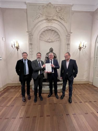
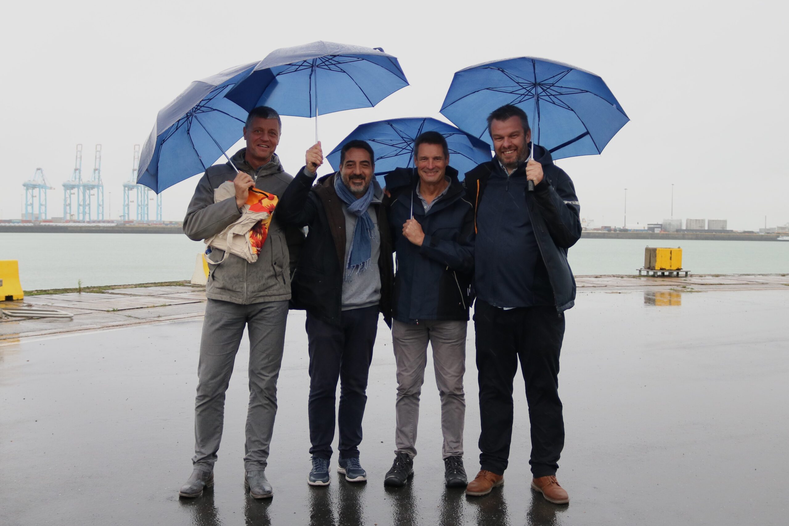
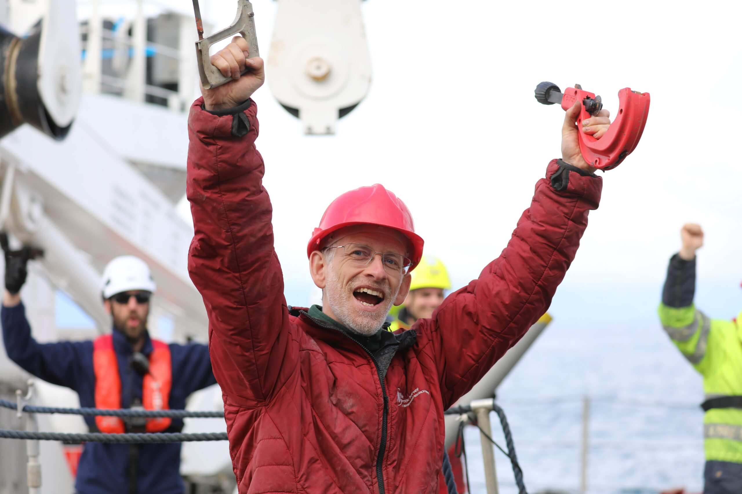
A new chapter in European marine research has begun with the official creation of Eurofleets AISBL, a pan-European research infrastructure designed to revolutionize access to marine research vessels. This groundbreaking initiative was formalized in Brussels with the signing of the constitutive act by representatives from Ireland, Italy, France, and Belgium. For Belgium it was Serge Scory from the Institute of Natural Sciences who did the honours.
Brussels, 26 March 2025. From left Aodhán Fitzgerald, (Marine Institute, Ireland), Giuseppe Magnifico (CNR, Italy), Olivier Lefort, (IFREMER, France) and Serge Scory (Institute of Natural Sciences, Belgium)
Eurofleets AISBL is the result of over a decade of collaboration between Europe’s leading marine research institutions. Since 2009, naval operators have worked together to establish a framework that ensures researchers across Europe, and even beyond, can access state-of-the-art research vessels. By pooling resources and expertise, this initiative will make oceanographic research more efficient, sustainable, and inclusive.
Expanding scientific access to the oceans
Marine research plays a crucial role in understanding climate change, protecting biodiversity, and managing ocean resources. However, research vessels are expensive and not all countries have the resources to operate them. Eurofleets AISBL bridges this gap, enabling scientists from different nations to collaborate and gain access to high-tech research fleets, regardless of their home country’s maritime capabilities.
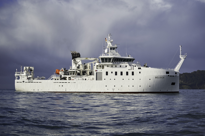
This initiative will help tackle some of the most pressing scientific challenges of our time, from mapping the ocean floor to studying the effects of climate change on marine ecosystems. Through coordinated access to research vessels, scientists will be able to conduct large-scale studies that were previously out of reach for many research teams. Also the Belgian state-of-the-art research vessel RV Belgica has been part of the Eurofleets initiatives since the very beginning, and continues to be so.
A greener future for marine research
One of Eurofleets AISBL’s key goals is to drive the environmental transition of European research fleets. The initiative is committed to reducing CO2 emissions, improving energy efficiency, and promoting sustainable maritime operations. By 2030, research vessels will be expected to meet stricter environmental standards, ensuring that marine science itself does not contribute to the degradation of the ecosystems it seeks to study and protect.
Supporting the next generation of marine scientists
Beyond improving research infrastructure, Eurofleets AISBL is dedicated to training and career development. Young researchers will benefit from coordinated training programs across Europe, gaining valuable experience aboard world-class research vessels. Collaborations with universities and research organizations will further support early-career scientists, ensuring that the next generation is equipped with the skills and knowledge needed to advance marine science.
A step towards a more unified European research landscape
By streamlining access to research vessels and fostering international collaboration, Eurofleets AISBL strengthens Europe’s position as a global leader in marine science. It ensures that scientific research is not limited by national borders and that Europe can respond collectively to the challenges facing our oceans.
As this ambitious initiative sets sail, it marks a turning point for European marine science. With increased accessibility, a strong focus on sustainability, and a commitment to fostering talent, Eurofleets AISBL is poised to shape the future of oceanographic research for years to come.
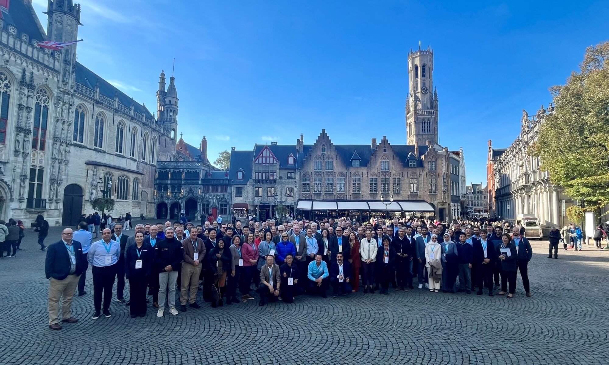
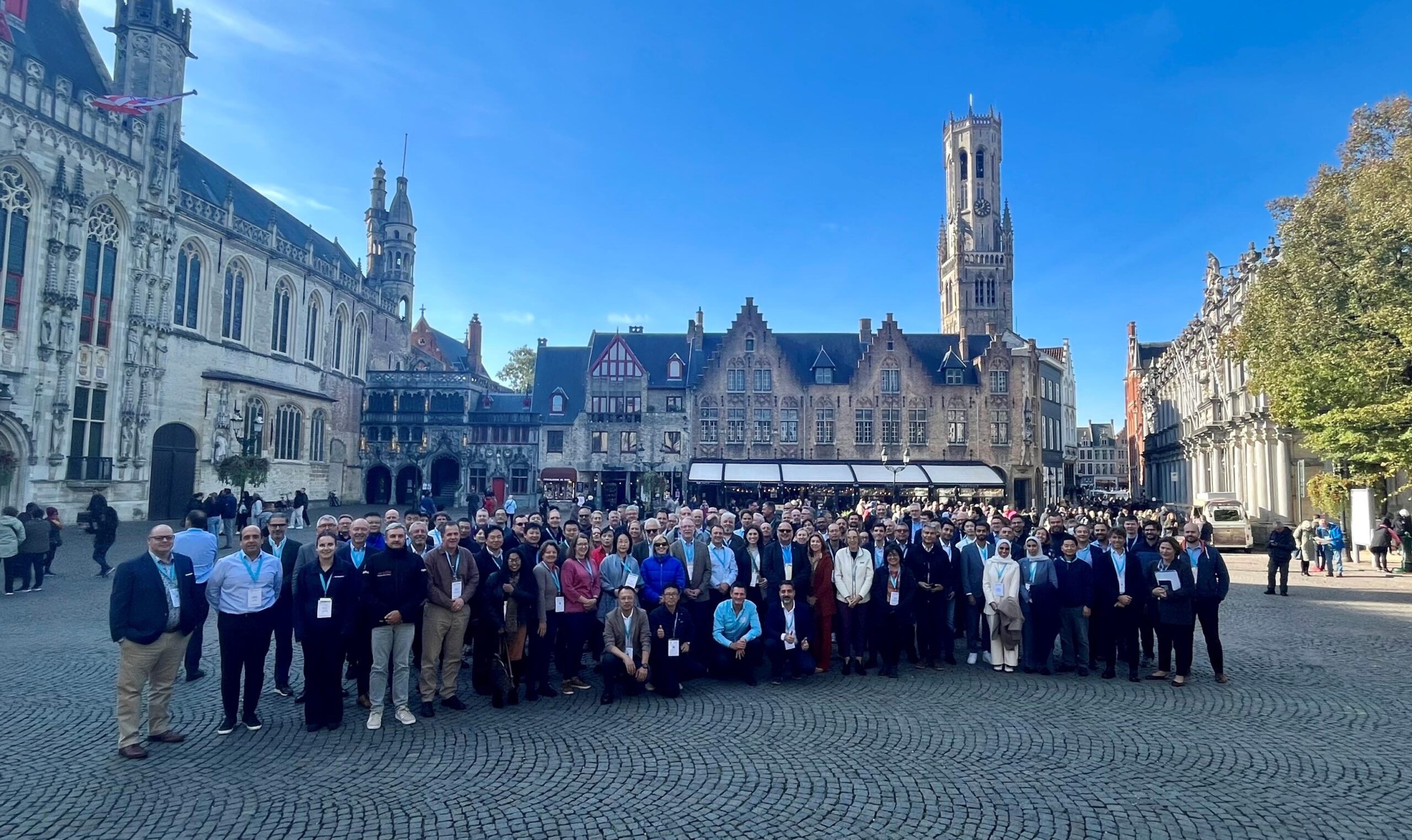
From 16 to 20 October 2023, the UNESCO world heritage city of Bruges was the scene of the 34th annual meeting of the International Research Ship Operators. The meeting was organised by the Institute of Natural Sciences and the Flanders Marine Institute. 129 participants attended the meeting to share information and solve problems of common interest. Improving support for the marine scientific community’s research efforts at sea is always a key focus.
International Research Ship Operators, 16-20 October 2023, Bruges, Belgium
The International Research Ship Operators (IRSO) forum brings together research ship operators representing 49 organisations from 30 countries. Together, they operate more than 100 of the world’s leading marine science research vessels. Membership of IRSO is open to all organisations operating research ships and national research programmes that collect data from ships at sea and follow established protocols for the open publication of their results.
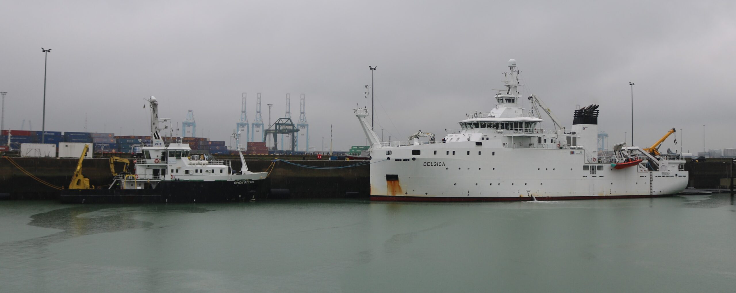
IRSO was founded in 1986 and since then has had annual meetings organised by and in participating countries. In 2023, the Institute of Natural Sciences, operator of the RV Belgica, and the Flanders Marine Institute, operator of the RV Simon Stevin, took care of the organisation. Together, they also guarantee the Belgian representation in IRSO. 129 participants travelled to Bruges for this 34th IRSO meeting. Besides plenary sessions and some specific workshops, which took place at the Bruges Grand Hotel Casselbergh, the programme also included some social activities. A visit to the research vessels RV Belgica and RV Simon Stevin was, of course, a must. For this occasion, both ships were docked at the Zeebrugge Naval Base on Friday 20 October.
Sharing successful experiences (best practices) in the design and operation of research vessels and scientific equipment are among the main objectives of the annual IRSO meeting.
“These meetings allow efficient sharing of information and resolution of problems of common interest. This allows the marine scientific community’s research efforts at sea to be ever better supported” clarifies Greg Foothead, chairman of IRSO and General Director of New Zealand’s NIWA Vessel Management Ltd.
Giuseppe Magnifico, IRSO vice-president and Deputy Director of the Italian Consiglio Nazionale delle Ricerche (CNR) completes, “IRSO also acts as a voice to promote the research ship community and provides expert advice to other bodies as required.”
Additional benefits
However, IRSO also goes a step further than keeping each other informed about experiences and developments in national research fleets. “Being active within IRSO sometimes also results in actual collaborations and in the exchange of ship time and equipment between institutes and countries,” says André Cattrijsse, Head of Research Infrastructure at the Flanders Marine Institute.
“Moreover, this strategic exchange of knowledge and experience is crucial in an era of declining budgets, while the need for knowledge of coastal seas and the ocean and their relationship with humans is rapidly increasing.” stresses Lieven Naudts, coordinator of the RV Belgica and head of the Ostend Measurement Service at the Institute of Natural Sciences.
IRSO also initiates projects of common interest to its members. For example, a code of conduct for marine research vessels was developed and IRSO contributed to the creation of the OCEANIC database for research vessels at the University of Delaware. IRSO also sponsors workshops and working groups, such as the biennial International Marine Technician’s Workshop (INMARTECH).
The Belgica Documents Climate Change in an Arctic Marine Ecosystem
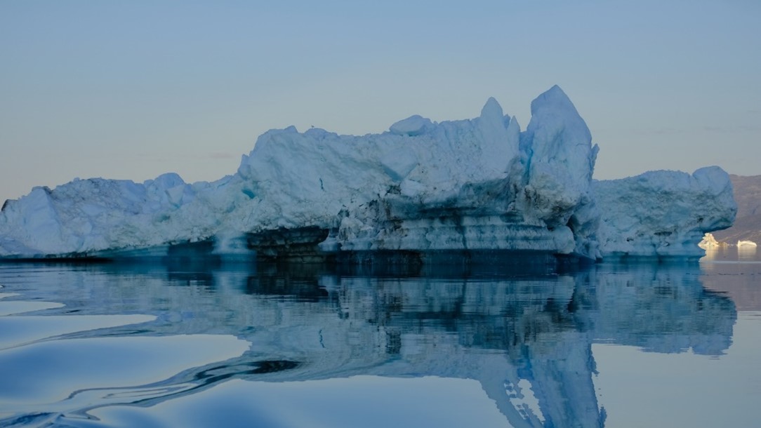
On the 13th of July 2023 the new Belgian oceanographic research vessel RV Belgica is leaving from Reykjavik, Iceland, for a trip of three weeks to southwest Greenland. The international research team on board will make use of the advanced facilities on board of the ship to investigate how climate change, and more specifically changes in glacial melt, will affect the carbon dynamics, biological communities and food webs in Greenlandic fjords, a typical Arctic marine ecosystem.
Fjords are systems of regional and global importance by supporting highly productive and diverse food webs. As this rich marine life stores a lot of carbon, the fjords play a far more important role as CO2 sinks than one would suspect based on their limited size relative to the vast ocean basin.
From Marine- to Land-terminating Glaciers
These days, global warming significantly impacts fjord systems through the accelerated melting of ice, with the greatest impact in polar areas such as Greenland. Here, coastal glaciers often terminate in the fjord, so called marine-terminating glaciers.
However, especially at Greenland’s marine-terminating glaciers draining 88 % of the ice sheet in the study area, discharge has recently increased sharply caused by increased melting of the ice sheet. As a consequence, many of Greenland’s marine-terminating glaciers are gradually shifting to land-terminating glaciers, a process which will likely intensify in the near future.
Whereas there is increasing evidence that shifts in glacier types cause major changes in the physical, biogeochemical and ecological processes in the associated fjord systems, the consequences for the marine food web and carbon burial in sediments are currently not fully understood. As a result, the impacts of further warming on ecosystem services provided by Arctic fjords (e.g. food provisioning, climate regulation) remain unknown.
This Belgica expedition aims to investigate to what extent changing glacial melts in Arctic fjords may lead to lower primary productivity and a less rich food web. The research is part of the CANOE project (Climate chANge impacts on carbon cycling and fOod wEbs in Arctic Fjords), which is funded by the Federal Science Policy Office (BELSPO).
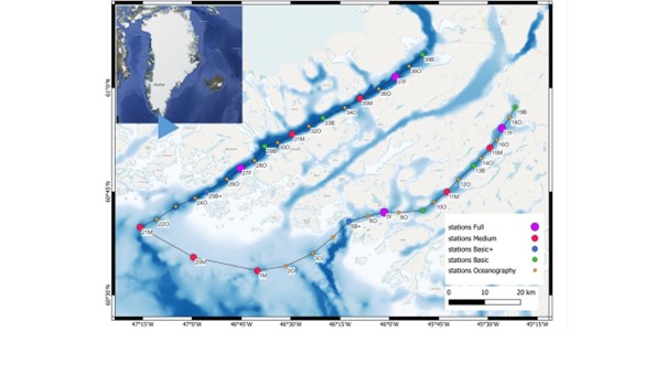
Study Area
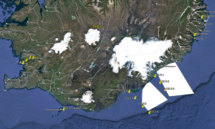
The study area consists of two adjacent fjords with contrasting glacier input, respectively marine- and land-terminating. In both fjords, a gradient from shelf to inner fjord will be sampled. Oceanography and pelagic (water column) biogeochemistry will be described at high resolution in each fjord (oceanographic stations), in addition to the benthic (seafloor) biogeochemistry and biodiversity (basic and medium stations), while the food web will be described and quantified at two contrasting locations in each fjord (full stations).
“With this expedition the team will contribute to major societal concerns for which research-based management strategies are crucial for the future” says Ann Vanreusel, professor at the Department of Biology of Ghent University and chief scientist of the RV Belgica Greenland expedition. “By providing insights into expected climate change effects on coastal marine food webs, important information for a future ecosystem-based management in the Arctic fjords is generated.”
The CANOE project, coordinated by prof. Ulrike Braeckman (RBINS and UGent), will also construct predictive models that will help to anticipate the ongoing and future climate-related shifts in marine ecosystems and the consequences for natural resources and other ecosystem functions such as CO2 mitigation.
The Tradition of Integrated Research
Belgium has a long tradition in marine Arctic research since Adrien de Gerlache set sail with the historical Belgica in 1907 for a scientific expedition exploring parts of the Arctic Ocean. Even at that time, this involved integrating many research disciplines into the expedition, and involving scientists of different nationalities. In the spirit of this tradition, the CANOE-scientists now also use the new RV Belgica for an integrated and international research campaign, linking physical, biogeochemical and biological aspects of the water column with seafloor processes in Greenlandic fjord ecosystems with glacier dynamics under influence of climate change. Such an interdisciplinary campaign requires optimal use of the numerous oceanographic and biological research instruments offered by the RV Belgica.
The multidisciplinary international CANOE team is led by researchers from Ghent University (UGent) (Prof. Ulrike Braeckman) and also consists of researchers from the Royal Belgian Institute of Natural sciences (RBINS), Flanders Marine Institute (VLIZ), University of Antwerp (UAntwerp), Royal Netherlands Institute for Sea Research (NIOZ), University of Southern Denmark (SDU) and University of Bonn (Germany). The research is also carried out in association with Greenland research institutes.
CANOE is funded by the Belgian Science Policy Office (BELSPO) as beneficiary of a specific call that was designed to give an impulsion to the start-up of research on the new RV Belgica and to allow researchers to get to know the ship and her potential. The project runs from 15 December 2021 to 15 March 2026. For more information of the project please visit http://canoe.marinetraining.eu/.
The CANOE expedition with RV Belgica follows the DEHEAT expedition that operated in Icelandic waters from 26 June to 11 July. Here, it investigated how the natural weathering of silicate minerals in the sea consumes the greenhouse gas carbon dioxide from the atmosphere, thereby helping to remove it from the atmosphere, and when accelerated could be an ally in the fight against global warming.
More information on RV Belgica can be consulted at the ship’s websites at RBINS (including live position information and webcam images) and BELSPO. The ship and its scientific activities can also be followed on Facebook and Twitter.
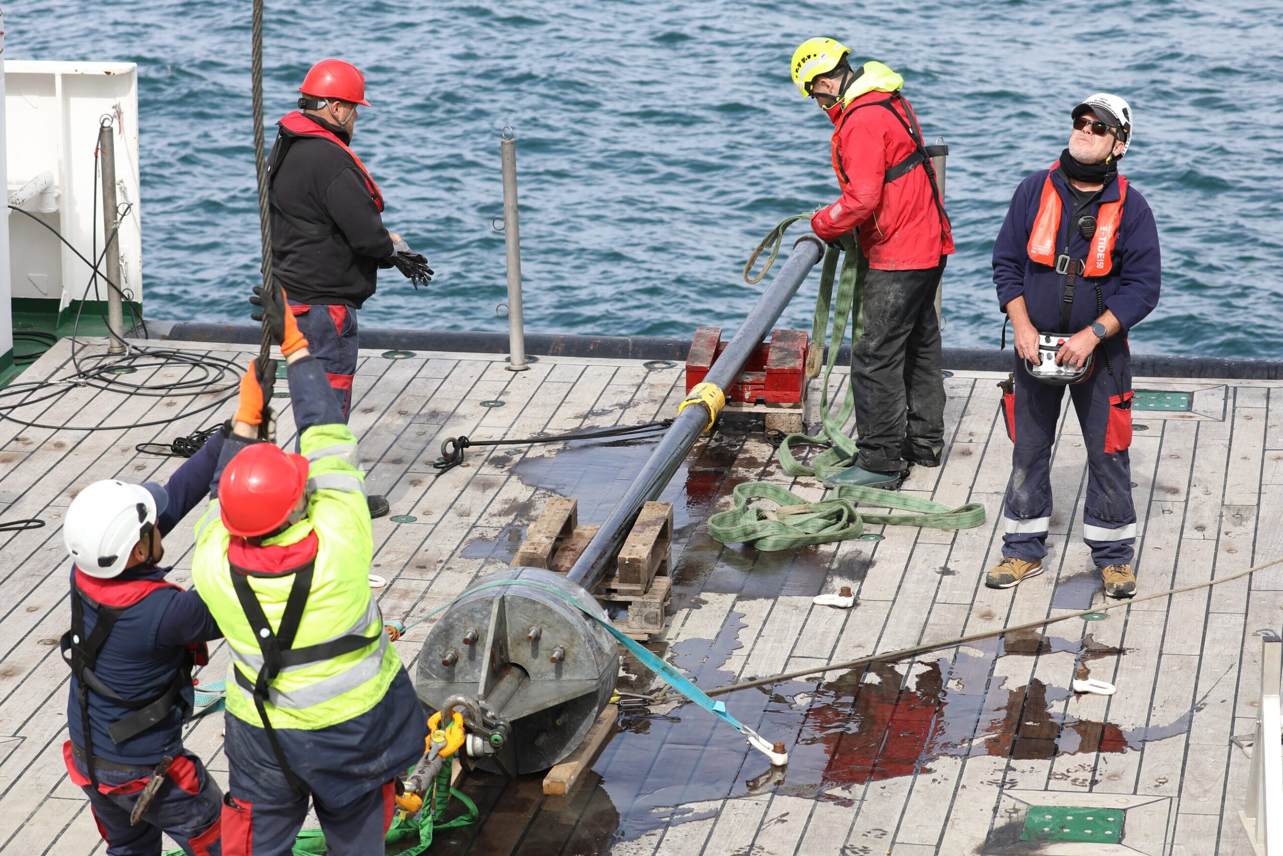
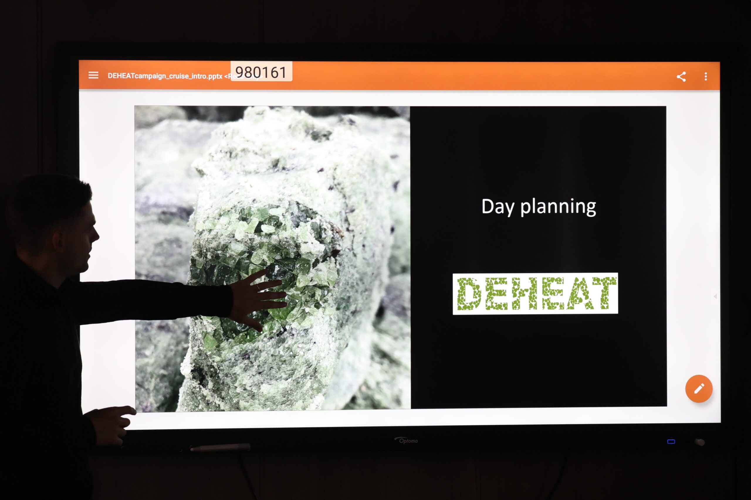
28 June 2023 – Three down, two to go! As if the Van Veen grab, the box corer and the GEMAX corer don’t provide the DEHEAT-team with enough sediment samples to learn to understand the bottom of Hvalfjördur and the biogeochemical processes taking place in it, the scientists are sending two additional types of devices to the bottom to collect even more sediments.
The first is the long gravity corer, that essentially consists of a narrow corer of 3m in which a sampling tube is fitted – or two such corers and tubes combined, totaling 6m – and a huge weight to drive the corer into the seafloor (hence ‘gravity’ corer). This way, much deeper sediment layers are cut than with the other techniques, with deeper meaning older. The long cores allow the sedimentological history of the seabed to be reconstructed and to unravel a host of secrets from the past. In the case of DEHEAT and of the biogeochemists on board, this is obviously done with attention to how silicate weathering has evolved over time here, and how historical changes can be linked to climate-relevant processes.
A 6m long gravity core arrives safely back on deck after a successful sampling event.
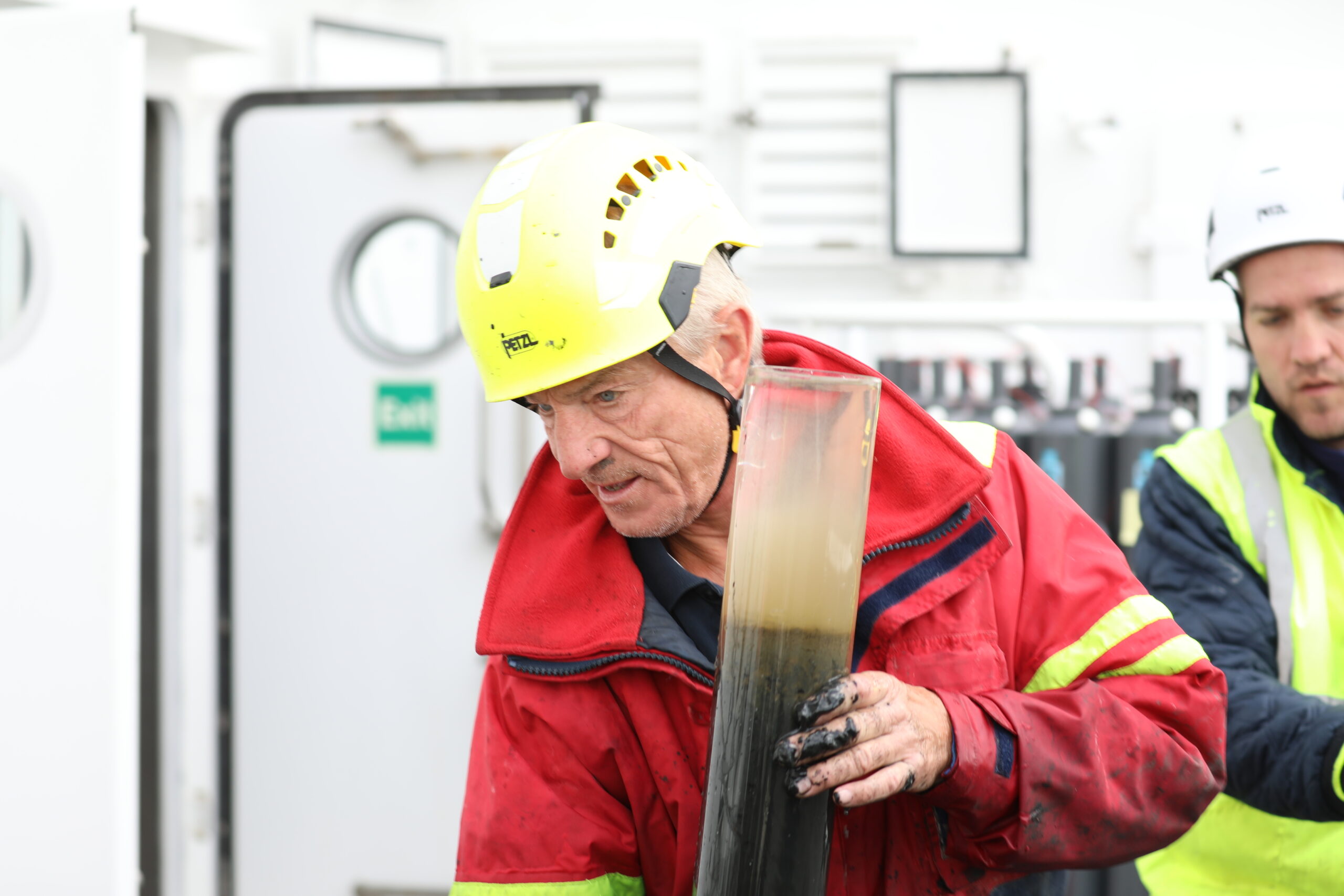
Christian März, Professor for General Geology at the University of Bonn, is especially interested in the deeper part of the sediments, and therefore depends on the long cores. By studying these, he can determine how the composition of the sediment changed over time and how these changes affected the cycling of essential elements like carbon, metals and nutrients in the seafloor. By studying past environments from the sedimentary records, climate change signals can also be extracted.
“It is also exciting to dive deeper into the topic of silicate weathering, a new and quite hip topic due to the need to stop and reverse global warming. Through this link, my colleague Katrin Wagner and I got offered the opportunity to join the expedition with RV Belgica in Iceland as collaboration partners of the DEHEAT project. As such, we bring in our expertise both for the benefit of our and the DEHEAT research” Christian explains.
However, deploying and retrieving the long gravity corer is anything but an easy task. And once in the water, the actual sampling of the bottom does not prove to be easy either. Indeed, the multi-purpose and interdisciplinary RV Belgica is not perfectly equipped for this particular type of sampling. It takes a lot of inventiveness and advancing insight to get the procedure right, but the highly motivated crew succeeds and regularly delivers usable ‘long cores’ to the scientists.
An elated Christian after several attempts to get a good long core.
Christian: “The long gravity corer cannot be deployed over the sides of RV Belgica, so this has to be done from the stern. If swell causes the amplitude of the movement of the stern to be bigger than the accuracy with which the position of the corer in relation to the depth of the seabed is known, it is nearly impossible to successfully apply this method. We sometimes have to try several times but in the end manage to secure good cores thanks to the crew”. He adds laughingly: “This is why I like working in the central arctic so much. There, the ice prevents the ship from moving and allows us to work more accurately”.
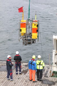
Finally, there is a fifth way by which sediment is brought to the surface during the DEHEAT cruise: the benthic lander. However, it would be irreverent to wear this unit down as a simple ground grabber. After all, the lander does much more than that. It is a platform that is sent down in the deep to take measurements on the seafloor itself, and that is equipped with so-called ‘benthic flux chambers’ that measure the flow of substances between the seafloor and the water above it. It stays on the seafloor for one or several days while the DEHEAT-scientists proceed and sample at another station, and carries out the pre-programmed actions while storing the resulting data in a battery-driven data logger.
The benthic lander that is used during the DEHEAT-expedition belongs to the University of Gothenburg, Sweden, that employs a true benthic lander guru in the form of Mikhael Kononets. It is almost inconceivable that the lander would be deployed without Mikhael being present to oversee the operation, so the Royal Belgian Institute of Natural Sciences arranged a contract for him for the duration of the RV Belgica adventure in Iceland, as well as for the subsequent expedition in Greenland. He boarded in Galway, Ireland, and was continuously engaged with the lander throughout the transit to Iceland as well as during the two-day stay in Reykjavik. Mikhael and the lander seem intertwined, and he did not even set foot on Icelandic soil but kept busy with making sure that the lander is fully ready for its duties on the RV Belgica. “It’s only concrete, that’s the same everywhere, isn’t it?” he jests.
Retrieval of the benthic lander.
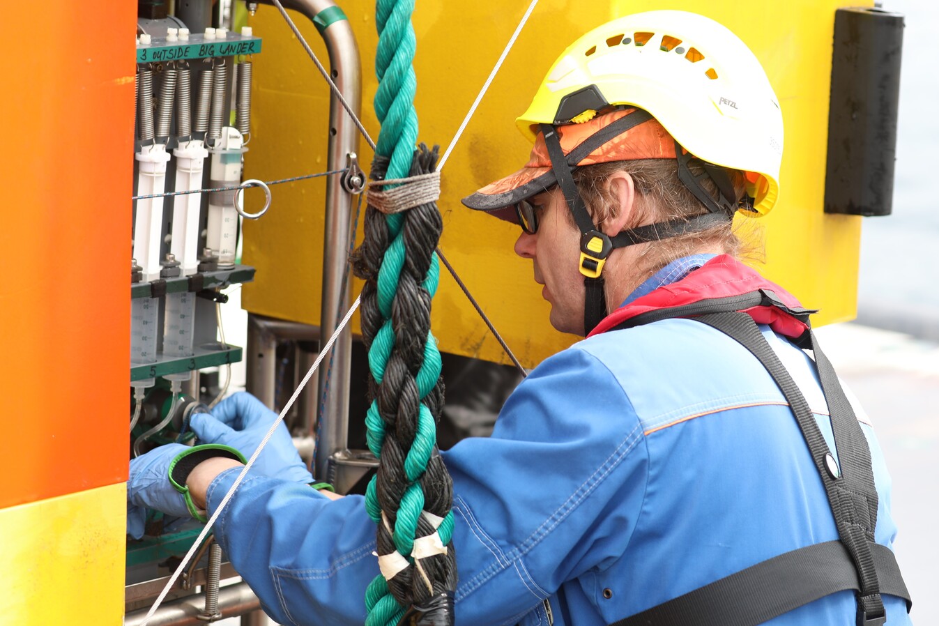
There is some work involved in deploying the lander from RV Belgica, and especially in retrieving it. Mikhael explains how this works: “Deploying the lander is not so much the problem. It can be lifted over the side, after which ballast causes it to sink to the seabed. Old pieces of railway track, which were donated to us by the Swedish company Stena Recycling, are used as ballast in this case. After the lander has done its job, we activate the decoupling mechanism with an acoustic signal via a hydrophone, whereupon the styrofoam-filled compartments cause it to rise back to the surface. The railway tracks remain behind, which is not a problem as primary production in the sea is limited by the availability of iron”.
Only then does the hardest work begin, getting the lander back on board. Mikhael: “First, the floating lander must be spotted. We usually know its position very accurately, but if we cannot see it immediately – due to wave action, for example – we can still determine in which direction to look using a simple radio signal. Once found, the lander is then carefully towed by RHIB (rigid-hulled inflatable boat) to near the stern of the RV Belgica, from where he can then be hoisted on board. The time elapsing during the calling and ascent of the lander through the water column can sometimes be nerve-wracking … after all, there are known cases of landers lost for eternity …”.
Mikhael working on the benthic lander.
For launching this wide variety of sampling equipment, for the actual sampling of the water column and the bottom, and for retrieving the equipment again, it is obviously very important that the platform on which these operations take place is very stable and remains very accurate on site. For the first, the RV Belgica is indeed a very stable vessel but wind and wave action are also important and one also depends on the swell. For the second, the so-called Dynamic positioning system comes into play. Dynamic positioning is a computer-controlled system to automatically maintain a vessel’s position and heading by using its own propellers and thrusters. The DEHEAT-team is blessed: all sampling is proceeding as planned in Hvalfjördur thanks to favourable conditions and the RV Belgica’s Dynamic Positioning. Fingers crossed that this will continue to be the case later on the continental shelf.
Now, don’t get us wrong, the soil sampling techniques mentioned are not only used on the day they are described in this blog but are part of the routine of every day. The same goes for the CTD reviewed earlier, and for many of the operations and analyses that will follow.
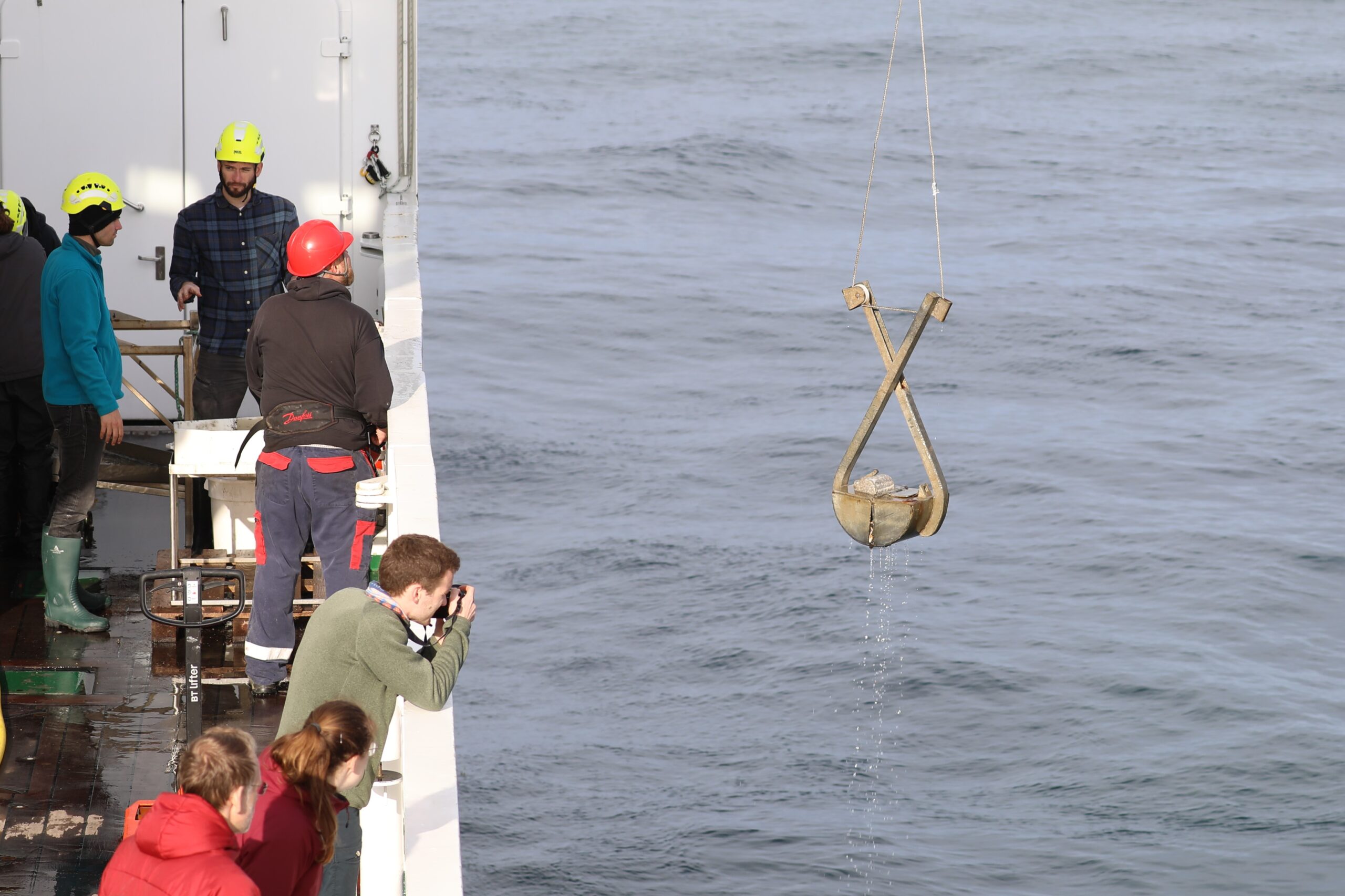
27 June 2023 – How many ways can one think of to bring mud from the seabed to the surface? As many as five are applied during the DEHEAT campaign with RV Belgica, all designed in different ways but with one common goal: bringing samples of the precious mud, its inhabitants and chemical gradients, to the scientists without them having to get wet! However, avoiding them getting dirty cannot be guaranteed! Admittedly, it is better to speak of ‘sediment’ instead of mud, because technically it is not always mud that is brought to the surface. Just as one water was not the other, neither is one sediment the other.
Let’s start with the simplest low-tech method, which is usually the first sediment sampler deployed on any new sampling station during the DEHEAT campaign: the Van Veen grab (or simply theVan Veen). Once the CTD is back on board, that is. This tool is nothing more than a clamshell bucket made of stainless steel that is spread open like scissors while it is let down through the water column. The locking mechanism is released when it touches the sea bottom, making the bucket halves close and grab a sediment sample when the device is pulled back upwards.
Van Veen grab
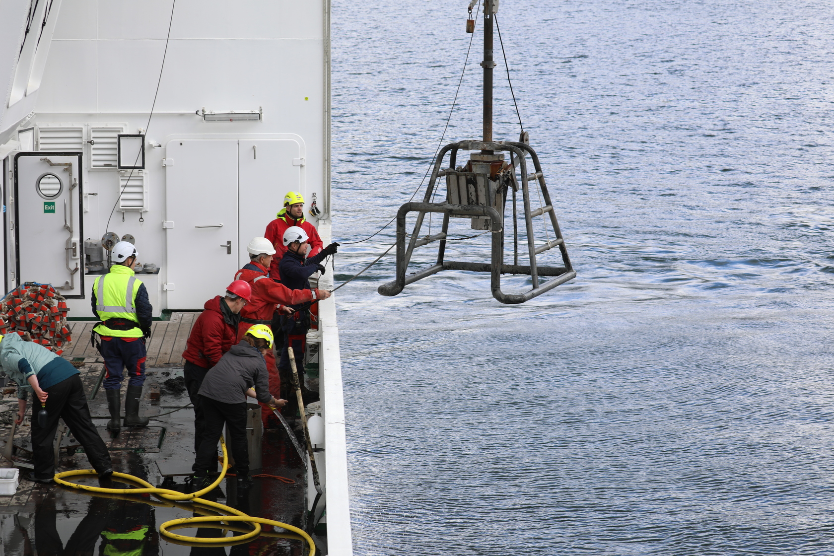
In the extended sampling scheme, a box corer is usually sent towards the seafloor when the Van Veen grabbing has been completed. This can be done once or multiple times, depending on the sampling needs. From a technical perspective, the box corer is also a rather simple sediment coring device, essentially consisting of a cylindrical core that relies on a weight to aid the cylinder to penetrate into the bottom and on a spade that seals the core from below to prevent the sample from being lost when the unit is lifted back to the surface.
Box corer
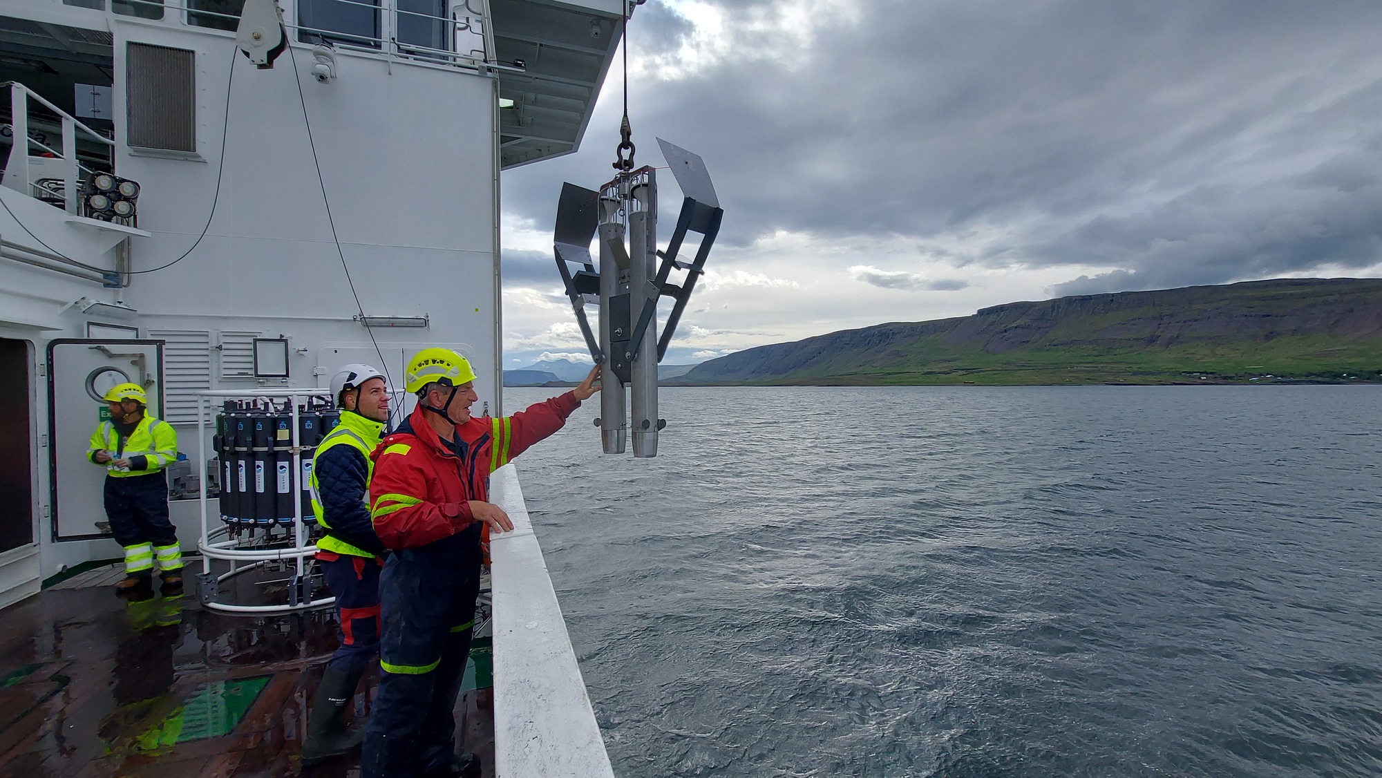
Next on the programme comes deploying the GEMAX corer. This one looks a bit like a double torpedo with wings (see photo, showing the device before it is lowered to the seafloor) where tubular sampling containers are inserted into the two cores to be taken out – hopefully filled with sediment – after retrieval.
GEMAX corer
Unlike the Van Veen grab and the box corer, the GEMAX is not deployed just once or a couple of times at every sampling station, but up to 22 cores are collected per location.
Per Hall, marine biogeochemist and emeritus professor at the University of Gothenburg, explains: “The GEMAX takes more undisturbed cores and therefore delivers a more representative sediment sample than for example the box corer. The latter disturbs the sediment more, for several reasons. One is that it has a very big ‘bow wave’ which may blow away particles from the sediment surface. Also, the sediment within the box may be more disturbed, there may be cracks in it, there may be water coming between the box wall and the sediment. That is often fine, like if you’re going for fauna samples, but if you want undisturbed chemical gradients in your cores as is needed for many of the DEHEAT biogeochemical analyses, the GEMAX is a far better choice. So, the choice of corer all depends on the purpose of your sampling.”
Per is a senior academic who is not averse to dirty hands. “Although I am officially retired, I still do part-time research because I remain interested in it and excited about it. Today, I am participating in this expedition on invitation of Sebastiaan, where I try to bring my expertise in throughout the entire chain from the practical aspects of the sampling to the discussions on the data“.
Per with a sample container from the GEMAX corer.
Saheed Puthan Purayil of the Royal Belgian Institute of Natural Sciences helps Per with the different sediment corers. He is a PhD in physical oceanography, and has extensive experience in ocean research, forecasting and modelling. But rolling up his sleeves was less of a part of these experiences.
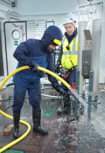
Saheed hosing down the GEMAX corer in between sampling sessions.
“I have been a part of many scientific expeditions at sea, and in some cases I had the position of chief scientist, but it is the first time that I am actually helping with taking sediment cores. I find it extraordinary to see how the cores are processed after we hand them over to other scientists, and how some data are already appearing during the expedition” he says.
Saheed clearly enjoys being part of the DEHEAT expedition: “It’s also a fun and engaging expedition, with scientists of so many different fields of expertise, institutes and nationalities, and a wonderful ship and crew. And everybody is very friendly!”
All the abovementioned sediment corers, as well as the CTD, are deployed over the starboard side of RV Belgica, using a crane and winch specially installed for deploying such instruments.
The CTD actually has it’s own hangar and deployment system, as you don’t want the sediments flying around contaminating the valuable water samples. Just kidding! Of course, the sediments are also handled with great care. But when hosing down the corers between sampling sessions (as even residual sediments from one sampling must not affect the next) it is not inconceivable that some sediment could get onto the CTD-rosette or into the water samples. And for the scientists carrying out the accurate and clean CTD sampling, it is also more correct and pleasant work in bad weather conditions.
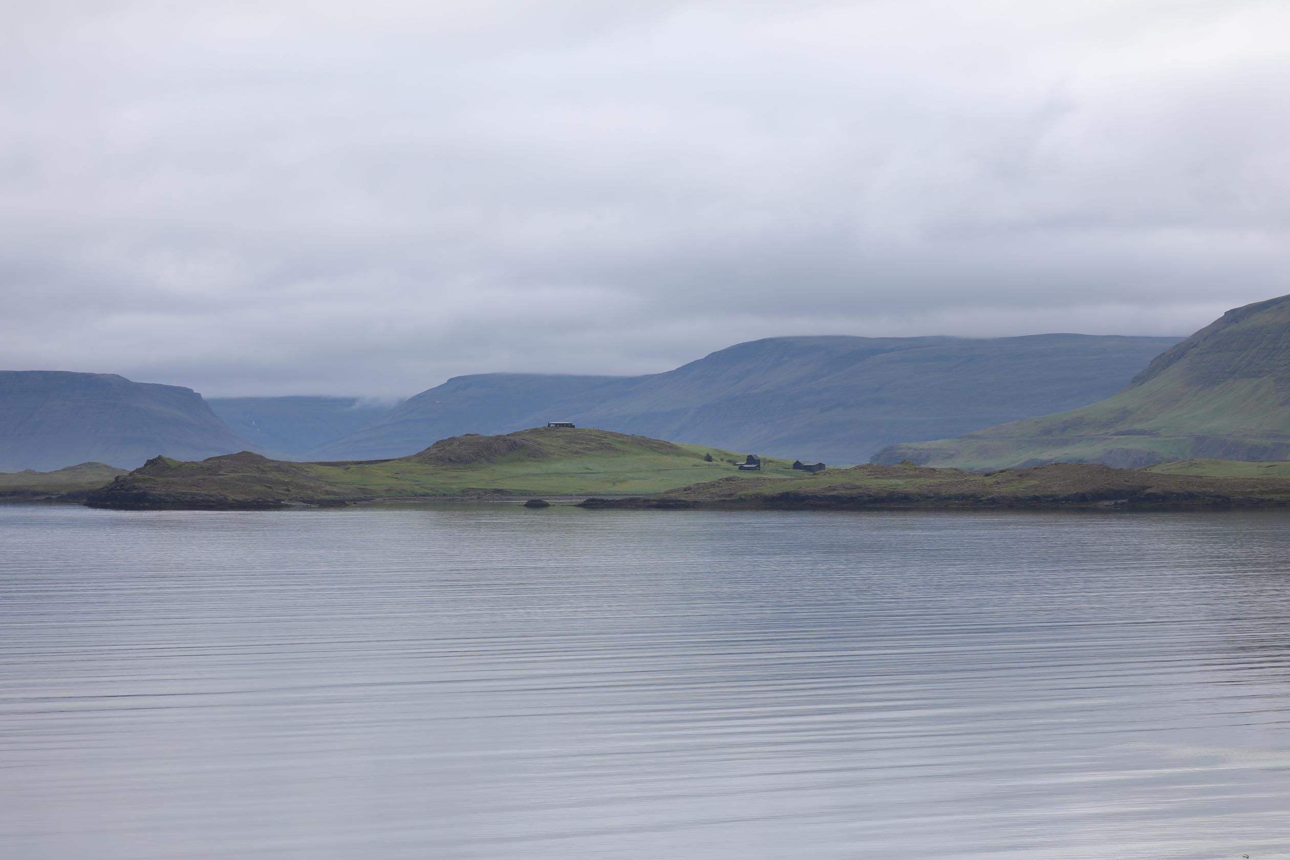
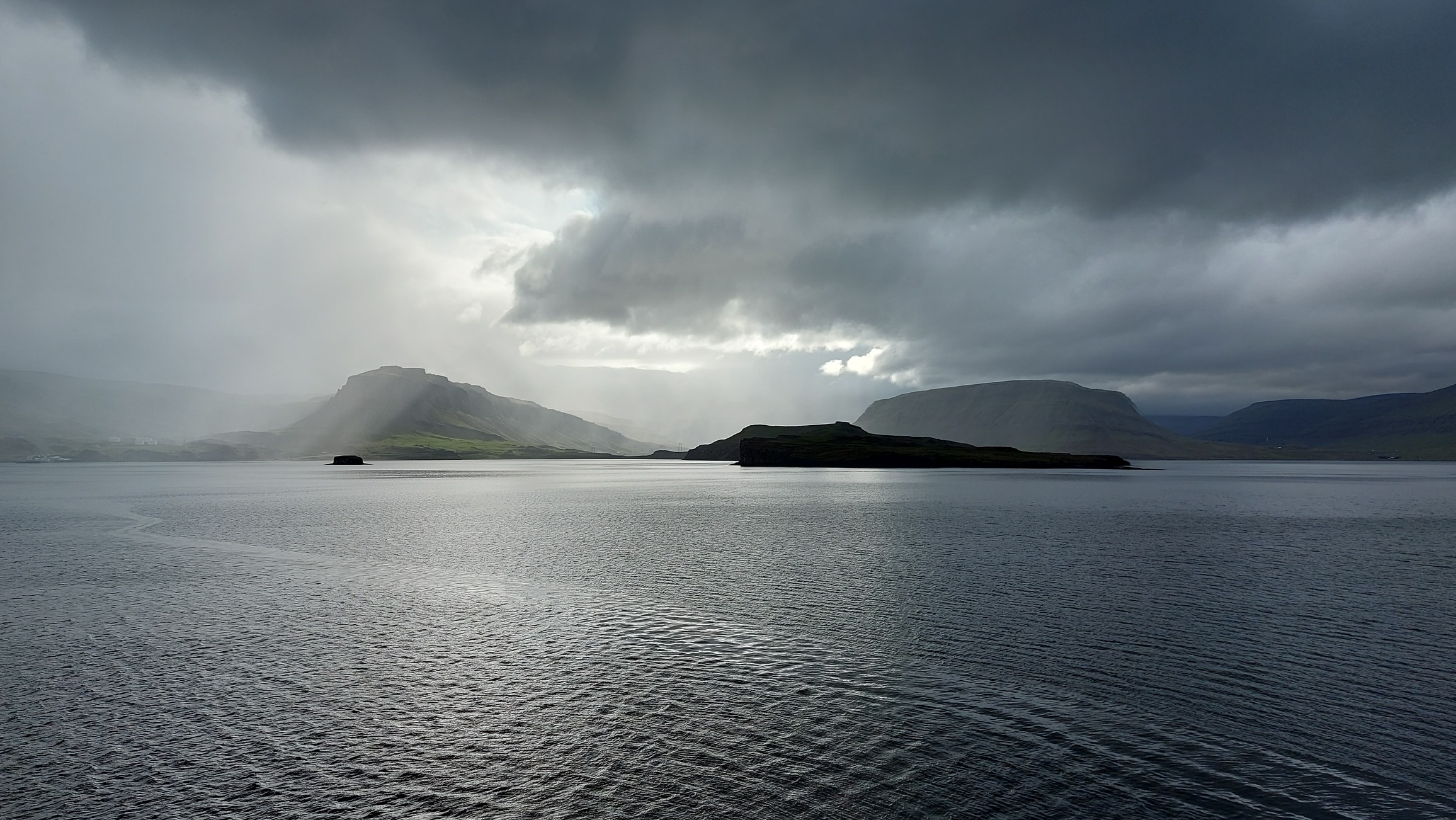
Talking about the weather, we were warned that the weather in Iceland can take any form in summer too. Today we witnessed that, with alternating sunshine, clouds, fog, a gust of rain and even a flake of snow. But Hvalfjördur remained as dramatically beautiful in all these conditions!
It is a pleasure to work in the fantastic scenery of the Hvalfjördur.
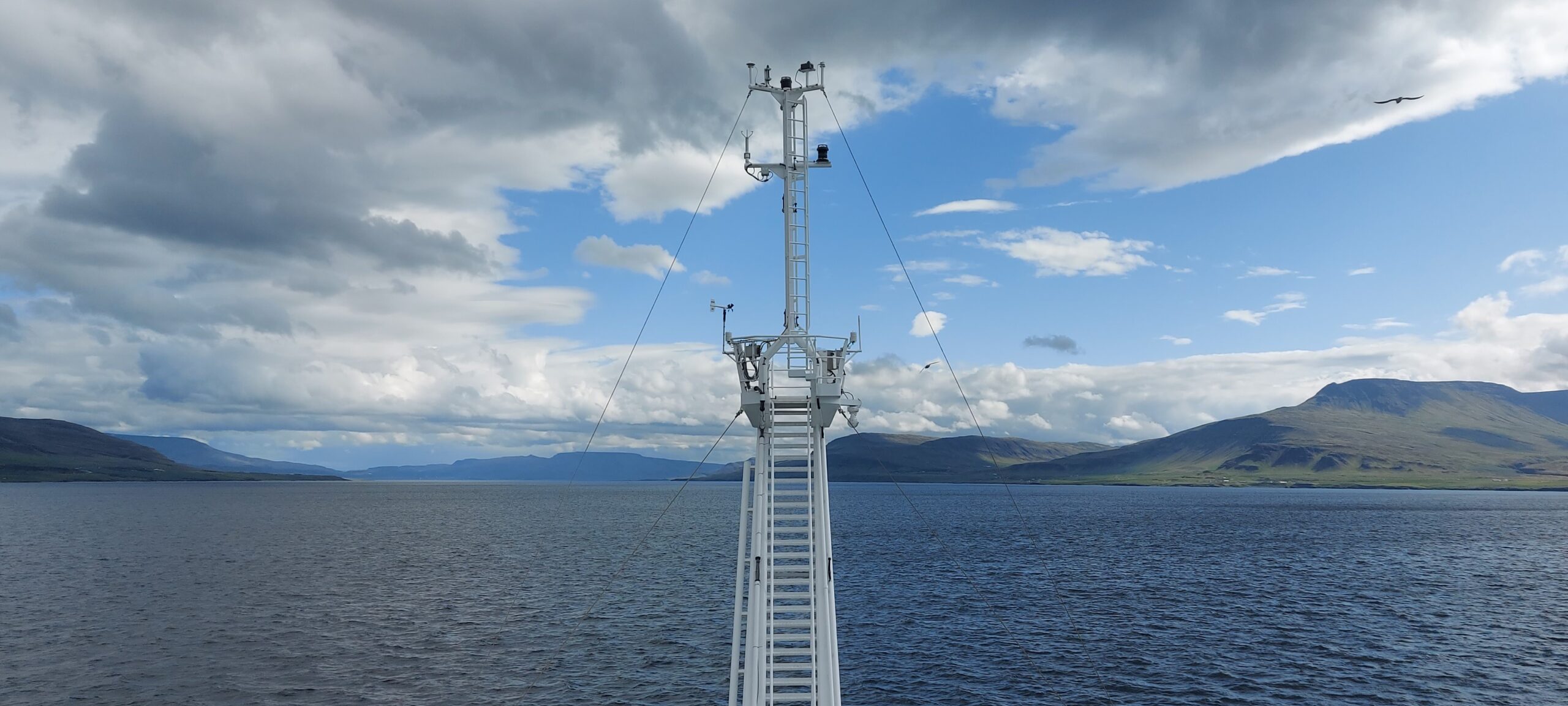
26 June 2023 – There is pleasant excitement on the RV Belgica this morning, as the ship leaves Reykjavik harbour and steams to the first sampling station. No far journey ahead, as the first days of the expedition will be spent in a fjord just north of the Icelandic capital. The fjord in question is the Hvalfjördur, literally translated as the ‘whale fjord’. It only takes less than two hours to arrive at station HF3, which gets the scoop of being the first to be sampled. That first sampling is always a crucial moment, as it is definitely better for morale to start with a success. However, only one thing is certain at this point: the weather will certainly not be a killjoy! The water is calm, the wind absent, and there is pleasant sunshine.
RV Belgica sails into Hvalfjördur.
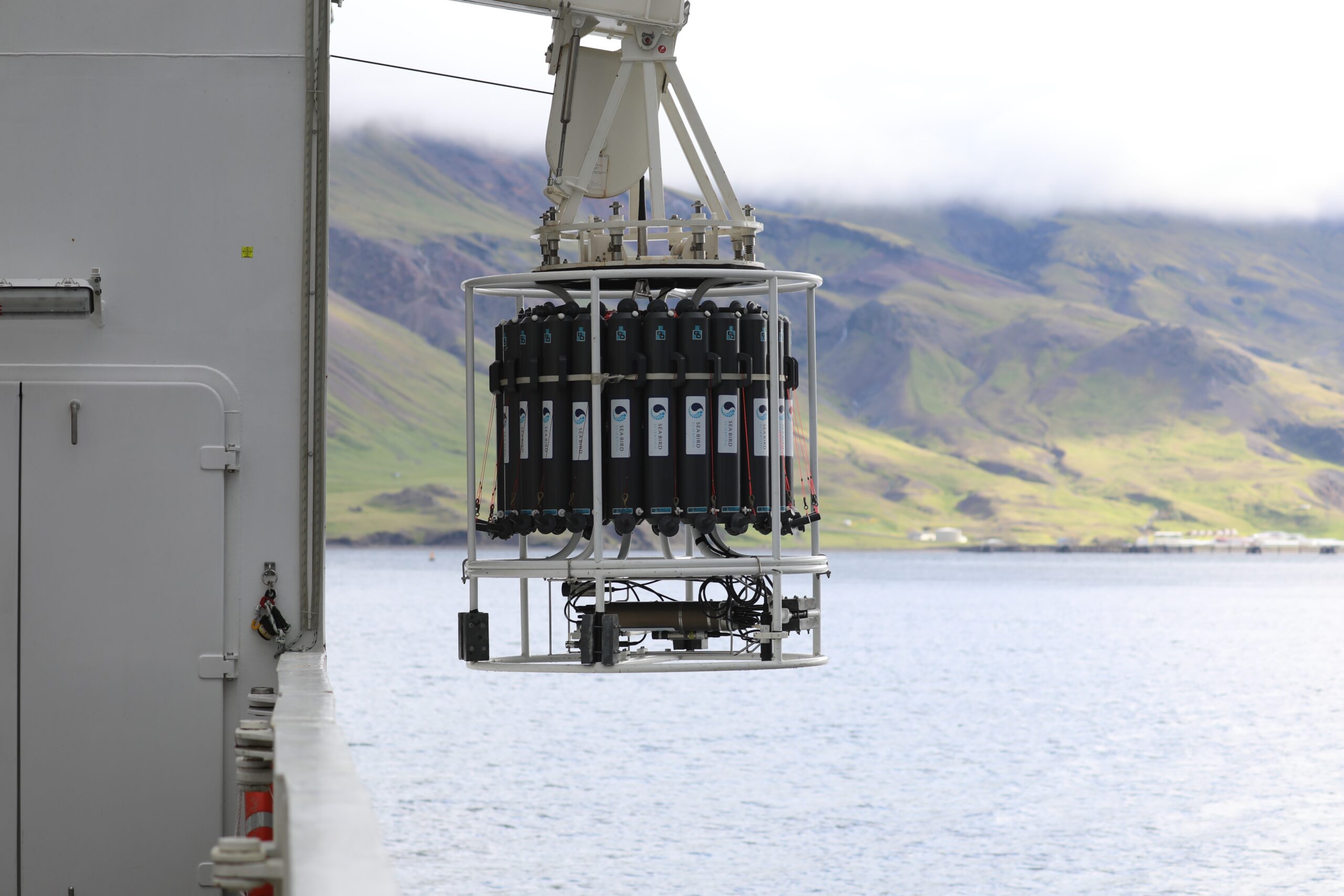
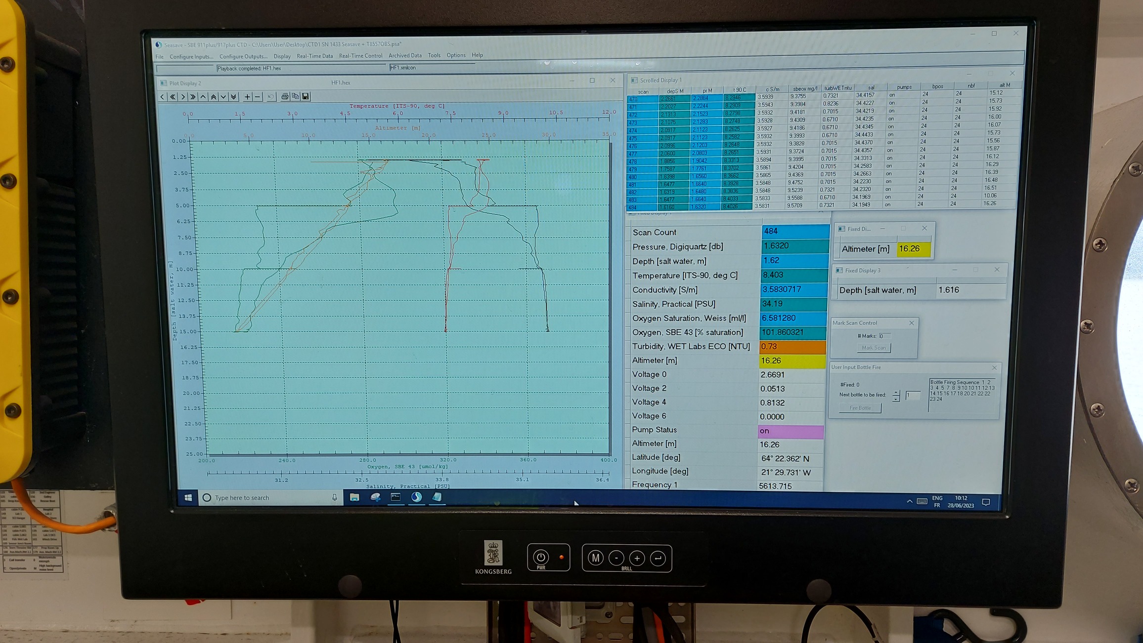
The DEHEAT campaign kicks off with a CTD deployment, which will become the regular start of activities at each sampling site. CTD stands for conductivity, temperature and depth, parameters that are measured by sensors that are incorporated in a construction that further includes 24 so-called Niskin bottles arranged in a rosette. For simplicity, we refer to the whole thing simply as ‘CTD’.
The rosette with 24 Niskin-bottles and CTD-sensors leaves the dedicated CTD-hangar of RV Belgica.
The CTD-construction is an essential oceanography instrument. As the CTD descends through the water column to just above the bottom, the depth and the changes in temperature, salinity and oxygen content of the water can be monitored in real time on a computer screen. Depending on the course of these parameters, the scientists will decide at which depths water samples will be taken. That is where the Niskin bottles come in, as they can be closed remotely one by one with a simple mouse click. This is done during the rosette’s journey back to the surface.
Real-time monitoring of temperature, salinity and oxygen content to determine at what depths the various Niskin bottles will be closed.
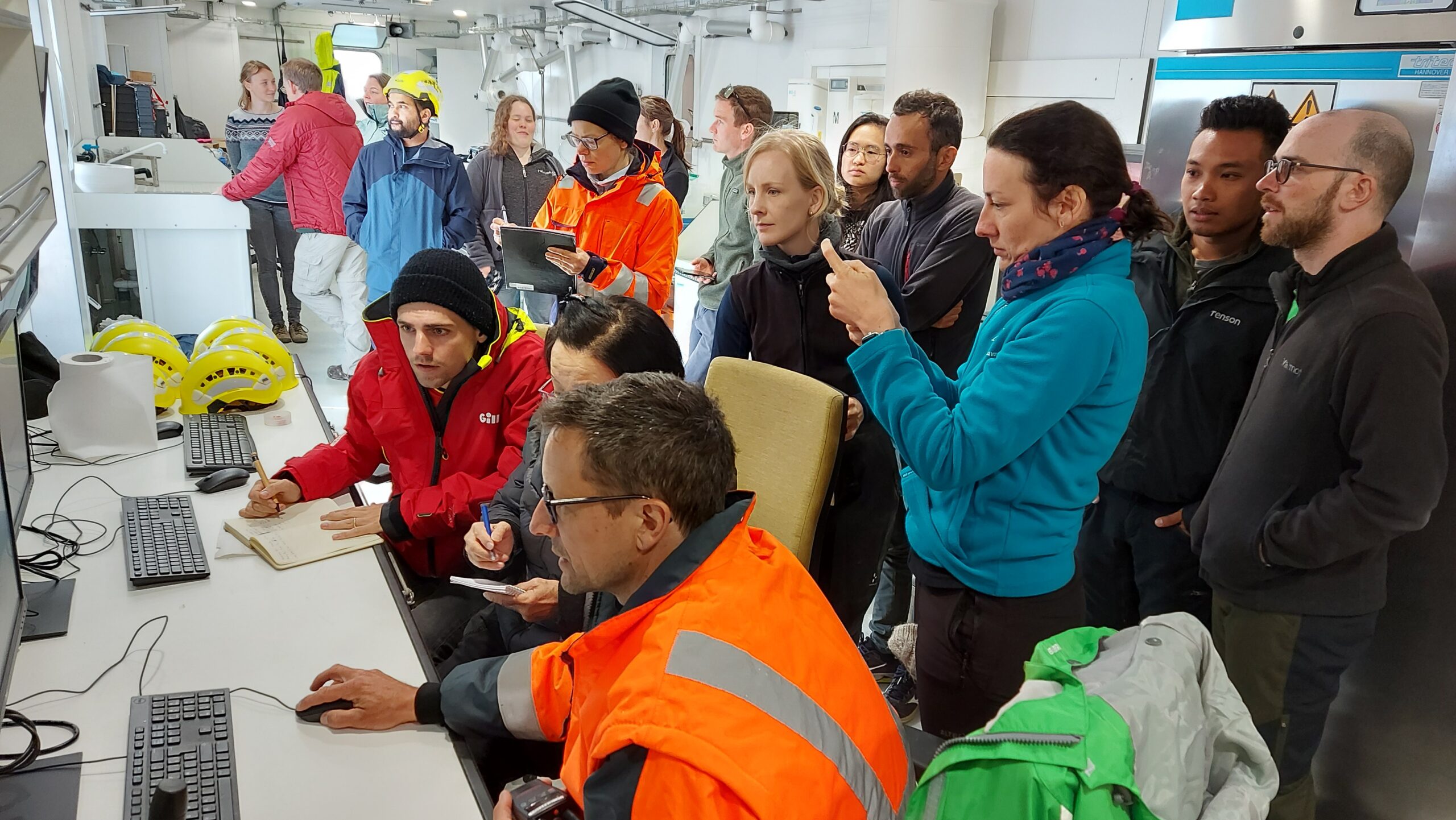
During the first trip of the CTD to the bottom and back up, the wet lab where the computer on which the CTD parameters are monitored was particularly crowded. Everyone wanted to personally witness the very first data that appeared during the DEHEAT expedition. In the following days, this moment will be much less attended. Of course, this has nothing to do with a loss of interest but is entirely due to the fact that during the very first CTD, no other activities had yet started. Things will be very different at subsequent stations, and the timing of activity from different scientists will also be increasingly divergent as a result.
A very busy wet lab during the first CTD measurements.
Later, it will therefore mainly be some regular faces who will be present at every CTD, make the decisions on water sampling and close the Niskin bottles. Besides DEHEAT chief scientist Sebastiaan van de Velde, the permanent CTD team consists of Kate, Lei and Felipe. It is also they who will eventually sample the contents of the Niskin bottles in different ways for different purposes.
A decent administration is involved as everyone on board wants their share of the water, and one water turns out not to be the other … There is a need to collect samples for determining alkalinity, dissolved inorganic carbon, nutrients, Silicium, metals, oxygen, Magnesium & Strontium, salinity, … and all of these samples are needed in different volumes, need to be stored in different recipients, require different processing and need to be brought to different places on the ship. To complicate matters further, some samples have to be collected only in the fjord, or later only on the shelf, or only at certain depths, and various expedition participants come with large or even larger bottles to get their share of water as well …
The important task of keeping record, not only for CTD sampling but for just about all samples taken during the expedition, falls to Kate Hendry. Kate is an ocean climate scientist, chemical oceanographer or biogeochemist at the British Antarctic survey. She is part of the science and steering groups of DEHEAT, and has also been designated as the expedition’s second chief scientist.
Kate Hendry (British Antarctic Survey) serves as co-chief scientist and general data manager during the DEHEAT expedition with RV Belgica.
Kate explains what that means: “The co-chief scientist position involves being there as a sanity check and a sounding board for the chief scientist. On an expedition like this, there is a lot to think about and keep an eye on, and there are a lot of important decisions to be made. My task is to come up with ideas, suggestions, alternatives, solutions to any problems that may arise. But to be honest, Sebastiaan is doing such a great job, so it’s not been too bad for me at all, it’s all running very smoothly”.
On the task of keeping track of all that’s going on, she adds: “Next to the science, I’m focusing on the data management, looking after the paperwork, making sure everything is archived. The last thing you want is some critical paperwork going missing, so I make sure everything is scanned and archived. This sometimes turns out to be even useful months or years after a cruise, when something confuses or puzzles people, creating a need to go back to the vital original logs”.
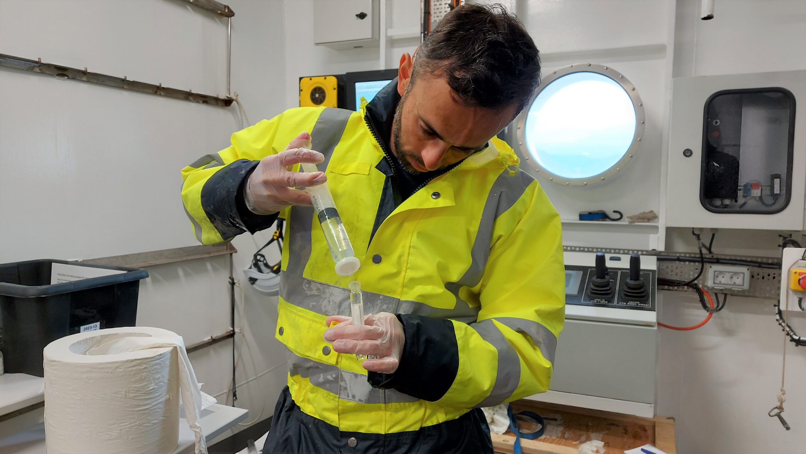
Back to the CTD sampling now. Felipe Sales de Freitas, chemical/geochemical oceanographer and postdoctoral researcher at the Université Libre de Bruxelles, is directly involved in the DEHEAT project and takes care of what can be considered the ‘small volume CTD sampling’ for a whole range of goals, most of which require the water from the Niskin bottles to be filtered.
“But first we have to go through the sacred ritual of rinsing every recipient or sampling tool three times with the actual water that is going to be sampled” he laughingly explains. “Next, we squeeze water through syringes and filters until our thumbs are completely cramped”.
Felipe further explains his role in the DEHEAT Belgica expedition as follows: “In this expedition, I am basically an extra pair of hands in various sampling actions because of my experience in field sampling and analysis. Later on, I will use a lot of the output data of the sediment coring and water analysis for the DEHEAT geochemical modelling”.
Felipe Sales de Freitas (ULB) during the processing of CTD water samples.
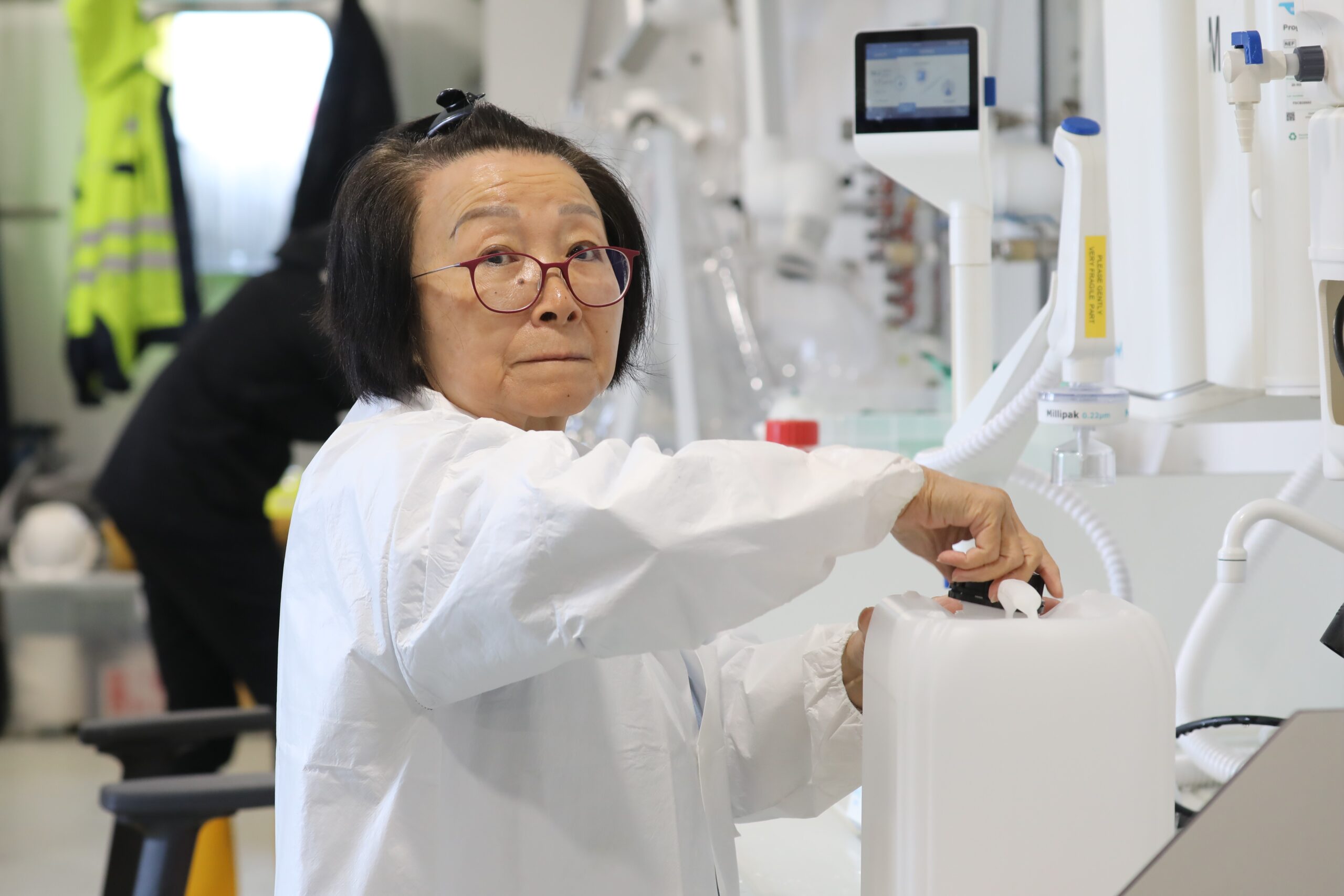
Lei Chou, meanwhile, drags larger containers back and forth between the Niskin bottles and a more sophisticated filter setup that she provided herself, that is better suited to filtering larger volumes. She is a marine biogeochemist and emeritus professor of the Université Libre de Bruxelles and remains active and connected to both research and training of students.
Lei had very little time to prepare for the DEHEAT expedition but is making the most of it: “I was offered a berth on RV Belgica only weeks before the start of the expedition when a place suddenly opened due to the cancellation of another participant. I had to move quickly, sending two suitcases of equipment to Reykjavik as the Belgica had already left its home port of Zeebruges. After all, I want to take the opportunity to collect additional samples for suspended matter content, nutrients, metals and chlorophyll to complement the already very ambitious DEHEAT plan”.
Lei Chou (ULB) during the processing of CTD water samples.
We can rest assured that Icelandic seawater will hold far fewer secrets after the analysis of the DEHEAT samples.
25 June 2023, 17h00 – It would be untrue to claim that preparations for an expedition at sea begin on the day participants embark. In reality, the preparations have been going on for a very long time, from thinking out the concept, writing the project proposal, preparing and submitting the application to use the chosen ship, to the concrete practical preparation of the expedition.
That last step is a titanic task, especially for an expedition with a large international character like the DEHEAT expedition. After all, materials had to be sent from various European locations to Zeebrugge and Reykjavik, everything had to be given a logical place on board, and a whole range of sampling equipment and laboratories also had to be prepared and set up so that they could be fired up into action immediately after the start of the actual expedition. In fact, a number of scientists already came on board in Galway for this purpose, to make the necessary preparations during transit from Ireland to Iceland.
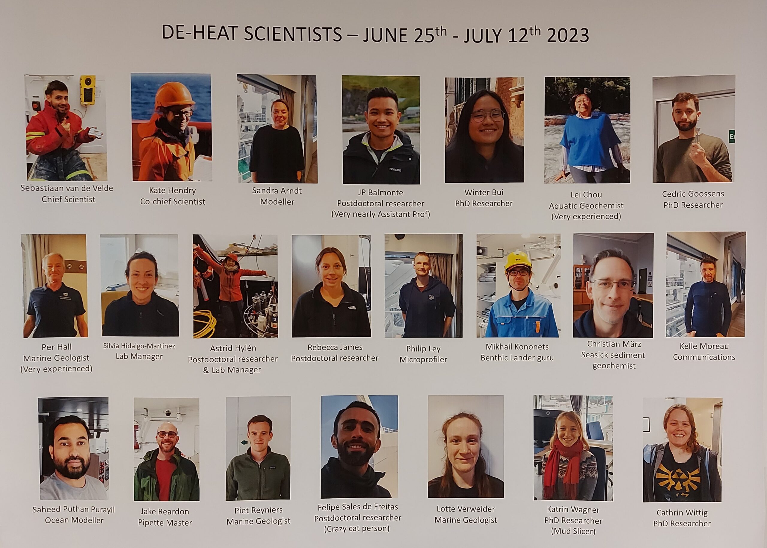
But today the big day has finally arrived: all the scientists who will take part in the DEHEAT Iceland expedition are now casting their first glance at the RV Belgica, discovering the ship on which they will spend 17 nights and spend the intervening days giving their best.
There are 22 of them, coming from universities and institutes from Belgium, the UK, Germany, Denmark and Sweden, but representing many more different nationalities. Some have worked together before during previous collaborations, but there are also many new faces.
No superfluous luxury to compile a photo overview with names, which immediately also makes it clear to the RV Belgica’s regular crew who is who. The overview is hung in the mess, just about the only place on board where everyone passes a few times every day. That way, everyone should see it regularly and be able to quickly connect names to the many faces!
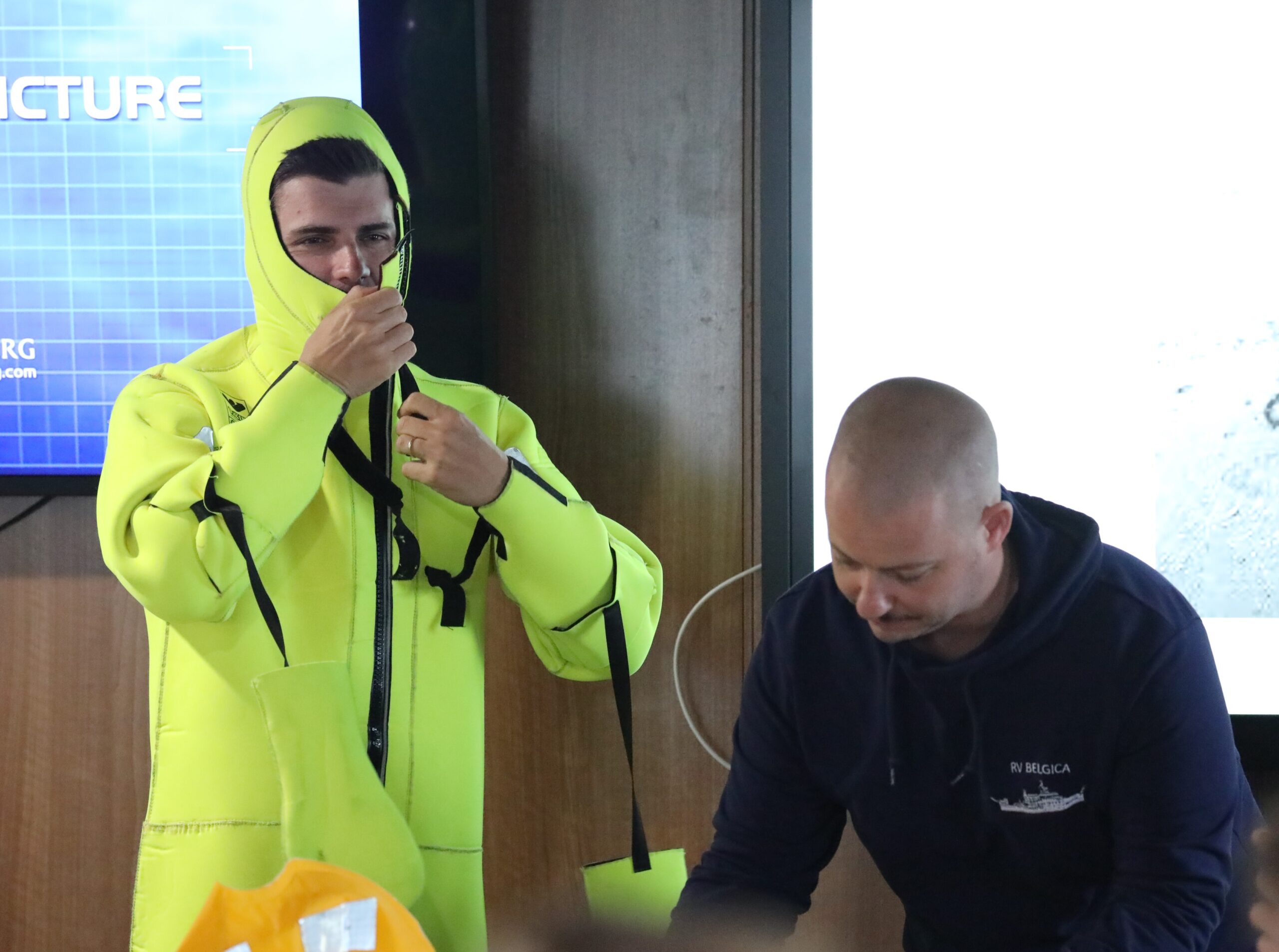
Setting sail is not scheduled until tomorrow morning, but the first evening on board is immediately filled with great meaning. First of all, there is the necessary safety briefing by chiefmate Sam, during which everyone is informed on the various safety procedures and the expected conduct on board. We also all had to squeeze ourselves into a rescue suit, which at times produced hilarious scenes.
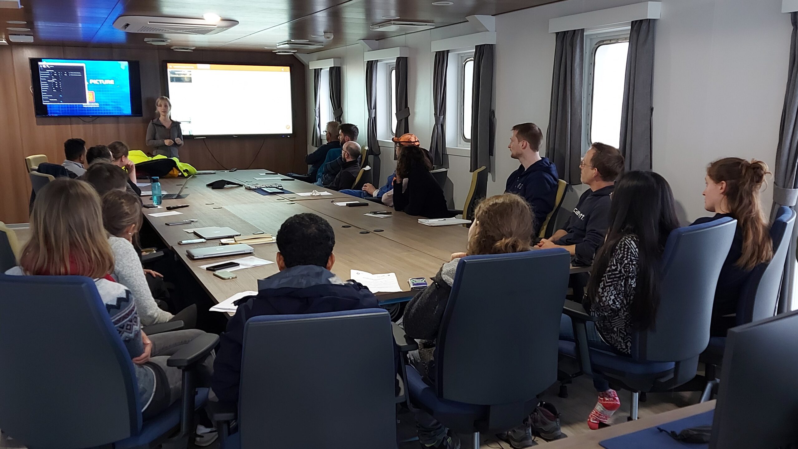
Next: the scientific order of the day. Chief scientist Sebastiaan summarises the set-up of the DEHEAT project, focusing of course on the crucial role of the RV Belgica expedition. Also the course and activities of the first sampling day are reviewed in detail.
Not only the deck, but also the RV Belgica’s labs will be fully staffed during this expedition. Proper organisation is indispensable to ensure everyone can work efficiently. Laboratory manager Astrid therefore takes the floor to explain the procedures and make proper arrangements.
On 26 June 2023, an international team of scientists embarked on the first arctic mission of the new Belgian oceanographic research vessel RV Belgica. They boarded in the Icelandic capital Reykjavik and will spend 16 days in the fjords and on the continental shelf of Iceland investigating the possibilities of reducing the concentration of atmospheric carbon dioxide by enhancing the weathering of silicates in the ocean. This process has potential to contribute to the active mitigation of the ongoing global warming.
Climate change is one of the biggest global challenges of the 21st century and urgently requires ambitious, transformative, and collective action to limit global warming. In 2015, representatives from 196 countries gathered at the United Nations Climate Change Conference in Paris and signed a historic agreement to limit the increase in global average temperature to below 2 degrees Celsius compared to pre-industrial levels.
Meanwhile, however, emissions of carbon dioxide (CO2) still continue to rise and have reached atmospheric concentrations that are unprecedented in at least the last 800.000 years. Humanity is now at the point where preventing emissions of carbon dioxide and other greenhouse gases to the atmosphere – the “conventional mitigation” – is no longer enough to achieve the ambitious goal. We also need to actively remove carbon dioxide from the atmosphere using negative emission technologies to meet the targets set in the 2015 Paris Agreement.
Enhanced Silicate Weathering
One promising approach among negative emission technologies is Enhanced Silicate Weathering. This process takes advantage of the natural weathering of silicate minerals, whereby silicate dissolution consumes atmospheric carbon dioxide and therefore helps to remove it from the atmosphere.
The concept of marine Enhanced Silicate Weathering involves distributing silicate minerals onto the seafloor of coastal oceans. Recent experiments have indicated that weathering can be accelerated in this way. The idea is that the increased availability of silicates, leading to a higher alkalinity of the ocean (a higher capacity of the water to resist acidification), will enhance the uptake of carbon dioxide, thereby reducing atmospheric carbon dioxide concentrations.
DEHEAT
However, it is still uncertain whether the high weathering rates observed in experiments actually occur in natural environments and how efficient the process would be in drawing down carbon dioxide. To address these uncertainties, a group of researchers from the Royal Belgian Institute of Natural Sciences (RBINS), University of Antwerp and Université libre de Bruxelles joined forces in the project DEHEAT ‐ Natural analogues and system‐scale modeling of marine enhanced silicate weathering.
“We aim at examining, for the first time, the feasibilityand efficiency of Enhanced Silicate Weathering under marine conditions, taking advantage of the coastal ocean as a large‐scale, natural biogeochemical reactor” says DEHEAT-coordinator Sebastiaan van de Velde, of University of Antwerp and RBINS. “A second critical issue concerns the potential side‐effects on marine ecosystems, both positive andnegative”, he adds.
With RV Belgica to Iceland
To shed light on these critical knowledge gaps, the DEHEAT-team put together a dedicated scientific expedition aboard the new Belgian research vessel RV Belgica to quantify the sediment geochemistry and mineralogy at a site that serves as a natural analogue for Enhanced Silicate Weathering: the continental shelf of Iceland, which is rich in basalt. Basalt is a volcanic rock that is suitable for the envisaged research in terms of silica content and weathering speed, so Iceland is an ideal place to visit in order to reach the objectives of DEHEAT.
The team, led by Sebastiaan van de Velde and expanded with scientific expertise under the form of colleagues and equipment of Ghent University, the British Antarctic Survey (United Kingdom), Universität Bonn (Germany), University of Southern Denmark (Denmark) and University of Gothenburg (Sweden), embarked on RV Belgica on Monday 26 June in the Icelandic capital Reykjavik. They will spend 16 days in fjords and on the Icelandic continental shelf and will return to Reykjavik on 11 July 2023.
During the expedition, the highly international and interdisciplinary team not only samples water, drills into the seafloor of Iceland and measures weathering rates in the sediment but also employs computer models to simulate seafloor weathering rates around Iceland. The collected data will then inform a large-scale virtual application of Enhanced Silicate Weathering in the Belgian North Sea using the COHERENS shelf sea model, that is designed for a wide range of applications in coastal and shelf areas and of which the development is led by researchers of RBINS.
During daily briefings in the conference room of RV Belgica, DEHEAT lead researcher Sebastiaan van de Velde (central back) evaluates the work of the day and informs all scientists on the sampling actions and experiments that are planned for the next day.
A Northern First
The scientific team’s ability to carry out this mission follows from the fact that the new research vessel Belgica is equipped for such interdisciplinary research and has a high enough autonomy to remain at sea uninterrupted for a sufficiently long time. From the moment the ‘new RV Belgica’ concept was conceived, bringing Arctic waters within the scope of Belgian and European research was an important objective. In this context, the documentation and research of climate change and the development of climate change mitigation measures were obviously key objectives, among other goals. To enable operations at the edge of the pack ice during the summer season, the RV Belgica even has light ice reinforcement.
RV Belgica’s northern journey to Iceland does not stand alone. Indeed, the ship left her home port of Zeebrugge as early as 6 June, first completing an expedition led by Ghent University’s Renard Centre of Marine Geology in which the sedimentary processes (past & present) offshore southwestern Ireland were studied, including in the area of the Belgica mounds (steep-flanked underwater mountains that were discovered using the previous Belgica). After a short stop in Galway (Ireland) and the transit to Reykjavik, the DEHEAT-leg of the international adventure kicked off. Next, RV Belgica will transit to Greenland where yet another scientific team will embark under the lead of the Marine Biology Research Group of Ghent University. They will investigate how climate change, and more specifically changes in glacial melt, will affect the carbon dynamics, biological communities and food webs in Greenlandic fjords, a typical Arctic marine ecosystem (project CANOE). The return of RV Belgica to Zeebrugge is foreseen for 13 August.
DEHEAT (as well as CANOE) is funded by the Belgian Science Policy Office (BELSPO) as beneficiary of a specific call that was designed to give an impulsion to the start-up of research on the new RV Belgica and to allow researchers to get to know the ship and her potential. DEHEAT runs from 15 December 2021 to 15 March 2026.
More information on RV Belgica can be consulted at the ship’s websites at RBINS (including live position information and webcam images) and BELSPO. The ship and its scientific activities can also be followed on Facebook and Twitter.
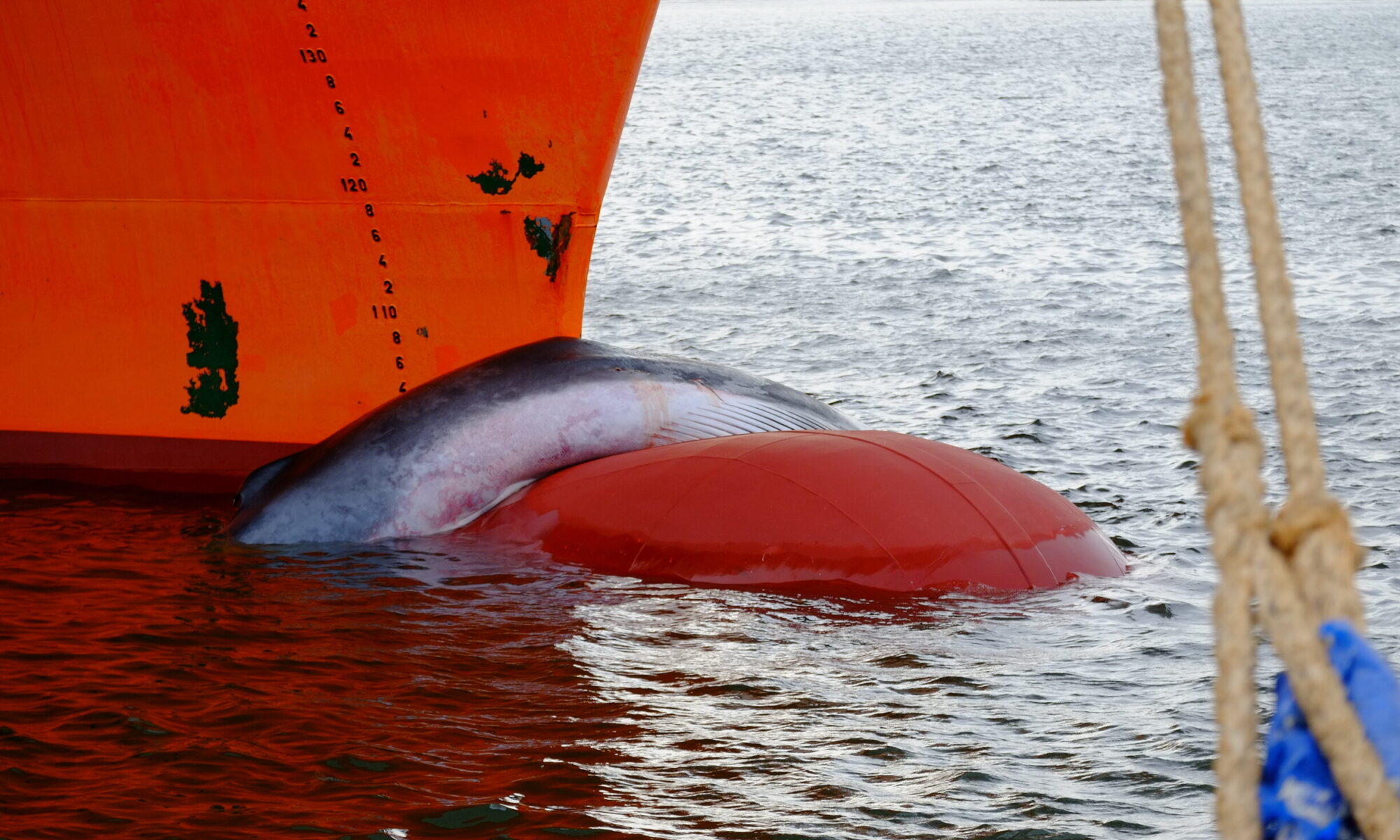
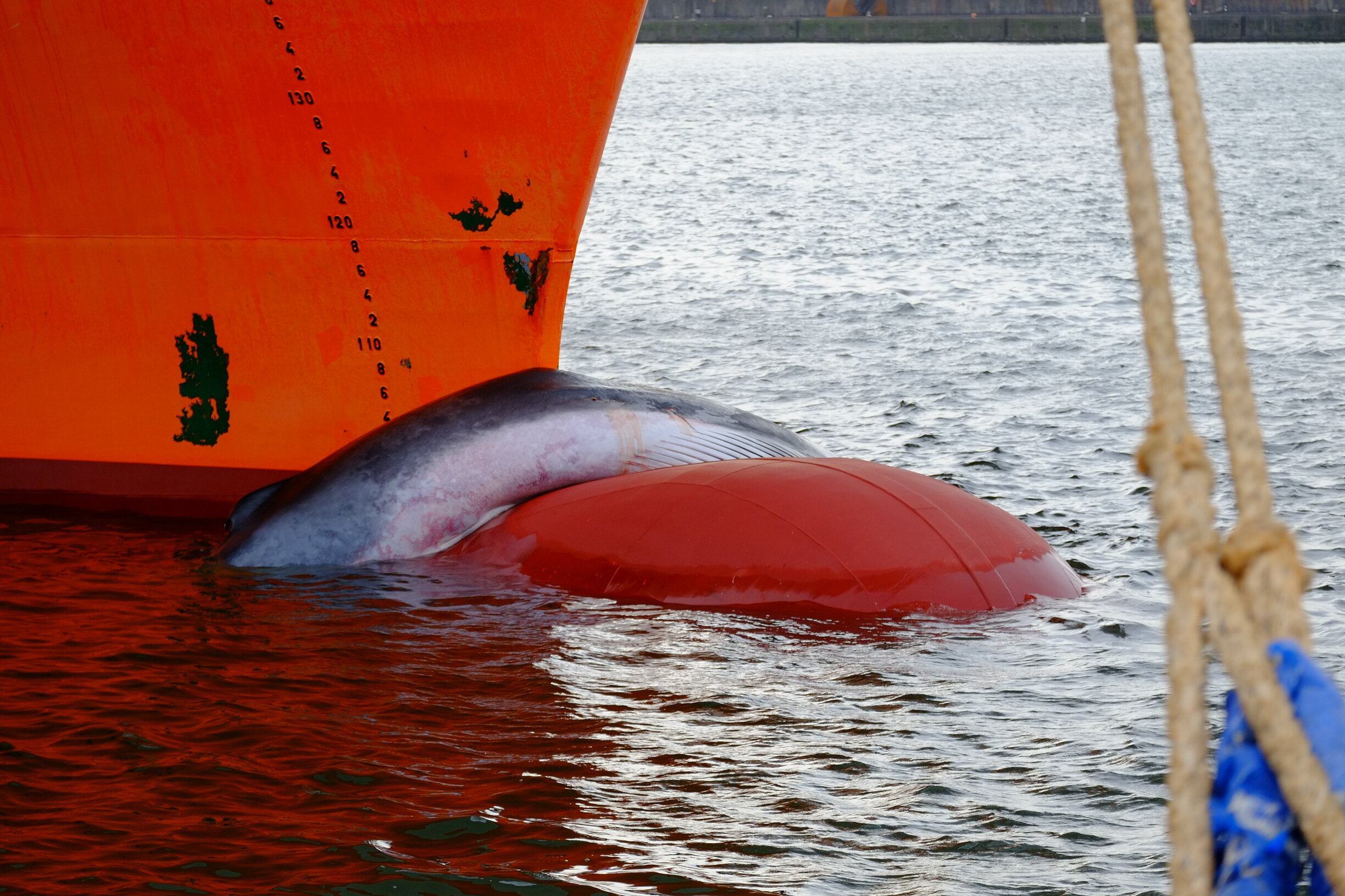
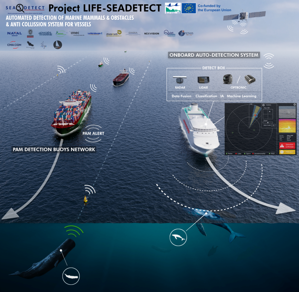
As part of the SEADETECT project financed by the EU LIFE programme, the Royal Belgian Institute of Natural Sciences will contribute to the development and validation of an automated detection system of marine mammals to prevent collisions between ships and cetaceans.
Today, global economy is mainly based on maritime traffic which represents 80% of world trade in volume and 70% in value. This intense traffic involves a growing number of ships moving ever faster through the world’s seas and oceans, which markedly increases the risk of collision with cetaceans.
Collisions between vessels and whales often result in the death of the animals. In recent decades, shipping traffic in combination with the increased speed of individual ships has led to a doubling of the number of fatal collisions. Several studies have shown ship strikes to be the leading cause of death of cetaceans in some areas. For instance, ship strikes are the highest form of mortality for fin whales and sperm whales in the Pelagos Sanctuary in the Mediterranean Sea, an area for which France, Monaco and Italy concluded an agreement to protect marine mammals.
In the arctic, climate change is predicted to result in increased exposure of vulnerable cetacean species to collision risk. Worldwide, reductions in collision mortality will benefit whale populations which are still recovering from the effects of historic over-hunting, and continue to suffer from human induced habitat degradation.
Faced with this situation, the SEADETECT project is developing a new solution that should enable vessels to reduce collisions with cetaceans by 80%.
Preventing ship strikes
Collisions are often due to a combination of three factors: the ability to detect, the reaction time of the crew and the time it takes to maneuver the ship, all depending on the size and speed of the ship and the state of the sea. The SEADETECT project will develop three systems to reduce such collisions:
A system on board ships that will detect unidentified objects, in particular marine mammals, in real time.
A network of passive acoustic monitoring buoys located in high-risk areas at sea that will determine and triangulate the position of cetaceans in real time.
Detection data sharing software, fed by the future detections, to inform vessels in the area about the risk of hazards.
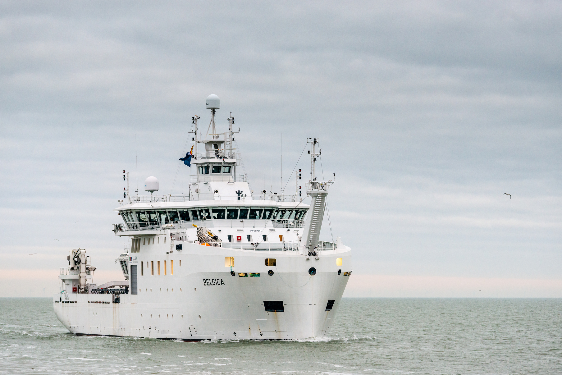
“The automatic detection and anti-collision system will be used in the existing multi-sensory infrastructure of the national oceanographic research vessel RV Belgica and will be validated by scientists of the Royal Belgian Institute of Natural Sciences during the expeditions and monitoring campaigns of the ship”, Bob Rumes of the RBINS Marine Ecology and Management team (MARECO) clarifies.
The automatic detection and anti-collision system will autonomously detect cetaceans but also obstacles or floating objects such as containers to prevent collisions with ships. Thanks to a high-performance data fusion and processing system, this solution will make it possible to detect in real time a 2-metre long object on the surface at a distance of 1km, by day and night, even in complex maritime conditions (strong sea states or bad weather conditions). In addition, the researchers will also investigate the impact of a general application of this detection and anti-collision system on several target species as an alternative to other possible measures.
The SEADETECT project, led by the French Group Naval, will last four years and brings together ten partners from three European countries: Belgium, France and Italy. More information can be found on the project website: https://life-seadetect.eu/.
The LIFE programme is a financial instrument of the European Commission, dedicated to supporting innovative private and public projects in the fields of environment and climate.
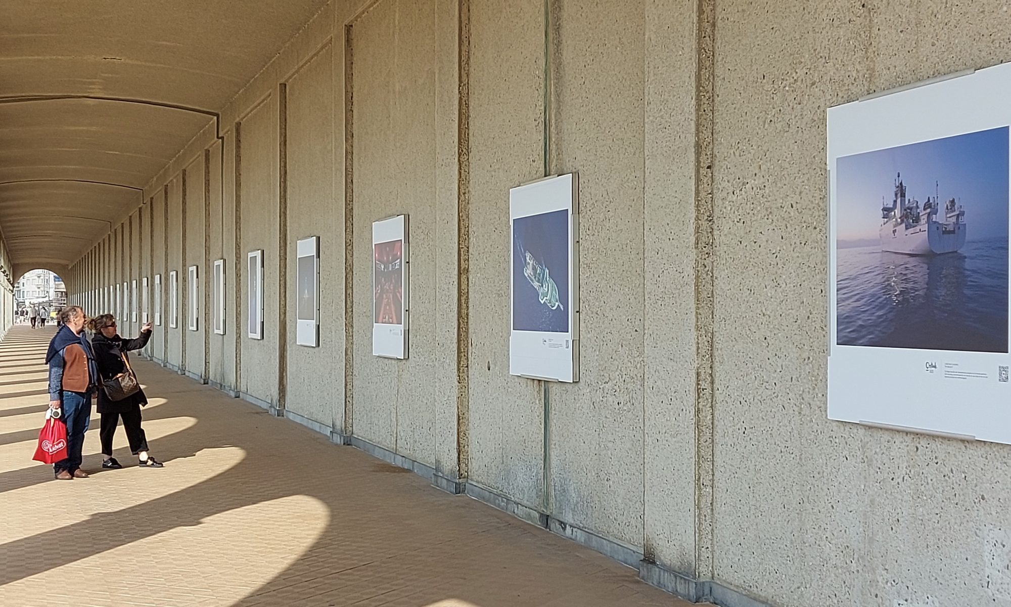
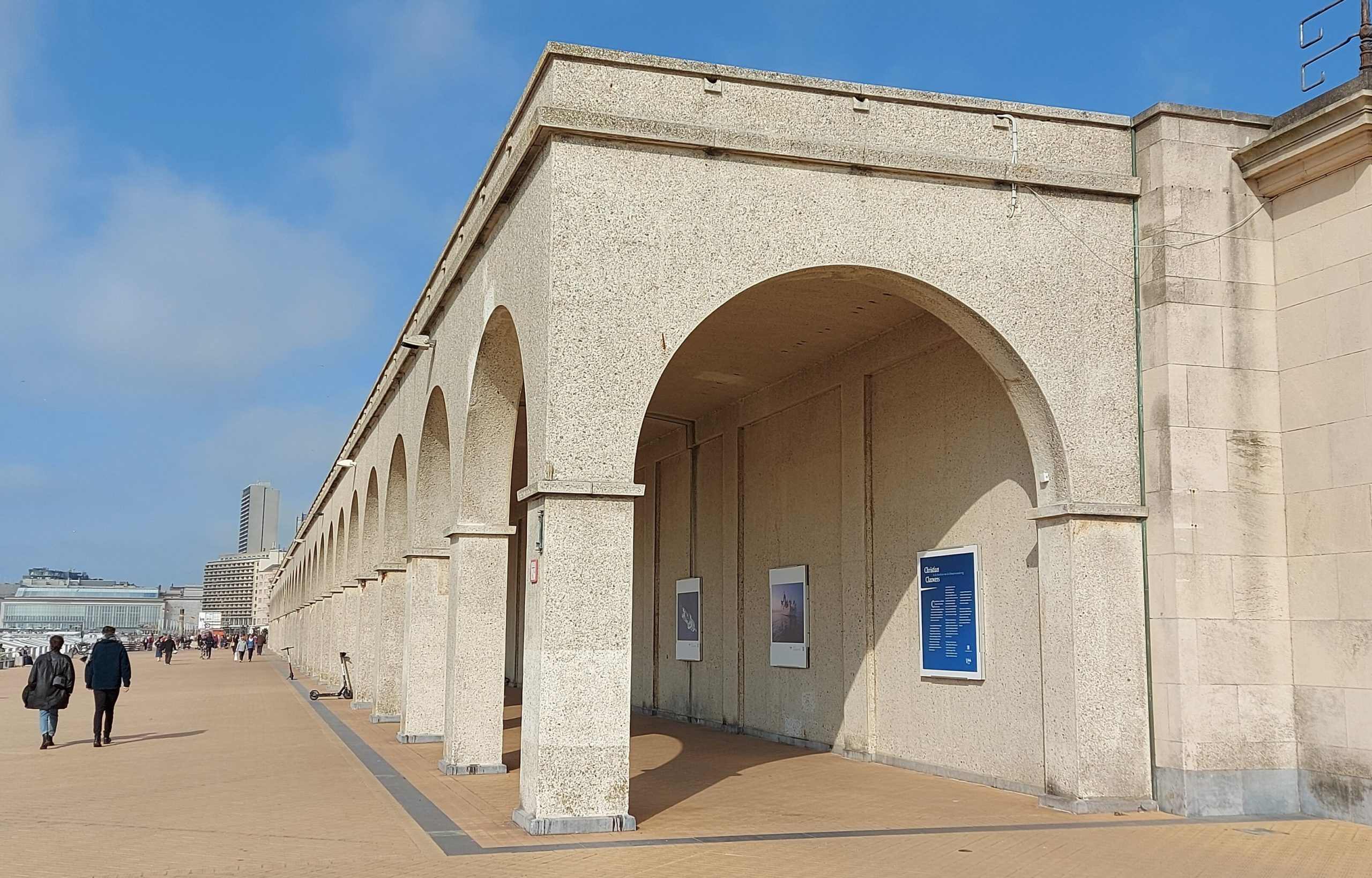
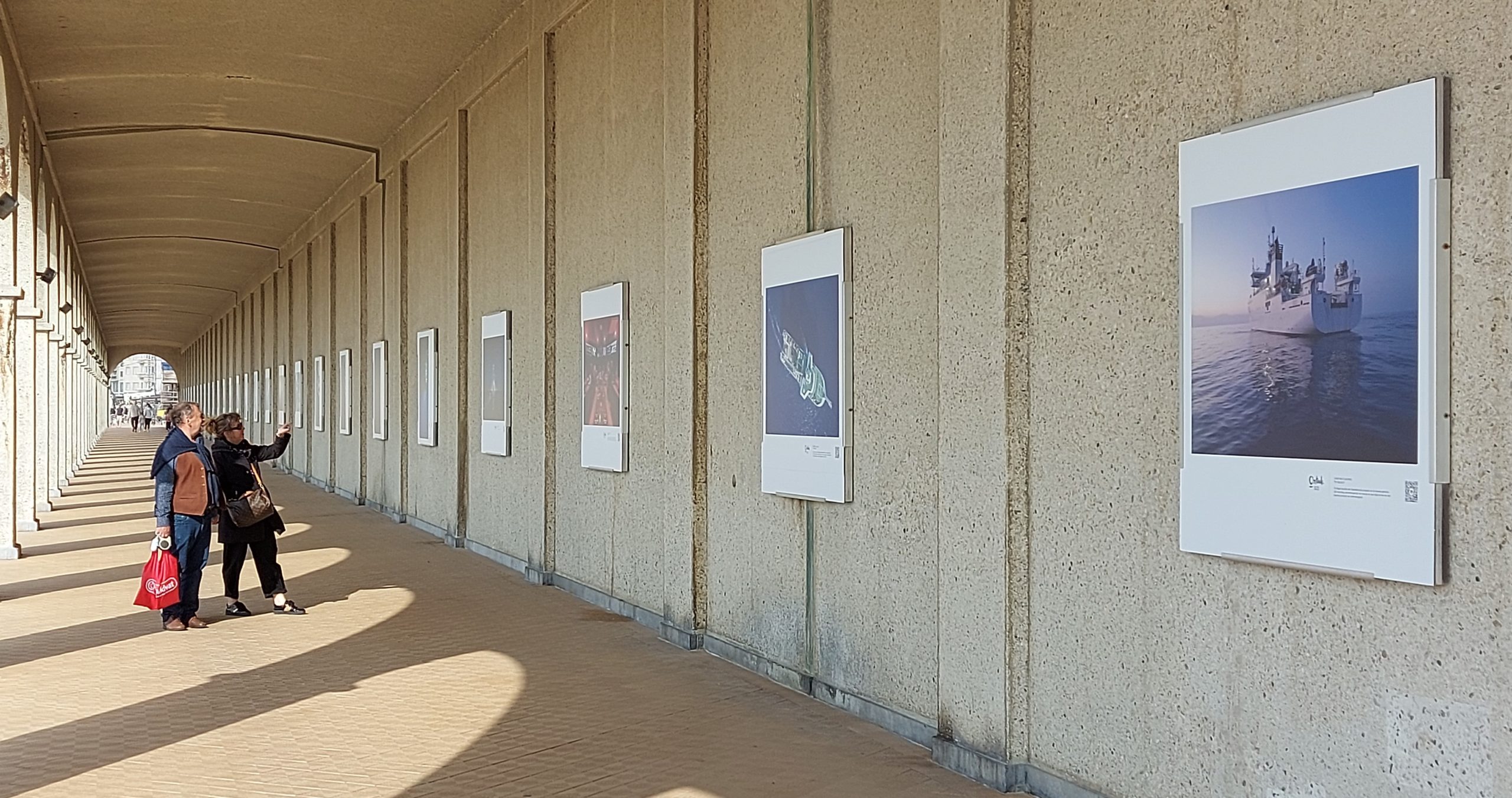
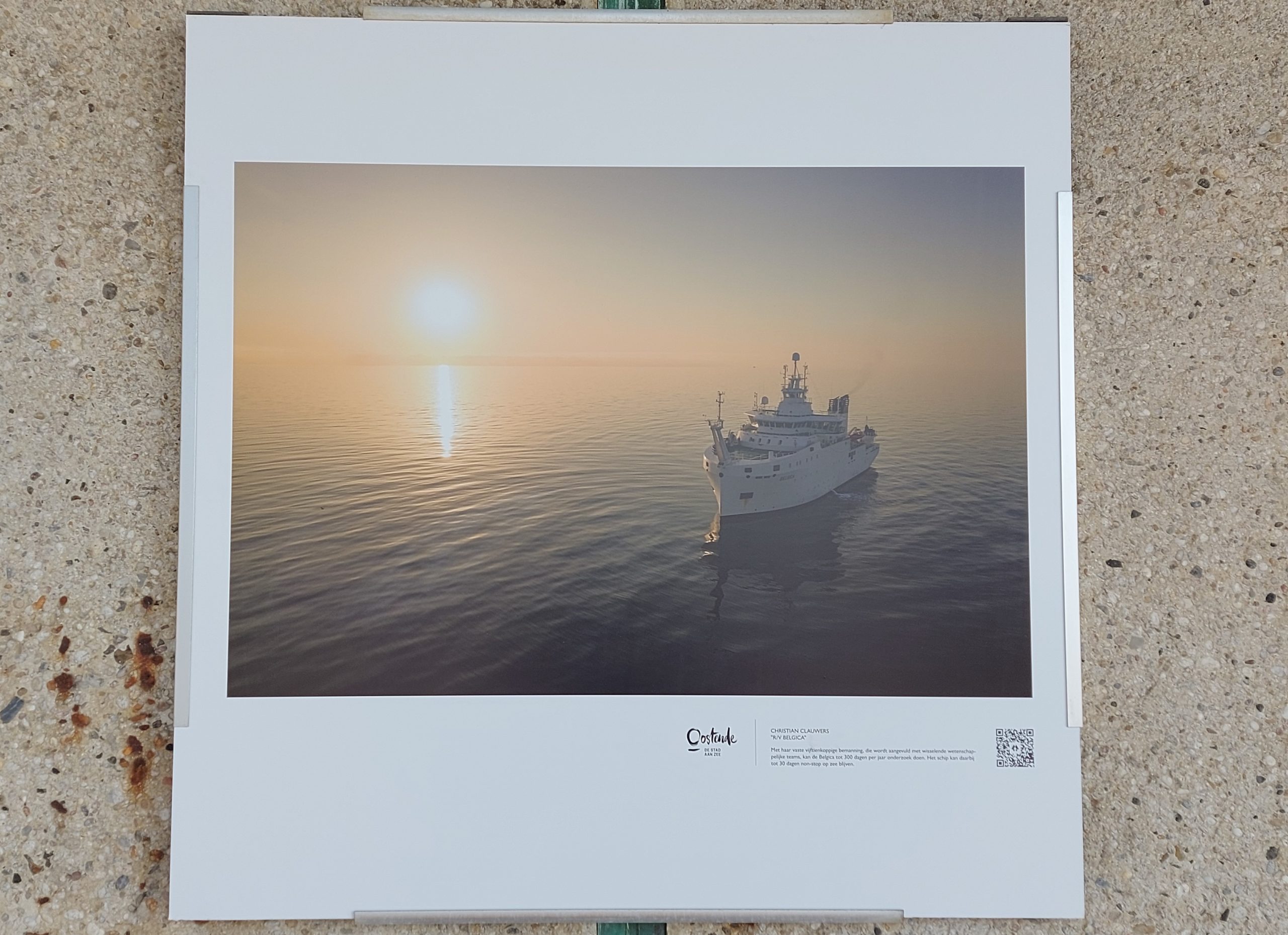
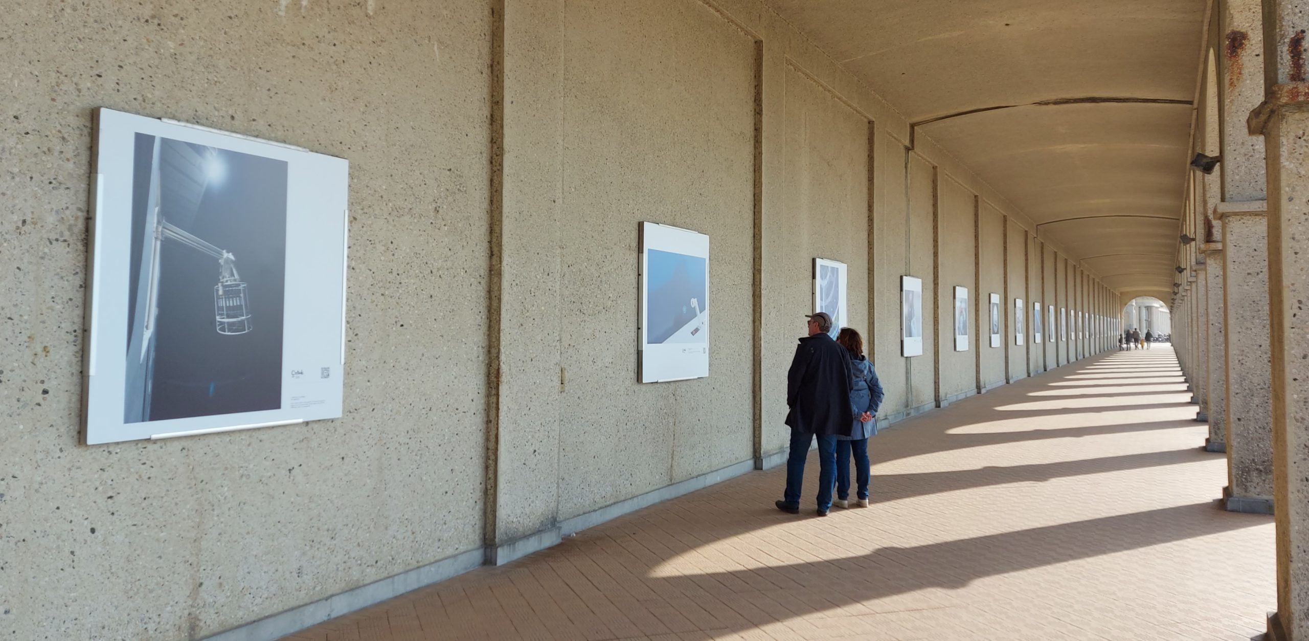
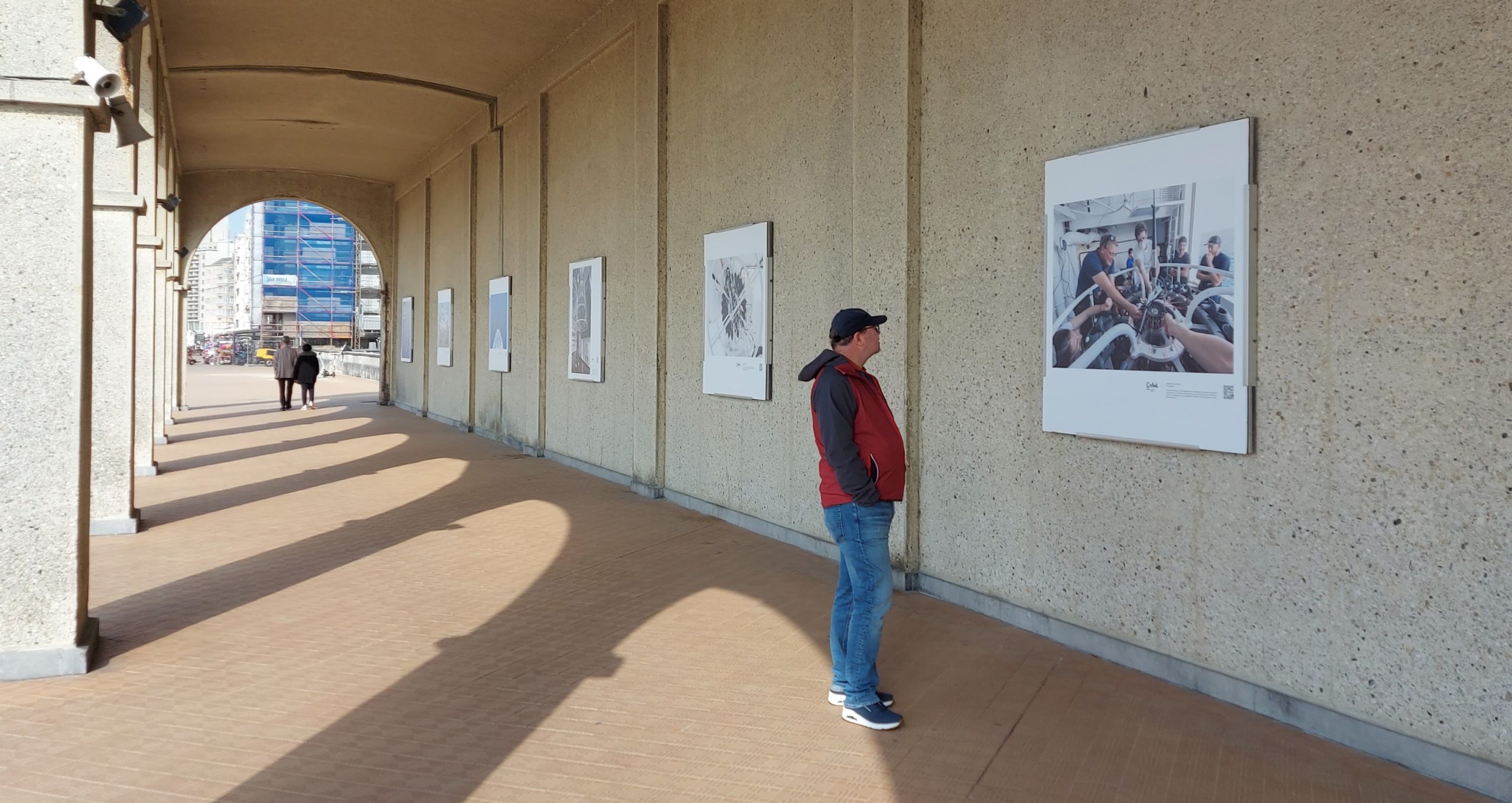
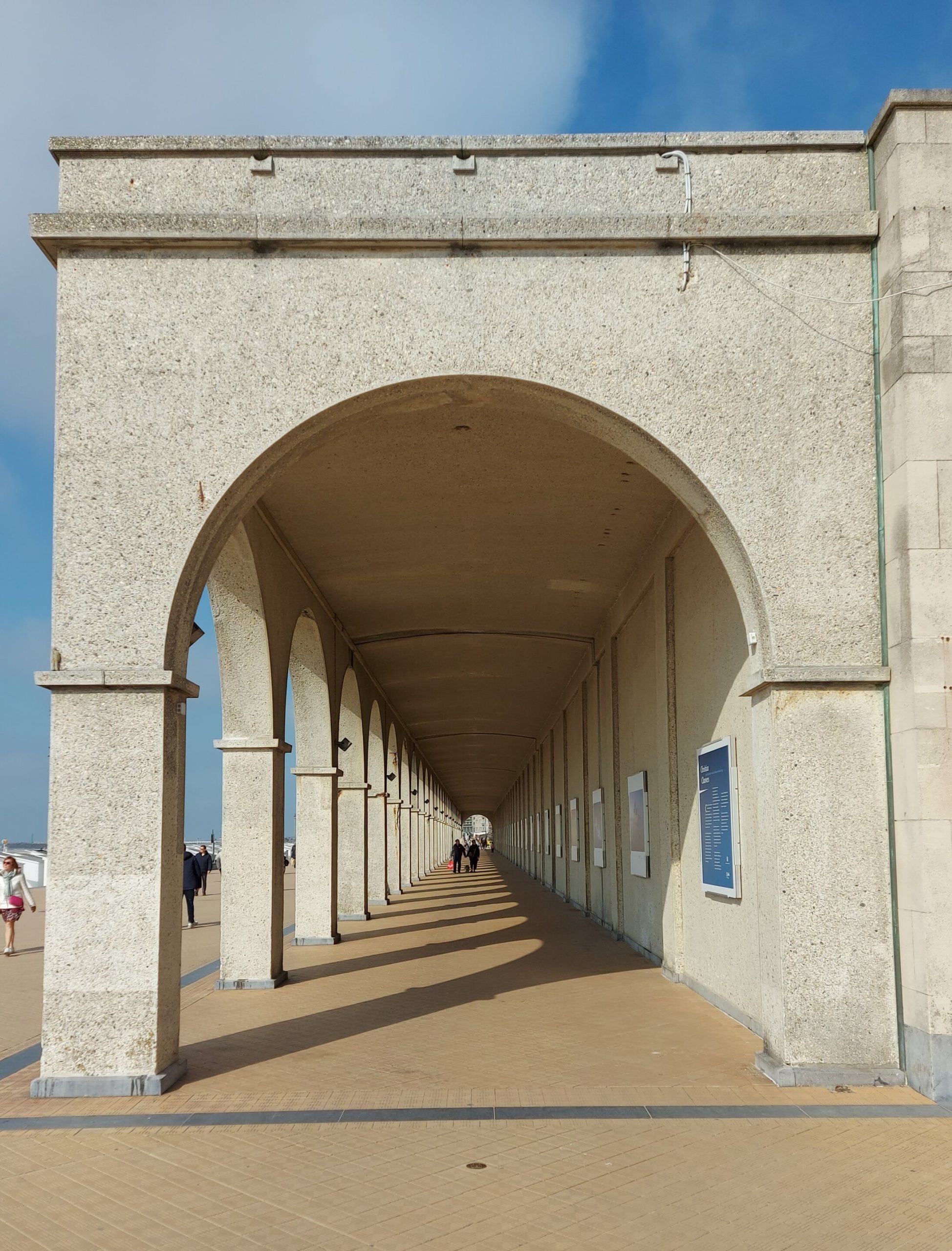
From 10 May until 4 July 2023, you can visit the Nieuwe Gaanderijen in Ostend for the photo exhibition ‘Christian Clauwers: on the front line of global warming’, which focuses on the RV Belgica and marine science. All the images were made by explorer-photographer Christian Clauwers during an expedition on the Belgica, the Belgian research ship of the Federal Science Policy and the Royal Belgian Institute of Natural Sciences.
Address: Nieuwe Gaanderijen, Koning Boudewijnpromenade (Zeedijk) z/n – 8400 Ostend
Price: free
A floating laboratory
Christian Clauwers is not only a photographer, but also an explorer, speaker and author. He has already sailed around the world twice, visited no fewer than 114 countries on all seven continents, and explored some of the planet’s most remote islands. His work focuses on the fragile relationship – and potential conflict – between humans and nature.
Scientists on the front line
Christian Clauwers was given the unique opportunity to sail on the TalPro22 expedition that set sail for the Tyrrhenian Sea. Aboard the Belgica, he captured both scientific research and the impact of the relationship between man and nature on film. The ship has more than 400 square metres of laboratory space and carries several high-tech oceanographic measuring instruments. For example, the rozette, a cylindrical structure from which sampling tubes and measuring equipment hang, can be lowered to a depth of up to 5,000 metres. It takes two hours to bring the measuring instrument back up, and this in conditions that can change rapidly. The ship is equipped with satellite technology that allows it to hold position to within a metre, even in the most difficult weather conditions. The photos let us take a look behind the scenes of these impressive experiments.
A must-see for anyone concerned about the future of our planet
But the expo is more than just looking at pretty pictures. Facing the sea, it is a call-to-action to take the fragility of our planet seriously.
Christian Clauwers: ” I want to give people the chance to witness what nature has to offer us and at the same time show them how precious it is. The series on the Belgica expresses this very nicely, because the scientific research carried out there makes that fragility of nature measurable. The scientists on board measure what I try to photograph, and now I photograph what they measure. It’s an exchange where the arrow goes both ways and that’s what makes it so fascinating.”
The expo shows the consequences of the human footprint and what is at stake if we do not act to tackle climate change. It is an impressive and inspiring example of how images can be used to raise awareness and change the world.