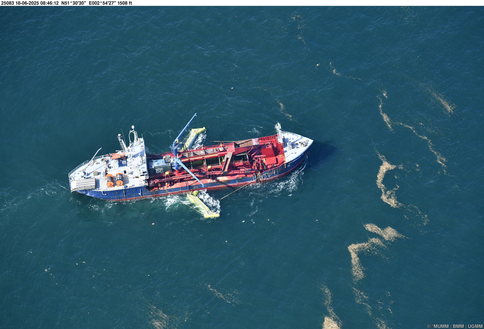
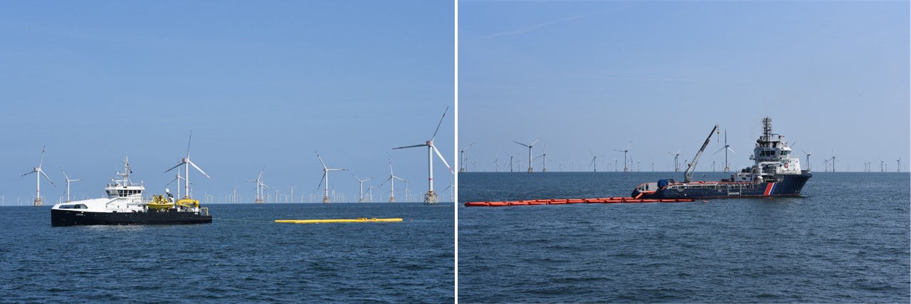
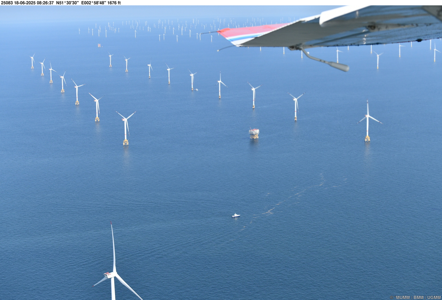
Maintaining a high level of preparedness is essential for all Belgian Coast Guard partners when facing maritime pollution threats.
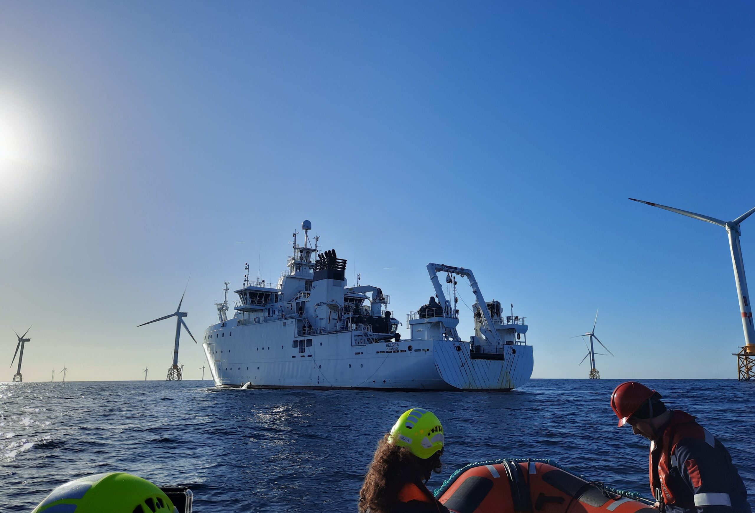
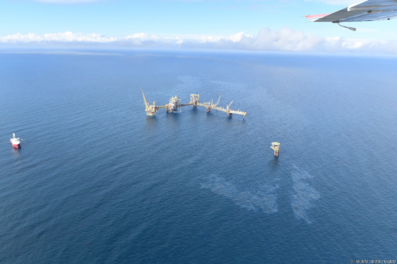
During POLEX 2025, Belgium’s national marine pollution response exercise that took place on 18 June 2025, the Institute of Natural Sciences contributed with two key assets: 1) the aerial surveillance aircraft provided coordination and real-time monitoring from above, while 2) model simulations developed by the Marine Forecasting Centre supported decision-making at sea.
These capabilities complemented the vessel Interballast III (chartered by the European Maritime Safety Agency), Belgian Coast Guard partners, and the French Navy vessel Argonaute in a simulated oil spill scenario near offshore wind farms.
By combining on-site response, satellite imagery, and scientific input, the Institute of Natural Sciences helped strengthen situational awareness and response coordination in this complex environment.
Exercises like POLEX 2025 are crucial to ensure that, when needed, science and operational capacity come together to protect the marine environment.
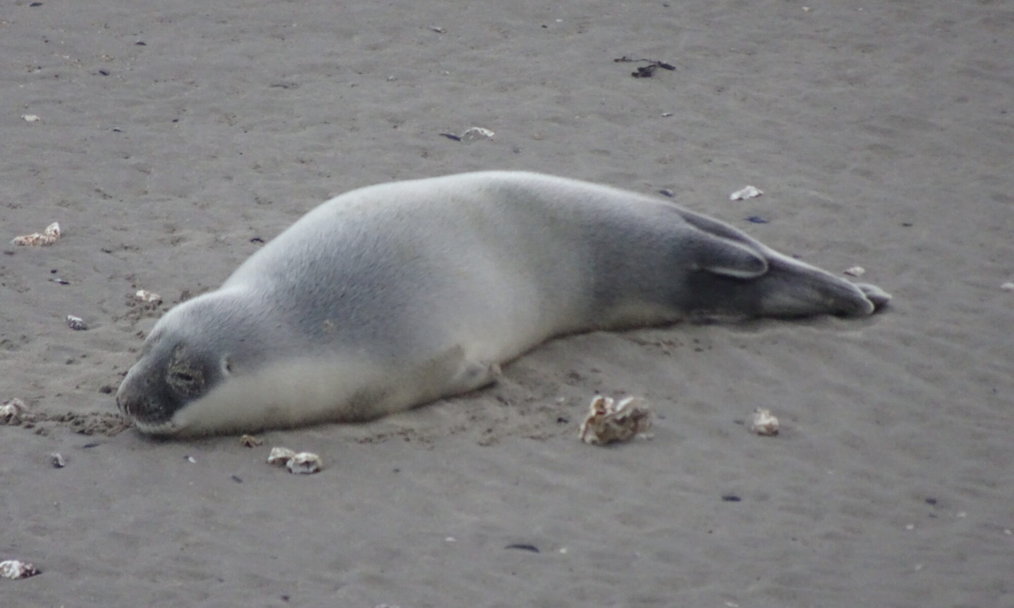
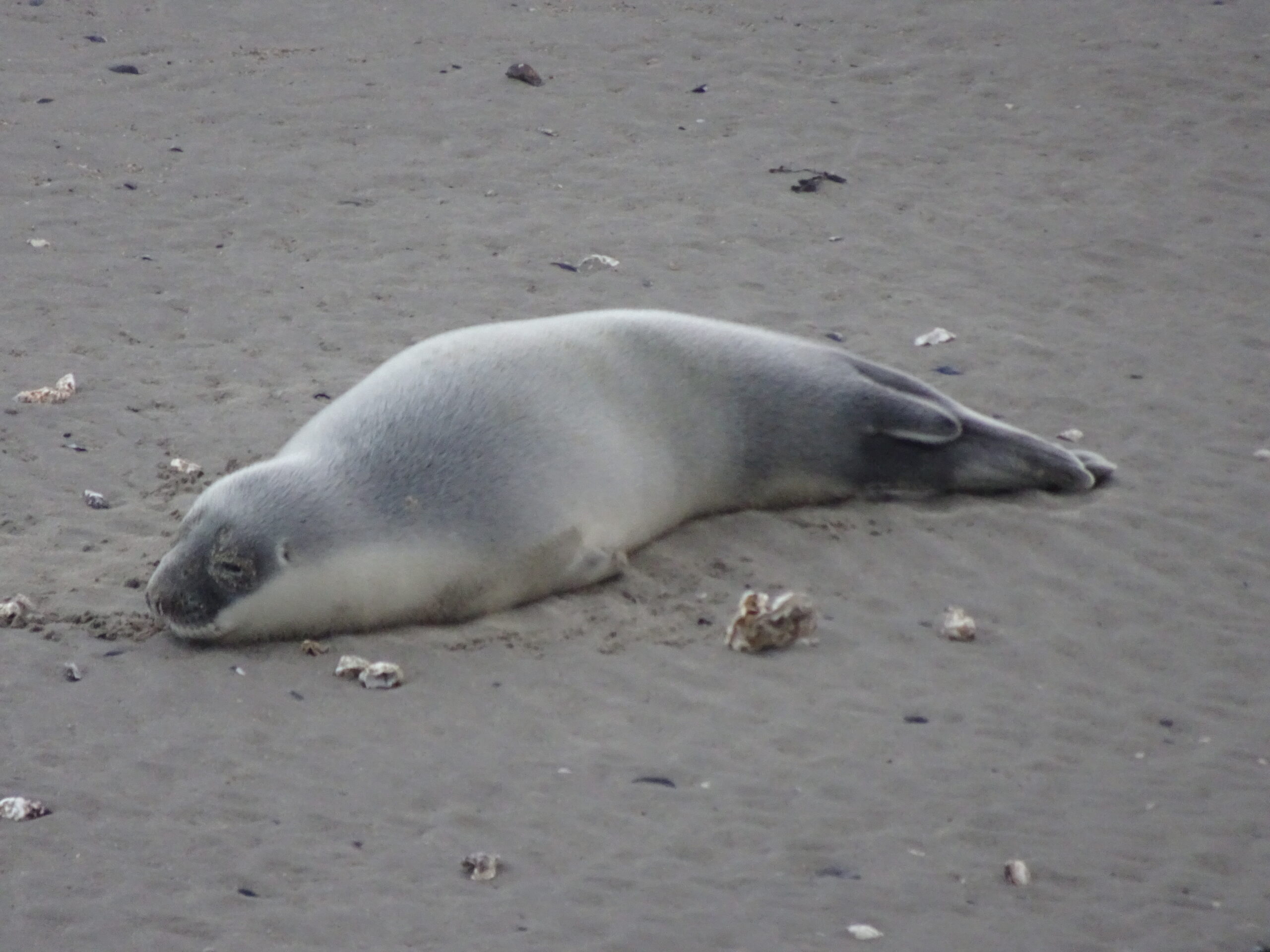
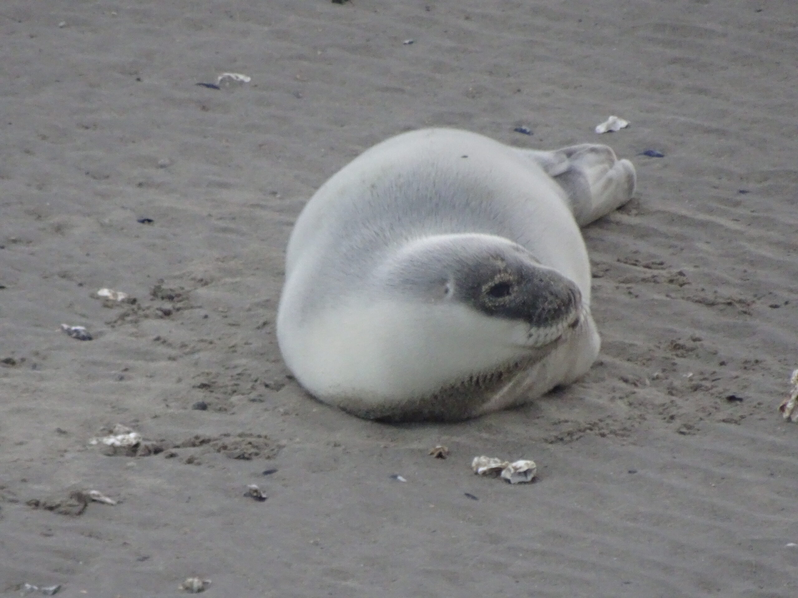
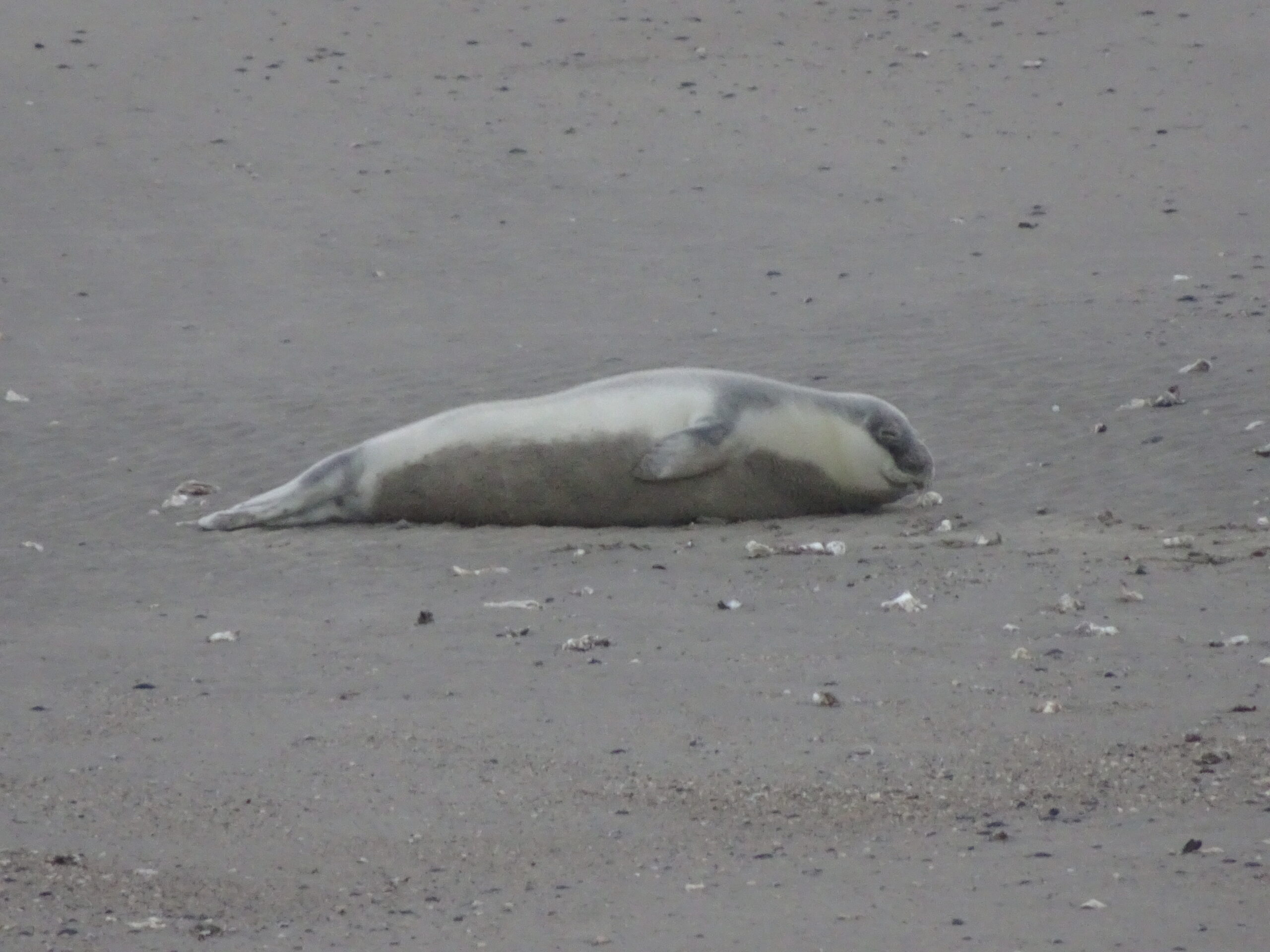
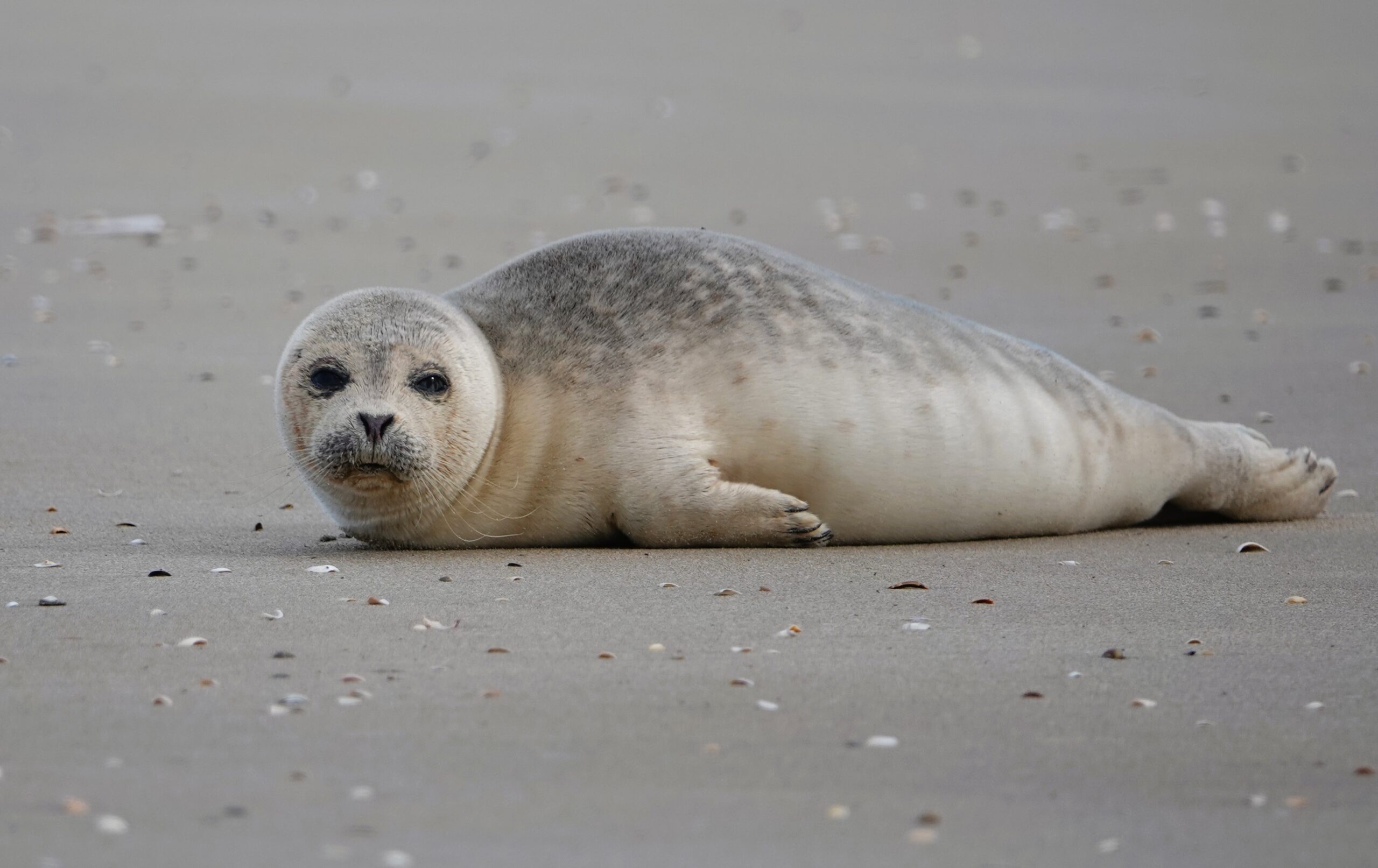
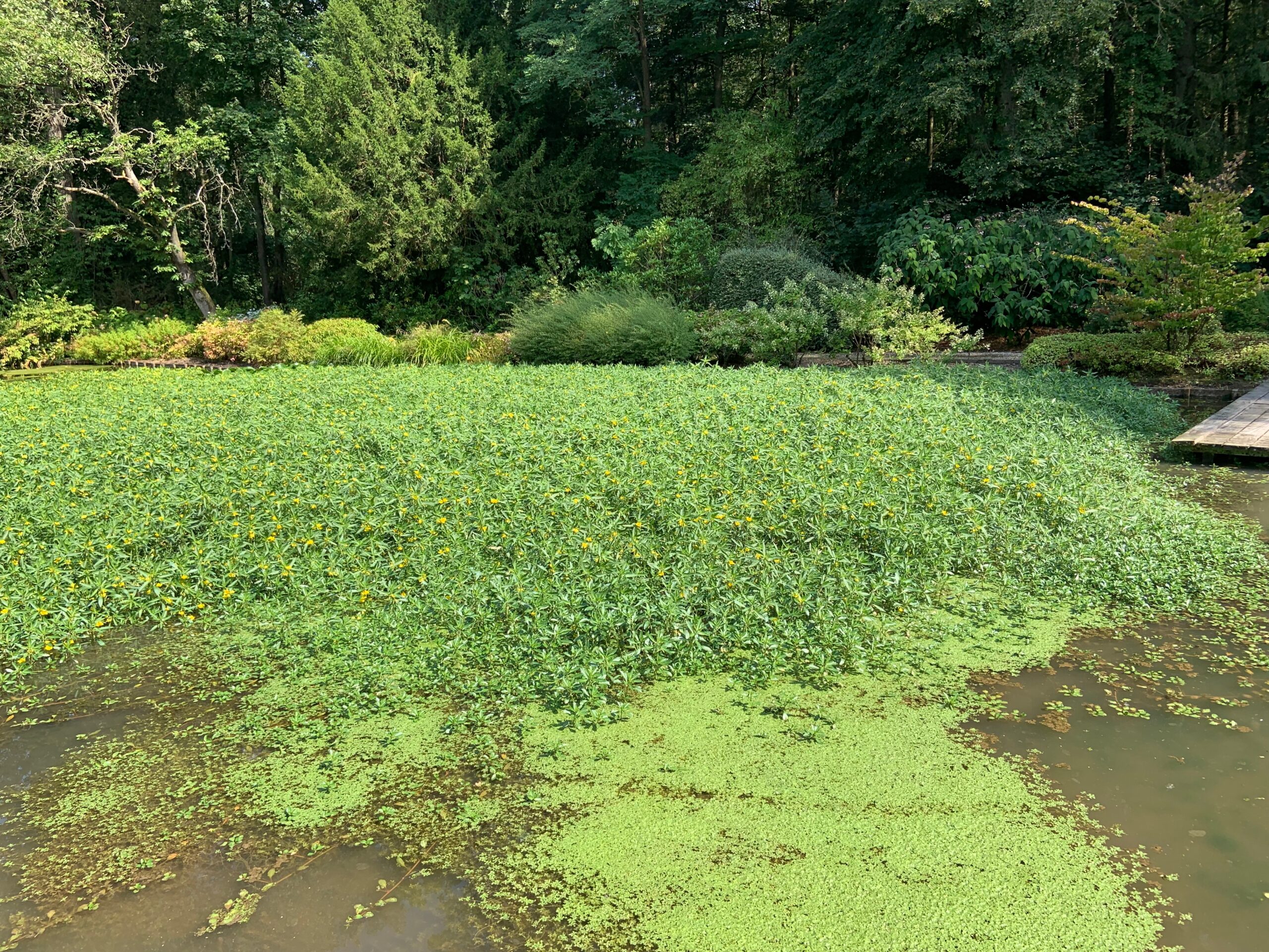
A young hooded seal photographed on the beach in Ostend on August 21st was the fifth documented case of this northern seal in Belgium. However, the animal was not identified until the next day. By then, it had already returned to the sea, never to be seen again. Or was it?
On Thursday evening, August 21st, a regular visitor to the Ostend beaches photographed a young seal on the eastern bank. Seals are no longer a rarity on our coast. West of the Ostend harbor channel, there’s even a permanent haul-out site where both common and gray seals can be seen regularly. The observer therefore thought he had captured a young gray seal. Always a nice sighting, but no longer unusual.
Only the next day, when the photos circulated on social media, did it become clear that it was a much rarer species: a young hooded seal (Cystophora cristata), a seal from the distant, icy waters of the far north. The animal appeared healthy, but despite searches by nature lovers and specialists from the Institute of Natural Sciences, it was not found again. The direction in which the young Hooded Seal continued its journey, and whether it would reappear, was unknown at that time.
Hooded seals are native to the North Atlantic and Arctic Oceans, from Spitsbergen to the east coast of Canada. The largest populations occur between Greenland and Canada, with also a significant breeding zone near the volcanic island of Jan Mayen (Norway).
Unlike our familiar common and grey seals, the hooded seal generally lives further offshore, hunting in deeper and colder waters and often inhabiting drifting pack ice. Pups are born there between March and May. Their nursing period is remarkably short, the shortest of any mammal. In just four days, the pups consume so much fat-rich mother’s milk that their weight nearly doubles. Afterward, they are independent and soon cover great distances at sea.
Young animals, like the Ostend specimen, have a blue-gray back and a pale belly, leading them to be called “bluebacks.” The typical hooded seal characteristic, a black skin pouch that adult males can inflate to the size of their heads, is not yet visible in young animals.
Belgian hooded seals
That someone was able to photograph a hooded seal on a Belgian beach on a summer evening shows how surprising nature can sometimes be. Why this young animal showed up in Ostend remains a mystery. It’s tempting to think of changes in its northern habitat, for example due to climate change, but hard evidence is lacking. Nor can the opposite be proven.
What is certain is that this is not the first time Belgium has been visited by a hooded seal. Previous sightings date back to 1987, 1999, 2000, and 2003. The first was the most remarkable: an adult female that had swum up the Scheldt River and was first seen near Ghent, later captured near Tournai. She was housed at Antwerp Zoo and then at the Pieterburen Seal Centre (Netherlands), but died soon after. The other three cases involved young animals: a male in Heist (1999), a female in Knokke (2000), and a male in Middelkerke (2003). All were weak and were cared for by SeaLife. Only the animal from 1999 survived its southern adventure and was released back into the North Sea in January 2000.
The fact that things usually end badly for young hooded seals that appear so far south was unfortunately also illustrated by the recent specimen in Ostend. On September 1st, it reappeared, this time in Rockanje, the Netherlands. After a 24-hour observation period, it was taken to the A Seal center in Stellendam on September 2nd, where it also died.
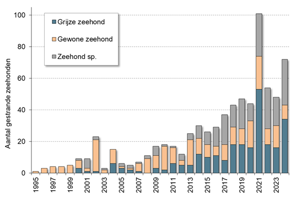
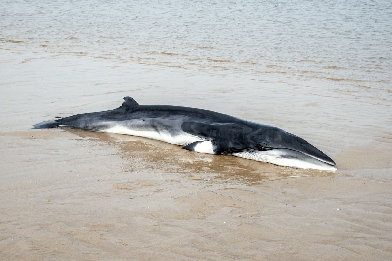
In the new report ‘Washed ashore. Marine mammals in Belgium in 2024’, the Institute of Natural Sciences summarises the results of the research into stranded marine mammals in Belgium in 2024. 36 harbour porpoises and 72 seals, as well as a very young minke whale, washed ashore. In addition, the report provides an overview of observations of remarkable species, and focuses on a number of relevant events.
In 2024, only 36 harbour porpoises washed ashore in Belgium. This number was only lower in 2023 (26) in the past 22 years. The increasing trend in the number of stranded harbour porpoises, which started around the turn of the century, is the result of a shift in the population within the North Sea, with the species increasingly occupying the southern part. The highest numbers of strandings were recorded ten years ago.
Why the number of stranded harbour porpoises has decreased since then is still unclear. An analysis of the data collected during aerial surveys showed that in 2024 there were relatively low numbers of harbour porpoises in Belgian waters: in April, August and October, the numbers were estimated at 5200, 1000 and 3300 animals respectively. In peak years, there were sometimes three to four times more. A study, together with neighbouring countries, showed that harbour porpoises were disturbed by shipping at relatively great distances.
Beachgoers reported a total of 72 dead seals along the Belgian coast in 2024. These were 34 grey and nine common seals, the others could not be identified to species. For these animals, this is the second highest number in the past 30 years, a trend that is the result of growing populations in the countries surrounding us. On the other hand, Sealife cared for relatively few seals in 2024: six grey and three common.
The minke whale that washed ashore in Ostend on 13 May 2024 was only 3.16 m long and was therefore very young. The animal undoubtedly lost its mother and starved to death. It was the only marine mammal that washed ashore in 2024 that was not a harbour porpoise or a seal. The authors take the opportunity to tell the story of two minke whales that ended up here in the 19th century.
At sea, besides many porpoises, one dead and two live humpback whales, two live minke whales, several bottlenose dolphins, a common dolphin and a pod of white-beaked dolphins were seen.
Whale related events
In 2024, many events were organized around whales. In front of the central station in Antwerp, a life-size blue whale attracted a lot of attention on June 13. The animal was placed there to draw attention to collisions of whales with ships.
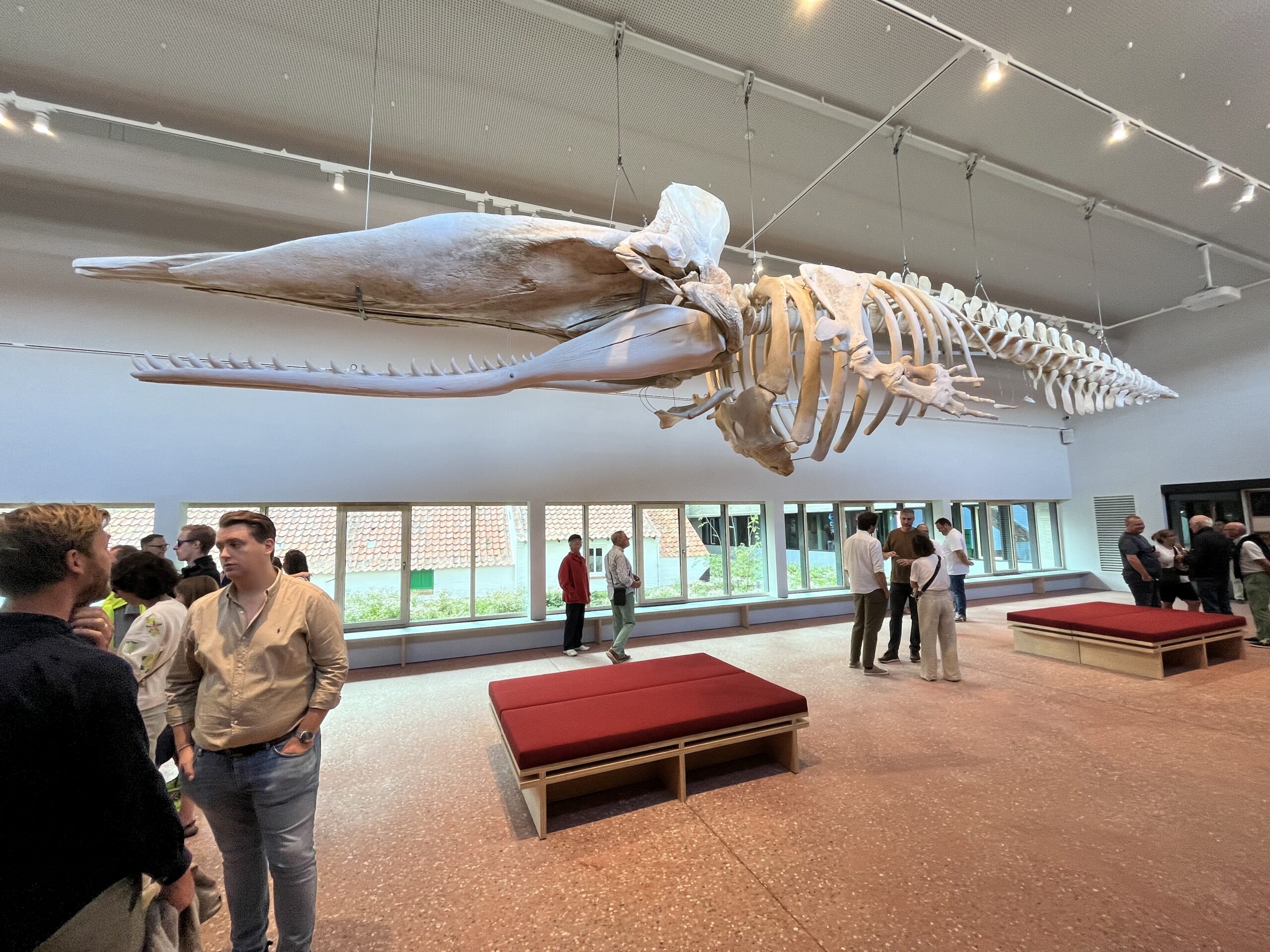
But it was especially in Koksijde that there was a lot to experience: from 25 May to 15 September there was a Cabin Art festival with the whale as central theme, and there was the reopening of the NAVIGO National Fisheries Museum on 7 September. A new eye-catcher in that museum is the skeleton of sperm whale Valentijn, buried in the polder soil in 1989, and excavated again after more than 30 years.
The new report ‘Washed ashore. Marine mammals in Belgium in 2024’ (only available in Dutch and French) is a publication of the Institute of Natural Sciences. The previous annual reports (available since 2014) can be downloaded here.
Brussels, 19 June 2025 – The Anemoi consortium welcomed stakeholders from across Europe for a dedicated event on chemical emissions linked to offshore wind energy at the Institute of Natural Sciences (RBINS).
Bringing together experts from industry, policy and environmental organisations, the interactive workshop focused on current challenges and future directions for regulating chemical emissions from offshore renewable infrastructure.
Planned policy actions at the regional level were presented by the OSPAR Commission addressing hazardous substances from offshore renewables in the North-East Atlantic.
The industry perspective was shared by European Energy, offering reflections on current practices and environmental responsibilities.
The ANEMOI project team presented intermediate research results, including:
The identification and distribution of chemical substances associated with offshore wind parks
Potential impacts on marine organisms and aquaculture products
Options for reduction measures to minimise environmental risks
The event fostered valuable exchange, contributing to a more informed and collaborative approach to safeguarding the marine environment as offshore renewable energy continues to expand.
The Anemoi project is funded by the Interreg North Sea programme, with co-funding from Provincie West-Vlaanderen (Belgium) and VLAIO (Belgium), and is coordinated by Flanders Research Institute for Agriculture, Fisheries and Food (ILVO, Belgium). Partners are the Institute of Natural Sciences (RBINS), POM West-Vlaanderen, Antwerp University (Belgium), SINTEF Ocean (Norway), DTU Wind (Denmark), NIOZ (The Netherlands), Ifremer (France), BSH, Hereon and TU Braunschweig (Germany).
For more information about the ANEMOI project and upcoming activities, visit the project website, the kick off news item & the LinkedIn profile dedicated to the project
Offshore wind farms attract a diverse marine life. New research shows that the fauna that colonizes the wind turbines also influences the marine food web. In particular, the increase in suspension feeders – such as mussels, amphipods and anemones that extract small food particles from the water – helps to transfer carbon more quickly and directly into the food web.
The offshore wind sector will continue to expand to help meet the EU’s targets for reducing CO₂ emissions. While much is already known about the impact of offshore wind farms on local biodiversity, the key question remains what these changes mean for the functioning of marine ecosystems as a whole.
“We collected a lot of samples in the Belgian part of the North Sea and beyond to model the food webs of natural and artificial habitats,” said Emil De Borger (Ghent University & NIOZ), principal investigator of the study. “This allowed us to investigate in detail how these systems function, and to compare the ecological processes of soft sediment habitats with those around wind turbines.”
Jan Vanaverbeke (UGent & Institute of Natural Sciences), co-author of the new study, emphasizes another important point: “Until now, most studies on food webs in offshore wind farms were based on simulated environments. In other words: wind farms that only exist in scientific models. We took a different approach. Our goal was to develop models of food webs based on reality, using data collected in real, operational wind farms.”
Using stable isotope analysis and ecological food web modelling, the researchers reconstructed and quantified how carbon and energy flow between species through food uptake, from plankton to fish. The resulting models revealed striking differences between natural sandy bottoms and offshore wind farms.
The study confirms that artificial reef structures such as offshore wind farms are indeed species-rich compared to surrounding soft-bottom habitats. However, many of these species occur only in a very low biomass when extrapolating to the scale of the offshore wind farm, which includes a lot of “empty space” in between the turbines.
The real ecological game-changer is the proliferation of suspension feeders, organisms such as mussels, amphipods, and anemones that attach to the hard surfaces of turbines and feed by extracting organic particles directly from the water column. The turbines thus promote a more direct uptake of the carbon and energy stored in the food particles into the food web. On sandy seabeds, carbon and energy often have to make longer detours.
“These suspension feeders act like biological pumps,” explained De Borger. “They take in carbon-rich particles from the water, process them, and enrich the surrounding sediment with organic matter. That deposition, in turn, becomes food for bottom-dwelling species, creating new feeding opportunities in an otherwise energy-poor environment. It is these numerous interactions between a diverse community of species that lead to the high productivity of the new food web.”
Fish diets and carbon budgets
One of the study’s notable findings relates to the diets of fish in and around wind farms. Field observations confirm earlier research suggesting that some fish species shift their diets toward prey that are particularly abundant near turbines.
“This supports the idea that offshore wind farms aren’t just physical structures,” said co-author Ulrike Braeckman (Ghent University & Institute of Natural Sciences). “They actively shape species behaviour, including predator-prey relationships. Some fish are clearly taking advantage of the concentrated food sources created by the turbines. It’s an engineered ecosystem that’s influencing natural processes.”
Understanding these food web changes is critical not just for scientific knowledge, but for practical management. “Food webs tell us about ecosystem stability, biodiversity, and even our food supplies and carbon budgets,” added Jan Vanaverbeke. “As we continue to increase offshore wind capacity, we need to understand how these systems function, both to protect marine life and to sustainably manage ocean resources.”
Balancing renewable energy and ecosystem stewardship
The study underscores the importance of integrating ecological insights into the planning, construction, and monitoring of offshore renewable energy projects. As Europe races to expand its offshore wind capacity to meet climate goals, these findings provide valuable guidance on how to balance the impact on the marine environment with the sustainable goal of offshore wind energy production.
The researchers call for a wider use of models based on real ecosystems and indicate that long-term monitoring is necessary to track and understand changes in food web dynamics and biodiversity over time. “Our work shows that wind farms can enhance certain ecological pathways, but it is essential to understand which ones, and how they affect the broader system,” says Emil De Borger.
The study “Offshore wind farms modify coastal food web dynamics by enhancing suspension feeder pathways” is freely available and was published in Communications Earth & Environment by a multidisciplinary team of marine researchers from Ghent University (Marine Biology Research group) and marine institutes from Belgium and the Netherlands (Institute of Natural Sciences; Flanders Research Institute for Agriculture, Fisheries and Food – ILVO; Royal Netherlands Institute of Sea Research – NIOZ; Wageningen Marine Research).
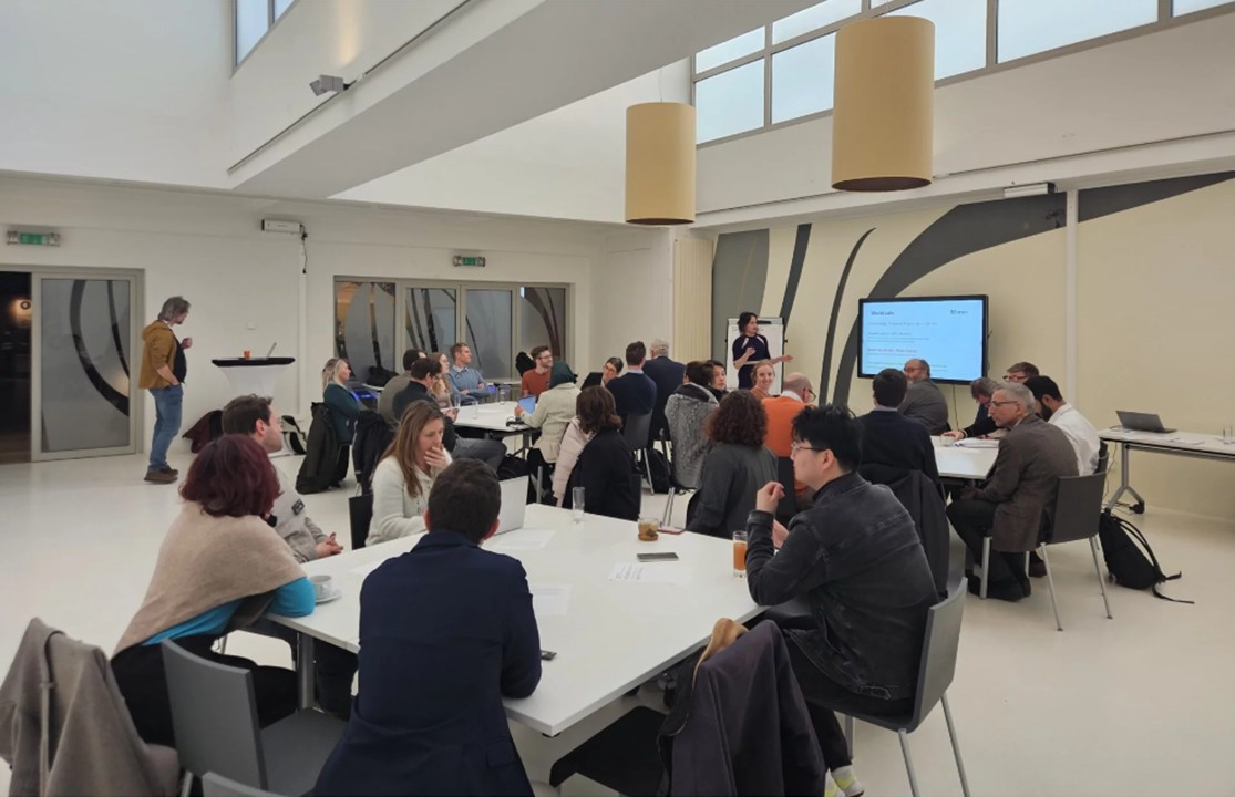
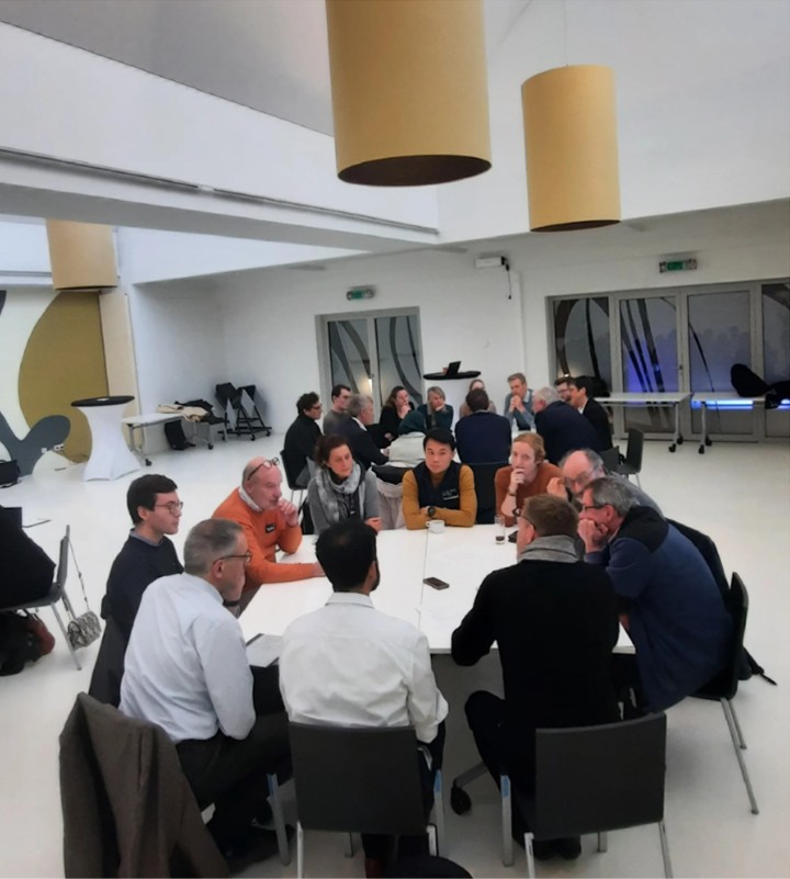
The SWiM (Solar and Wind in the Belgian Marine Zone) project, funded by the Belgian Energy Transition Funds, brings together six partners from industry and science. They conduct research into the combination of marine technologies in Belgium’s Exclusive Economic Zone, in particular to integrate Offshore Floating Photovoltaics into wind farms in an ecologically sustainable way. On 6 March 2025, a first workshop took place at the Institute of Natural Sciences (RBINS), Brussels, to discuss some crucial issues.
Organised by Blue Cluster and RBINS, the workshop brought together almost 40 policymakers, industry experts, and researchers to discuss key challenges and opportunities in regulation, tendering and environmental permit criteria (https://www.swimproject.be/results-workshop-01/).
The discussions highlighted the urgent need for regulatory frameworks and standardisation for multi-use and, more specifically, offshore solar energy in wind to create a level playing field with wind energy and reach the energy targets and sustainability goals.
Unlocking the potential of OPV in offshore wind farms
A key point of discussion was whether Offshore Photovoltaics (OPV) should be integrated into offshore wind tenders or developed independently. While integration could lead to optimised infrastructure use, it also raised concerns about added costs and operational complexity.
Crucial factors in the tendering process include financial viability, environmental impact assessments, grid integration, and circular design principles. To enhance economic feasibility, participants explored policy tools such as subsidies and innovative financing mechanisms.
Flexible tendering approaches, offering shorter initial project durations with options for extension, were highlighted as a way to accelerate innovation. Additionally, well-defined permitting procedures and legal frameworks are essential to clarify ownership and facilitate the development of multi-use zones.
Environmental considerations
Environmental considerations featured prominently in the discussions. Nature-inclusive design was highlighted as a strategy to support marine biodiversity, though potential ecological risks were also acknowledged. The current lack of data on the cumulative environmental impacts of OPV and offshore wind underscores the need for further research and pilot projects.
Emphasis was placed on circularity and sustainable decommissioning practices to mitigate long-term environmental effects. Co-using cable infrastructure with wind farms was proposed as a way to optimize spatial efficiency and reduce ecological footprints.
To drive sustainability, tender criteria should prioritize projects that align with environmental objectives and integrate seamlessly with existing offshore infrastructure. Notably, components such as cables and transformers often outlast wind turbines, presenting opportunities for reuse or repowering in combination with OPV technologies.
The workshop underlined the importance of a long-term vision, well-defined policy frameworks, and collaboration among governments, industry, and research institutions. Demonstration projects will be key in further assessing the technological and ecological viability of OPV. Future SWiM workshops will continue to address implementation strategies and scaling opportunities.
The next SWiM workshop will take place on October 20, 2025 at KULeuven and will focus on 1) remaining challenges in OPV and additional uses in existing farms to reach targets EU energy strategies, 2) expansion towards other energy-related uses, such as wave and tidal energy, and 3) integration of positive environmental impacts in permitting and tendering procedures.
SWiM is a two years project in which six partners are joining forces: KU Leuven/EnergyVille (lead partner), Engie Laborelec, Blue Cluster, Imec, UHasselt and RBINS. RBINS, represented by Arthur Capet, Pauline Denis, Geneviève Lacroix (Ecosystem Modelling – ECOMOD), Ee Zin Ong and Jan Vanaverbeke (Marine Ecology and Management – MARECO), is responsible for the work package on environmental aspects.
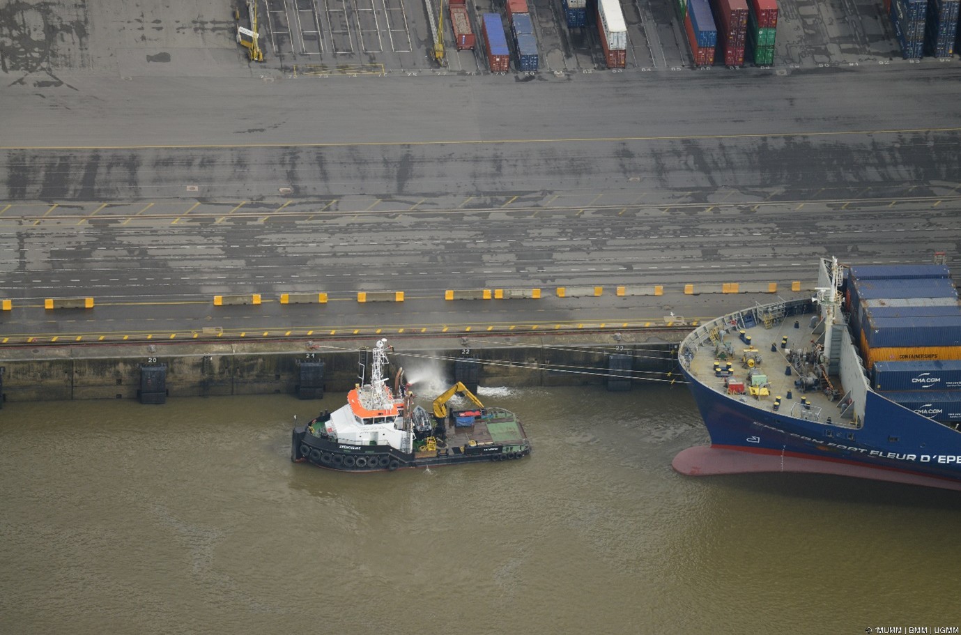
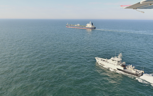
From the end of May to September, the Belgian and French Coastguards will work together in a Multipurpose Maritime Operation (MMO). The MMO is a large-scale maritime operation in the North Sea, coordinated by the European Maritime Safety Agency (EMSA) and the European Fisheries Control Agency (EFCA), with the support of the European Union. In this operation, member states work closely together on Coastguard tasks, such as maritime safety, environmental protection and border control. The Scientific Service MUMM of the Institute of Natural Sciences is also involved.
In 2024, a four-month MMO was also held in the North Sea, with Belgium and France as participating member states. In 2025, drones and underwater robots will again be deployed to test coastguard tasks, such as locating drowning people or small vessels, detecting marine pollution, checking ship emissions, monitoring fisheries regulations and mapping wrecks, measuring poles and seabed structures. In addition, the Coastguard will have the opportunity to work with the Ocean Protector, one of EFCA’s three ships, and to carry out tests with an emergency sea tug. There has also been a long-standing demand for this type of tug in Belgium.
What is new is that in 2025 a Search and Rescue exercise will also take place on the border between Belgium and France, in which rescue vessels and helicopters will be used to rescue around fifty drowning people, both dummies and real people, from the North Sea.
Nathalie Balcaen, administrator general of the Agency for Maritime and Coastal Services (MDK), is pleased that a new MMO is being launched. “Last year we learned a lot during the MMO and the cross-border cooperation with France. Geopolitically these are turbulent times with many threats. Together, much more is possible.”
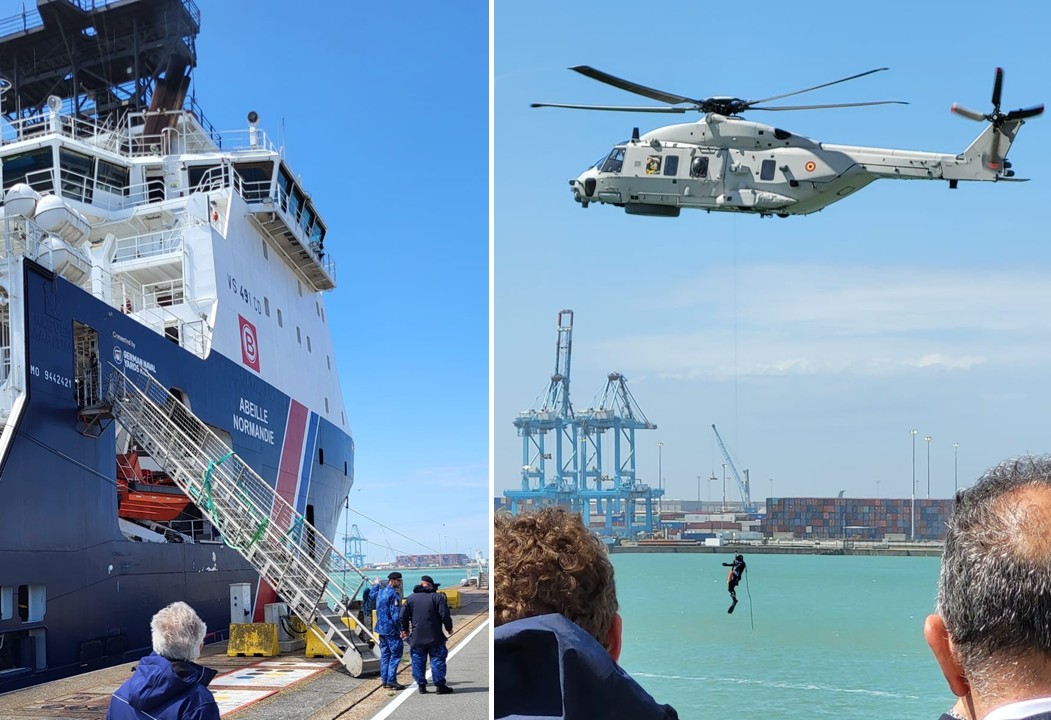
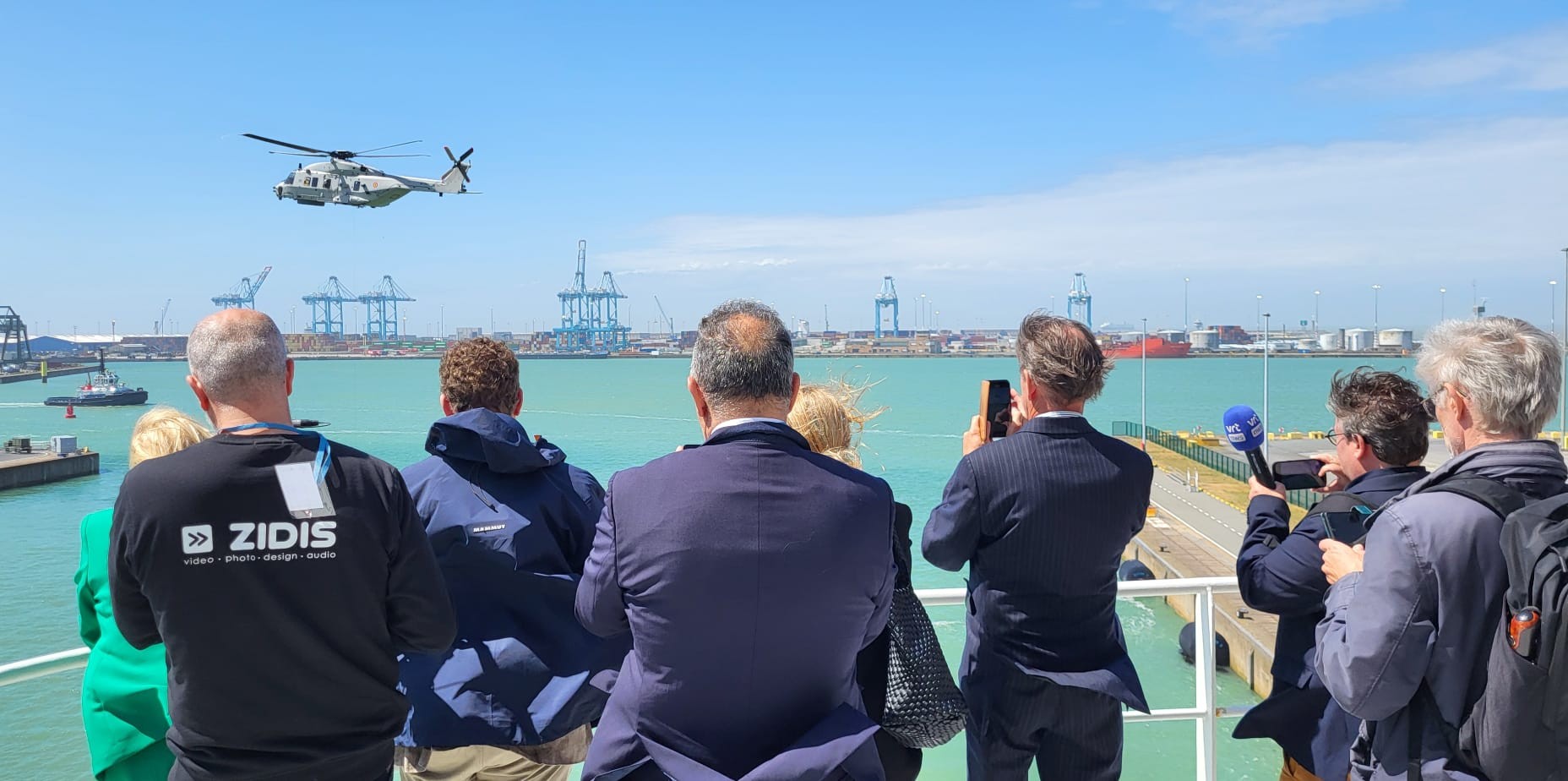
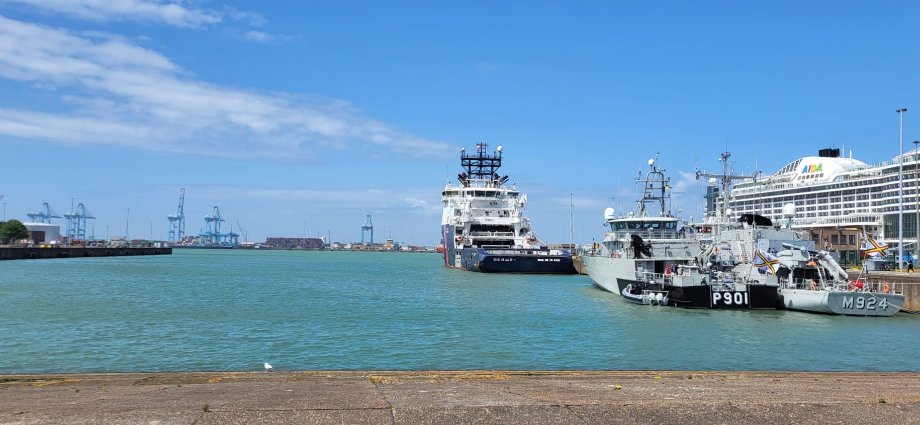
The collaboration officially started on May 28 and will end on September 19, 2025. The starting shot was given on Wednesday May 28 in Zeebrugge, in the presence of all partners.
During the launch event, the guests were given a unique look behind the scenes. At the Naval Base, they were guided on board various vessels, including Sirius (MDK), Primula (Defense) and Abeille Normandie (Boluda). The functions of the ships and the cooperation between the partners were explained in detail. As a conclusion, the guests were able to attend an impressive Search And Rescue exercise with the Orinoco and the NH90 helicopter, during which the coordination between the services involved came into action live.
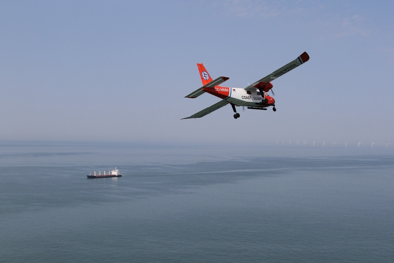
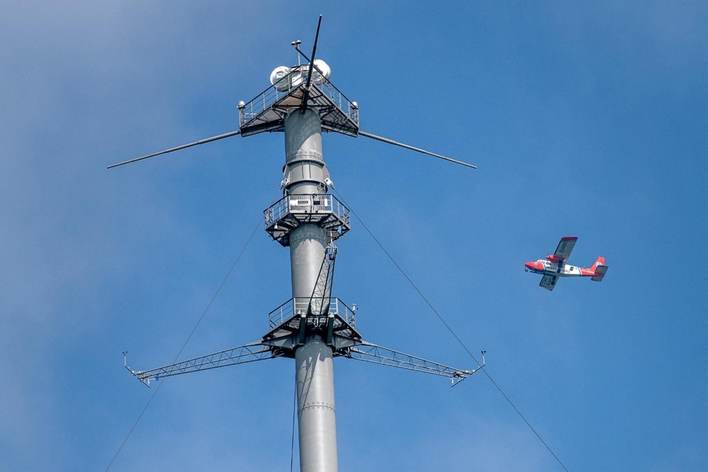
During this Multipurpose Maritime Operation, the Scientific Service MUMM (Management Unit of the Mathematical Model of the North Sea) of the Institute of Natural Sciences will work closely with Defence in the use of medium-sized drones (Remotely Piloted Aircraft System – RPAS) to perform additional environmental surveillance above the Belgian part of the North Sea. The drones will be deployed in support of the national programme for aerial surveillance above the North Sea.
Ronny Schallier of the MUMM aerial surveillance explains: “Although drones cannot replace a Coastguard aircraft that is fully equipped with sensors and manned, they are considered important additional surveillance platforms to support the various Coastguard functions. Through an intelligent combination of manned and unmanned aerial surveillance, the Coastguard hopes to significantly strengthen monitoring and enforcement at sea. The combination is expected to yield benefits, including for detecting pollution from ships, for verifying pollution reported via the European CleanSeaNet service (satellite detection service), and for monitoring navigation violations.”
In 2024, the Coast Guard Aircraft of the Institute of Natural Sciences documented 4 cases of operational marine pollution by ships. In addition, suspicious sulphur and nitrogen values were measured in the exhaust plumes of 31 and 59 ships. Other activities included broader maritime surveillance in support of the Coast Guard, participation in international operations and marine mammal counts.
In 2024, a total of 220 flight hours were performed over the North Sea as part of the national aerial surveillance programme. This programme is organised by the Scientific Service MUMM (Management Unit of the Mathematical Model of the North Sea) of the Institute of Natural Sciences, in collaboration with the Ministry of Defence.
The biggest effort (177.5 hours) was dedicated to national flights, with no less than 161.5 flying hours in the context of the Belgian Coast Guard. This included 118.5 hours for maritime surveillance under the International Convention for the Prevention of Pollution from Ships (MARPOL). Of these, 69 hours were dedicated to monitoring for discharges of oil, other harmful substances, and garbage, while the remaining 49.5 hours were spent monitoring sulphur and nitrogen emissions from ships. Another 43 hours were used for fisheries control on behalf of the Flemish Fisheries Service, including aerial support during a marine pollution response exercise. In addition, 16 hours were dedicated to marine mammal monitoring.
Internationally, 42.5 hours were flown in the framework of the Bonn Agreement, which provides for international cooperation among North Sea coastal states in the fight against marine pollution. This included a Tour d’Horizon (TdH) mission for the monitoring of oil and gas installations and a multi-day monitoring campaign at the border of the ship emission control area off Brittany (France). Finally, 23.5 hours were flown in the context of the European research project CINDI-3, in collaboration with the Belgian Institute for Space Aeronomy (BIRA).
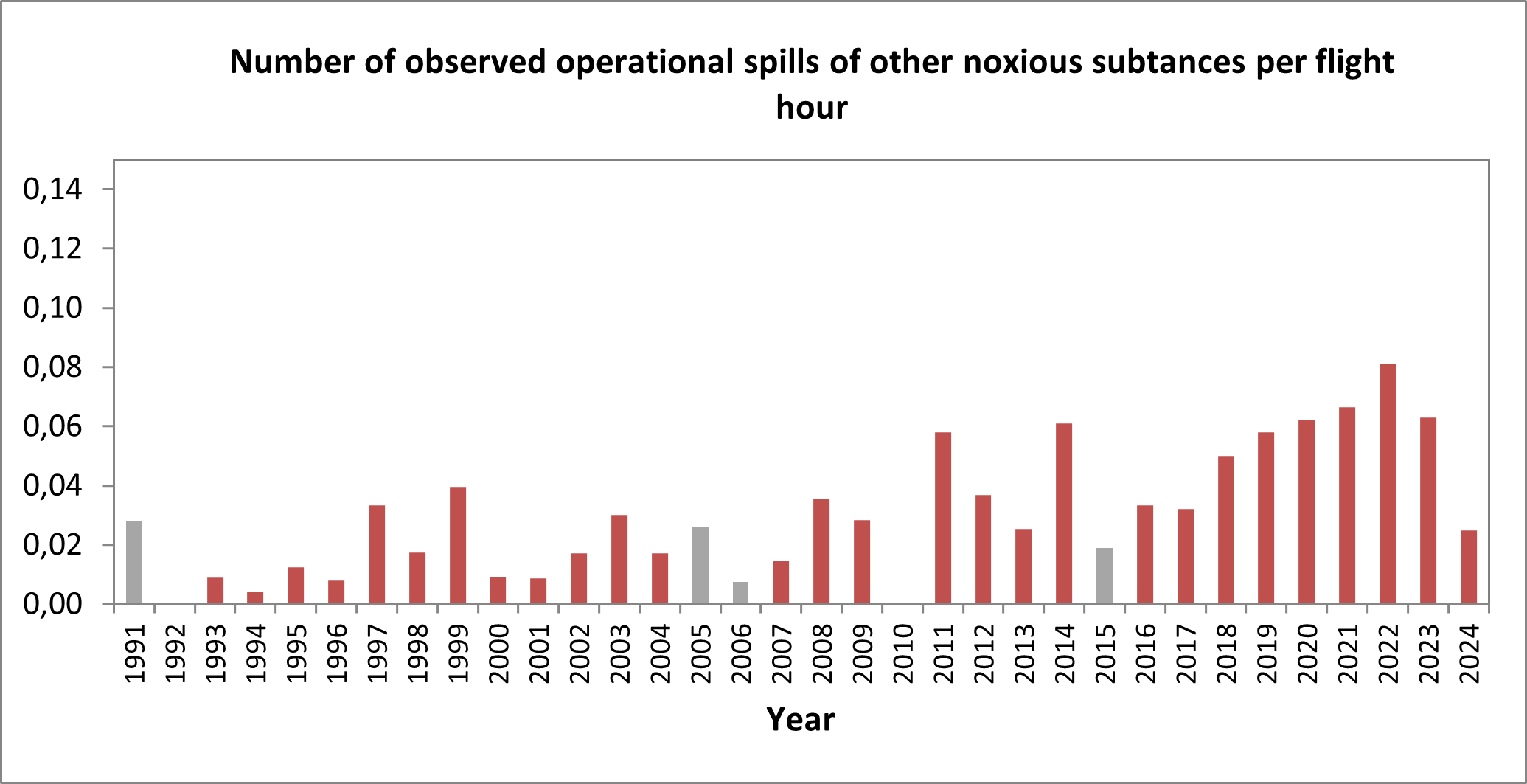
Spills from ships
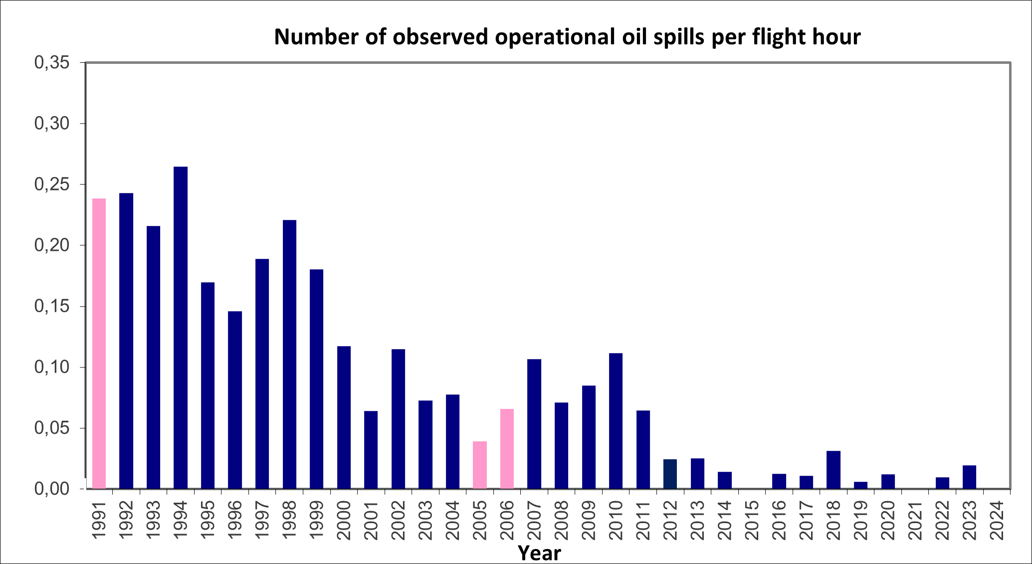
No oil pollution was observed in the Belgian part of the North Sea in 2024, maintaining the declining trend seen over the past 34 years.
However, 4 operational discharges of harmful substances other than oil (MARPOL Annex II) were observed, each time without a polluter in sight. This made it impossible to determine which specific type of liquid was discharged into the sea.
Unlike oil spills, discharges of noxious liquid substances remain a common problem. Until 2022, an increasing trend in observations had been noted, which was confirmed by other North Sea countries. 2023 marked the first year in the past decade with a decrease, a trend that appears to continue in 2024. However, it is still too early to draw firm conclusions. The fact that some discharges are legally permitted does not change the reality that they may have a negative impact on the marine environment. Continued monitoring by coastal states is important, both to map potential problems at sea and to encourage legal updates where necessary.
No violations of MARPOL Annex V, which concerns the discharge of garbage and solid bulk substances into the sea, were observed in 2024.
Oil pollution in ports
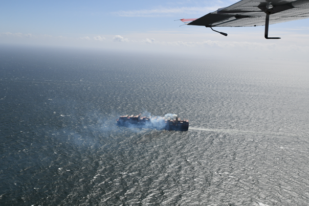
On 14 March 2024, the Coast Guard Aircraft detected a weathered oil slick in the port of Antwerp, with no polluter nearby. On 4 June, several oil slicks were observed in the same port, possibly a historical pollution released during dredging operations. Shortly thereafter, on 7 June, oil was again observed. After contacting the port authorities, the pollution was found to be the result of an overflow of heavy fuel oil during a bunkering operation. In the following days, several flights were conducted over the port to monitor the situation and assess the effectiveness of the pollution response actions.
Belgium continues to be a frontrunner in the international fight against air pollution from ships through the use of a sniffer sensor on board the Coast Guard Aircraft (monitoring and enforcement of MARPOL Annex VI). This sensor allows for real-time measurement of various air pollutants in the exhaust plumes of vessels.
Sulphur measurements have been part of the programme since 2016 and aim to monitor compliance with the strict sulphur limits for ship fuel within the North Sea Emission Control Area. In 2024, 31 out of 743 ships inspected showed suspiciously high sulphur values.
Since 2020, with the addition of a NOx sensor, the aircraft has also measured nitrogen compound (NOx) concentrations in ship exhaust plumes. These measurements support the enforcement of stricter NOx limits applicable since 1 January 2021 in the North Sea Emission Control Area. In 2024, suspicious NOx values were observed in 59 out of 735 ships.
All suspicious cases were reported to the competent Belgian and European maritime inspection services for follow-up and further checks in port.
In 2021, a black carbon sensor was added to the sniffer set-up. This sensor measures black carbon emissions, an indicator of soot levels in ship exhaust. Emissions of 451 vessels were measured in 2024. Preliminary results show that ships emit significantly more soot at sea than previously estimated.
Within the framework of the Coast Guard, the aircraft also contributes to broader missions of maritime enforcement and safety. MUMM’s aerial operators regularly report violations of navigational rules and the mandatory use of AIS (Automatic Identification System) to the Coast Guard Centre, and monitor potential breaches of safety perimeters around certain infrastructure such as wind farms or aquaculture farms.
In 2024, 11 vessels were observed without an active AIS signal, all of them fishing vessels. Additionally, 26 navigational violations were observed — a significant increase — mainly involving vessels sailing in the wrong direction (ghost sailing) or anchoring in shipping lanes. These observations were systematically reported to the Directorate-General for Shipping (FPS Mobility and Transport) for follow-up.
Last year, 3 violations related to intrusions into sea safety perimeters were also reported to the competent authorities. This is in line with 2023 figures but significantly lower than in previous years. A likely explanation is that restricted areas such as the aquaculture farm off Nieuwpoort and the calibration zone near Ostend are now more widely known and respected by the maritime community.
Finally, in close coordination with the Maritime Information Crossroad (MIK) , the aircraft monitored 4 suspicious activities in or near Belgian sea areas, 3 of which involved Russian vessels.
In April, August and November 2024, the Institute of Natural Sciences carried out seasonal surveys of marine mammals. Respectively 109, 21 and 69 Harbour Porpoises were observed along the flight paths. Scientific extrapolation suggest population estimates of over 5,200 animals in April, over 1,000 in August, and over 3,300 in November within Belgian waters.
Seals were also regularly observed: 3, 10 and 18 in the respective months. The April survey was particularly noteworthy, with rare sightings including a Minke Whale and a group of five White-beaked Dolphins.
International missions
In July, a multi-day campaign was held at the edge of the Emission Control Area near Brest, resulting in 21.2 flight hours. During 5 days, emissions from 189 ships were monitored. Fourteen vessels exceeded sulphur limits, and 4 showed excessive NOx emissions. All observations were reported to the French authorities and the relevant European ports of call and were entered into the European inspection database Thetis-EU.
In September, the annual international ‘Tour d’Horizon’ mission was carried out under the Bonn Agreement (21.3 flight hours), focusing on pollution from oil and gas installations in the central North Sea (Dutch, Danish, British and Norwegian waters). The aircraft detected a total of 8 oil spills — a low number compared to previous years, likely due to poor weather conditions and rough seas causing rapid dilution of oil in water. Seven of the eight spills could be directly linked to an oil platform. All observations were systematically reported to the competent coastal states for follow-up in accordance with international procedures.
The CINDI-3 campaign was held for the third time in Cabauw, the Netherlands. More than 100 participants from 16 countries collaborated with the goal of comparing scientific measuring instruments for nitrogen dioxide, ozone, aerosols and other gases. Measurements were taken from land, air and space.
A key part of the campaign was the use of the Coast Guard Aircraft to measure air quality over Cabauw and the ports of Rotterdam and Antwerp. Combining airborne data with other instruments provided valuable information for validating satellite observations of air pollution.
A new horizon?
While 2024 was another successful year in terms of the results achieved by the North Sea aerial surveillance programme, it should be noted that the coastguard aircraft is an ageing platform that will soon be 50 years old. Its replacement is necessary to ensure the continuity of the increasingly delicate operations entrusted to Belgium as a coastal state in an increasingly complex maritime and international context. Without this, it is likely that Belgium will no longer have a suitable aerial surveillance platform and will therefore no longer be able to fully meet its national and international commitments to environmental protection, safety and security in the North Sea.
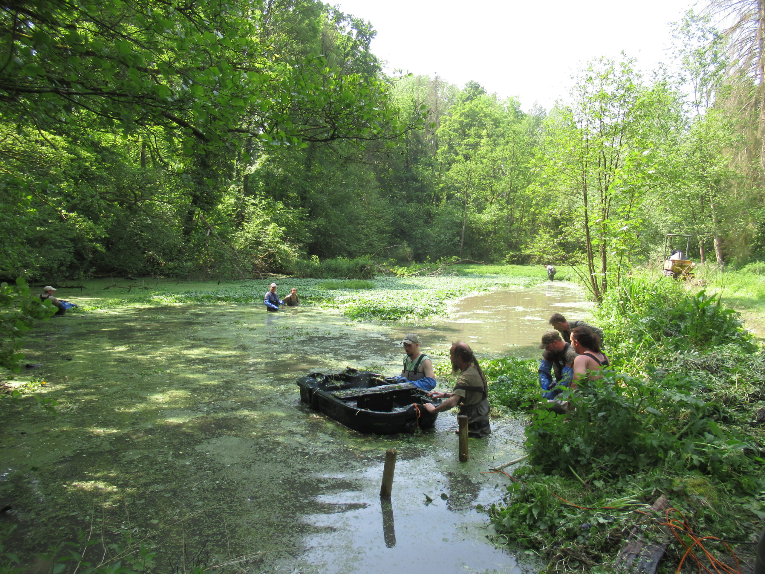
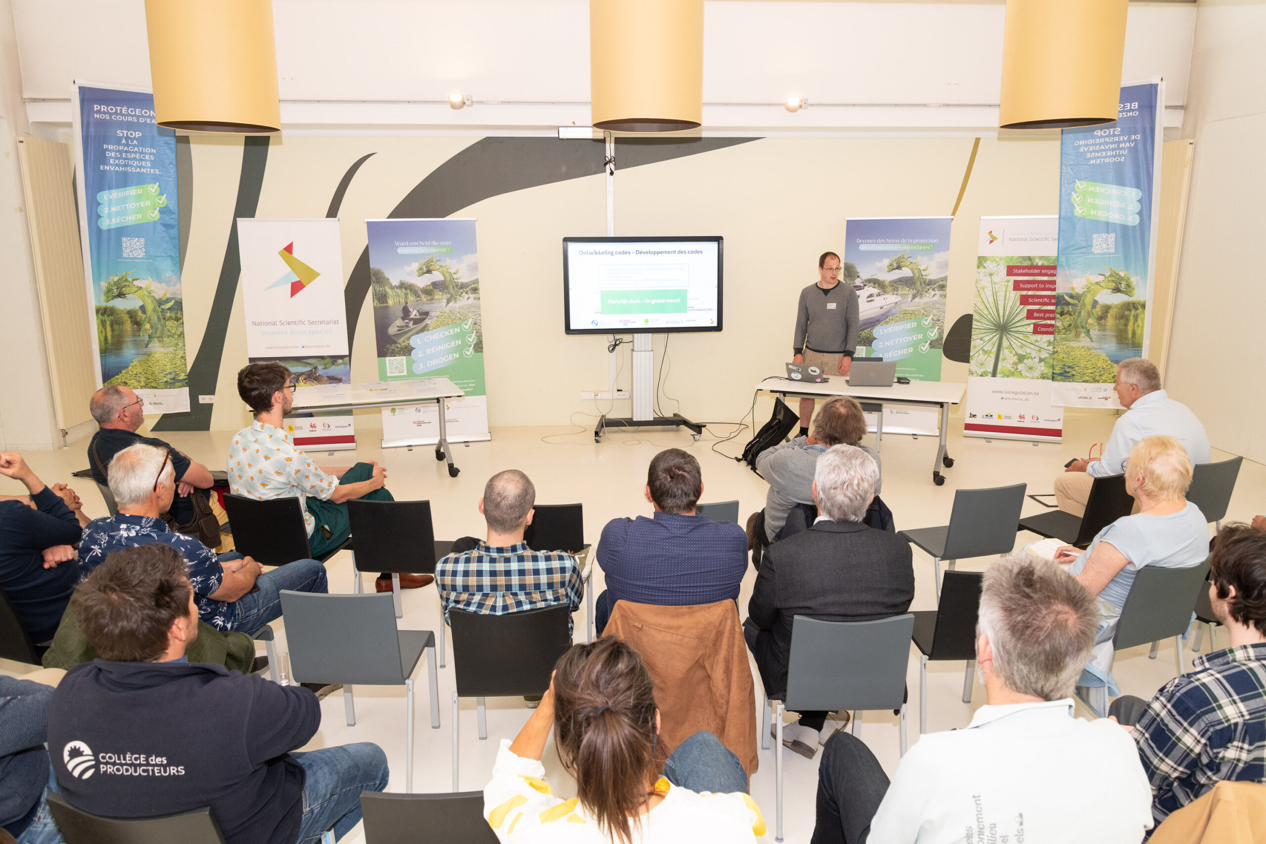
As part of the fight against biological invasions in Belgium, a new national campaign entitled “Check – Clean – Dry” was launched on May 15. Supported by regional authorities, it aims at raising awareness among users of freshwater ecosystems about biosecurity. On this occasion, several aquatic sector federations signed voluntary codes of conduct, demonstrating their concrete commitment to protecting biodiversity.
On Thursday, May 15, representatives of four key sectors active in freshwater environments in Belgium gathered to mark an important milestone in the fight against biological invasions. During an official ceremony at the Institute of Natural Sciences, federations and organizations from the sectors of aquatic sports, angling, aquaculture, recreational and professional boating signed voluntary codes of conduct, demonstrating their shared commitment to protecting our aquatic ecosystems.
This initiative, coordinated by the National Scientific Secretariat for Invasive Alien Species (NSS-IAS, based at the Institute of Natural Sciences) on behalf of the regional authorities (Brussels Environment, Agentschap voor Natuur en Bos (ANB), and the Department of Nature and Forests (DNF)), is part of a comprehensive European-wide approach to combating invasive alien species (IAS) (European Regulation (EU) 1143/2014) and is part of the National Action Plan on priority pathways, which constitutes the Belgian implementation of the necessary prevention measures.
The adopted codes of conduct are a voluntary instrument aimed at preventing the introduction and spread of IAS in Belgium’s aquatic ecosystems. They are the result of a participatory process that began a year ago with the various sectors involved. Together, they defined biosecurity measures that are both effective in limiting the spread of IAS and compatible with user practices.
The signatory federations and organizations thus commit to encouraging their members to implement rigorous biosecurity protocols and to participate in awareness-raising activities regarding biological invasions and their impact. A guide for waterbodies managers has also been published to include biosecurity in the technical specifications.
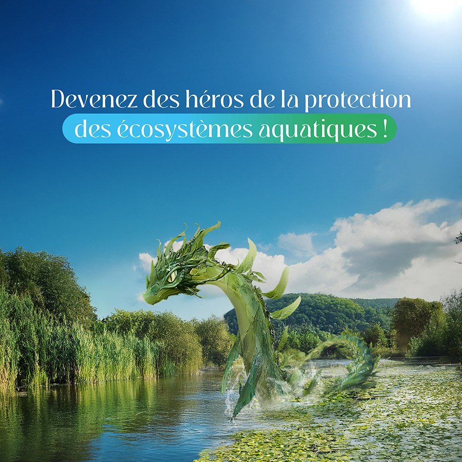
Launch of the “Check – Clean – Dry” Campaign
At the same time, a national communication campaign is being launched to raise awareness about biosecurity among all recreational and professional users of freshwater environments—whether they are kayakers, anglers, divers, boaters, fish farmers, or managers.
Inspired by campaigns already in place elsewhere in Europe, such as in Great Britain since 2011, this initiative aims to prevent the accidental spread of IAS via wet equipment. The central message: “Become heroes in protecting our aquatic ecosystems.”
But what exactly is the problem?
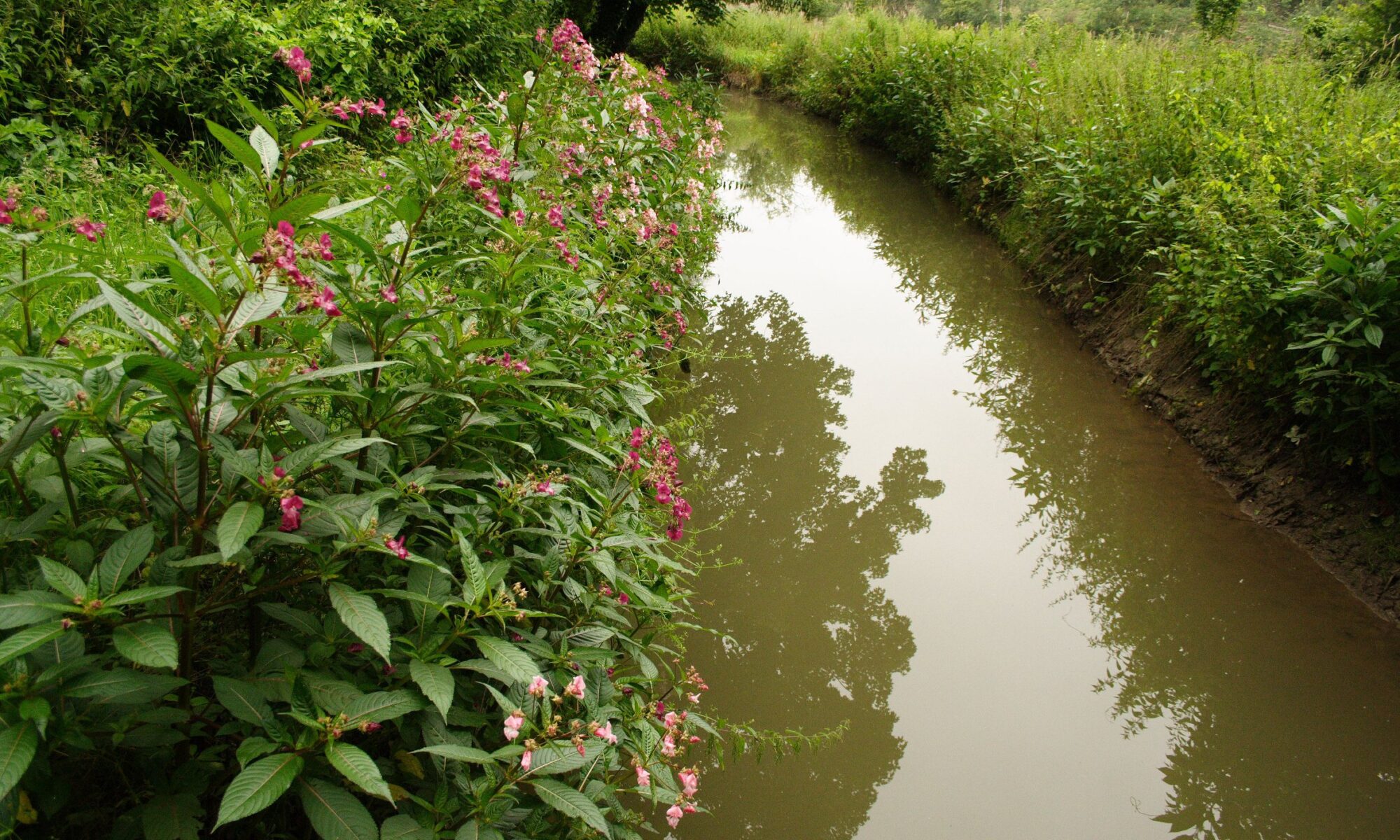
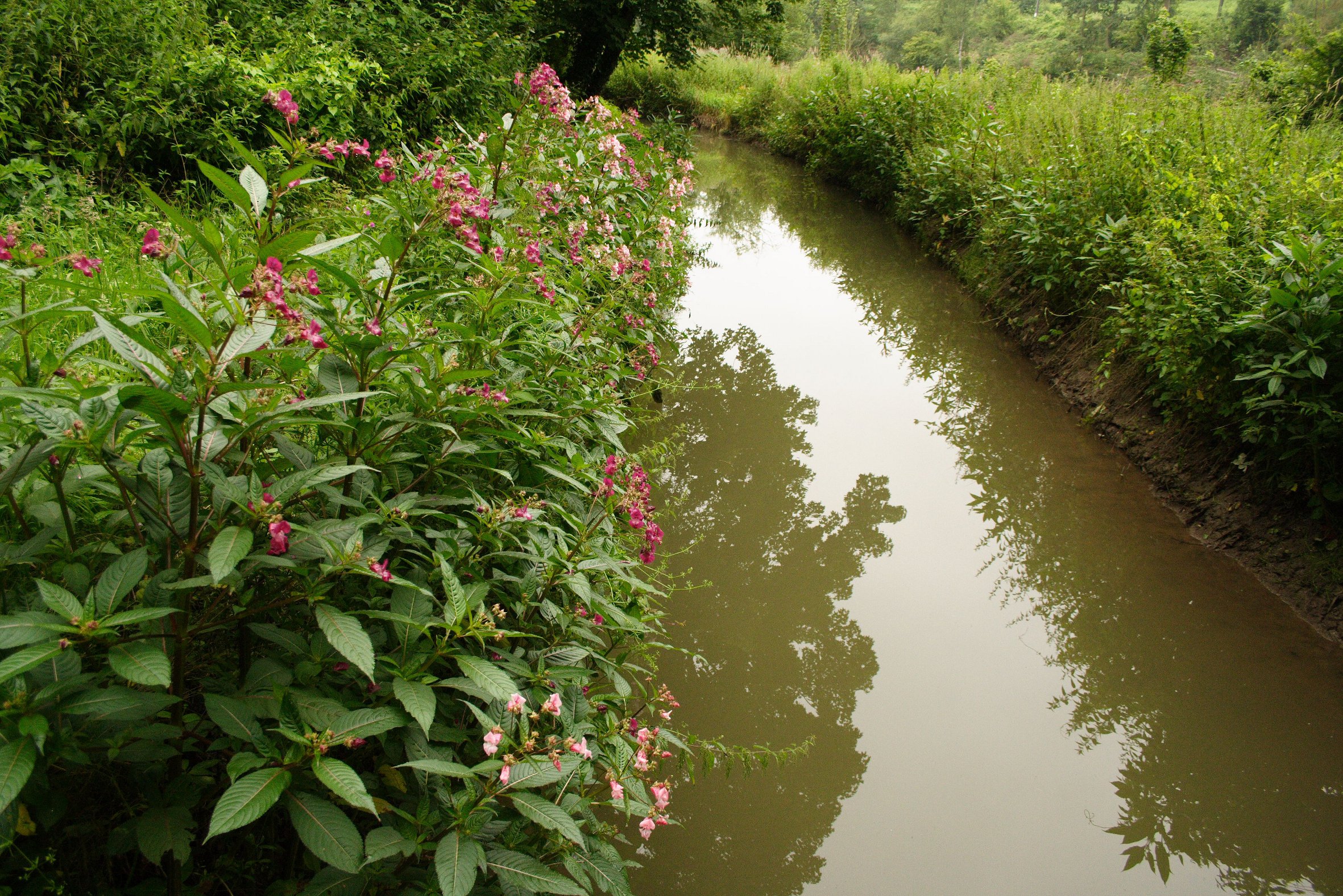
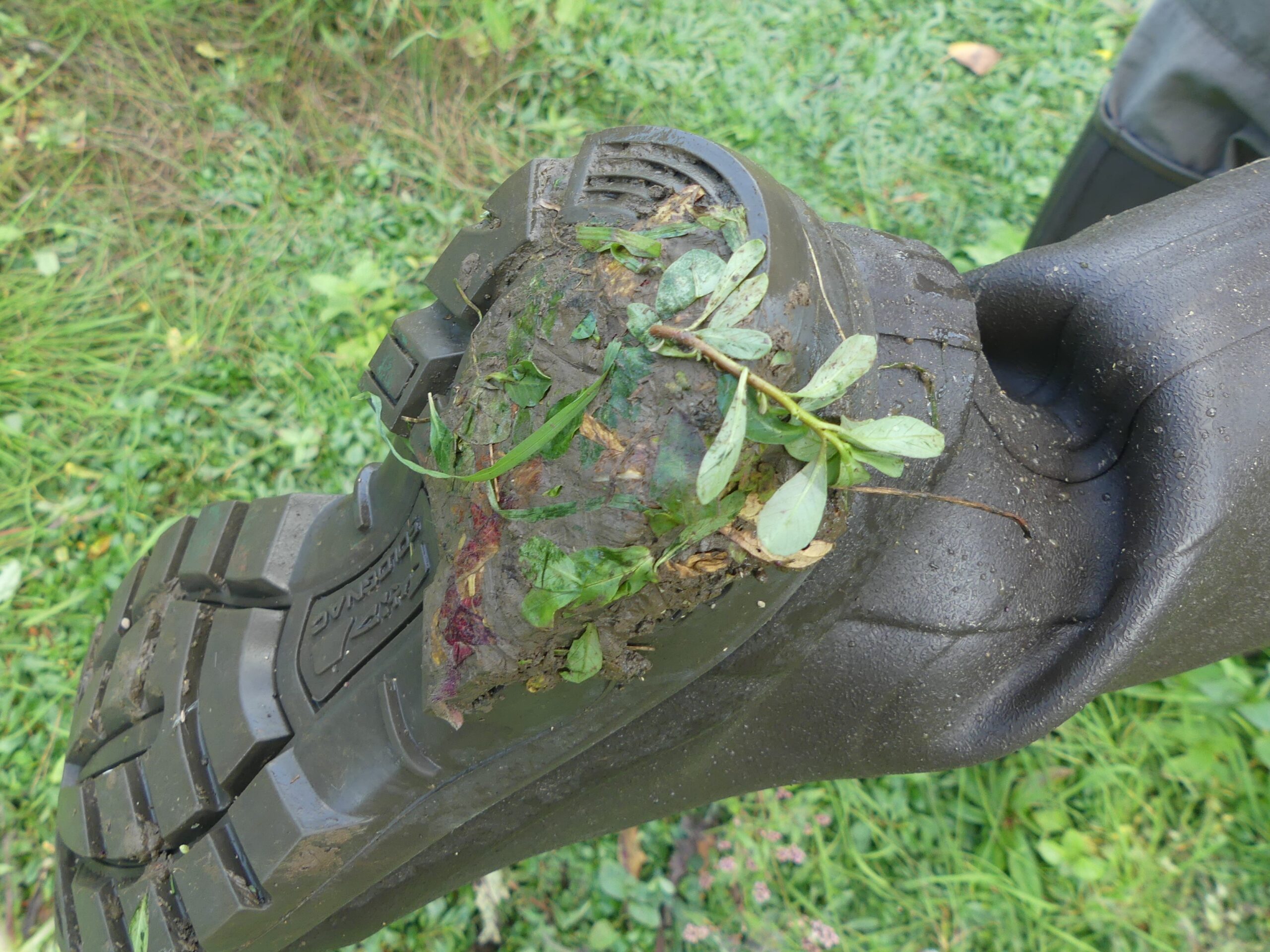
Biological invasions pose a threat to the biodiversity of our waterways, rivers, and lakes. The often accidental introduction of these species can seriously disrupt the natural equilibrium of ecosystems and, in turn, have harmful consequences for the economy and leisure activities.
Whether animal or plant, IAS often spread accidentally. For example, via the hull of a pleasure boat or fishing gear that has not been properly cleaned after a trip abroad or used in various locations. IAS can be small and difficult to spot, can usually survive temporary drought, and therefore spread easily on equipment and clothing.
Once established, these species can grow, spread, and thus damage infrastructure and hamper business. But they can also cause problems by transmitting diseases that affect the health of animals and humans.
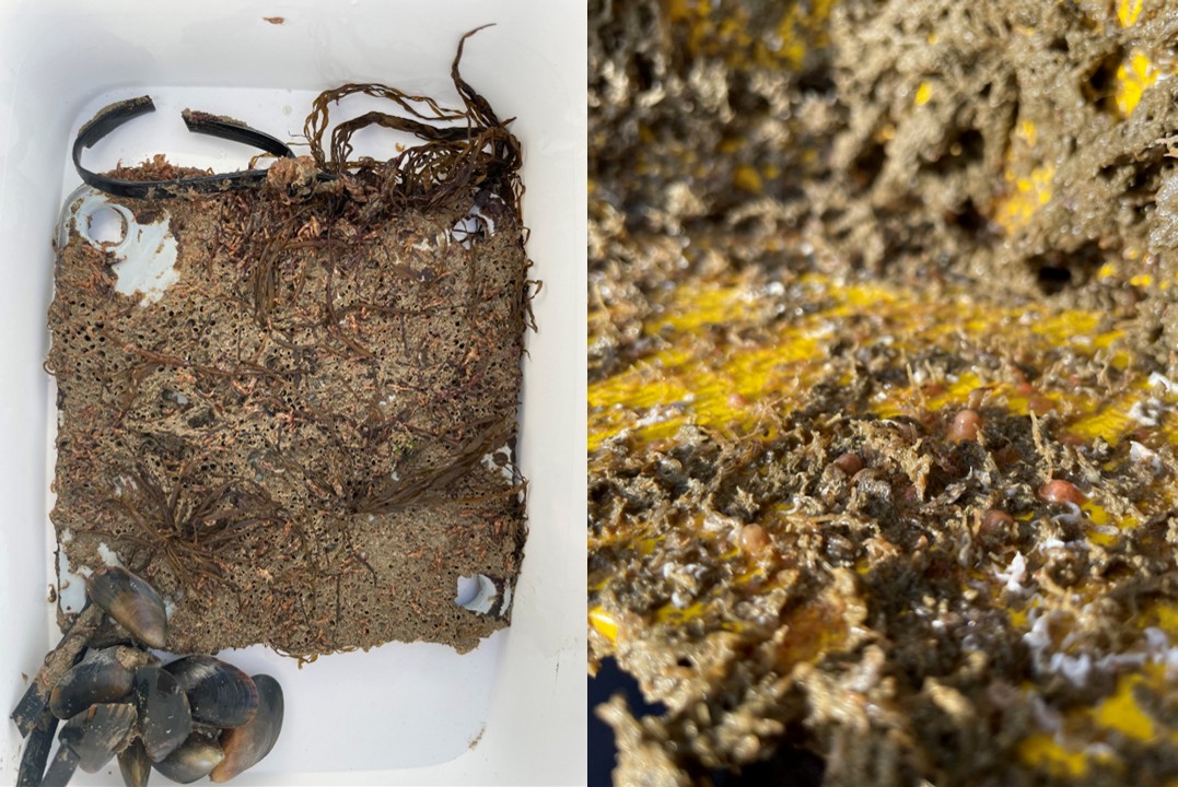
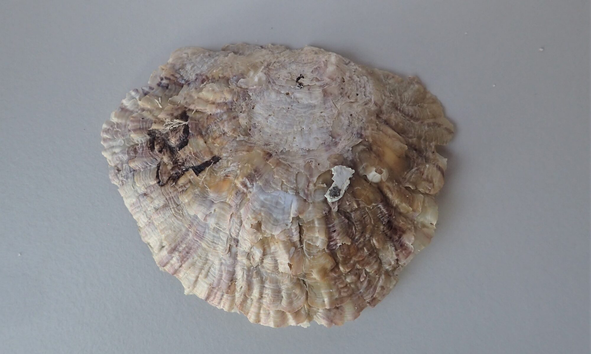
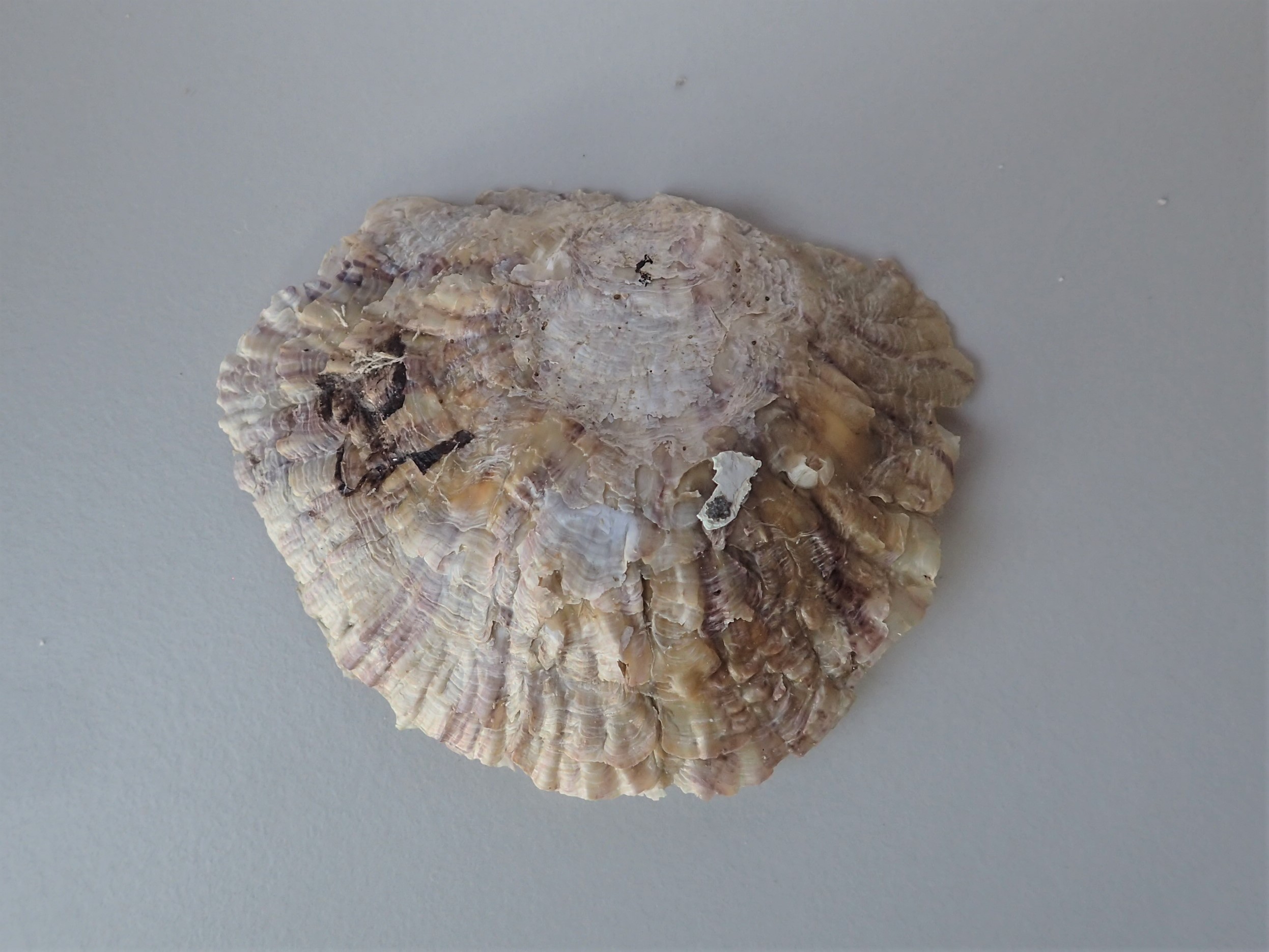
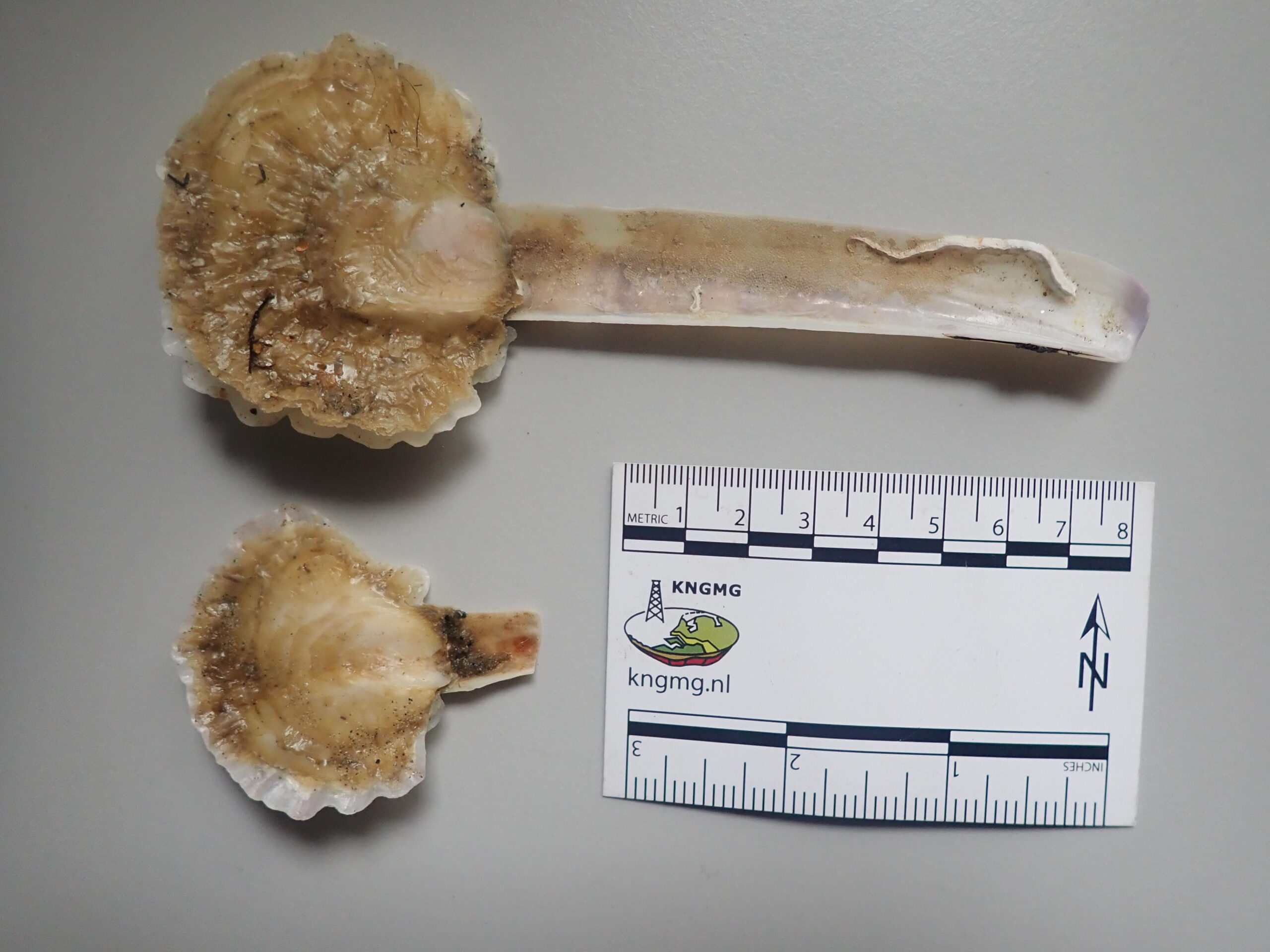
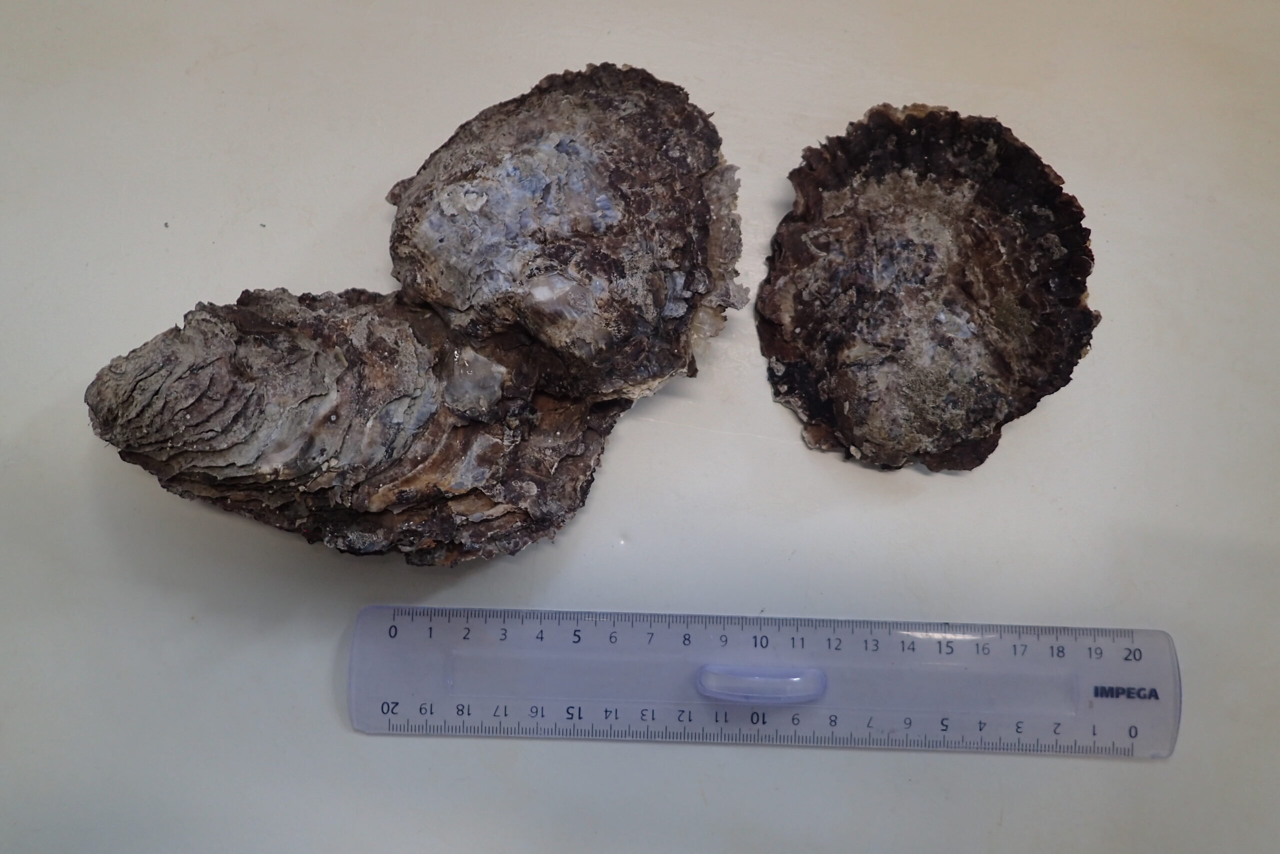
Long ago, the Flat oyster was ubiquitous in the southern North Sea. But due to overfishing, pollution and diseases, this native species almost completely disappeared from our country. Today, there are signs that the Flat oyster has begun a cautious recovery. This is demonstrated by finds in unexpected places, such as in ports and offshore wind farms.
The fact that the Flat oyster (Ostrea edulis) has been found again in Belgian waters can certainly be called a sensation. After decades of absence, marine biologists have found living specimens and empty shells of Flat oysters on all kinds of human infrastructure, including scientific instruments. Flat oysters are now also being found in port areas such as Zeebrugge and Ostend.
In addition, offshore structures, such as the steel foundations of offshore wind turbines, provide new habitats for oyster larvae to attach. Beachcombers have found live specimens and fresh shells of Flat oysters washed up on the beaches of the western coastal zone.
Francis Kerckhof and Thomas Kerkhove of the research group ‘Marine Ecology and Management’ (MARECO) of the Institute of Natural Sciences summarize the recent finds in an article in ‘De Strandvlo’, the magazine of the Belgian Beach Working Group (Strandwerkgroep België), and examine possible explanations. What is striking is that the new finds seem to be at least partly of wild origin. A comeback to the rhythm of the sea.
Why are ports and wind farms interesting for oysters?
The modern seaport has surprisingly become a suitable habitat for some species that used to occur in natural reefs. Solid structures such as quay walls, pontoons, mooring posts and shipwrecks provide hard substrates to which oyster larvae can attach. Furthermore, harbours often provide a certain shelter, which facilitates larval settlement. In addition, the water quality has improved considerably in recent decades.
Offshore wind farms are a similar story. Underwater, the foundations transform into artificial reefs that attract life, from starfish and sea squirts to mussels and… Flat oysters. The structures are little disturbed because shipping and fishing are not allowed, while pilot projects focusing on the recovery of Flat oysters ensure more larvae in the water. That turns out to be exactly what a species like Ostrea edulis needs to regain a foothold.
A history of loss
The Flat oyster has a turbulent history in Belgium. It was once ubiquitous in the southern North Sea, and a culinary icon. Until the beginning of the 20th century, oysters were harvested in abundance from natural banks in the North Sea and watered down in so-called oyster pits on the coast, among others in Oostende (the famous Ostendaise). But due to overexploitation, habitat loss, pollution and the creep of diseases and the oyster parasite Bonamia ostreae, the species disappeared from our waters.
In the second half of the 20th century, commercial oyster farming switched to the Japanese oyster (Crassostrea gigas), which is easier to grow and less susceptible to the oyster parasite. As a result, Ostrea edulis also faded further into the background in Belgium.
Francis Kerckhof: “The rediscovery of the Flat oyster is not only culturally and historically interesting, it is above all an ecological story. After all, the Flat oyster is an essential part of the marine ecosystem. As a filter feeder, it helps keep the water clear, and its reefs create a habitat for countless other species. Where there are oysters, underwater life flourishes. Moreover, the Flat oyster is a native species, it belongs here by nature and its recovery can contribute to the marine recovery of the North Sea.”
In addition, this comeback is part of a broader European trend. In countries such as the United Kingdom, Germany, the Netherlands and France, reintroduction programs have been started to re-establish the species, and in Belgium there are also pilot projects supported by Belgian and European funding.
And now?
For scientists, this rediscovery is both an opportunity and a challenge. Can we use monitoring and DNA analysis to determine where these oysters come from? Do they come from isolated relict populations, did they come with shipping or ocean currents from locations where restoration projects are underway, or did the oyster larvae come from commercial oyster farming?
At the same time, the new knowledge also raises policy questions. Should we support this natural recolonization? Can ports or offshore installations be consciously designed as oyster-friendly structures? And how do we avoid repeating the same mistakes of the past, such as overexploitation or insufficient protection?
Thomas Kerkhove: “For the time being, the number of Flat oysters is still limited, and there is no talk of large populations yet. But the fact that Ostrea edulis is spontaneously appearing in various places is a hopeful sign. The sea shows us that, if we give it space, recovery is possible. In this context, every find on the beach or on a quay wall is a small reminder of the resilience of nature.”