
On 4 August 1945 an American military aircraft flew the entire length of our country’s coastline from Knokke to De Panne. From the air a photographer took more than 80 photographs that produce a unique insight into how the coast of West Flanders looked just after the Second World War. The photos had been neatly stored in the US national archives, and were recently accidentally discovered by some archaeologists of Ghent University who were looking for photos on which they could see remnants of the war.
These photos are not only interesting because of their historical value, but also allow a comparison with the current state of our coast. If only there were a similar series of recent images …
RBINS to the rescue!
On Tuesday 14 April 2020, at low tide, the RBINS aerial survey team flew the same trajectory along the entire Belgian coastline using the RBINS aircraft OO-MMM, taking unique images of empty beaches during the first Covid lockdown.
The press loved it, and on 4 August 2021, 76 years after the American flight of 1945, the Flemish Radio and Television Broadcasting Association (Vlaamse Radio- en Televisieomroeporganisatie – VRT) put two and two together and compared the two image series, revealing both amazing similarities and remarkable differences.
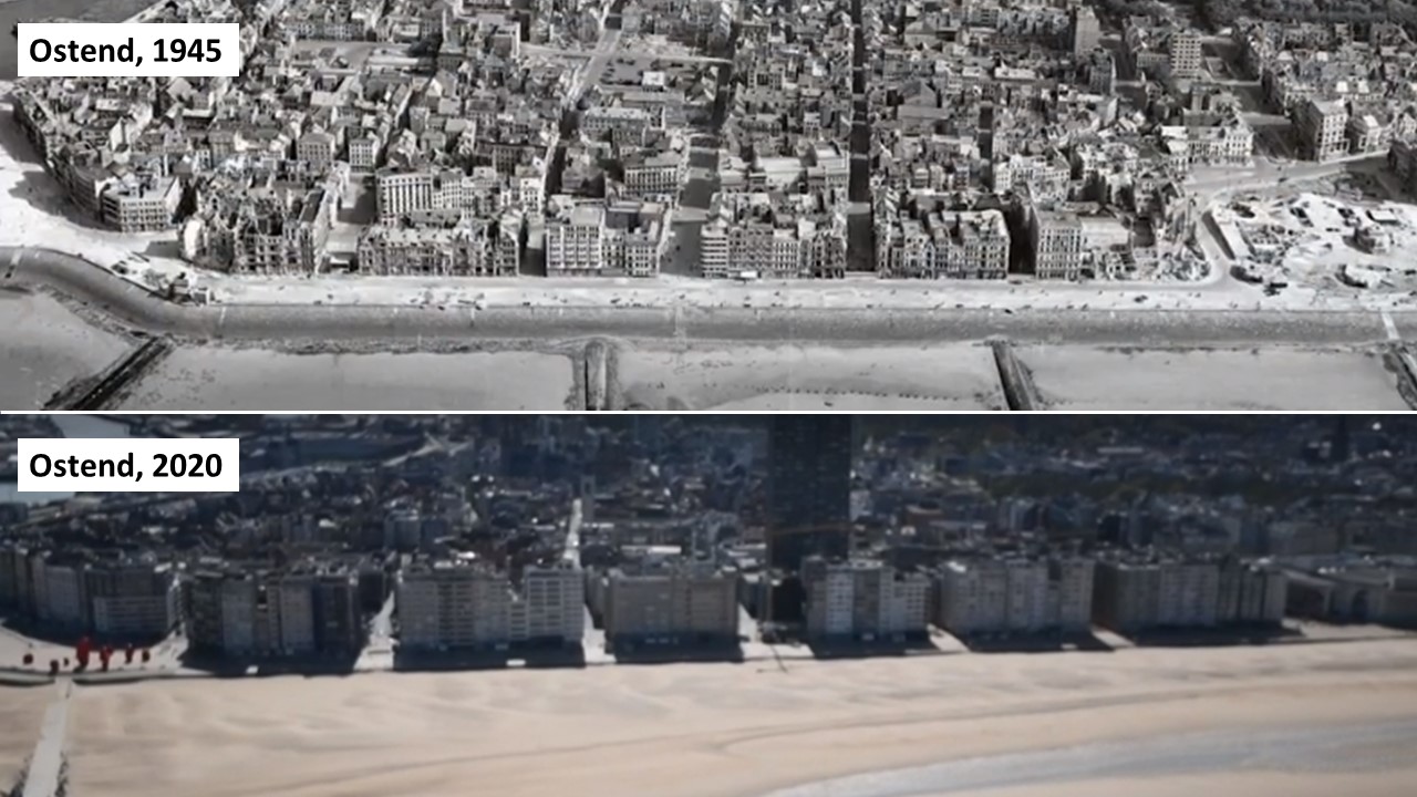
Check out the image comparisons (and more information) on the VRT website (in Dutch, with a shorter version without comparison in English).
Maybe one day, 76 years from now, people will rediscover our footage in some archive … 😉